Hyde Lea

Settlement in Staffordshire Stafford

England

Hyde Lea

Bigwood Lane Bridleway off Bigwood Lane
Bigwood Lane Credit: P Gaskell

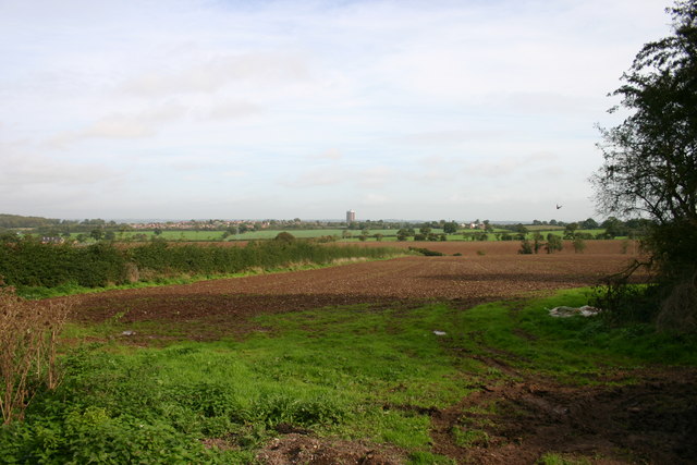
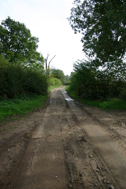
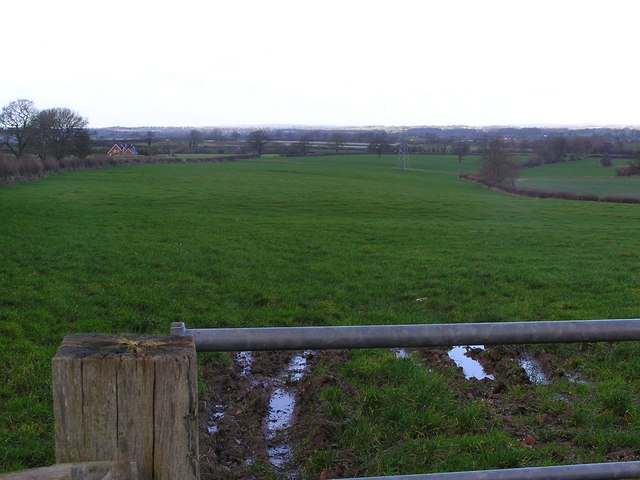
Hyde Lea is a small village located in the county of Staffordshire, England. Situated approximately three miles north-west of the county town of Stafford, it is nestled in a picturesque rural setting with rolling countryside and scenic views. The village lies on the edge of Cannock Chase, an Area of Outstanding Natural Beauty.

Hyde Lea is a tight-knit community with a population of around 500 residents. It is known for its peaceful and idyllic atmosphere, attracting those seeking a tranquil countryside lifestyle. The village is predominantly residential, with a mix of traditional stone cottages and more modern houses. Despite its rural setting, Hyde Lea is conveniently located close to the amenities and services of Stafford town.

The village has a strong sense of community spirit, with various local events and activities taking place throughout the year. The village hall is a central hub for gatherings and social events, offering a place for residents to come together. Additionally, the nearby Cannock Chase provides ample opportunities for outdoor activities such as walking, cycling, and horse riding.

Hyde Lea benefits from its proximity to Stafford, where residents can access a wider range of services including schools, healthcare facilities, shopping centers, and recreational amenities. Transportation links are also easily accessible, with the M6 motorway and Stafford railway station a short distance away, providing connections to major cities such as Birmingham and Manchester.

Overall, Hyde Lea offers a peaceful and picturesque village lifestyle with the convenience of nearby amenities, making it an attractive place to reside for those seeking a rural retreat within reach of urban facilities.

If you have any feedback on the listing, please let us know in the comments section below.

Hyde Lea Images

Images are sourced within 2km of 52.779288/-2.131171 or Grid Reference SJ9120. Thanks to Geograph Open Source API. All images are credited.

Bigwood Lane Bridleway off Bigwood Lane
Bigwood Lane
Bridleway off Bigwood Lane
Fields off Billington Bank, Stafford A view of fields from an unnamed lane off the brow of Billington bank near Stafford. On the horizon in the distance is 'The Keep', a block of flats on the Highfields Estate in Stafford. There used to be a second block but that was brought down and new housing built.
Fields off Billington Bank, Stafford
A view of fields from an unnamed lane off the brow of Billington bank near Stafford. On the horizon in the distance is 'The Keep', a block of flats on the Highfields Estate in Stafford. There used to be a second block but that was brought down and new housing built.
Unnamed Lane to Leese Farm At the end of this unnamed lane is a public footpath and Leese Farm which can just be seen (the two white features are the windows!).
Unnamed Lane to Leese Farm
At the end of this unnamed lane is a public footpath and Leese Farm which can just be seen (the two white features are the windows!).
Leese Farm from Thorneyfields Lane
The A518 A518 looking back to M6 Motorway and Stafford.
The A518
A518 looking back to M6 Motorway and Stafford.
Track and Barns, Leese Farm
Gateway and Field Taken from Leese Farm, looking towards Stafford Castle, which can be seen above the trees in the centre of the picture.
Gateway and Field
Taken from Leese Farm, looking towards Stafford Castle, which can be seen above the trees in the centre of the picture.
Lowland in central Staffordshire
Track (footpath) to White Farm Cottages
Toft Barn
Toft Barn
Hedgerow and field
Hedgerow and field
Coppenhall Church St Lawrence's, described by Pevsner as 'the perfect 13C village church, small but with great dignity.'  The bell-turret is a Victorian addition.
Coppenhall Church
St Lawrence's, described by Pevsner as 'the perfect 13C village church, small but with great dignity.' The bell-turret is a Victorian addition.
Argos Home Delivery at  Acton Gate Home delivery Regional Distribution Centre, the smallest of three!
Argos Home Delivery at Acton Gate
Home delivery Regional Distribution Centre, the smallest of three!
Ploughed field and the view to the mill at Butter Hill House Looking from the lane from The Toft to Coppenhall. The mill among the trees is at <a href="https://www.geograph.org.uk/gridref/SJ898181">SJ898181</a>
Ploughed field and the view to the mill at Butter Hill House
Looking from the lane from The Toft to Coppenhall. The mill among the trees is at SJ898181
View across fields to Coppenhall
A new hedge
A new hedge
Track to The Wheats
Track to The Wheats
Believe me, there is a pond here. Looking down at the pond, which lies below the level of the surrounding field, and is hidden by various trees and bushes, including a crab-apple.

See <a href="https://www.geograph.org.uk/photo/250688">SJ9119 : Crab-apples</a>
Believe me, there is a pond here.
Looking down at the pond, which lies below the level of the surrounding field, and is hidden by various trees and bushes, including a crab-apple. See SJ9119 : Crab-apples
Show me another place!

Hyde Lea is located at Grid Ref: SJ9120 (Lat: 52.779288, Lng: -2.131171)

Administrative County: Staffordshire

District: Stafford

Police Authority: Staffordshire

What 3 Words

///accordion.minute.party. Near Stafford, Staffordshire

Nearby Locations

Burton Manor Hyde Lea

Related Wikis

Hyde Lea

Hyde Lea is a village and parish in Staffordshire, England, just west of Stafford itself. Hyde Lea borders the southern boundary of Castle Church parish...

Stafford Grammar School

Stafford Grammar School is a mixed independent day school at Burton Manor, located on the outskirts of Stafford, the county town of Staffordshire. Founded...

St Lawrence's Church, Coppenhall

St Lawrence's Church, Coppenhall is a Grade II* listed parish church in the Church of England in Coppenhall, Staffordshire. == History == The small ancient...

Stafford Manor High School

Stafford Manor High School is a mixed secondary school and sixth form located in Stafford in the English county of Staffordshire.Previously known as Rising...

1996 Stafford rail crash

The 1996 Stafford rail crash occurred on 8 March 1996 when a Transrail freight train travelling from Mossend, North Lanarkshire, to Willesden, North London...

Stafford Town F.C.

Stafford Town Football Club is an English football club based in Stafford. The club's senior men's team play in the North West Counties League Division...

King Edward VI High School, Stafford

King Edward VI High School is a coeducational secondary school and sixth form located in the Highfields area of Stafford, England. The school's sixth form...

Coppenhall

Coppenhall is a small settlement in Staffordshire, England. Coppenhall lies 2 kilometres (1 mi) southwest of Stafford and 4 miles (6.4 km) NNW of Penkridge...

Nearby Amenities

Located within 500m of 52.779288,-2.131171
Bus Stop
Crown Inn PH
Bus: yes
Naptan AtcoCode: 3800C705200
Naptan Bearing: NE
Naptan CommonName: Crown Inn PH
Naptan Indicator: Adj
Naptan Landmark: Crown Inn PH
Naptan Street: Hyde Lea Bank
Naptan Verified: no
Public Transport: platform
Source: naptan_import
Lat/Long: 52.7778185/-2.1321781
Bus Stop
Crown Inn PH
Bus: yes
Naptan AtcoCode: 3800C705201
Naptan Bearing: SW
Naptan CommonName: Crown Inn PH
Naptan Indicator: Opp
Naptan Landmark: Crown Inn PH
Naptan Street: Hyde Lea Bank
Naptan Verified: no
Public Transport: platform
Source: naptan_import
Lat/Long: 52.7777736/-2.1320742
Bus Stop
Stafford Grammar School
Bus: yes
Naptan AtcoCode: 3800C718600
Naptan Bearing: N
Naptan CommonName: Stafford Grammar School
Naptan Indicator: Adj
Naptan Landmark: Stafford Grammar Sch
Naptan Street: Hyde Lea Bank
Naptan Verified: no
Public Transport: platform
Source: naptan_import
Lat/Long: 52.782866/-2.1282792
Pub
The Crown
Addr Postcode: ST18 9BG
Addr Street: Hyde Lea Bank
Fhrs Id: 1195508
Source Addr: FHRS Open Data
Lat/Long: 52.777802/-2.1324295
Barrier: stile
Lat/Long: 52.781718/-2.1265595
Barrier: stile
Lat/Long: 52.7806919/-2.1308175
Barrier: stile
Lat/Long: 52.7798873/-2.1332354
Hyde Lea
Place: village
Source: NLS - OS 1:25k 1st Series 1937-61
Wikidata: Q2509756
Lat/Long: 52.7787771/-2.1330916
Generator Method: photovoltaic
Generator Output Electricity: yes
Generator Source: solar
Generator Type: solar_photovoltaic_panel
Location: roof
Power: generator
Lat/Long: 52.7760186/-2.1335524
Generator Method: photovoltaic
Generator Output Electricity: yes
Generator Source: solar
Generator Type: solar_photovoltaic_panel
Location: roof
Power: generator
Lat/Long: 52.776176/-2.1330911
Generator Method: photovoltaic
Generator Output Electricity: yes
Generator Source: solar
Generator Type: solar_photovoltaic_panel
Location: roof
Power: generator
Lat/Long: 52.776614/-2.1331421
Generator Method: photovoltaic
Generator Output Electricity: yes
Generator Source: solar
Generator Type: solar_photovoltaic_panel
Location: roof
Power: generator
Lat/Long: 52.7770424/-2.1322033
Generator Method: photovoltaic
Generator Output Electricity: yes
Generator Source: solar
Generator Type: solar_photovoltaic_panel
Location: roof
Power: generator
Lat/Long: 52.7793074/-2.1324286
Generator Method: photovoltaic
Generator Output Electricity: yes
Generator Source: solar
Generator Type: solar_photovoltaic_panel
Location: roof
Power: generator
Lat/Long: 52.7789975/-2.1334425
Defibrillator
Access: yes
Emergency: defibrillator
Indoor: no
Lat/Long: 52.7764973/-2.1340602
The data included in this document is from www.openstreetmap.org. The data is made available under ODbL.

Have you been to Hyde Lea?

Leave your review of Hyde Lea below (or comments, questions and feedback).