Butter Hill

Hill, Mountain in Dumfriesshire

Scotland

Butter Hill

Road along Carewood Rig
Road along Carewood Rig Credit: Alan Reid

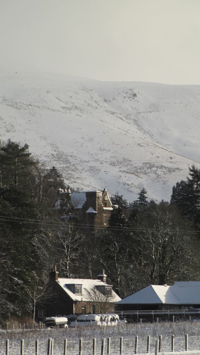
Butter Hill is a prominent hill located in Dumfriesshire, Scotland. It is part of the Southern Uplands, a range of rolling hills and mountains in the southern region of the country. Rising to an elevation of 521 meters (1,709 feet), Butter Hill offers stunning panoramic views of the surrounding countryside.

The hill is easily recognizable due to its distinctive shape, resembling a dome or a mound. It is covered in lush green vegetation, including grasses, heather, and various wildflowers, which create a picturesque landscape. The slopes of the hill are gentle and relatively easy to climb, making it a popular destination for hikers and nature enthusiasts.

At the summit of Butter Hill, visitors are rewarded with breathtaking vistas of the surrounding area. On clear days, one can see the rolling hills of Dumfriesshire stretching out in all directions, with glimpses of distant mountains and valleys. The hill provides an excellent vantage point for observing the natural beauty of the region.

Butter Hill is also known for its historical significance. It is believed that the hill was once used as a site for ceremonial gatherings and rituals by ancient Celtic tribes. Archaeological remains, including burial mounds and standing stones, have been discovered in the vicinity, adding to its cultural value.

Overall, Butter Hill offers a splendid opportunity for both leisurely walks and immersive experiences in nature. Its combination of scenic beauty, accessibility, and historical significance make it a must-visit destination for anyone exploring the Dumfriesshire area.

If you have any feedback on the listing, please let us know in the comments section below.

Butter Hill Images

Images are sourced within 2km of 55.258504/-2.9234337 or Grid Reference NY4196. Thanks to Geograph Open Source API. All images are credited.

Road along Carewood Rig
Tudhope Hill across Pyat Knowe
Glenrief On the Hermitage road out of Ewesdale.
Glenrief
On the Hermitage road out of Ewesdale.
View up Glen Reif Upper Ewes Water.
View up Glen Reif
Upper Ewes Water.
Carewoodrig Burn A headwater of the Ewes Water.
Carewoodrig Burn
A headwater of the Ewes Water.
Carewoodrig Burn
Carewoodrig Burn
An access road on Crude Hill This road was built to provide access to forestry on Bught Knowe in the background and Glenrief Rig, but it is also used by the local hill farmer.
An access road on Crude Hill
This road was built to provide access to forestry on Bught Knowe in the background and Glenrief Rig, but it is also used by the local hill farmer.
The Road Past Carewoodrig Carewoodrig Farm is in the middle distance.
The Road Past Carewoodrig
Carewoodrig Farm is in the middle distance.
Road to Carewoodrig I had parked my car off the road in a convenient small lay-by under Tup Knowe so as to take this view looking towards Carewoodrig, whose position is marked by a green blob to the left of centre. It was an exceptionally warm day for late March, around 20 celsius.
Road to Carewoodrig
I had parked my car off the road in a convenient small lay-by under Tup Knowe so as to take this view looking towards Carewoodrig, whose position is marked by a green blob to the left of centre. It was an exceptionally warm day for late March, around 20 celsius.
A small plantation on Castlewink This small block of forestry on the lower southern slopes of Castlewink was viewed from Blackhall Hill. The forestry in the background at the top left is on Bught Knowe. Sheep are grazing on the lower part of the hillside.
A small plantation on Castlewink
This small block of forestry on the lower southern slopes of Castlewink was viewed from Blackhall Hill. The forestry in the background at the top left is on Bught Knowe. Sheep are grazing on the lower part of the hillside.
A fence and gate on Wether Law The gate in the fence is at the summit area of the hill. Tudhope Hill is prominent in the background directly over the gate.
A fence and gate on Wether Law
The gate in the fence is at the summit area of the hill. Tudhope Hill is prominent in the background directly over the gate.
Butter Hill Butter Hill is the small conical hill right of centre in this view from Peat Rig. The snow-covered minor road to the left of Butter Hill winds its way past rounded hills to Hermitage on the B6399.
Butter Hill
Butter Hill is the small conical hill right of centre in this view from Peat Rig. The snow-covered minor road to the left of Butter Hill winds its way past rounded hills to Hermitage on the B6399.
A building at Twislehope Hope This former shepherd’s cottage by the Twislehope Burn is now used as a storage building by the local farmer.
A building at Twislehope Hope
This former shepherd’s cottage by the Twislehope Burn is now used as a storage building by the local farmer.
An old building at Twislehope Hope This former shepherd’s cottage by the Twislehope Burn is now used as a storage building by the local farmer. For a wider view of the building, see <a href="https://www.geograph.org.uk/photo/3258891">NY4395 : A building at Twislehope Hope</a>.
An old building at Twislehope Hope
This former shepherd’s cottage by the Twislehope Burn is now used as a storage building by the local farmer. For a wider view of the building, see NY4395 : A building at Twislehope Hope.
A detail on the building at Twislehope Hope A rusting cast iron hopper head on the right is the remnant of a rain water downpipe system while the cast iron pipe on the left is a vent pipe that would have served a toilet. This former shepherd’s cottage is now used as a storage building by the local farmer. For a wider view of the building, see <a href="https://www.geograph.org.uk/photo/3258891">NY4395 : A building at Twislehope Hope</a>.
A detail on the building at Twislehope Hope
A rusting cast iron hopper head on the right is the remnant of a rain water downpipe system while the cast iron pipe on the left is a vent pipe that would have served a toilet. This former shepherd’s cottage is now used as a storage building by the local farmer. For a wider view of the building, see NY4395 : A building at Twislehope Hope.
A building at Twislehope Hope This former shepherd’s cottage by the Twislehope Burn is now used as a storage building by the local farmer. For a wider view of the building, see <a href="https://www.geograph.org.uk/photo/3258891">NY4395 : A building at Twislehope Hope</a>.
A building at Twislehope Hope
This former shepherd’s cottage by the Twislehope Burn is now used as a storage building by the local farmer. For a wider view of the building, see NY4395 : A building at Twislehope Hope.
A timber safe lintel at Twislehope Hope In old traditional stone-built buildings timber lintels were often used behind an outer stone lintel to support stonework over door and window openings. Sometimes these wooden beams are riddled with woodworm and can look anything but safe. For a view of the building by the Twislehope Burn, see <a href="https://www.geograph.org.uk/photo/3258891">NY4395 : A building at Twislehope Hope</a>.
A timber safe lintel at Twislehope Hope
In old traditional stone-built buildings timber lintels were often used behind an outer stone lintel to support stonework over door and window openings. Sometimes these wooden beams are riddled with woodworm and can look anything but safe. For a view of the building by the Twislehope Burn, see NY4395 : A building at Twislehope Hope.
Guile Sike Sheep are grazing on the lower western slopes of Dog Knowe at Guile Sike. The two fir trees are an unusual sight in an area of rounded grassy hills.
Guile Sike
Sheep are grazing on the lower western slopes of Dog Knowe at Guile Sike. The two fir trees are an unusual sight in an area of rounded grassy hills.
Show me another place!

Butter Hill is located at Grid Ref: NY4196 (Lat: 55.258504, Lng: -2.9234337)

Unitary Authority: Dumfries and Galloway

Police Authority: Dumfries and Galloway

What 3 Words

///tilts.slopes.overture. Near Teviothead, Scottish Borders

Nearby Locations

Butter Hill

Related Wikis

Unthank, Dumfries and Galloway

Unthank is a village in Dumfries and Galloway, Scotland. == References == The geographic coordinates are from the Ordnance Survey.

Cauldcleuch Head

Cauldcleuch Head is a hill in an unnamed range of Roxburghshire hills north of Langholm, part of the Southern Uplands of Scotland. The highest hill in...

Arkleton

Arkleton is a mansion and estate in the civil parish of Ewes, in Dumfries and Galloway, Scotland. Arkleton House was built in 1860/1884 and incorporates...

Dinley

Dinley is a hamlet in the Scottish Borders through which Hermitage Water flows. == Etymology == The first element, din, seems to be the Cumbric word for...

Nearby Amenities

Located within 500m of 55.258504,-2.9234337
Butter Hill
Ele: 342
Natural: peak
Lat/Long: 55.2588591/-2.9244405
The data included in this document is from www.openstreetmap.org. The data is made available under ODbL.

Have you been to Butter Hill?

Leave your review of Butter Hill below (or comments, questions and feedback).