Angletarn Pikes

Hill, Mountain in Westmorland Eden

England

Angletarn Pikes

Small rocky outcrops in Bannerdale The long drystone wall is shown on the earliest large-scale OS map, surveyed in 1860.
Small rocky outcrops in Bannerdale Credit: Christine Johnstone

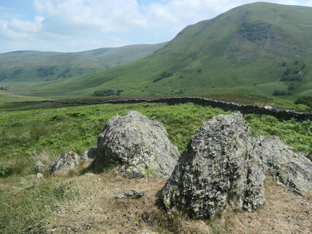
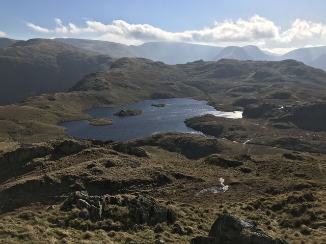
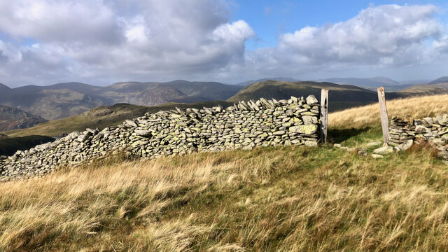
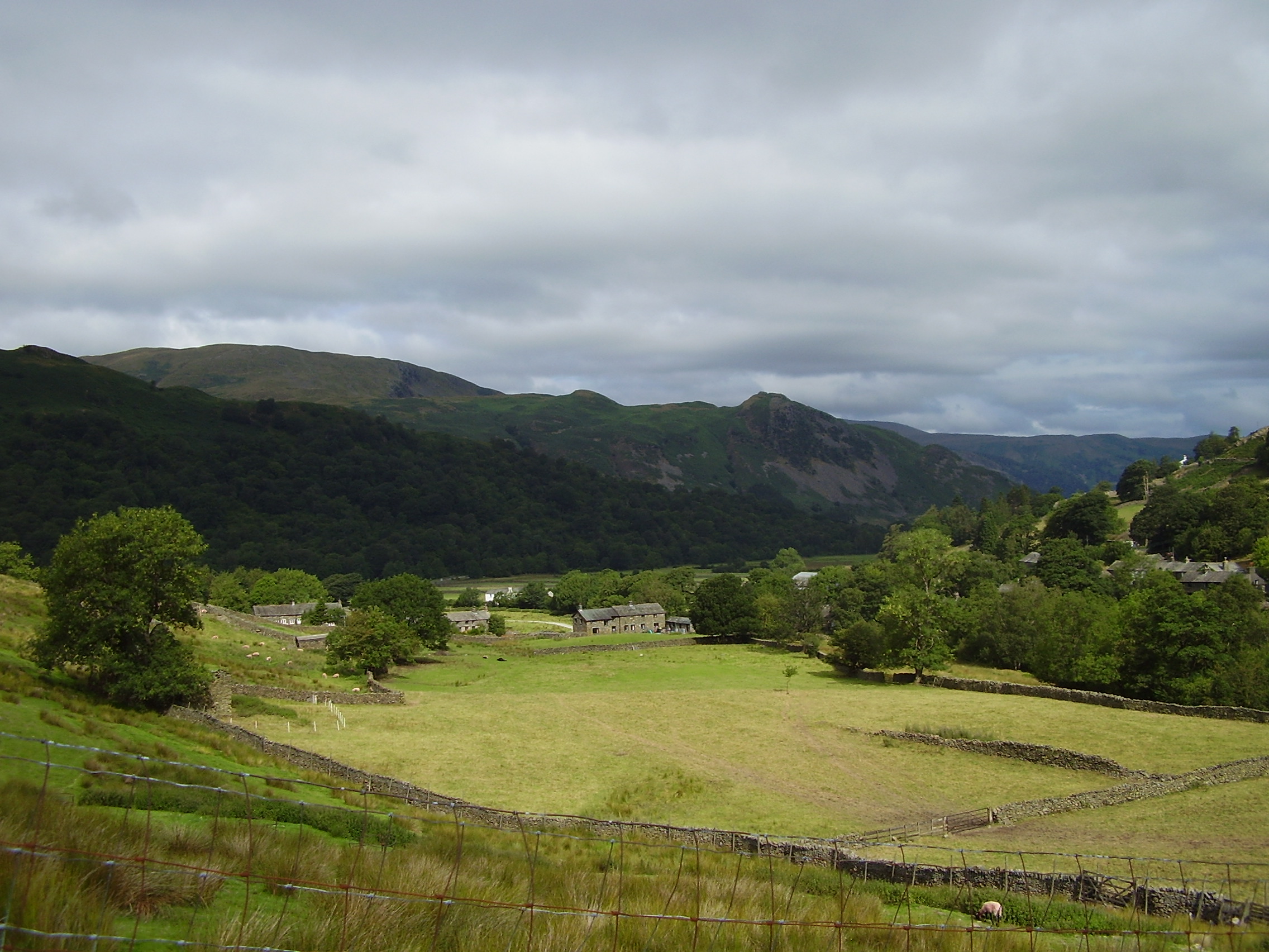
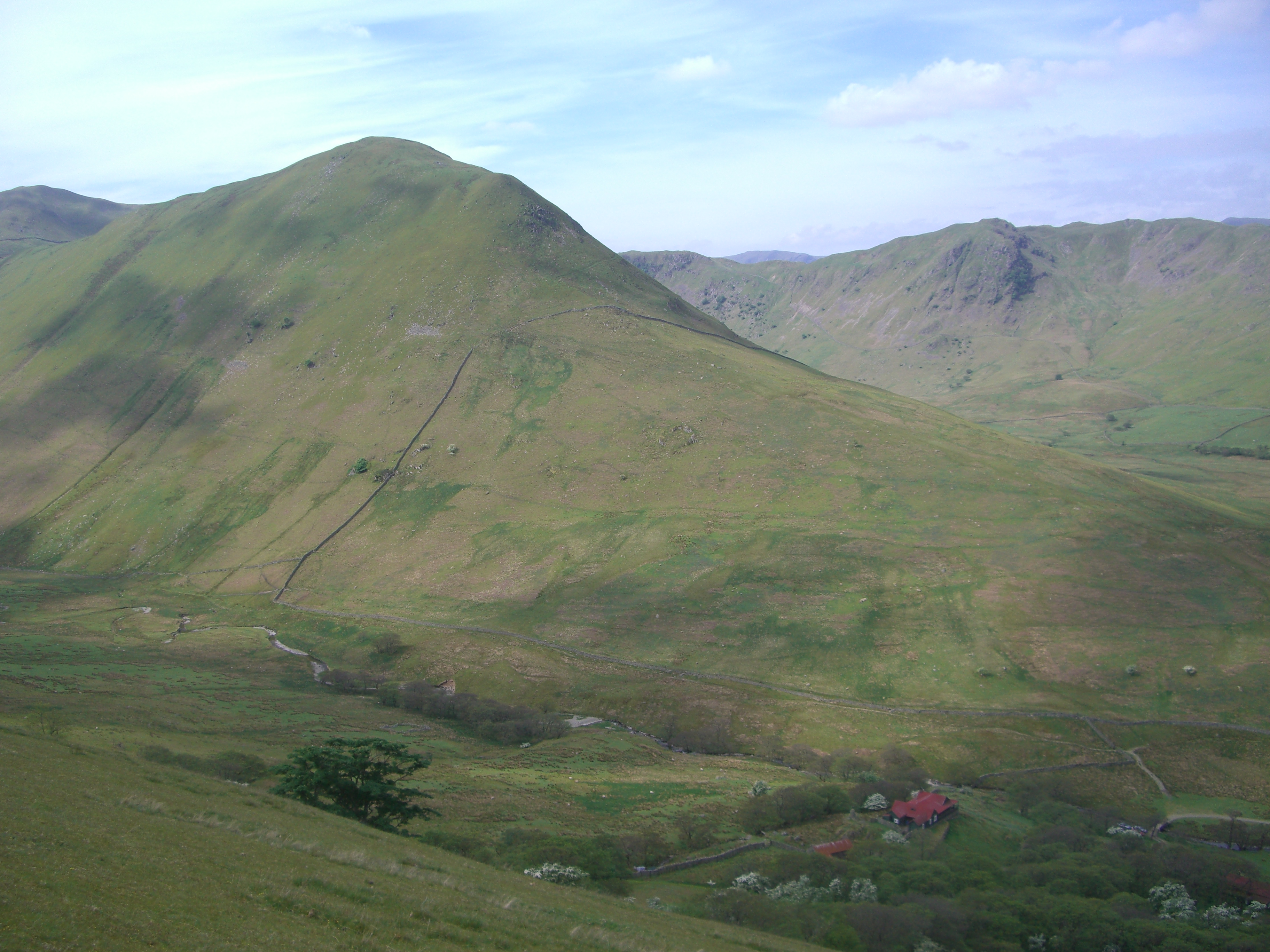
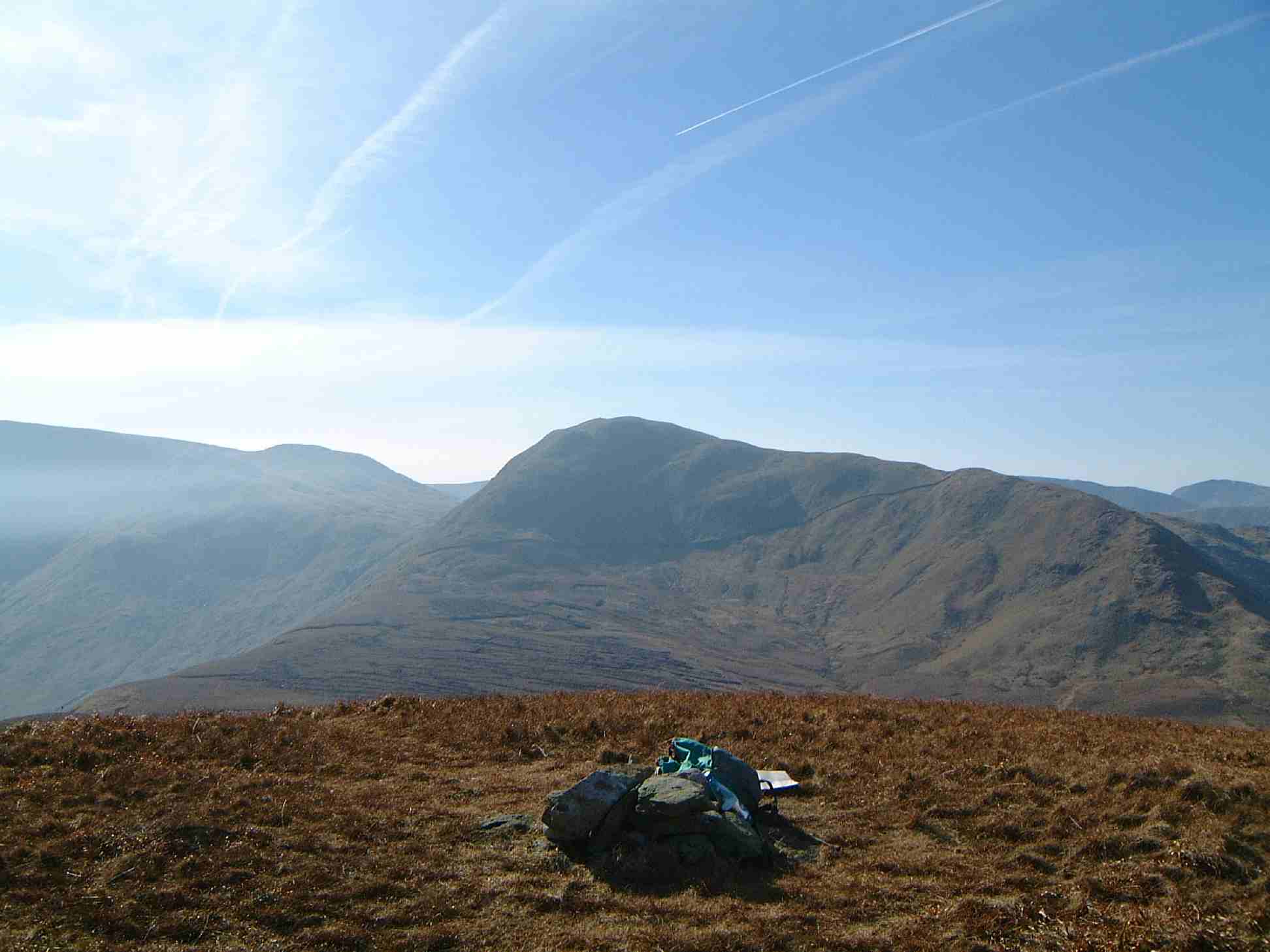
Angletarn Pikes is a prominent hill/mountain located in the Westmorland region of England, specifically in the Lake District National Park. It stands at an elevation of 575 meters (1,886 feet) and is situated between the valleys of Martindale to the east and Patterdale to the west. The name "Angletarn" is derived from the tarn (a small mountain lake) located at the foot of the hill.

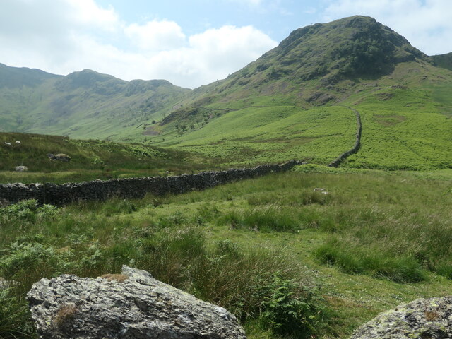
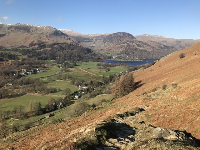
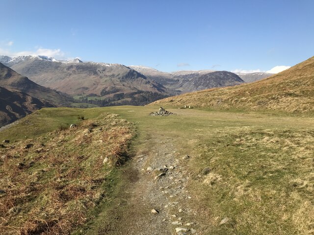
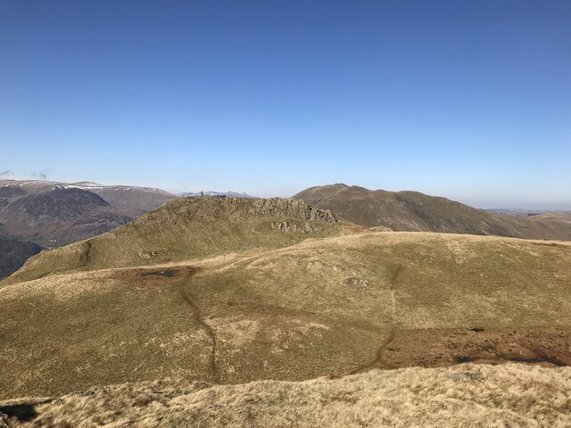
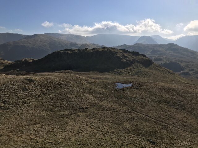
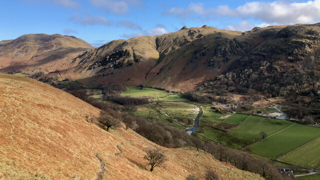
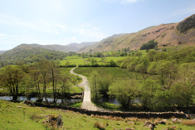
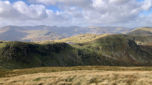
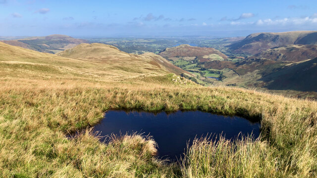
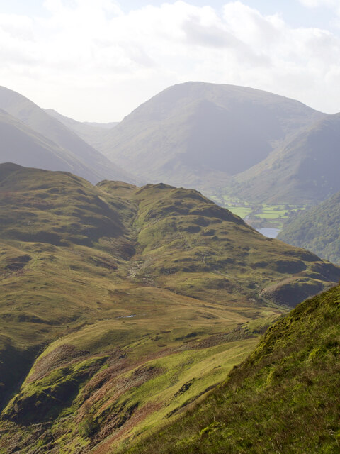
The twin peaks of Angletarn Pikes are a distinctive feature of the landscape and are a popular destination for hikers and nature enthusiasts. The hill offers breathtaking panoramic views of the surrounding valleys, including the sparkling waters of Ullswater Lake to the west and the picturesque Martindale Valley to the east.

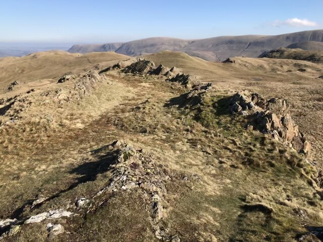
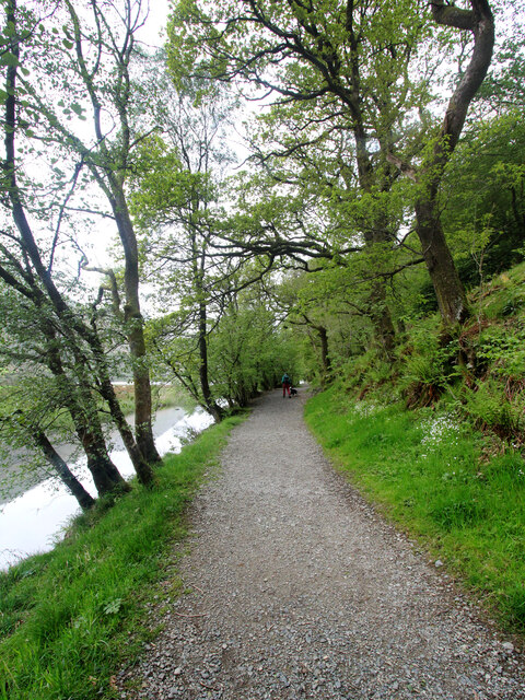
The ascent to Angletarn Pikes can be challenging, with steep and rocky sections that require proper hiking equipment and experience. However, the effort is rewarded with stunning vistas and a sense of accomplishment upon reaching the summit.

The area around Angletarn Pikes is rich in flora and fauna, with heather, bracken, and grasses covering the slopes. Wildlife such as red deer, sheep, and birds can often be spotted during the climb.

For those seeking a longer hike, Angletarn Pikes can be incorporated into a larger circuit, including other nearby fells such as Beda Fell and Place Fell. The hill/mountain offers a true taste of the natural beauty and rugged terrain that the Lake District is famous for.

If you have any feedback on the listing, please let us know in the comments section below.

Angletarn Pikes Images

Images are sourced within 2km of 54.525233/-2.9080723 or Grid Reference NY4114. Thanks to Geograph Open Source API. All images are credited.

Small rocky outcrops in Bannerdale The long drystone wall is shown on the earliest large-scale OS map, surveyed in 1860.
Small rocky outcrops in Bannerdale
The long drystone wall is shown on the earliest large-scale OS map, surveyed in 1860.
Wall climbing towards Heck Crag, Bannerdale In 1860 'Heck' was mapped as 'Haig'. Probably just a difference in accent between the locals and the surveyor.
Wall climbing towards Heck Crag, Bannerdale
In 1860 'Heck' was mapped as 'Haig'. Probably just a difference in accent between the locals and the surveyor.
Red deer, below Bedafell Knott, Bannerdale 300 metres away, but well aware of me. Red deer are more usually seen on the east [Nab] side of Bannerdale.
Red deer, below Bedafell Knott, Bannerdale
300 metres away, but well aware of me. Red deer are more usually seen on the east [Nab] side of Bannerdale.
Access track to a field barn, Bannerdale The barn [but not the tree it is under!] is shown on the large-scale OS map surveyed in 1860.
Access track to a field barn, Bannerdale
The barn [but not the tree it is under!] is shown on the large-scale OS map surveyed in 1860.
Path on Patterdale Common
Boredale Hause
Boredale Hause
Angle Tarn
Angle Tarn
Angletarn Pikes North Top
Angletarn Pikes summit
Angletarn Pikes South Top
Goldrill Beck The principal “river” in Patterdale between Ullswater and Brotherswater is Goldrill Beck. That’s it there, just right of centre and to the left of the “holiday village” of Hartsop Fold.

But compare it to the map, which shows the beck hugging the road, hidden by the trees of low Wood.

In the late 18th-century, the beck was canalised, made straighter between embankments in an attempt to drain the fields and make them more productive.

The beck became fast flowing with uniform depth and a lack of natural features made them a poor wildlife habitat. And the high embankments actually prevented the fields from draining  into the beck and so became boggy and reed-filled.

This was done in many of the valleys of the Lake District, but Goldrill Beck also had a particular issue for Goldrill Beck as its canalised route alongside the A592 caused it to continually undercut the road. This was particularly bad during Storm Desmond

The National Trust, in conjunction with the Environment Agency, Natural England and Cumbria County Council have undertaken a project to restore Goldrill Beck to a more natural course with features such as gravel bars, riffles, and meanders. The parlance is to re-wiggle the rivers although in the case of Goldrill Beck it seems to be one big loop but at the lower end of the loop the beck is split into multiple channels where it joins Angletarn Beck.

The old river channel has been partially filled so that it may act as an overflow pond at times of high rainfall.

Ahead, on skyline, are the twin summits of Angletarn Pikes. To the left the deep gash of Dubhow Beck with the cottage of Dubhow and its foot.

It’s just occurred to me that the online mapping below will eventually be updated to show the new river system, so for posterity here is a link to the 1920 O.S. Map, <span class="nowrap"><a title="https://maps.nls.uk/view/101104881#zoom=4&lat=5401&lon=3141&layers=BT" rel="nofollow ugc noopener" href="https://maps.nls.uk/view/101104881#zoom=4&lat=5401&lon=3141&layers=BT">Link</a><img style="margin-left:2px;" alt="External link" title="External link - shift click to open in new window" src="https://s1.geograph.org.uk/img/external.png" width="10" height="10"/></span>

For sources see my blog <span class="nowrap"><a title="http://www.fhithich.uk/?p=27519" rel="nofollow ugc noopener" href="http://www.fhithich.uk/?p=27519">Link</a><img style="margin-left:2px;" alt="External link" title="External link - shift click to open in new window" src="https://s1.geograph.org.uk/img/external.png" width="10" height="10"/></span>
Goldrill Beck
The principal “river” in Patterdale between Ullswater and Brotherswater is Goldrill Beck. That’s it there, just right of centre and to the left of the “holiday village” of Hartsop Fold. But compare it to the map, which shows the beck hugging the road, hidden by the trees of low Wood. In the late 18th-century, the beck was canalised, made straighter between embankments in an attempt to drain the fields and make them more productive. The beck became fast flowing with uniform depth and a lack of natural features made them a poor wildlife habitat. And the high embankments actually prevented the fields from draining into the beck and so became boggy and reed-filled. This was done in many of the valleys of the Lake District, but Goldrill Beck also had a particular issue for Goldrill Beck as its canalised route alongside the A592 caused it to continually undercut the road. This was particularly bad during Storm Desmond The National Trust, in conjunction with the Environment Agency, Natural England and Cumbria County Council have undertaken a project to restore Goldrill Beck to a more natural course with features such as gravel bars, riffles, and meanders. The parlance is to re-wiggle the rivers although in the case of Goldrill Beck it seems to be one big loop but at the lower end of the loop the beck is split into multiple channels where it joins Angletarn Beck. The old river channel has been partially filled so that it may act as an overflow pond at times of high rainfall. Ahead, on skyline, are the twin summits of Angletarn Pikes. To the left the deep gash of Dubhow Beck with the cottage of Dubhow and its foot. It’s just occurred to me that the online mapping below will eventually be updated to show the new river system, so for posterity here is a link to the 1920 O.S. Map, LinkExternal link For sources see my blog LinkExternal link
Path to Dovedale The car park at Cow bridge has that essential quality of anywhere I choose to leave a vehicle - it's free. Consequently, it is also likely to be full very early in the morning. Today we won, and this footpath is the one that led us onwards (and eventually upwards) up Dovedale to a traverse of Fairfield (a mountain I seem to have climbed or descended in pretty much every available direction).
Path to Dovedale
The car park at Cow bridge has that essential quality of anywhere I choose to leave a vehicle - it's free. Consequently, it is also likely to be full very early in the morning. Today we won, and this footpath is the one that led us onwards (and eventually upwards) up Dovedale to a traverse of Fairfield (a mountain I seem to have climbed or descended in pretty much every available direction).
Menneting Bridge from Hause Gate Hause Gate is the bridleway which enables walkers to stay on the east side of Goldrill Beck, away from the main road. However, whilst the route to the photographer's left continues to Hartsop for both walkers and riders, the continuing path towards Patterdale is for those on foot only, while the bridleway cuts back and crosses the beck via Menneting Bridge. Cyclists or equestrians desperate to reach Patterdale without encountering heavy weekend traffic must turn off a little earlier and make a 230m ascent to Boredale Hause before dropping even more steeply back towards Ullswater. There is also a permissive path heading up-valley to the left on the far side of the bridge, but this is not signposted prominently to attract attention.
Menneting Bridge from Hause Gate
Hause Gate is the bridleway which enables walkers to stay on the east side of Goldrill Beck, away from the main road. However, whilst the route to the photographer's left continues to Hartsop for both walkers and riders, the continuing path towards Patterdale is for those on foot only, while the bridleway cuts back and crosses the beck via Menneting Bridge. Cyclists or equestrians desperate to reach Patterdale without encountering heavy weekend traffic must turn off a little earlier and make a 230m ascent to Boredale Hause before dropping even more steeply back towards Ullswater. There is also a permissive path heading up-valley to the left on the far side of the bridge, but this is not signposted prominently to attract attention.
A glimpse of Angle Tarn between Buck Crag and Heck Crag
Old gate on the northern nose of Rest Dodd
Small pool above Hawk Crag
Boredale Hause
Boredale Hause
Romano-British Enclosed Stone Hut Circle Settlement "Settlement site which covers an area of ca 2 acres with the usual arrangement of circular huts and enclosures. One irregular enclosure has well-preserved orthostats of unusual size, many of which stand 3 ft above the ground. The principal enclosure is sub-divided into 2 main divisions, each with a clearly marked entrance on the E, whilst the walls 7-8 ft in thickness are considerably wider than the walls of the village. The part of the village which lies S of the beck shows only traces of a few huts. It is suggested that there may have been an enlargement or rebuilding of the village on more than one occasion (S1048, S1361). See the RCHM 1936 Westmorland (S1389 p. 166-167). The monument is a Romano-British enclosed stone hut circle settlement located in the remote valley of Bannerdale, on a sloping shelf either side of Heck Beck which runs through the site. It includes an enclosure wall 0.9m - 1.4m wide and 0.6m high which is visible at the south-west, north and north-east sides of the settlement only. A mound of large outcropping rocks is incorporated into the wall in the north-west side adjacent to which is a re-entrant or inwardly pointing entrance. South of Heck Beck, and within the enclosure wall, are 3 hut circles having internal diameters of between 1.4 - 7.3m. Immediately north of the beck is an area of irregular small enclosures, with a well-defined entrance of flat stones through the enclosure wall, within which are 5 hut circles with internal diameters between 1.5-6.4m. At the north-eastern end of the site 3 sub- rectangular enclosures, two of which have entrances defined by large, flat stones, have been constructed against the internal side of the enclosure wall. Close by are 2 hut circles with internal diameters of 6.2 and 4.5m. Dominating the north-eastern end of the settlement is a well preserved irregular enclosure with walls up to 7.3m thick constructed of stones standing up to 0.9m high. This enclosure is sub-divided into 2 main parts, each with clearly marked entrances on the east, and is thought to indicate a rebuilding and/or enlargement of the settlement. A modern drystone wall running across the monument is excluded from the scheduling although the ground beneath it is included. The monument is a good example of a R-B enclosed stone hut circle settlement which exhibits several phases of occupation and activity. Its earthworks survive well, preserve considerable detail of the layout of the site, and will facilitate further study of Romano-British settlement patterns in the area (S905, S904)."

‘Heritage Gateway - Results’. 2012. Heritagegateway.org.uk <<span class="nowrap"><a title="https://www.heritagegateway.org.uk/Gateway/Results_Single.aspx?uid=2886004&resourceID=801" rel="nofollow ugc noopener" href="https://www.heritagegateway.org.uk/Gateway/Results_Single.aspx?uid=2886004&resourceID=801">Link</a><img style="margin-left:2px;" alt="External link" title="External link - shift click to open in new window" src="https://s1.geograph.org.uk/img/external.png" width="10" height="10"/></span> > [accessed 15 October 2022]
Romano-British Enclosed Stone Hut Circle Settlement
"Settlement site which covers an area of ca 2 acres with the usual arrangement of circular huts and enclosures. One irregular enclosure has well-preserved orthostats of unusual size, many of which stand 3 ft above the ground. The principal enclosure is sub-divided into 2 main divisions, each with a clearly marked entrance on the E, whilst the walls 7-8 ft in thickness are considerably wider than the walls of the village. The part of the village which lies S of the beck shows only traces of a few huts. It is suggested that there may have been an enlargement or rebuilding of the village on more than one occasion (S1048, S1361). See the RCHM 1936 Westmorland (S1389 p. 166-167). The monument is a Romano-British enclosed stone hut circle settlement located in the remote valley of Bannerdale, on a sloping shelf either side of Heck Beck which runs through the site. It includes an enclosure wall 0.9m - 1.4m wide and 0.6m high which is visible at the south-west, north and north-east sides of the settlement only. A mound of large outcropping rocks is incorporated into the wall in the north-west side adjacent to which is a re-entrant or inwardly pointing entrance. South of Heck Beck, and within the enclosure wall, are 3 hut circles having internal diameters of between 1.4 - 7.3m. Immediately north of the beck is an area of irregular small enclosures, with a well-defined entrance of flat stones through the enclosure wall, within which are 5 hut circles with internal diameters between 1.5-6.4m. At the north-eastern end of the site 3 sub- rectangular enclosures, two of which have entrances defined by large, flat stones, have been constructed against the internal side of the enclosure wall. Close by are 2 hut circles with internal diameters of 6.2 and 4.5m. Dominating the north-eastern end of the settlement is a well preserved irregular enclosure with walls up to 7.3m thick constructed of stones standing up to 0.9m high. This enclosure is sub-divided into 2 main parts, each with clearly marked entrances on the east, and is thought to indicate a rebuilding and/or enlargement of the settlement. A modern drystone wall running across the monument is excluded from the scheduling although the ground beneath it is included. The monument is a good example of a R-B enclosed stone hut circle settlement which exhibits several phases of occupation and activity. Its earthworks survive well, preserve considerable detail of the layout of the site, and will facilitate further study of Romano-British settlement patterns in the area (S905, S904)." ‘Heritage Gateway - Results’. 2012. Heritagegateway.org.uk <LinkExternal link > [accessed 15 October 2022]
Show me another place!

Angletarn Pikes is located at Grid Ref: NY4114 (Lat: 54.525233, Lng: -2.9080723)

Administrative County: Cumbria

District: Eden

Police Authority: Cumbria

What 3 Words

///manuals.cooking.roughest. Near Ambleside, Cumbria

Related Wikis

Angletarn Pikes

Angletarn Pikes is a fell in the English Lake District near the village of Patterdale. Its most notable feature is Angle Tarn from which it derives its...

Angle Tarn (Patterdale)

Angle Tarn is a tarn in Cumbria, England, within the Lake District National Park, about a mile north-east of Hartsop. Located at an altitude of 479 m...

Brock Crags

Brock Crags is a fell in the English Lake District, standing above Hartsop in the Far Eastern Fells. It forms part of the perimeter of Martindale, lying...

Hartsop

Hartsop is a small village in the English Lake District. It lies in the Patterdale valley, near Brothers Water, Hayeswater and Kirkstone Pass. It consists...

Patterdale

Patterdale (Saint Patrick's Dale) is a small village and civil parish in the eastern part of the English Lake District in the Eden District of Cumbria...

Arnison Crag

Arnison Crag is a fell in the English Lake District, an outlier of the Fairfield group in the Eastern Fells. It looks down on Patterdale village and the...

The Nab

The Nab is a fell in the English Lake District. It has a moderate height of 576 metres (1,890 feet), and lies in the quieter eastern high ground between...

Rest Dodd

Rest Dodd is a fell in the English Lake District. It is situated in the quieter far eastern region of the national park and reaches a height of 696 metres...

Nearby Amenities

Located within 500m of 54.525233,-2.9080723
Source: npe
Lat/Long: 54.5216705/-2.9043772
Source: npe
Lat/Long: 54.5226309/-2.902455
Tourism: viewpoint
Lat/Long: 54.5227373/-2.9096792
Angletarn Pikes
Ele: 567
Natural: peak
Source: Database of British Hills & own gps
Wikidata: Q4763401
Wikipedia: en:Angletarn Pikes
Lat/Long: 54.5253704/-2.9079584
Stony Rigg
Is In: Eden, Cumbria
Place: locality
Lat/Long: 54.5271789/-2.911032
Ford: yes
Lat/Long: 54.5232572/-2.9023352
Dubhow Brow
Place: locality
Lat/Long: 54.5233319/-2.9092824
Ford: yes
Lat/Long: 54.5231484/-2.9040571
Angletarn Pikes South Top
Ele: 565
Natural: peak
Source: Database of British Hills & own gps
Wikidata: Q4763401
Wikipedia: en:Angletarn Pikes
Lat/Long: 54.5241793/-2.9063614
The data included in this document is from www.openstreetmap.org. The data is made available under ODbL.

Have you been to Angletarn Pikes?

Leave your review of Angletarn Pikes below (or comments, questions and feedback).