White Hill

Hill, Mountain in Midlothian

Scotland

White Hill

A7 lay-by
A7 lay-by Credit: Alex McGregor

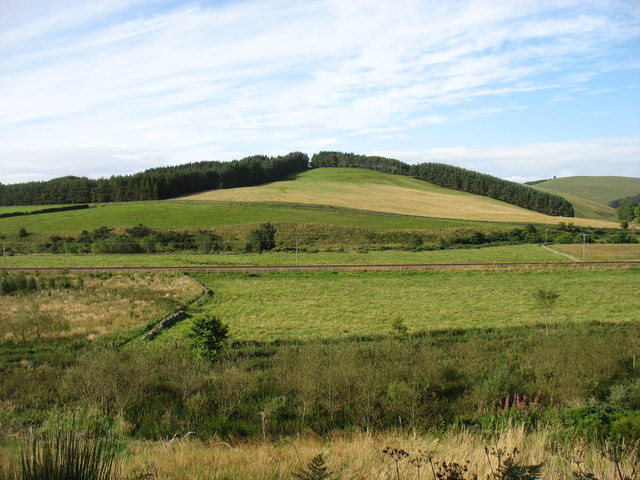
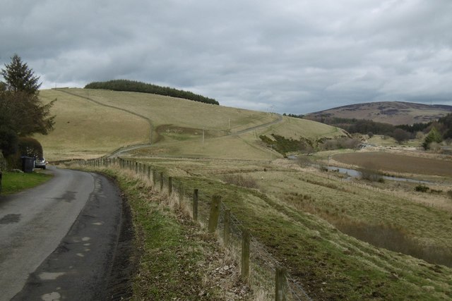
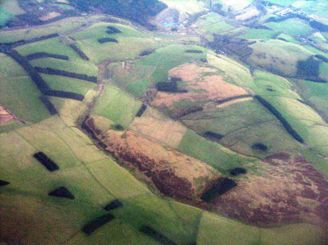
White Hill is a prominent hill located in Midlothian, Scotland. It is situated approximately 10 miles south of Edinburgh, making it easily accessible to both locals and tourists. Rising to a height of 424 meters (1,391 feet), White Hill is known for its stunning panoramic views of the surrounding countryside.

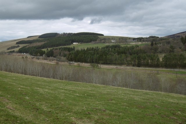
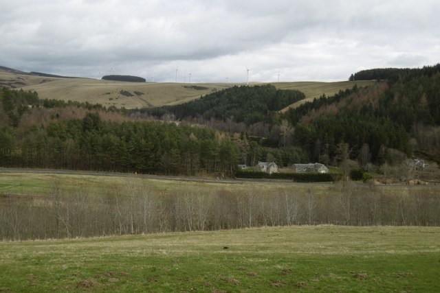
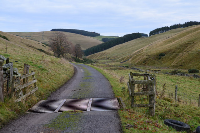
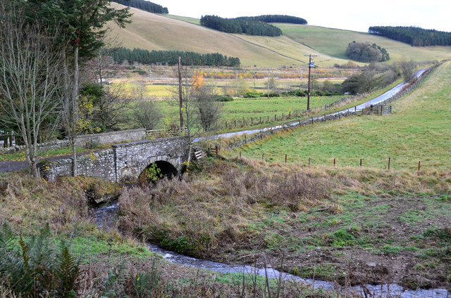
The hill is characterized by its gentle slopes and green, grassy terrain, which make it a popular destination for outdoor enthusiasts and hikers. Its strategic location provides unparalleled vistas of the Pentland Hills, Edinburgh, and the Firth of Forth, creating a picturesque backdrop for visitors.

White Hill is part of the larger Pentland Hills Regional Park, a designated area of natural beauty that spans over 100 square kilometers. This park offers numerous walking trails and paths, catering to varying levels of difficulty and allowing visitors to explore the diverse flora and fauna found in the area.

At the summit of White Hill, there is a trig point, a concrete pillar used in surveying, which serves as a landmark for hikers. This point offers a rewarding viewpoint, allowing visitors to appreciate the breathtaking landscape from an elevated position.

Due to its close proximity to Edinburgh, White Hill is a popular destination for day trips and outdoor activities. Whether it's a leisurely walk, a challenging hike, or simply enjoying the tranquility of nature, White Hill offers something for everyone seeking to escape the hustle and bustle of city life.

If you have any feedback on the listing, please let us know in the comments section below.
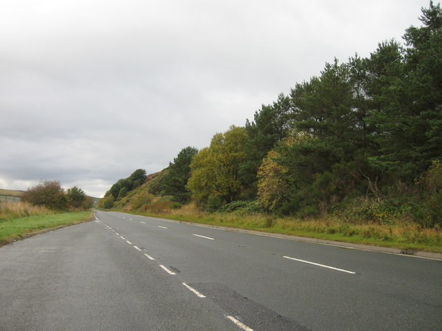
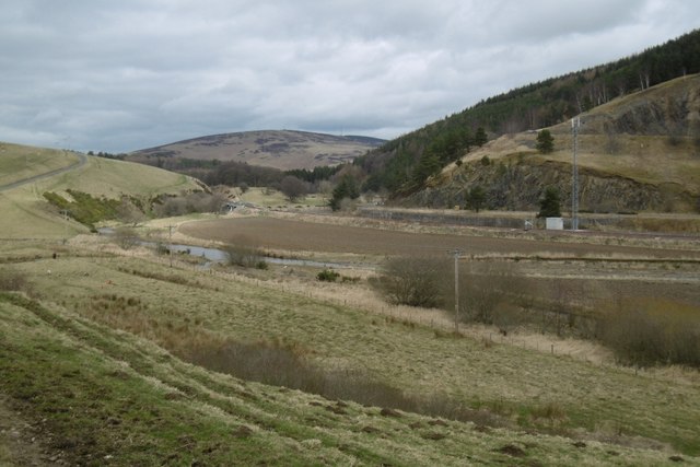
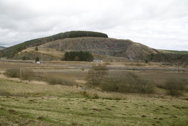
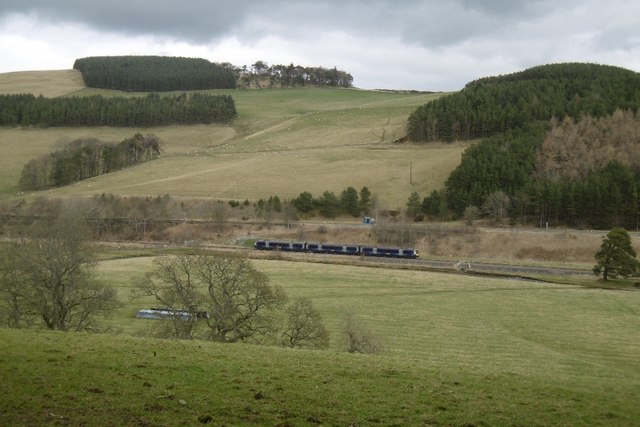
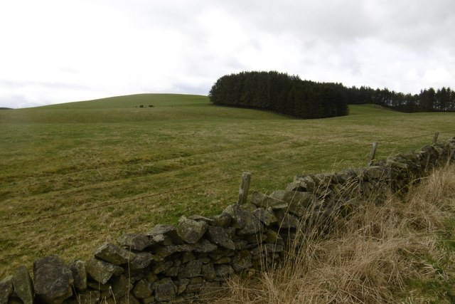
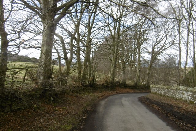
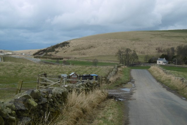
White Hill Images

Images are sourced within 2km of 55.754711/-2.9363684 or Grid Reference NT4151. Thanks to Geograph Open Source API. All images are credited.

A7 lay-by
A7 lay-by
Chapel Hill The recently reopened Borders Railway crosses the centre of this picture.
Chapel Hill
The recently reopened Borders Railway crosses the centre of this picture.
Gala Water A transport corridor with the A7 and again, the railway.
Gala Water
A transport corridor with the A7 and again, the railway.
Hazelbank Quarry The quarry has reopened.
Hazelbank Quarry
The quarry has reopened.
Yellow road, passing Brockhouse Looking upstream along the Gala Water.
Yellow road, passing Brockhouse
Looking upstream along the Gala Water.
View of Crookston Looking over the Gala Water from the single track road on the west side of the river.
View of Crookston
Looking over the Gala Water from the single track road on the west side of the river.
Crookston Across the Gala Water.
Crookston
Across the Gala Water.
Stripwood, White Hill A strip on the west side of the Gala Water.
Stripwood, White Hill
A strip on the west side of the Gala Water.
Borders Railway, Halltree An Edinburgh bound train passes a road junction on the A7.
Borders Railway, Halltree
An Edinburgh bound train passes a road junction on the A7.
Hillside above Halltree
Yellow road, Kilcoulter Approach to Kilcoulter Bridge, heading northwards.
Yellow road, Kilcoulter
Approach to Kilcoulter Bridge, heading northwards.
Road south of Heriot The white house by the A7 used to have a shop and filling station.
<a href="https://www.geograph.org.uk/photo/38033">NT4053 : Hangingshaw Post Office.</a>
Road south of Heriot
The white house by the A7 used to have a shop and filling station. NT4053 : Hangingshaw Post Office.
Between Heriot and Fountainhall Plantations and upland pastures to the west of the Gala Water valley. The A7 runs in the valley across the  top of the picture.
Between Heriot and Fountainhall
Plantations and upland pastures to the west of the Gala Water valley. The A7 runs in the valley across the top of the picture.
Rough path near White Bridge, Heriot The path shown running ENE from White Bridge cannot be recommended. The section shown here looks straightforward but led here through a flooded ditch, avoided by taking to the undergrowth on the right.
Rough path near White Bridge, Heriot
The path shown running ENE from White Bridge cannot be recommended. The section shown here looks straightforward but led here through a flooded ditch, avoided by taking to the undergrowth on the right.
A forlorn hope, Heriot On an abortive attempt to follow the path shown on the S bank of the Heriot Water between White Bridge and Kilcoulter Bridge. Beyond this point the route was heavily overgrown with fallen trees, swampland and barbed wire adding to the fun.
A forlorn hope, Heriot
On an abortive attempt to follow the path shown on the S bank of the Heriot Water between White Bridge and Kilcoulter Bridge. Beyond this point the route was heavily overgrown with fallen trees, swampland and barbed wire adding to the fun.
Heriot Water at Kilcoulter Wood The furthest point reached on the attempt to follow the path from White Bridge to Kilcoulter Bridge.
Heriot Water at Kilcoulter Wood
The furthest point reached on the attempt to follow the path from White Bridge to Kilcoulter Bridge.
Corsehope glen On the access road to Corsehope House from the minor road at Kilcoulter.
Corsehope glen
On the access road to Corsehope House from the minor road at Kilcoulter.
Chapel Bridge, Kilcoulter Old maps (e.g. OS 6" Edinburghshire sheet XXI.SW 1895) show Halltree Chapel a short distance to the south on Chapel Hill. The bridge carries the Fountainhall road across the Corsehope Burn.
Chapel Bridge, Kilcoulter
Old maps (e.g. OS 6" Edinburghshire sheet XXI.SW 1895) show Halltree Chapel a short distance to the south on Chapel Hill. The bridge carries the Fountainhall road across the Corsehope Burn.
Show me another place!

White Hill is located at Grid Ref: NT4151 (Lat: 55.754711, Lng: -2.9363684)

Unitary Authority: The Scottish Borders

Police Authority: The Lothians and Scottish Borders

What 3 Words

///decently.steams.blaze. Near Gorebridge, Midlothian

Nearby Locations

Shank Wood White Hill

Related Wikis

Halltree

Halltree is a hamlet in the Scottish Borders. == Etymology == The etymology of Halltree is debated, but the second element is likely to be a Cumbric word...

Heriot, Scottish Borders

Heriot is a small village in the Moorfoot Hills southeast of Edinburgh, Scotland, within Eildon (part of the Scottish Borders council area, though historically...

Fountainhall railway station

Fountainhall railway station served the village of Fountainhall, Scottish Borders from 1848 to 1969 on the Waverley Route. == History == The station opened...

Borders Railway

The Borders Railway connects the city of Edinburgh with Galashiels and Tweedbank in the Scottish Borders. The railway follows most of the alignment of...

Heriot railway station

Heriot railway station served the village of Heriot, Scottish Borders, Scotland from 1848 to 1969 on the Waverley Route. == History == The station opened...

Allanshaugh

Allanshaugh is a fermtoun in the Scottish Borders area of Scotland. == See also == List of places in the Scottish Borders List of places in Scotland...

Carcant

Carcant is a small settlement and a wind farm, near Heriot in the Scottish Borders area of Scotland. A famous inhabitant of Carcant was Eric Liddell....

Falahill

Falahill is a village in the Scottish Borders, in the Moorfoot Hills, at NT387563, in the Parish of Heriot, and close to the border with Midlothian. Nearby...

Nearby Amenities

Located within 500m of 55.754711,-2.9363684
White Hill
Ele: 316
Natural: peak
Lat/Long: 55.7545086/-2.9363584
Barrier: cattle_grid
Lat/Long: 55.7581465/-2.9338196
Barrier: cattle_grid
Lat/Long: 55.7589773/-2.9348958
Barrier: cattle_grid
Lat/Long: 55.7582945/-2.9368216
Barrier: cattle_grid
Lat/Long: 55.7565921/-2.941581
The data included in this document is from www.openstreetmap.org. The data is made available under ODbL.

Have you been to White Hill?

Leave your review of White Hill below (or comments, questions and feedback).