Westcott Hill

Hill, Mountain in Shropshire

England

Westcott Hill

Stream by the side of a footpath south of Habberley This is a scene of environmental destruction. All the stream and fence lines in this area have been destroyed by the owner farmer - trees cut down or uprooted, shrub and scrub levelled, all wildlife and biodiversity cover decimated. For what purpose - very minimal agricultural gain, wanton destruction, ignorance, “efficiency” ??? I notice a geograph taken at this spot 10 months previously shows a natural stream with wild garlic flourishing - a sign of longevity of undisturbed nature. This was so sad and depressing to see.
Stream by the side of a footpath south of Habberley Credit: Andrew Shannon

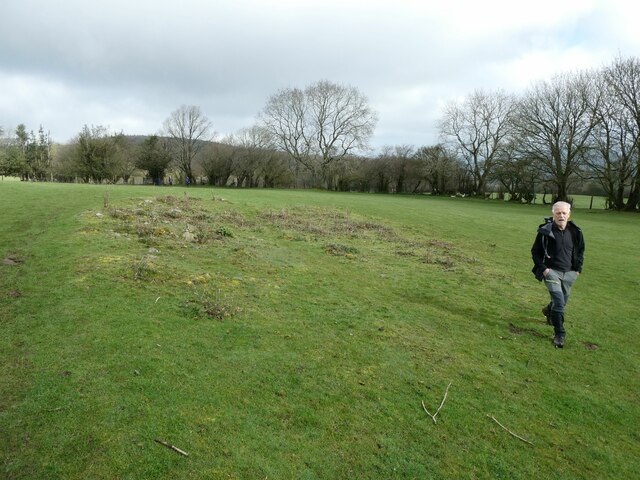
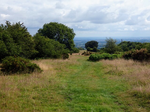
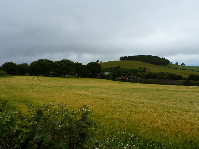
Westcott Hill is a prominent landmark located in the county of Shropshire, England. Rising to an elevation of approximately 420 meters, it is classified as a hill rather than a mountain, yet its impressive height grants it a commanding presence in the surrounding landscape. Situated in the heart of the Shropshire Hills Area of Outstanding Natural Beauty, Westcott Hill offers breathtaking panoramic views of the rolling countryside and the nearby Long Mynd.

The hill itself is characterized by its gentle slopes and verdant vegetation, which includes a mix of grasses, ferns, and wildflowers. These slopes are often frequented by hikers and nature enthusiasts who are drawn to the area's natural beauty and tranquility. The summit of Westcott Hill provides an ideal vantage point to admire the picturesque scenery, with vistas stretching as far as the eye can see.

In addition to its natural allure, Westcott Hill holds historical significance. It is believed that the hill was once used as a lookout point during medieval times, offering a strategic advantage for those guarding the surrounding land. Today, remnants of these ancient fortifications can still be found, adding to the hill's allure for history enthusiasts.

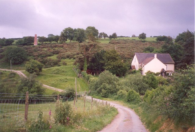
Westcott Hill is easily accessible, located just a short distance from the charming market town of Church Stretton. Its proximity to other notable landmarks, such as the Carding Mill Valley and the Stiperstones, makes it an ideal destination for those seeking to explore the scenic beauty of the Shropshire countryside.

Overall, Westcott Hill is a captivating natural landmark, offering visitors a chance to connect with nature, soak in breathtaking views, and immerse themselves in the rich history of the region.

If you have any feedback on the listing, please let us know in the comments section below.

Westcott Hill Images

Images are sourced within 2km of 52.607674/-2.8776206 or Grid Reference SJ4001. Thanks to Geograph Open Source API. All images are credited.

Stream by the side of a footpath south of Habberley This is a scene of environmental destruction. All the stream and fence lines in this area have been destroyed by the owner farmer - trees cut down or uprooted, shrub and scrub levelled, all wildlife and biodiversity cover decimated. For what purpose - very minimal agricultural gain, wanton destruction, ignorance, “efficiency” ??? I notice a geograph taken at this spot 10 months previously shows a natural stream with wild garlic flourishing - a sign of longevity of undisturbed nature. This was so sad and depressing to see.
Stream by the side of a footpath south of Habberley
This is a scene of environmental destruction. All the stream and fence lines in this area have been destroyed by the owner farmer - trees cut down or uprooted, shrub and scrub levelled, all wildlife and biodiversity cover decimated. For what purpose - very minimal agricultural gain, wanton destruction, ignorance, “efficiency” ??? I notice a geograph taken at this spot 10 months previously shows a natural stream with wild garlic flourishing - a sign of longevity of undisturbed nature. This was so sad and depressing to see.
On footpath south of Habberley These magnificent old trees frame the southern aspect of Earls Hill.
On footpath south of Habberley
These magnificent old trees frame the southern aspect of Earls Hill.
Walkers on the 2023 Pontesbury Potter cross a field The walk is a fixture in my calendar most years. You always meet nice, interesting, friendly, engaging and memorable walking companions. 

Plus we laugh 90% of the way round.
Walkers on the 2023 Pontesbury Potter cross a field
The walk is a fixture in my calendar most years. You always meet nice, interesting, friendly, engaging and memorable walking companions. Plus we laugh 90% of the way round.
Wooded valley on the edge of Cothercott Hill Pastureland on the edge of Long Rough. The sheep are enjoying the winter sunshine and being in the open air.
Wooded valley on the edge of Cothercott Hill
Pastureland on the edge of Long Rough. The sheep are enjoying the winter sunshine and being in the open air.
Cothercott Barytes Mill Barium mining was once an industry in the Stiperstones area. I don't know what they used this heavy mineral for, today it is used to make the 'mud' used to control oil wells. As its name suggests it is dense.
Cothercott Barytes Mill
Barium mining was once an industry in the Stiperstones area. I don't know what they used this heavy mineral for, today it is used to make the 'mud' used to control oil wells. As its name suggests it is dense.
Cothercott Hill View from the barytes mill.
Cothercott Hill
View from the barytes mill.
New gate, Cothercott Hill Irony that it is as awkward to get up the steps from the road as it would be to get over a traditional stile. Very encouraging to see that Shropshire County Council is still looking after its path network - they have earned a fine reputation over the years.
New gate, Cothercott Hill
Irony that it is as awkward to get up the steps from the road as it would be to get over a traditional stile. Very encouraging to see that Shropshire County Council is still looking after its path network - they have earned a fine reputation over the years.
Where is the footpath? A footpath leads through the centre of this field but it is clearly seldom used as there was no sign of trodden grass.
Where is the footpath?
A footpath leads through the centre of this field but it is clearly seldom used as there was no sign of trodden grass.
Inner Bailey at Castle Pulverbatch View from the motte. <span class="nowrap"><a title="https://historicengland.org.uk/listing/the-list/list-entry/1012860?section=official-list-entry" rel="nofollow ugc noopener" href="https://historicengland.org.uk/listing/the-list/list-entry/1012860?section=official-list-entry">Link</a><img style="margin-left:2px;" alt="External link" title="External link - shift click to open in new window" src="https://s1.geograph.org.uk/img/external.png" width="10" height="10"/></span>
Inner Bailey at Castle Pulverbatch
View from the motte. LinkExternal link
Motte at Castle Pulverbatch <span class="nowrap"><a title="https://historicengland.org.uk/listing/the-list/list-entry/1012860?section=official-list-entry" rel="nofollow ugc noopener" href="https://historicengland.org.uk/listing/the-list/list-entry/1012860?section=official-list-entry">Link</a><img style="margin-left:2px;" alt="External link" title="External link - shift click to open in new window" src="https://s1.geograph.org.uk/img/external.png" width="10" height="10"/></span>
Motte at Castle Pulverbatch
Late Snowdrops on the lane verge at Pulverbatch Gorgeous and glorious little gems.
Late Snowdrops on the lane verge at Pulverbatch
Gorgeous and glorious little gems.
Walkers on the 2023 Pontesbury Potter follow a field edge pat Walkers on this charity walk in aid of Severn Hospice follow a well trodden path along a footpath.
Walkers on the 2023 Pontesbury Potter follow a field edge pat
Walkers on this charity walk in aid of Severn Hospice follow a well trodden path along a footpath.
The motte at Castle Pulverbatch The castle was probably built in the late 11th century but it had been abandoned by 1202. The motte still stands at over 20 feet high, surrounded by a deep ditch on two sides and earthworks.
The motte at Castle Pulverbatch
The castle was probably built in the late 11th century but it had been abandoned by 1202. The motte still stands at over 20 feet high, surrounded by a deep ditch on two sides and earthworks.
Lower slopes of Wilderley Hill south of Pulverbatch Looking back down the Shropshire Way as it tracks gradually up Wilderley Hill. It is a wild and remote area, which claimed the lives of two local women in the severe winter of 1947. They were caught out on this hillside in a freak winter storm not far from this location.  There is a sadness to the area still.
Lower slopes of Wilderley Hill south of Pulverbatch
Looking back down the Shropshire Way as it tracks gradually up Wilderley Hill. It is a wild and remote area, which claimed the lives of two local women in the severe winter of 1947. They were caught out on this hillside in a freak winter storm not far from this location. There is a sadness to the area still.
Looking north on the slopes of Wilderley Hill The woodland in the valley is Long Rough, and the distant hill is Earl's Hill at Pontesbury, with Lawn Hill and Broom Hill adjacent. Beautiful view of some lovely countryside on the fringe of Shrewsbury.
Looking north on the slopes of Wilderley Hill
The woodland in the valley is Long Rough, and the distant hill is Earl's Hill at Pontesbury, with Lawn Hill and Broom Hill adjacent. Beautiful view of some lovely countryside on the fringe of Shrewsbury.
Wheatfield at the side of East Broomhill plantation
Bank Farm, with Broom Hill beyond
The track to Bank farm
Show me another place!

Westcott Hill is located at Grid Ref: SJ4001 (Lat: 52.607674, Lng: -2.8776206)

Unitary Authority: Shropshire

Police Authority: West Mercia

What 3 Words

///headings.albatross.circling. Near Pontesbury, Shropshire

Related Wikis

Habberley, Shropshire

Habberley is a small village and former civil parish, now in the parish of Pontesbury, in the Shropshire district, in the ceremonial county of Shropshire...

Eastridge Mountain Bike Trail Centre

Eastridge Mountain Bike Trail Centre is a free mountain biking venue in Shropshire, UK. The venue is developed and maintained by volunteers, and features...

Church Pulverbatch

Church Pulverbatch is a small village and civil parish in central Shropshire, England. The population of the parish was 344 at the time of the 2001 census...

Snailbeach

Snailbeach is a village in Shropshire, England, located near Shrewsbury at grid reference SJ375025. The population details taken at the 2011 census can...

Nearby Amenities

Located within 500m of 52.607674,-2.8776206
Huglith Hill
Ele: 329
Natural: peak
Lat/Long: 52.6114014/-2.8754548
Power: pole
Lat/Long: 52.6068576/-2.8810497
Power: pole
Lat/Long: 52.6090846/-2.8815449
Power: pole
Lat/Long: 52.6105043/-2.8818807
The data included in this document is from www.openstreetmap.org. The data is made available under ODbL.

Have you been to Westcott Hill?

Leave your review of Westcott Hill below (or comments, questions and feedback).