Arkleton Hill

Hill, Mountain in Dumfriesshire

Scotland

Arkleton Hill

View towards Arkleton Hill A track climbs out of Ewesdale towards sunlit Arkleton Hill.
View towards Arkleton Hill Credit: Richard Webb

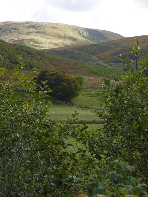
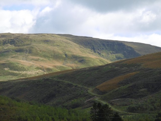
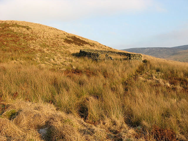
Arkleton Hill is a prominent geographical feature located in Dumfriesshire, Scotland. Situated in the southern part of the county, it forms part of the picturesque landscape of the Scottish Borders region. Rising to an elevation of approximately 159 meters (522 feet), it is classified as a hill rather than a mountain.

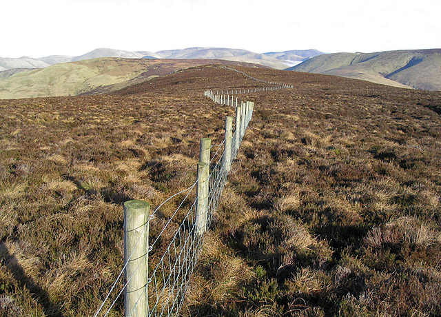
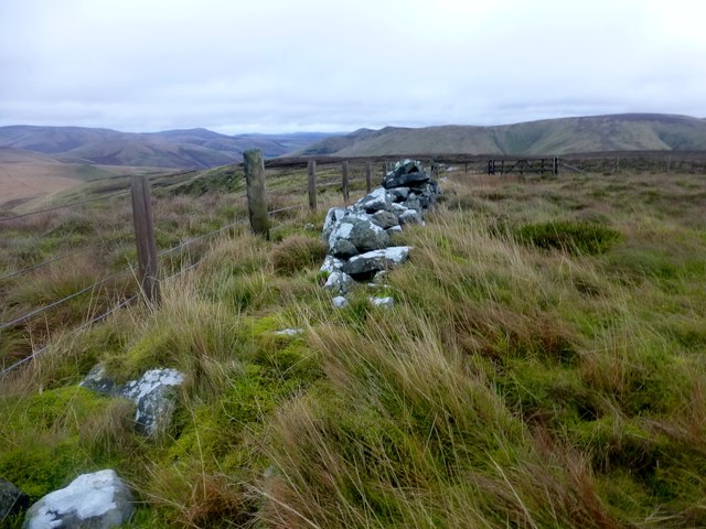
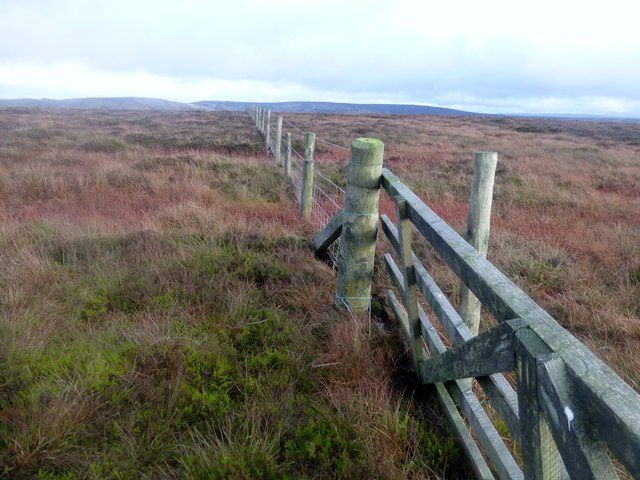
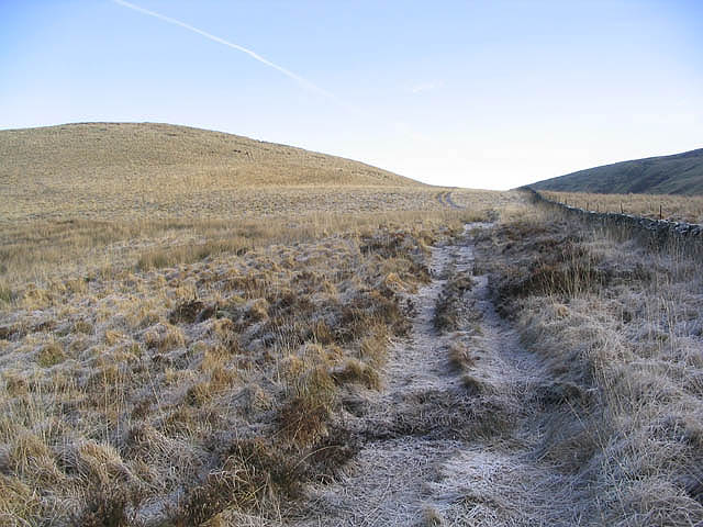
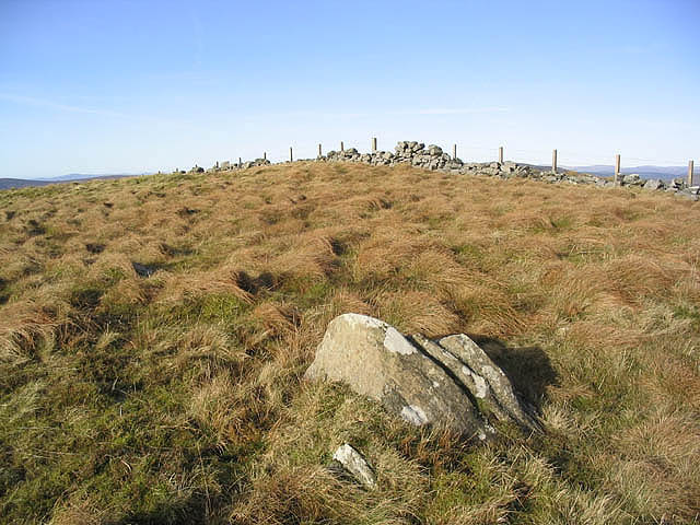
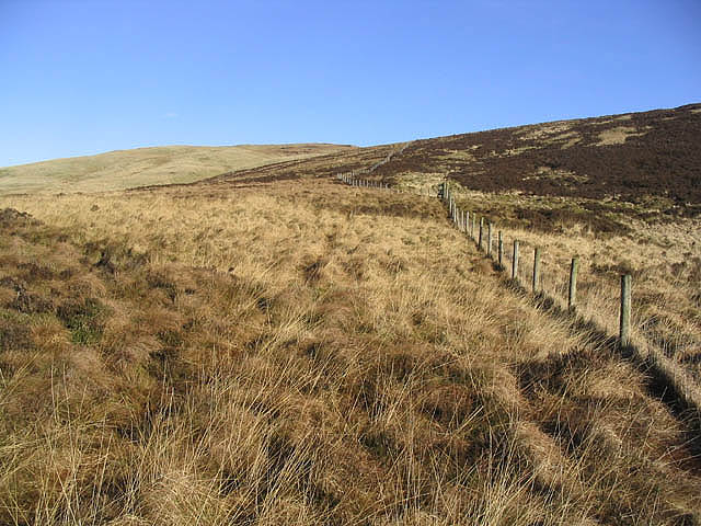
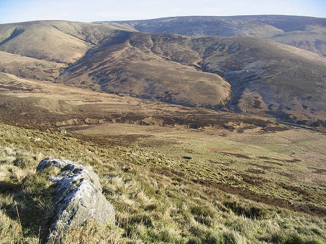
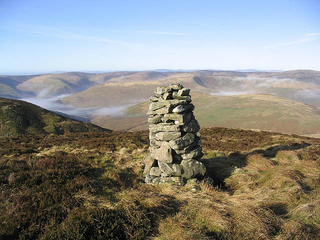
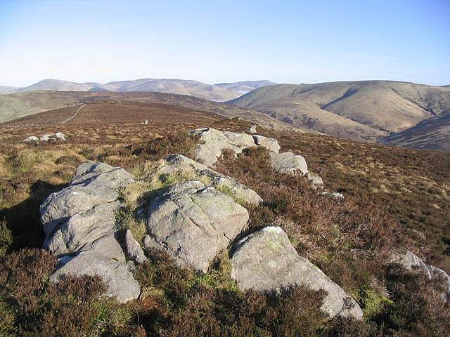
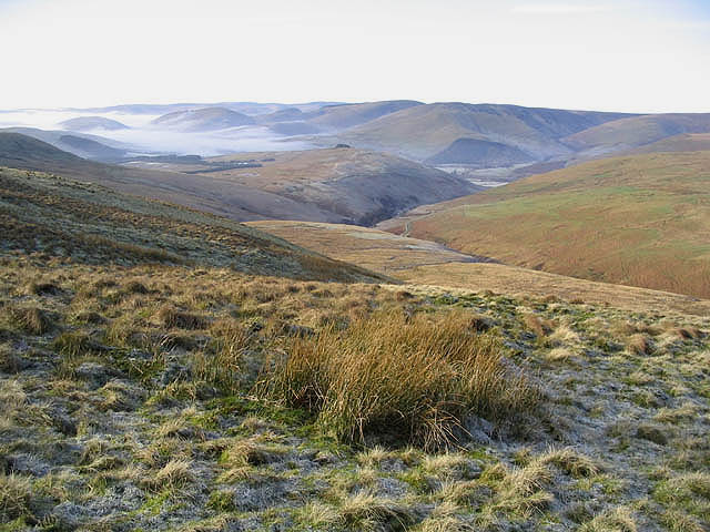
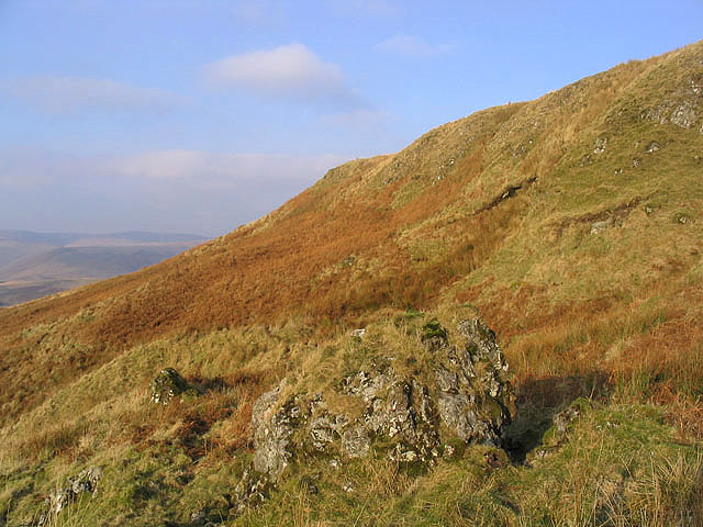
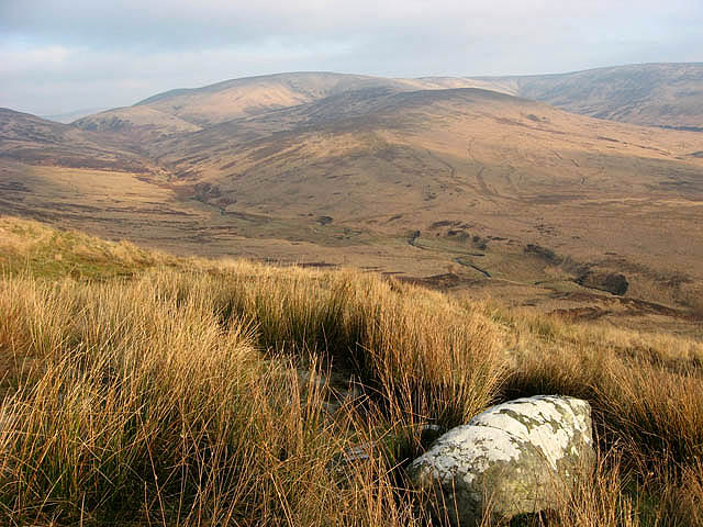
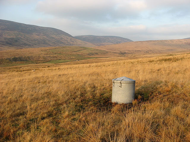
The hill is characterized by its gently rolling slopes and offers breathtaking panoramic views of the surrounding countryside. Its location in the Eskdale valley provides a picturesque backdrop, with lush green fields and meandering rivers adding to its charm. The hill is covered in a patchwork of vegetation, including heather, grasses, and scattered trees, creating a diverse and visually appealing landscape.

Arkleton Hill is a popular destination for outdoor enthusiasts, offering a range of recreational activities. Hiking and walking trails traverse the hill, providing opportunities for visitors to explore and enjoy the natural beauty of the area. The hill's moderate elevation makes it accessible to individuals of varying fitness levels, and its well-maintained paths ensure a pleasant and safe experience.

Nature lovers will also appreciate the diverse wildlife that inhabits the hill. Various bird species can be spotted throughout the year, including buzzards, kestrels, and pheasants. Additionally, small mammals such as rabbits and hares can be seen darting through the fields.

Overall, Arkleton Hill is a stunning natural feature that offers visitors a chance to immerse themselves in the tranquil beauty of the Scottish countryside. Whether it be for a leisurely walk or to admire the breathtaking views, this hill is a must-visit destination for those exploring Dumfriesshire.

If you have any feedback on the listing, please let us know in the comments section below.

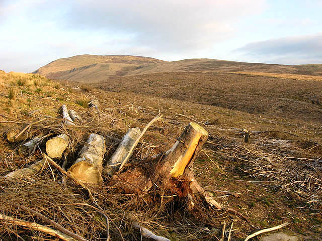
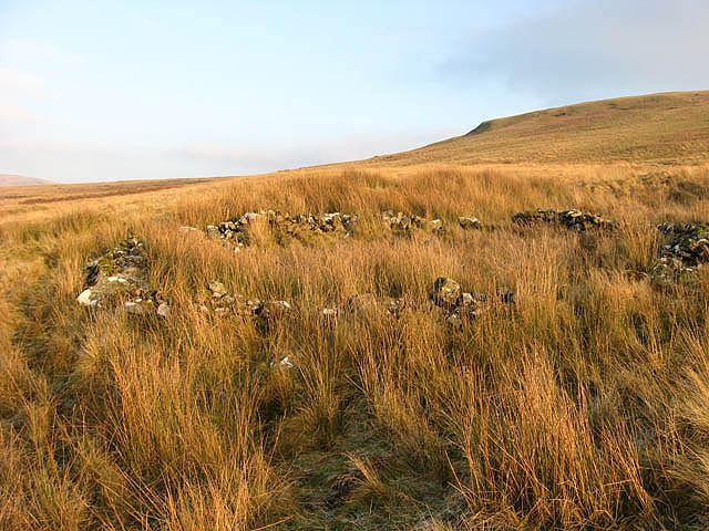
Arkleton Hill Images

Images are sourced within 2km of 55.220349/-2.9363511 or Grid Reference NY4092. Thanks to Geograph Open Source API. All images are credited.

View towards Arkleton Hill A track climbs out of Ewesdale towards sunlit Arkleton Hill.
View towards Arkleton Hill
A track climbs out of Ewesdale towards sunlit Arkleton Hill.
Arkleton Hill This hill looks good from the A7 with Arkleton Craigs showing up well but the summit area is a bit of a plod through heather.
Arkleton Hill
This hill looks good from the A7 with Arkleton Craigs showing up well but the summit area is a bit of a plod through heather.
Pike Fell Bagged trig first with Phil Cooper then White Hill TUMP, Salter Grain Hill, Pike Fell and Arkleton Hill after parking near Mosspeeble.
Name: Pike Fell
Hill number: 5116
Height: 499m / 1637ft
Parent (Ma/M): 1918  Roan Fell
Section: 28B: The River Tweed to the English Border
County/UA: Dumfries and Galloway (UA)
Class: HuMP, Tump (400-499m)
Grid ref: NY 41282 93947
Summit feature: no feature: ground between wall and fence
Drop: 107m
Col: 392m  NY409932
Pike Fell
Bagged trig first with Phil Cooper then White Hill TUMP, Salter Grain Hill, Pike Fell and Arkleton Hill after parking near Mosspeeble. Name: Pike Fell Hill number: 5116 Height: 499m / 1637ft Parent (Ma/M): 1918 Roan Fell Section: 28B: The River Tweed to the English Border County/UA: Dumfries and Galloway (UA) Class: HuMP, Tump (400-499m) Grid ref: NY 41282 93947 Summit feature: no feature: ground between wall and fence Drop: 107m Col: 392m NY409932
Arkleton Hill Bagged trig first with Phil Cooper then White Hill TUMP, Salter Grain Hill, Pike Fell and Arkleton Hill after parking near Mosspeeble.
Name: Arkleton Hill
Hill number: 1926
Height: 521m / 1709ft
Parent (Ma/M): 1918  Roan Fell
Section: 28B: The River Tweed to the English Border
County/UA: Dumfries and Galloway (UA)
Class: HuMP, Donald Dewey, subMarilyn
Grid ref: NY 40507 92181
Summit feature: no feature: near fence junction
Drop: 146m
Col: 375m  NY421937
Arkleton Hill
Bagged trig first with Phil Cooper then White Hill TUMP, Salter Grain Hill, Pike Fell and Arkleton Hill after parking near Mosspeeble. Name: Arkleton Hill Hill number: 1926 Height: 521m / 1709ft Parent (Ma/M): 1918 Roan Fell Section: 28B: The River Tweed to the English Border County/UA: Dumfries and Galloway (UA) Class: HuMP, Donald Dewey, subMarilyn Grid ref: NY 40507 92181 Summit feature: no feature: near fence junction Drop: 146m Col: 375m NY421937
Black Cove Small corrie on Arkleton Hill. View from the A7 over Mosspeeble.
Black Cove
Small corrie on Arkleton Hill. View from the A7 over Mosspeeble.
On a track heading for Pike Fell The unnamed hill on the left has a spot height of 365m.
On a track heading for Pike Fell
The unnamed hill on the left has a spot height of 365m.
The summit area of Pike Fell The highest point at the dyke is 499m.
The summit area of Pike Fell
The highest point at the dyke is 499m.
At the col between Arkleton Hill and Pike Fell The fence runs up towards Pike Fell.
At the col between Arkleton Hill and Pike Fell
The fence runs up towards Pike Fell.
Hawknest Sike from Arkleton Hill Looking over to Hawknest Rig with Scawd Bank behind.
Hawknest Sike from Arkleton Hill
Looking over to Hawknest Rig with Scawd Bank behind.
A cairn on Arkleton Hill Taken on a fine February morning. The cairn is exactly on the edge of squares NY4092 and NY4192, but as the photograph was taken from just inside NY4192, I have allocated it to NY4192.
A cairn on Arkleton Hill
Taken on a fine February morning. The cairn is exactly on the edge of squares NY4092 and NY4192, but as the photograph was taken from just inside NY4192, I have allocated it to NY4192.
Arkleton Hill A small outcrop breaks the monotony of trudging through heather on this moorland hill. Taken on a fine February day with Scawd Bank to the right.
Arkleton Hill
A small outcrop breaks the monotony of trudging through heather on this moorland hill. Taken on a fine February day with Scawd Bank to the right.
Rough grazing on Pike Fell Looking down towards Mosspeeble.
Rough grazing on Pike Fell
Looking down towards Mosspeeble.
Clear fell area on Auldshiels Hill The forestry shown on the O.S. Map no longer exists. Viewed from a forestry road towards Arkleton Hill.
Clear fell area on Auldshiels Hill
The forestry shown on the O.S. Map no longer exists. Viewed from a forestry road towards Arkleton Hill.
Under Nick on Arkleton Hill On the southwest slopes of the hill on a fine December day.
Under Nick on Arkleton Hill
On the southwest slopes of the hill on a fine December day.
White Brae Rough grazing hill countryside with the Byrecleuch Burn below and Mid Height in the centre background. Viewed in December.
White Brae
Rough grazing hill countryside with the Byrecleuch Burn below and Mid Height in the centre background. Viewed in December.
Old sheepfold At the edge of the square in a rough grazing area to the west of Cloak Knowe.
Old sheepfold
At the edge of the square in a rough grazing area to the west of Cloak Knowe.
Sheepfold at Mid Height
Hill farmland Rough grazing for hill cattle and sheep to the east of Lodgegill with Pike Fell in the centre background.
Hill farmland
Rough grazing for hill cattle and sheep to the east of Lodgegill with Pike Fell in the centre background.
Show me another place!

Arkleton Hill is located at Grid Ref: NY4092 (Lat: 55.220349, Lng: -2.9363511)

Unitary Authority: Dumfries and Galloway

Police Authority: Dumfries and Galloway

What 3 Words

///reckons.answers.remix. Near Langholm, Dumfries & Galloway

Nearby Locations

Arkleton Hill

Related Wikis

Arkleton

Arkleton is a mansion and estate in the civil parish of Ewes, in Dumfries and Galloway, Scotland. Arkleton House was built in 1860/1884 and incorporates...

Unthank, Dumfries and Galloway

Unthank is a village in Dumfries and Galloway, Scotland. == References == The geographic coordinates are from the Ordnance Survey.

Ewesdale

Ewesdale is a glen and former lordship in Dumfries and Galloway, Scotland. The Ewes Water runs through the valley from its source at Mosspaul, until it...

Barntalloch Castle

Barntalloch Castle was a castle located at Staplegorton, in Dumfries and Galloway, Scotland. The castle was built in the 12th century by Galfrid de Coninsburgh...

Nearby Amenities

Located within 500m of 55.220349,-2.9363511
Arkleton Hill
Ele: 521
Natural: peak
Source: NLS-OS-1st_Series
Lat/Long: 55.2201622/-2.9371262
Black Cove
Place: locality
Lat/Long: 55.2191986/-2.9423698
Arkleton Crags
Place: locality
Lat/Long: 55.2213441/-2.9426943
Rowantree Cove
Place: locality
Lat/Long: 55.2240864/-2.936343
The data included in this document is from www.openstreetmap.org. The data is made available under ODbL.

Have you been to Arkleton Hill?

Leave your review of Arkleton Hill below (or comments, questions and feedback).