Limiecleuch Hill

Hill, Mountain in Roxburghshire

Scotland

Limiecleuch Hill

Minor road near to the Hizzy Memorial Cairn Looking north-eastward.
Minor road near to the Hizzy Memorial Cairn Credit: Peter Wood

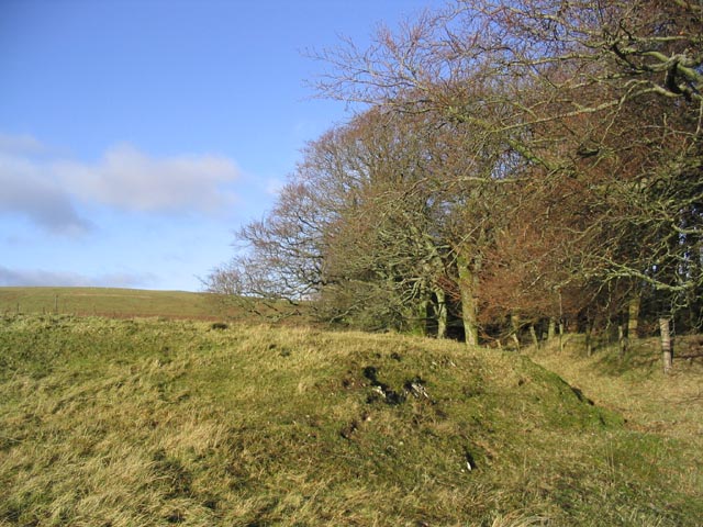
Limiecleuch Hill is a prominent hill located in Roxburghshire, a historic county in the Scottish Borders region of Scotland. Standing at an elevation of approximately 390 meters (1,280 feet), it is considered a significant landmark in the area. The hill is situated near the town of Hawick and is easily accessible to hikers and nature enthusiasts.

With its distinctive cone-shaped profile and lush green surroundings, Limiecleuch Hill offers breathtaking panoramic views of the surrounding countryside. From the summit, one can admire the picturesque valleys, rolling hills, and distant mountain ranges that stretch as far as the eye can see.

The hill is characterized by a diverse range of flora and fauna, making it a haven for wildlife. Visitors may encounter various species of birds, including red grouse and skylarks, as well as rabbits and deer. The hill is also home to a variety of plant life, including heather, grasses, and wildflowers, which create a vibrant and colorful landscape during the summer months.

Hiking to the top of Limiecleuch Hill is a popular activity among locals and visitors alike. There are several well-marked paths that wind their way up the hill, providing a moderate challenge for walkers. On a clear day, the summit offers an ideal spot for a picnic or simply to sit and soak in the serene and tranquil atmosphere.

Overall, Limiecleuch Hill is a natural gem in Roxburghshire, offering stunning views, diverse wildlife, and a chance to reconnect with nature in this beautiful part of Scotland.

If you have any feedback on the listing, please let us know in the comments section below.

Limiecleuch Hill Images

Images are sourced within 2km of 55.315549/-2.954918 or Grid Reference NT3902. Thanks to Geograph Open Source API. All images are credited.

Minor road near to the Hizzy Memorial Cairn Looking north-eastward.
Minor road near to the Hizzy Memorial Cairn
Looking north-eastward.
A sign at Linhope Farm I rather like this sign by the entrance to the farmyard.
A sign at Linhope Farm
I rather like this sign by the entrance to the farmyard.
A pair of carrion crows at Linhope The birds were viewed from the road to Linhope Farm on a fine December morning.
A pair of carrion crows at Linhope
The birds were viewed from the road to Linhope Farm on a fine December morning.
The A7 at Linhope There was a good overnight fall of snow but the main road was clear.
The A7 at Linhope
There was a good overnight fall of snow but the main road was clear.
Road to Langholm near Lightning Hill
Road to Hawick near Lightning Hill
Lightning Hill
Lightning Hill
The Horn
The Horn
Frostly Burn Upstream of Teviothead.
Frostly Burn
Upstream of Teviothead.
Binks Hill Sheepwalk in evening light, Teviothead.
Binks Hill
Sheepwalk in evening light, Teviothead.
The A7 heading for Hawick
Frostlie Burn A headwater of the Teviot is somewhere in the vegetation beside the A7.
Frostlie Burn
A headwater of the Teviot is somewhere in the vegetation beside the A7.
A7 near Teviothead
A7 near Teviothead
Blackcleuch This house stands by the River Teviot in a remote location.
Blackcleuch
This house stands by the River Teviot in a remote location.
Moorland Landscape The hill in the background is Blackcleuch Rig.
Moorland Landscape
The hill in the background is Blackcleuch Rig.
A country road A single track road with passing places that runs for approximately 6km from Teviothead to Merrylaw at the edge of Craik Forest.
A country road
A single track road with passing places that runs for approximately 6km from Teviothead to Merrylaw at the edge of Craik Forest.
Woodland edge at Watch Knowe
The Hizzy Cairn Beside a minor road near Teviothead and dedicated to Steve Hislop who was killed near this spot.
A plaque on the small enclosure fence reads:-

'Hizzy'
This cairn was built by a
few friends of Steve Hislop,
British Superbike Champion,
who was tragically killed in a
helicopter accident near this site,
on July 30th 2003.

Kind permission was granted
by His Grace
The Duke of Buccleuch.
The Hizzy Cairn
Beside a minor road near Teviothead and dedicated to Steve Hislop who was killed near this spot. A plaque on the small enclosure fence reads:- 'Hizzy' This cairn was built by a few friends of Steve Hislop, British Superbike Champion, who was tragically killed in a helicopter accident near this site, on July 30th 2003. Kind permission was granted by His Grace The Duke of Buccleuch.
Show me another place!

Limiecleuch Hill is located at Grid Ref: NT3902 (Lat: 55.315549, Lng: -2.954918)

Unitary Authority: The Scottish Borders

Police Authority: The Lothians and Scottish Borders

What 3 Words

///square.crowned.headlines. Near Teviothead, Scottish Borders

Related Wikis

River Teviot

The River Teviot (; Scottish Gaelic: Abhainn Tìbhiot), or Teviot Water, is a river of the Scottish Borders area of Scotland, and is the largest tributary...

Caerlanrig

Caerlanrig - also spelled 'Carlenrig' - (Gaelic: Cathair Lannraig) is a hamlet in the parish of Cavers, Borders, Scotland, lying on the River Teviot, 6...

Teviothead

Teviothead (Scottish Gaelic: Ceann Tìbhiot) is a small village and civil parish in Teviotdale in the Scottish Borders, known locally as Teviotheid. It...

Falnash

Falnash (Scots: Fawenesh) is a village in the Scottish Borders of Scotland. It is near Teviothead, in the former Roxburghshire, and in the parish of Teviothead...

Nearby Amenities

Located within 500m of 55.315549,-2.954918
Limiecleuch Hill
Ele: 364
Natural: peak
Source: NLS-OS-1st_Series
Lat/Long: 55.3164245/-2.9545927
The data included in this document is from www.openstreetmap.org. The data is made available under ODbL.

Have you been to Limiecleuch Hill?

Leave your review of Limiecleuch Hill below (or comments, questions and feedback).