Arnison Crag

Hill, Mountain in Westmorland Eden

England

Arnison Crag

Path on Patterdale Common
Path on Patterdale Common Credit: Anthony Foster

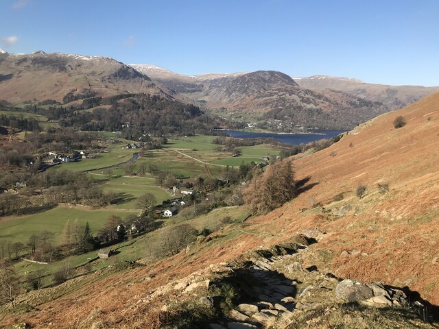
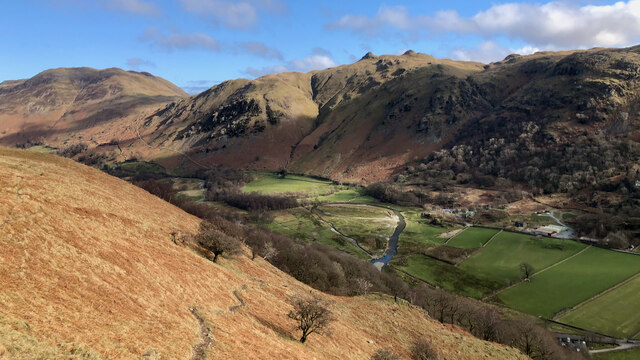
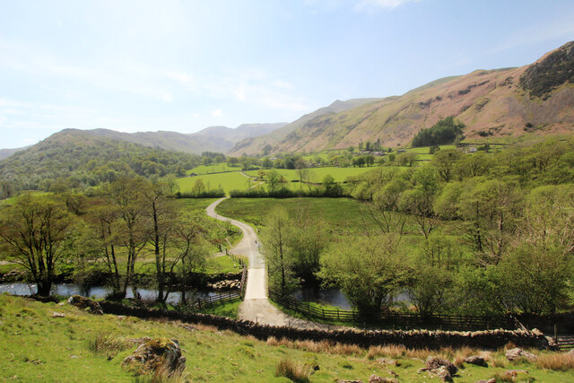
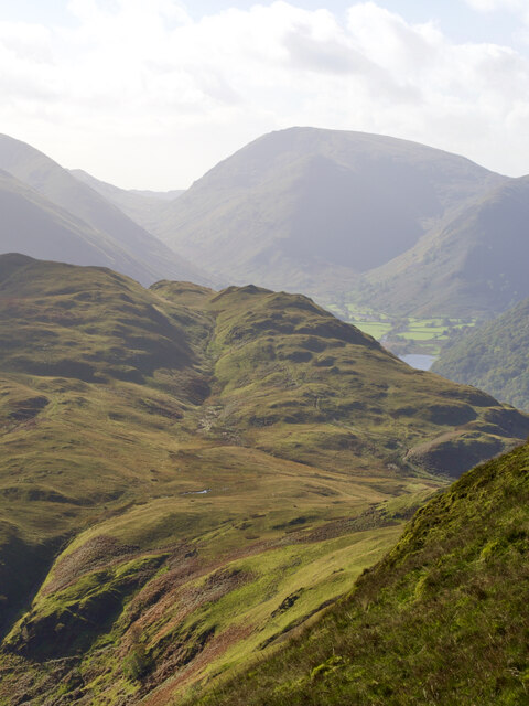
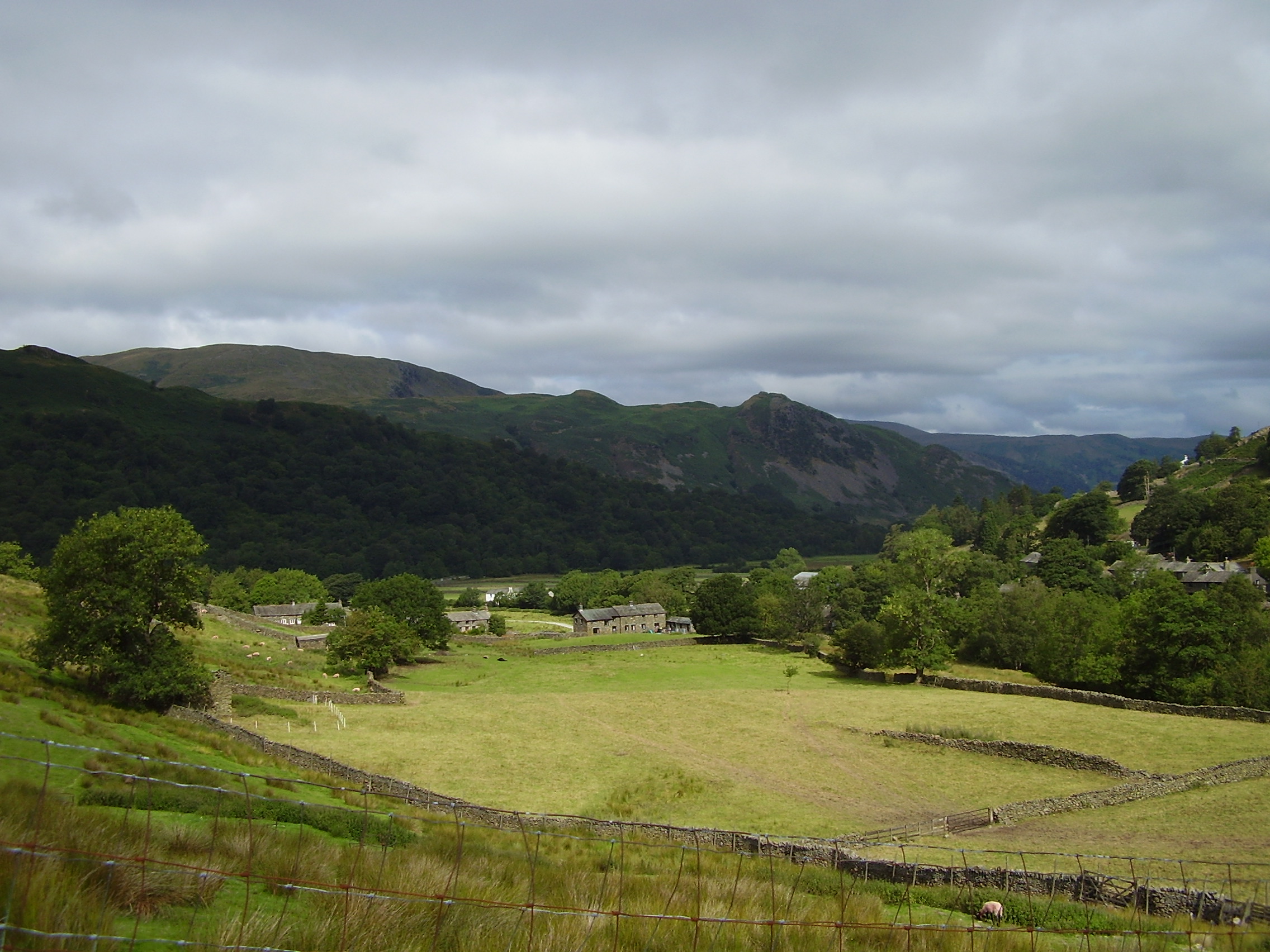
Arnison Crag is a prominent hill located in the county of Westmorland, in the northwestern region of England. Situated within the Lake District National Park, it forms part of the popular mountainous area known as the Eastern Fells. With an elevation of 433 meters (1,421 feet), Arnison Crag offers a relatively modest climb compared to some of the higher peaks in the region, making it a popular destination for hikers and walkers of all abilities.

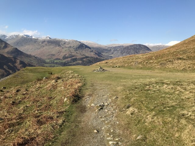
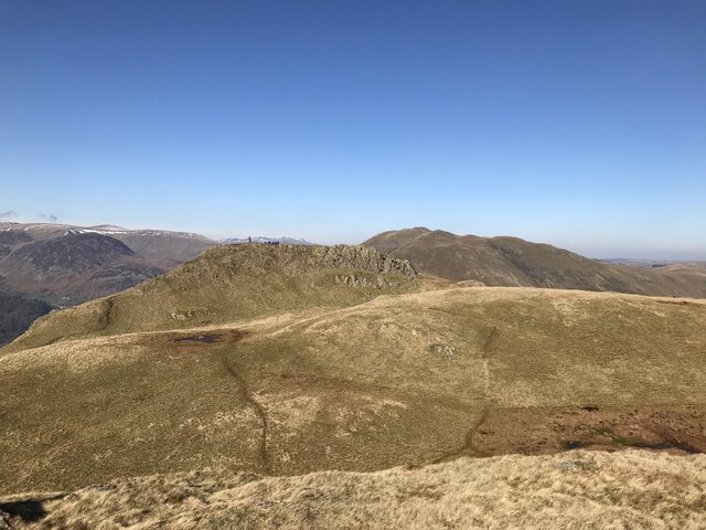
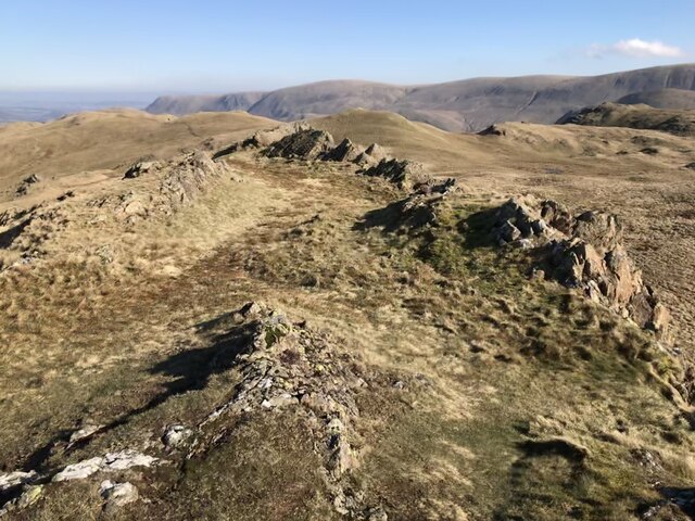
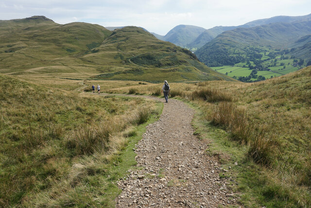
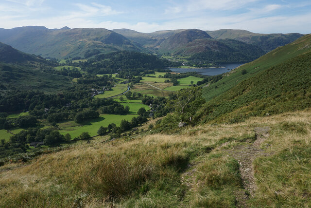
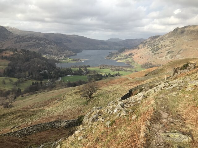
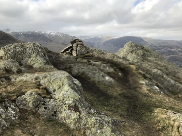
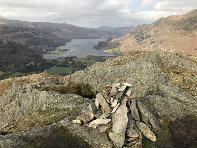
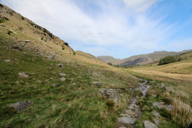
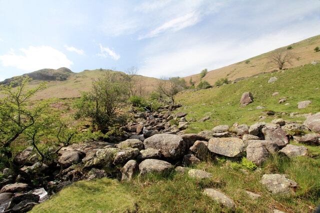
The hill is characterized by its distinctive rocky outcrops, which give it a unique and picturesque appearance. The summit of Arnison Crag provides breathtaking panoramic views of the surrounding landscape, including the nearby Ullswater Lake, one of the largest and most beautiful lakes in the Lake District.

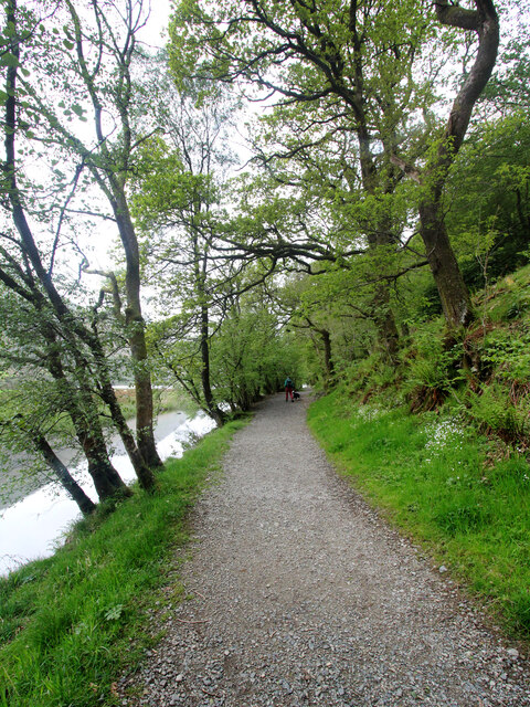
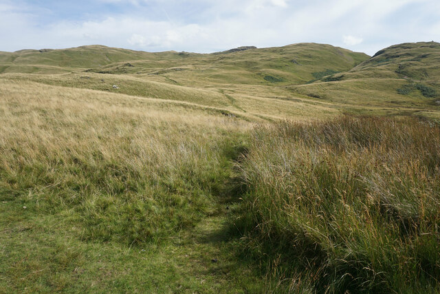
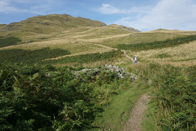
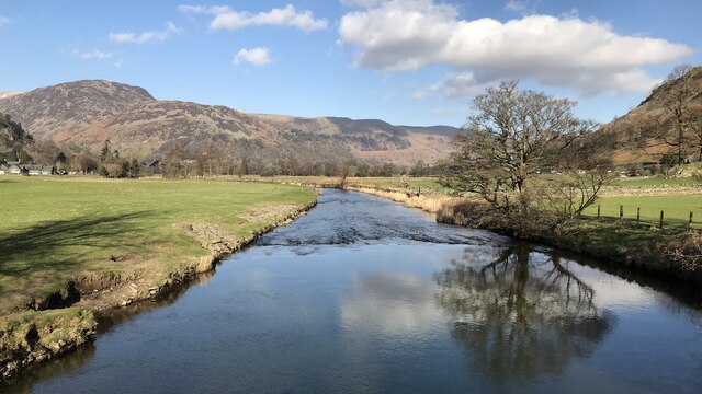
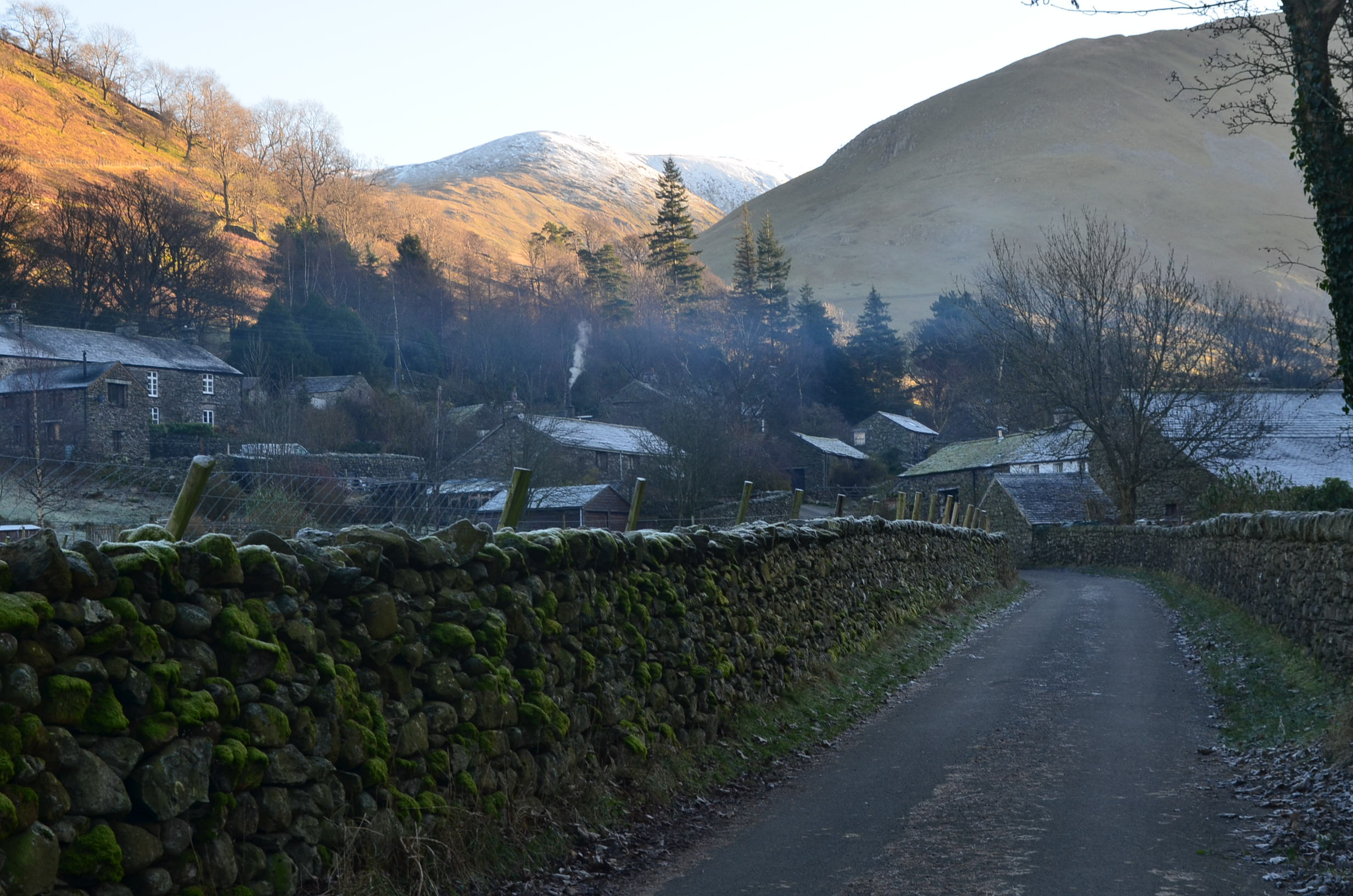
To reach the summit, there are several well-defined footpaths that wind their way up the hillside. One of the most popular routes starts from Patterdale village, where visitors can follow a clearly marked trail that gradually ascends to the top of the crag. Along the way, walkers can enjoy the diverse flora and fauna that thrive in this area, including heather, bilberry, and various bird species.

Arnison Crag also holds historical significance, with evidence of ancient settlements and mining activity in the vicinity. Today, it remains a beloved spot for outdoor enthusiasts seeking to immerse themselves in the natural beauty of the Lake District, offering a rewarding and relatively accessible adventure for all who visit.

If you have any feedback on the listing, please let us know in the comments section below.

Arnison Crag Images

Images are sourced within 2km of 54.52634/-2.9384435 or Grid Reference NY3914. Thanks to Geograph Open Source API. All images are credited.

Path on Patterdale Common
Boredale Hause
Boredale Hause
Angletarn Pikes North Top
Angletarn Pikes summit
Goldrill Beck The principal “river” in Patterdale between Ullswater and Brotherswater is Goldrill Beck. That’s it there, just right of centre and to the left of the “holiday village” of Hartsop Fold.

But compare it to the map, which shows the beck hugging the road, hidden by the trees of low Wood.

In the late 18th-century, the beck was canalised, made straighter between embankments in an attempt to drain the fields and make them more productive.

The beck became fast flowing with uniform depth and a lack of natural features made them a poor wildlife habitat. And the high embankments actually prevented the fields from draining  into the beck and so became boggy and reed-filled.

This was done in many of the valleys of the Lake District, but Goldrill Beck also had a particular issue for Goldrill Beck as its canalised route alongside the A592 caused it to continually undercut the road. This was particularly bad during Storm Desmond

The National Trust, in conjunction with the Environment Agency, Natural England and Cumbria County Council have undertaken a project to restore Goldrill Beck to a more natural course with features such as gravel bars, riffles, and meanders. The parlance is to re-wiggle the rivers although in the case of Goldrill Beck it seems to be one big loop but at the lower end of the loop the beck is split into multiple channels where it joins Angletarn Beck.

The old river channel has been partially filled so that it may act as an overflow pond at times of high rainfall.

Ahead, on skyline, are the twin summits of Angletarn Pikes. To the left the deep gash of Dubhow Beck with the cottage of Dubhow and its foot.

It’s just occurred to me that the online mapping below will eventually be updated to show the new river system, so for posterity here is a link to the 1920 O.S. Map, <span class="nowrap"><a title="https://maps.nls.uk/view/101104881#zoom=4&lat=5401&lon=3141&layers=BT" rel="nofollow ugc noopener" href="https://maps.nls.uk/view/101104881#zoom=4&lat=5401&lon=3141&layers=BT">Link</a><img style="margin-left:2px;" alt="External link" title="External link - shift click to open in new window" src="https://s1.geograph.org.uk/img/external.png" width="10" height="10"/></span>

For sources see my blog <span class="nowrap"><a title="http://www.fhithich.uk/?p=27519" rel="nofollow ugc noopener" href="http://www.fhithich.uk/?p=27519">Link</a><img style="margin-left:2px;" alt="External link" title="External link - shift click to open in new window" src="https://s1.geograph.org.uk/img/external.png" width="10" height="10"/></span>
Goldrill Beck
The principal “river” in Patterdale between Ullswater and Brotherswater is Goldrill Beck. That’s it there, just right of centre and to the left of the “holiday village” of Hartsop Fold. But compare it to the map, which shows the beck hugging the road, hidden by the trees of low Wood. In the late 18th-century, the beck was canalised, made straighter between embankments in an attempt to drain the fields and make them more productive. The beck became fast flowing with uniform depth and a lack of natural features made them a poor wildlife habitat. And the high embankments actually prevented the fields from draining into the beck and so became boggy and reed-filled. This was done in many of the valleys of the Lake District, but Goldrill Beck also had a particular issue for Goldrill Beck as its canalised route alongside the A592 caused it to continually undercut the road. This was particularly bad during Storm Desmond The National Trust, in conjunction with the Environment Agency, Natural England and Cumbria County Council have undertaken a project to restore Goldrill Beck to a more natural course with features such as gravel bars, riffles, and meanders. The parlance is to re-wiggle the rivers although in the case of Goldrill Beck it seems to be one big loop but at the lower end of the loop the beck is split into multiple channels where it joins Angletarn Beck. The old river channel has been partially filled so that it may act as an overflow pond at times of high rainfall. Ahead, on skyline, are the twin summits of Angletarn Pikes. To the left the deep gash of Dubhow Beck with the cottage of Dubhow and its foot. It’s just occurred to me that the online mapping below will eventually be updated to show the new river system, so for posterity here is a link to the 1920 O.S. Map, LinkExternal link For sources see my blog LinkExternal link
Path to Dovedale The car park at Cow bridge has that essential quality of anywhere I choose to leave a vehicle - it's free. Consequently, it is also likely to be full very early in the morning. Today we won, and this footpath is the one that led us onwards (and eventually upwards) up Dovedale to a traverse of Fairfield (a mountain I seem to have climbed or descended in pretty much every available direction).
Path to Dovedale
The car park at Cow bridge has that essential quality of anywhere I choose to leave a vehicle - it's free. Consequently, it is also likely to be full very early in the morning. Today we won, and this footpath is the one that led us onwards (and eventually upwards) up Dovedale to a traverse of Fairfield (a mountain I seem to have climbed or descended in pretty much every available direction).
Menneting Bridge from Hause Gate Hause Gate is the bridleway which enables walkers to stay on the east side of Goldrill Beck, away from the main road. However, whilst the route to the photographer's left continues to Hartsop for both walkers and riders, the continuing path towards Patterdale is for those on foot only, while the bridleway cuts back and crosses the beck via Menneting Bridge. Cyclists or equestrians desperate to reach Patterdale without encountering heavy weekend traffic must turn off a little earlier and make a 230m ascent to Boredale Hause before dropping even more steeply back towards Ullswater. There is also a permissive path heading up-valley to the left on the far side of the bridge, but this is not signposted prominently to attract attention.
Menneting Bridge from Hause Gate
Hause Gate is the bridleway which enables walkers to stay on the east side of Goldrill Beck, away from the main road. However, whilst the route to the photographer's left continues to Hartsop for both walkers and riders, the continuing path towards Patterdale is for those on foot only, while the bridleway cuts back and crosses the beck via Menneting Bridge. Cyclists or equestrians desperate to reach Patterdale without encountering heavy weekend traffic must turn off a little earlier and make a 230m ascent to Boredale Hause before dropping even more steeply back towards Ullswater. There is also a permissive path heading up-valley to the left on the far side of the bridge, but this is not signposted prominently to attract attention.
Boredale Hause
Boredale Hause
Path down to Boredale Hause The path has come down off Place Fell.
Path down to Boredale Hause
The path has come down off Place Fell.
Path up to Angletarn Pikes One of several paths which meet on Boredale Hause.
Path up to Angletarn Pikes
One of several paths which meet on Boredale Hause.
Boredale Hause A pass between Patterdale to the left and Boredale to the right. This view looks up towards Place Fell but the summit is hidden behind Round How. The pile of stones in the foreground on the left is all that remains of a former chapel which served the residents of both Patterdale and Boredale.
Boredale Hause
A pass between Patterdale to the left and Boredale to the right. This view looks up towards Place Fell but the summit is hidden behind Round How. The pile of stones in the foreground on the left is all that remains of a former chapel which served the residents of both Patterdale and Boredale.
Path down to Patterdale The higher of two paths which come off Boredale Hause.
Path down to Patterdale
The higher of two paths which come off Boredale Hause.
Glenamara Park
Glenamara Park
Arnison Crag summit
Arnison Crag summit
Arnison Crag summit
Arnison Crag summit
Goldrill Beck
Goldrill Beck
Path descending Deepdale The path down Deepdale (or up it, if you are heading that way to reach any of a number of minor climbing crags) skirts the foot of St. Sunday Crag's unfrequented east spur and at this point, seems further from Deepdale Beck than it has been for much of the mile or so behind the photographer.
Path descending Deepdale
The path down Deepdale (or up it, if you are heading that way to reach any of a number of minor climbing crags) skirts the foot of St. Sunday Crag's unfrequented east spur and at this point, seems further from Deepdale Beck than it has been for much of the mile or so behind the photographer.
Coldcove Gill Coldcove Gill drains the area between the unfrequented east spur of St. Sunday Crag (down which a very faint path seems to arrive in Deepdale) and it much more popular north ridge traversed by both a public footpath and a very fine (and popular) scrambling route. As the two "off-piste" routes (one down the spur, one down the dale) join, the path becomes a much more well-defined track, and a public right of way, just about at the point that this view was taken.
Coldcove Gill
Coldcove Gill drains the area between the unfrequented east spur of St. Sunday Crag (down which a very faint path seems to arrive in Deepdale) and it much more popular north ridge traversed by both a public footpath and a very fine (and popular) scrambling route. As the two "off-piste" routes (one down the spur, one down the dale) join, the path becomes a much more well-defined track, and a public right of way, just about at the point that this view was taken.
Show me another place!

Arnison Crag is located at Grid Ref: NY3914 (Lat: 54.52634, Lng: -2.9384435)

Administrative County: Cumbria

District: Eden

Police Authority: Cumbria

What 3 Words

///plot.reissued.dancer. Near Ambleside, Cumbria

Nearby Locations

Bridgend Arnison Crag

Related Wikis

Arnison Crag

Arnison Crag is a fell in the English Lake District, an outlier of the Fairfield group in the Eastern Fells. It looks down on Patterdale village and the...

Patterdale

Patterdale (Saint Patrick's Dale) is a small village and civil parish in the eastern part of the English Lake District in the Eden District of Cumbria...

Birks (Lake District)

Birks is a fell in the English Lake District situated two kilometres south west of the village of Patterdale in the Eastern Fells. The fells summit sits...

Angletarn Pikes

Angletarn Pikes is a fell in the English Lake District near the village of Patterdale. Its most notable feature is Angle Tarn from which it derives its...

Glenridding

Glenridding is a village at the southern end of Ullswater, in the English Lake District. The village is popular with mountain walkers who can scale England...

Hartsop

Hartsop is a small village in the English Lake District. It lies in the Patterdale valley, near Brothers Water, Hayeswater and Kirkstone Pass. It consists...

Place Fell

Place Fell is a hill in the English Lake District. It stands at the corner of the upper and middle reaches of Ullswater, with steep western flanks overlooking...
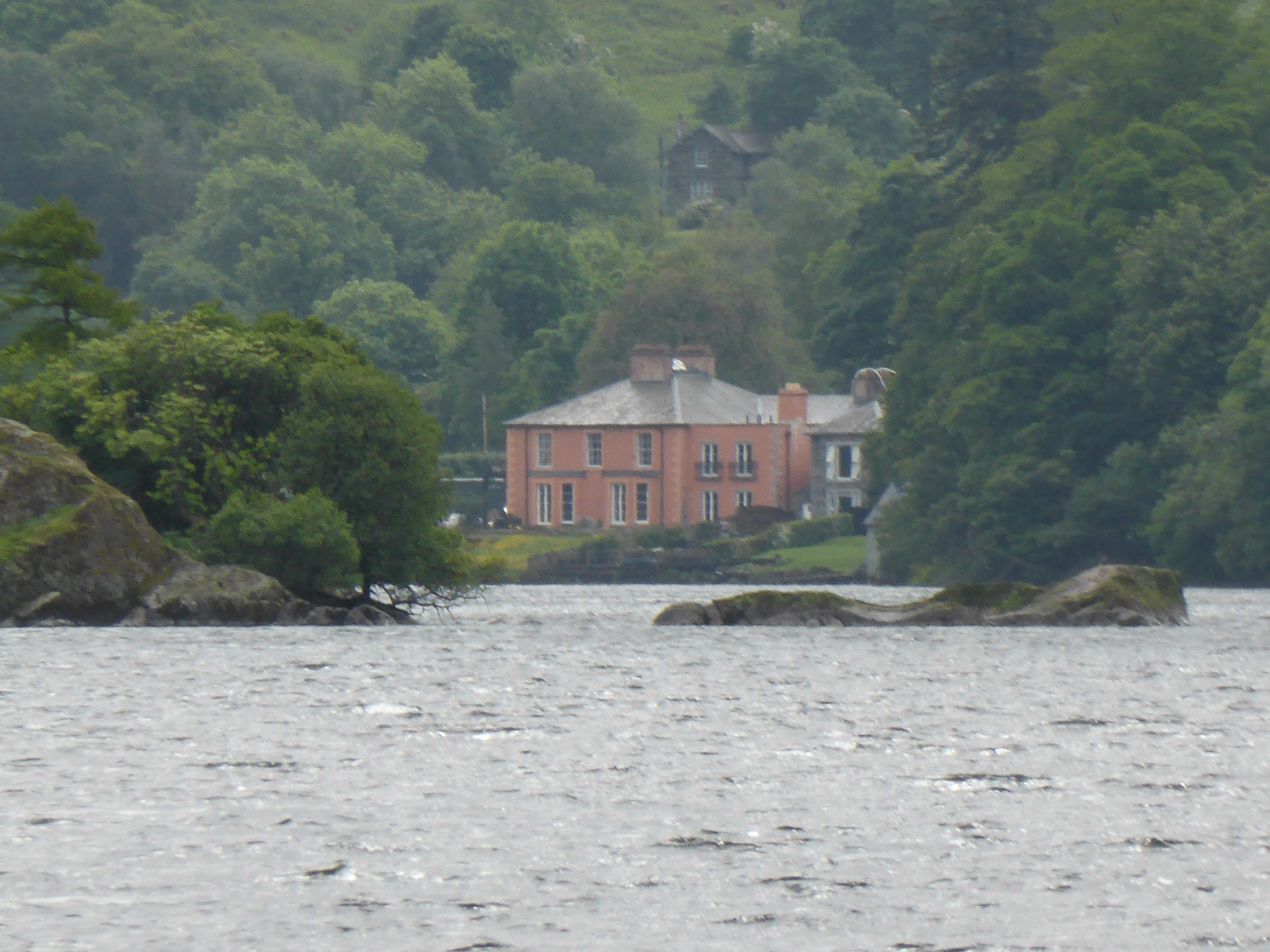
Glenridding House

Glenridding House is a Regency era building in Glenridding on Ullswater, constructed between 1807 and 1814. It was a private summer villa until about 1860...

Related Videos

Coast to Coast: Solo Hiking Across the Country - Day 6 (4K)

Join me on Patreon! https://www.patreon.com/TinyPineOutdoors Day 6 of solo hiking the Coast to Coast, I left the Patterdale YHA ...

The Priest's Hole // Hiking Vlog #11

Filmed on Sunday 3rd March 2019 Having avoided the Priest's Hole like the plague I decided it was about time I visited it – after ...

Striding Edge | Adventure Ep. 23 | Hiking | HD Quality.

Striding Edge. Adventure No:23 Last August me and Rachel went to visit my parents and twin brother up in Cumbria, we took the ...

Nearby Amenities

Located within 500m of 54.52634,-2.9384435
Arnison Crag
Ele: 433
Natural: peak
Source: npe
Wikidata: Q4794845
Wikipedia: en:Arnison Crag
Lat/Long: 54.5263024/-2.9385699
Barrier: cattle_grid
Lat/Long: 54.5256833/-2.9312825
Deepdale Common
Place: locality
Lat/Long: 54.5304121/-2.936882
Greenbank Farm Bed and Breakfast
Addr City: Patterdale
Addr Housename: Greenbank Farm
Addr Postcode: CA11 0NR
Fhrs Id: 307739
Tourism: guest_house
Website: http://greenbankfarmpatterdale.co.uk/
Wikidata: Q26537860
Lat/Long: 54.5238055/-2.9320957
Noran Bank Farm House B&B
Addr City: Patterdale
Addr Housename: Noran Bank Farm
Addr Postcode: CA11 0NR
Fhrs Id: 307758
Tourism: guest_house
Website: https://www.noranbankfarm.co.uk/farmhouse-b-b
Lat/Long: 54.5280343/-2.9312914
Glenamara Park
Place: locality
Lat/Long: 54.5266202/-2.944083
Power: pole
Lat/Long: 54.5276649/-2.9318055
Power: pole
Lat/Long: 54.5266366/-2.9321173
Power: pole
Lat/Long: 54.5257146/-2.9324573
Power: pole
Lat/Long: 54.524674/-2.9328201
Power: pole
Lat/Long: 54.5236129/-2.9331284
The data included in this document is from www.openstreetmap.org. The data is made available under ODbL.

Have you been to Arnison Crag?

Leave your review of Arnison Crag below (or comments, questions and feedback).