Broad Head

Hill, Mountain in Dumfriesshire

Scotland

Broad Head

Terrona Hill Above the road, Langholm Moor.
Terrona Hill Credit: Richard Webb

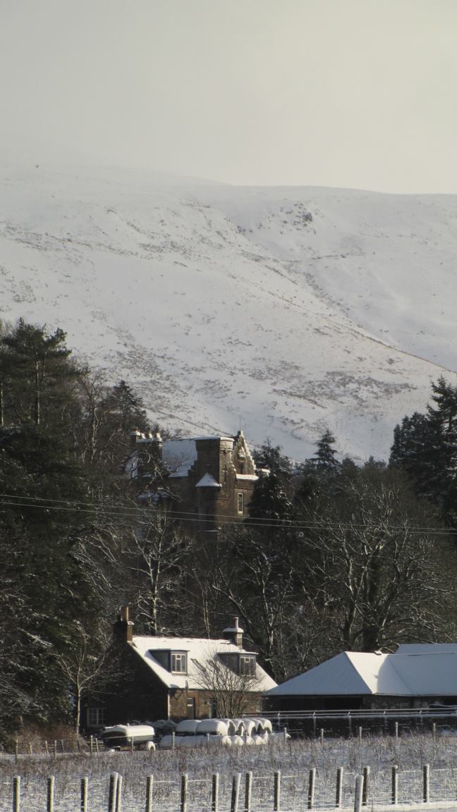
Broad Head is a prominent hill located in Dumfriesshire, Scotland. It is part of the Southern Uplands range, which stretches across the southern region of the country. Standing at an elevation of approximately 617 meters (2,024 feet), Broad Head is a notable landmark in the area.

The hill is characterized by its rounded shape, with grassy slopes and rocky outcrops. It offers breathtaking panoramic views of the surrounding countryside, including the picturesque valleys and rolling hills that define Dumfriesshire. On clear days, it is even possible to catch glimpses of the Solway Firth and the Lake District in England.

Broad Head is a popular destination for hikers and outdoor enthusiasts, thanks to its accessibility and stunning vistas. Several well-marked trails lead to the summit, making it an achievable goal for both experienced and novice walkers. The climb can be challenging at times, particularly in adverse weather conditions, but it is a rewarding experience for those who make the journey.

The hill is also home to a rich diversity of flora and fauna. It supports a variety of plant species, including heather, grasses, and wildflowers, which create a vibrant tapestry of colors during the summer months. Wildlife such as red grouse, mountain hares, and various bird species can often be spotted in the area, adding to the natural beauty and appeal of Broad Head.

Overall, Broad Head is a captivating hill in Dumfriesshire, offering visitors an opportunity to immerse themselves in the stunning landscapes and abundant wildlife that Scotland has to offer.

If you have any feedback on the listing, please let us know in the comments section below.

Broad Head Images

Images are sourced within 2km of 55.182211/-2.9537832 or Grid Reference NY3987. Thanks to Geograph Open Source API. All images are credited.

Terrona Hill Above the road, Langholm Moor.
Terrona Hill
Above the road, Langholm Moor.
Little Tarras Water View over Langholm Moor.
Little Tarras Water
View over Langholm Moor.
Little Tarras Water Looking down from the road over Little Tarras Water.
Little Tarras Water
Looking down from the road over Little Tarras Water.
Tarras Water Bridge
Tarras Water Bridge
Tarras Rig, Langholm Moor
Bridge over the Tarras Water A road junction on Langholm Moor.
Bridge over the Tarras Water
A road junction on Langholm Moor.
Tarras Water
Tarras Water
Woodland, Tarras Water Broad leaf woodland hangs on beside the Tarras Water on Langholm Moor.
Woodland, Tarras Water
Broad leaf woodland hangs on beside the Tarras Water on Langholm Moor.
Road Bridge at Tarras Lodge The bridge carries the minor hill road from Langholm to Newcastleton across Tarras Water, a tributary of the River Esk.
Road Bridge at Tarras Lodge
The bridge carries the minor hill road from Langholm to Newcastleton across Tarras Water, a tributary of the River Esk.
Arkleton Cottage Ford This ford on Tarras Water is found in the entrance to the remote Arkleton Cottage. A video of the ford can be seen at:
<span class="nowrap"><a title="https://youtu.be/I2FqmXW5mU4" rel="nofollow ugc noopener" href="https://youtu.be/I2FqmXW5mU4">Link</a><img style="margin-left:2px;" alt="External link" title="External link - shift click to open in new window" src="https://s1.geograph.org.uk/img/external.png" width="10" height="10"/></span>
Arkleton Cottage Ford
This ford on Tarras Water is found in the entrance to the remote Arkleton Cottage. A video of the ford can be seen at: LinkExternal link
Track to Middlemoss The rough track which leads to Middlemoss Farm.
Track to Middlemoss
The rough track which leads to Middlemoss Farm.
Tarras Water Woodland A small area of woodland, the only one on these bleak moorlands. Hen Harriers and Black grouse can be spotted out here if you are lucky.
Tarras Water Woodland
A small area of woodland, the only one on these bleak moorlands. Hen Harriers and Black grouse can be spotted out here if you are lucky.
Arkleton Cottage Arkleton Cottage over The Tarras Water.
Arkleton Cottage
Arkleton Cottage over The Tarras Water.
Clear fell, Ewe Rig Another stand of sitka spruce has been harvested. The feral goats are looking for pickings amongst the wreckage.
Clear fell, Ewe Rig
Another stand of sitka spruce has been harvested. The feral goats are looking for pickings amongst the wreckage.
Road bridge over Tarras Water Scenic route between Newcastleton and Langholm
Road bridge over Tarras Water
Scenic route between Newcastleton and Langholm
A minor road near Tarras Lodge This single lane with passing places unclassified road links Langholm and Newcastleton over hill moorland terrain.
A minor road near Tarras Lodge
This single lane with passing places unclassified road links Langholm and Newcastleton over hill moorland terrain.
The Tarras Water
The Tarras Water
The road to Cooms by the Tarras Water This single lane road by the Tarras Water runs for just over 3km from Tarras Lodge to Cooms Farm.
The road to Cooms by the Tarras Water
This single lane road by the Tarras Water runs for just over 3km from Tarras Lodge to Cooms Farm.
Show me another place!

Broad Head is located at Grid Ref: NY3987 (Lat: 55.182211, Lng: -2.9537832)

Unitary Authority: Dumfries and Galloway

Police Authority: Dumfries and Galloway

What 3 Words

///crunching.spouse.keys. Near Langholm, Dumfries & Galloway

Nearby Locations

Broad Head

Related Wikis

Ewesdale

Ewesdale is a glen and former lordship in Dumfries and Galloway, Scotland. The Ewes Water runs through the valley from its source at Mosspaul, until it...

Arkleton

Arkleton is a mansion and estate in the civil parish of Ewes, in Dumfries and Galloway, Scotland. Arkleton House was built in 1860/1884 and incorporates...

Barntalloch Castle

Barntalloch Castle was a castle located at Staplegorton, in Dumfries and Galloway, Scotland. The castle was built in the 12th century by Galfrid de Coninsburgh...

Langholm

Langholm , also known colloquially as the "Muckle Toon", is a burgh in Dumfries and Galloway, southern Scotland. Langholm lies between four hills in the...

Nearby Amenities

Located within 500m of 55.182211,-2.9537832
The data included in this document is from www.openstreetmap.org. The data is made available under ODbL.

Have you been to Broad Head?

Leave your review of Broad Head below (or comments, questions and feedback).