Kaim Knowe

Hill, Mountain in Peeblesshire

Scotland

Kaim Knowe

View towards Walkerburn and the River Tweed Line of the disused railway line can clearly be seen between the field and river.
View towards Walkerburn and the River Tweed Credit: Les Hull

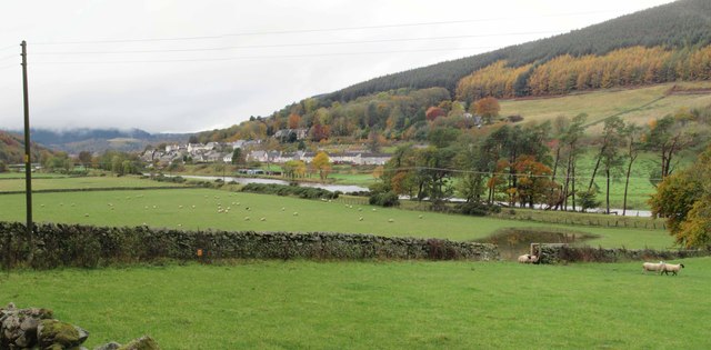
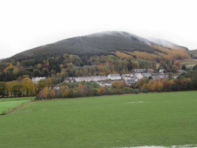
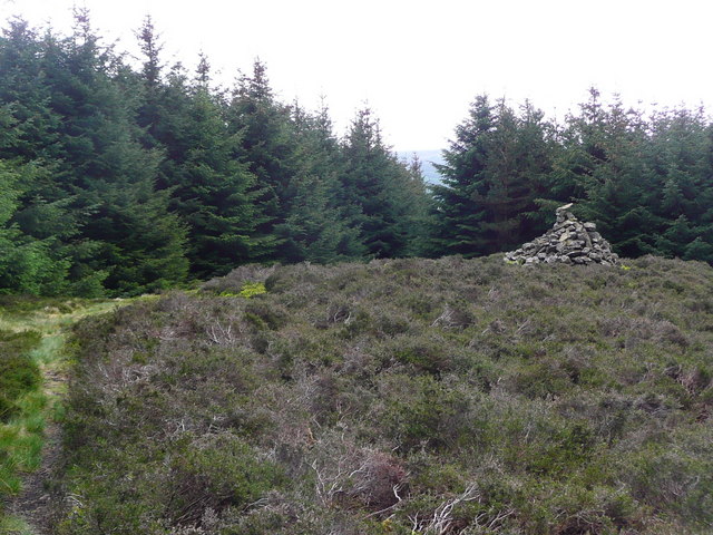
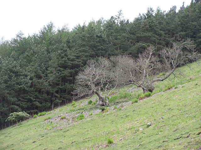
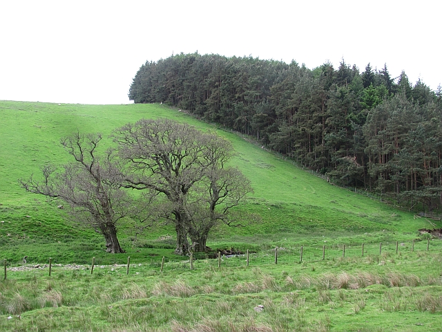
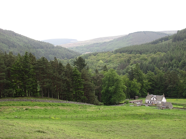
Kaim Knowe, located in Peeblesshire, Scotland, is a prominent hill that attracts outdoor enthusiasts and nature lovers alike. Standing at an elevation of approximately 468 meters (1,535 feet), it offers stunning panoramic views of the surrounding countryside and is a popular destination for hikers and walkers.

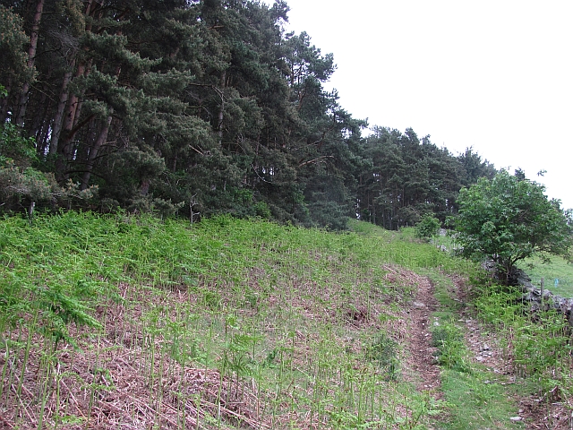
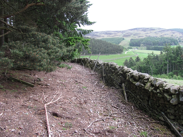
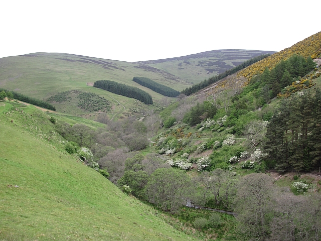
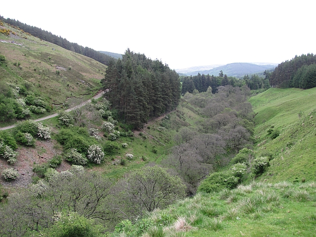
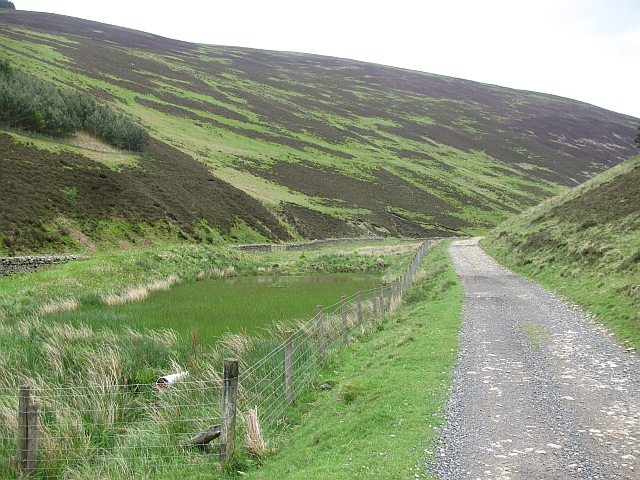
The hill is characterized by its gentle slopes, making it accessible to people of all fitness levels. Its well-maintained paths and trails make it an enjoyable experience for both beginners and experienced trekkers. The summit of Kaim Knowe provides a breathtaking vista, with the rolling hills and lush valleys of Peeblesshire stretching out as far as the eye can see.

The area around Kaim Knowe is rich in wildlife, offering opportunities for birdwatching and spotting other native fauna. The hill is covered in heather and grass, which provide a vibrant and colorful landscape throughout the seasons. Visitors may also come across a variety of wildflowers, adding to the natural beauty of the area.

For those interested in history, Kaim Knowe is believed to have ancient origins and has been shaped by human activity over the centuries. Archaeological remains and artifacts have been discovered in the vicinity, further adding to its historical significance.

Overall, Kaim Knowe is a captivating and accessible hill in Peeblesshire, offering breathtaking views, diverse wildlife, and a touch of history. It is a must-visit destination for anyone seeking a scenic and rewarding outdoor adventure in the heart of Scotland.

If you have any feedback on the listing, please let us know in the comments section below.
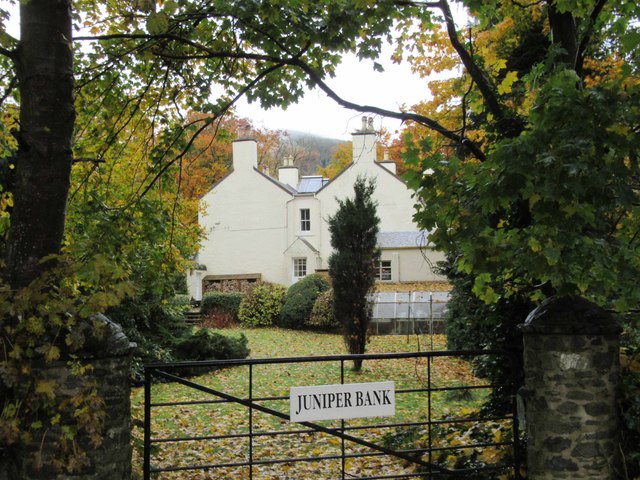
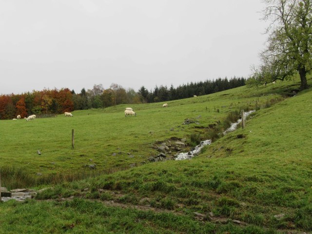
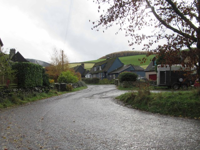
Kaim Knowe Images

Images are sourced within 2km of 55.628674/-2.9808004 or Grid Reference NT3837. Thanks to Geograph Open Source API. All images are credited.

View towards Walkerburn and the River Tweed Line of the disused railway line can clearly be seen between the field and river.
View towards Walkerburn and the River Tweed
Line of the disused railway line can clearly be seen between the field and river.
View towards Walkerburn and Cairn Hill
Wood End Cottage
Wood End Cottage
Land Rover Hospital? Land Rover repairs and garage.
Land Rover Hospital?
Land Rover repairs and garage.
Juniper Bank
Juniper Bank
Juniperbank Burn
Juniperbank Burn
Glenbenna Forestry Village
The lower cairn on Cairn Hill
Quad bike track, Gatehopeknowe It runs up Pyat Hill and is a very useful way on to the hill or to Gate Hope avoiding the houses.
Quad bike track, Gatehopeknowe
It runs up Pyat Hill and is a very useful way on to the hill or to Gate Hope avoiding the houses.
Woodland edge, Gatehopeknowe A useful way into Gate Hope, but watch the rabbit holes. This is death to ankles. There must be some well fed buzzards hereabouts.
Woodland edge, Gatehopeknowe
A useful way into Gate Hope, but watch the rabbit holes. This is death to ankles. There must be some well fed buzzards hereabouts.
Gate Hope A very beautiful glen, north of the Tweed.  I spend a lot of time on Windlestraw Law and this has to be the best way up I have yet found.
Gate Hope
A very beautiful glen, north of the Tweed. I spend a lot of time on Windlestraw Law and this has to be the best way up I have yet found.
Gate Hope A well wooded, hidden glen north of the Tweed. A grassy track runs up the west side and the main estate and house access road runs up the eastern side.
Gate Hope
A well wooded, hidden glen north of the Tweed. A grassy track runs up the west side and the main estate and house access road runs up the eastern side.
Kill Brae It would be a Killer Brae if you tried to run up it. Ashes on a steep scree slope on the east side of Gate Hope.
Hope is word in common usage along both of England's borders and in Northwest England. Usually it means a steep sided and often blind valley.
Kill Brae
It would be a Killer Brae if you tried to run up it. Ashes on a steep scree slope on the east side of Gate Hope. Hope is word in common usage along both of England's borders and in Northwest England. Usually it means a steep sided and often blind valley.
Trees, Gatehopeknowe Burn Look like the same trees as here: <a href="https://www.geograph.org.uk/photo/162214">NT3738 : Trees, Gatehopeknowe Burn</a>
Summer is here, but alders are late coming to leaf.  Gate Hope has some extensive alder woods along the burn.
Trees, Gatehopeknowe Burn
Look like the same trees as here: NT3738 : Trees, Gatehopeknowe Burn Summer is here, but alders are late coming to leaf. Gate Hope has some extensive alder woods along the burn.
Flight pool, Gate Hope A Summer view of the pool here: <a href="https://www.geograph.org.uk/photo/162222">NT3739 : Duckpond, Gatehopeknowe Burn</a>. The shallow pool has been colonised by horsetails. There is a nesting raft in the pool but no residents.
Flight pool, Gate Hope
A Summer view of the pool here: NT3739 : Duckpond, Gatehopeknowe Burn. The shallow pool has been colonised by horsetails. There is a nesting raft in the pool but no residents.
Gatehopeknowe View down a well wooded stretch of Tweeddale past Gatehopeknowe.
Gatehopeknowe
View down a well wooded stretch of Tweeddale past Gatehopeknowe.
Track, Gate Hope A grassy track runs up the western side of Gate Hope. The main access to the glen is by a bigger, well surfaced road from Holylee on the eastern side.
Track, Gate Hope
A grassy track runs up the western side of Gate Hope. The main access to the glen is by a bigger, well surfaced road from Holylee on the eastern side.
Back Burn A wooded section of Gate Hope where the Back Burn meets the Gatehopeburn.
Back Burn
A wooded section of Gate Hope where the Back Burn meets the Gatehopeburn.
Show me another place!

Kaim Knowe is located at Grid Ref: NT3837 (Lat: 55.628674, Lng: -2.9808004)

Unitary Authority: The Scottish Borders

Police Authority: The Lothians and Scottish Borders

What 3 Words

///climate.trembles.fried. Near Innerleithen, Scottish Borders

Related Wikis

Walkerburn

Walkerburn (Scottish Gaelic: Allt an Fhùcadair) is a small village in the Scottish Borders area of Scotland, on the A72 about 8 miles (13 km) from Peebles...

Walkerburn railway station

Walkerburn railway station served the village of Walkerburn, Scottish Borders, Scotland from 1867 to 1962 on the Peebles Railway. == History == The station...

Thornielee railway station

Thornielee railway station served the smallholding of Thornielee, Scottish Borders, Scotland from 1866 to 1950 on the Peebles Railway. == History == The...

The Kirna

The Kirna, known locally as Kirna House (previously also as Grangehill), is a Category A listed villa in Walkerburn, Peeblesshire, Scotland. It is one...

Ashiestiel

Ashiestiel is a village in the Scottish Borders area of Scotland, in the Parish of Caddonfoot, on the south side of the River Tweed, 4m (6.5 km) east of...

Innerleithen

Innerleithen (Scottish Gaelic: Inbhir Leitheann) is a civil parish and a small town in the committee area of Tweeddale, in the Scottish Borders. It was...

Robert Smail's Printing Works

Robert Smail's Printing Works is a fully functional Victorian era letterpress printing works in the small Scottish Borders town of Innerleithen, now preserved...

Innerleithen railway station

Innerleithen railway station served the town of Innerleithen, Scottish Borders, Scotland from 1864 to 1962 on the Peebles Railway. == History == The station...

Nearby Amenities

Located within 500m of 55.628674,-2.9808004
Scrogbank
Place: locality
Lat/Long: 55.6268271/-2.9802456
Gatehopeknowe
Place: locality
Lat/Long: 55.6289985/-2.976933
Power: pole
Lat/Long: 55.6275319/-2.9807845
Power: pole
Lat/Long: 55.62707/-2.9785666
Power: pole
Lat/Long: 55.6278857/-2.9822524
Power: pole
Lat/Long: 55.6280764/-2.9837075
Power: pole
Lat/Long: 55.6282947/-2.9851498
Power: pole
Lat/Long: 55.6282767/-2.9865455
Power: pole
Lat/Long: 55.6282503/-2.9880048
Material: wood
Power: pole
Lat/Long: 55.627642/-2.9781097
Power: pole
Lat/Long: 55.6259796/-2.9851643
Power: pole
Lat/Long: 55.627033/-2.9851812
Power: pole
Lat/Long: 55.6277531/-2.9851918
Power: pole
Lat/Long: 55.62581/-2.9863954
Power: pole
Lat/Long: 55.6258889/-2.9857904
Power: pole
Lat/Long: 55.6260131/-2.9841891
Power: pole
Lat/Long: 55.6260453/-2.9831843
The data included in this document is from www.openstreetmap.org. The data is made available under ODbL.

Have you been to Kaim Knowe?

Leave your review of Kaim Knowe below (or comments, questions and feedback).