Bier Law

Hill, Mountain in Peeblesshire

Scotland

Bier Law

Caberston Coffee Shop, Walkerburn This coffee shop is located on the north side of the A72 in the village centre.
Caberston Coffee Shop, Walkerburn Credit: Walter Baxter

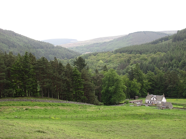
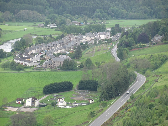
Bier Law is a prominent hill located in Peeblesshire, Scotland. Standing at an elevation of approximately 527 meters (1,729 feet), it offers picturesque views of the surrounding countryside, making it a popular destination for outdoor enthusiasts, hikers, and nature lovers.

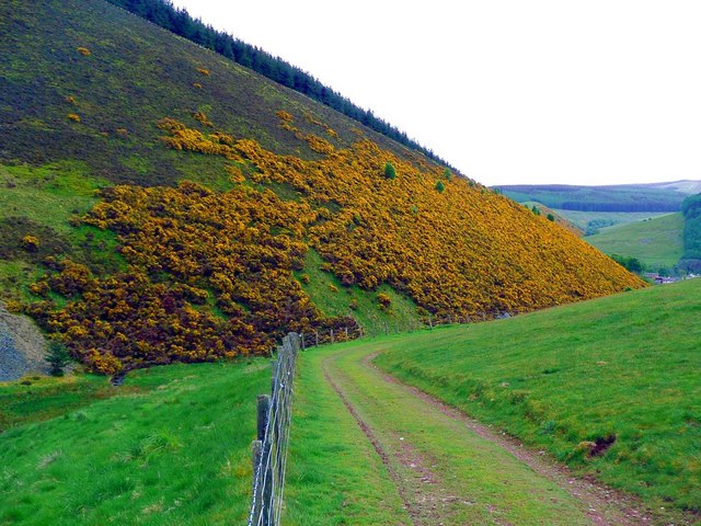
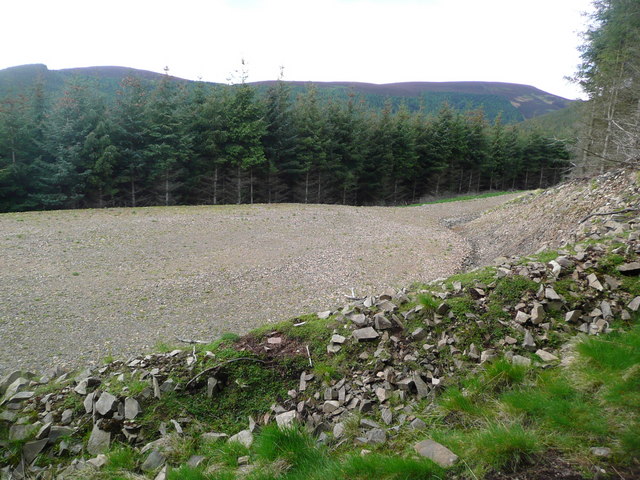
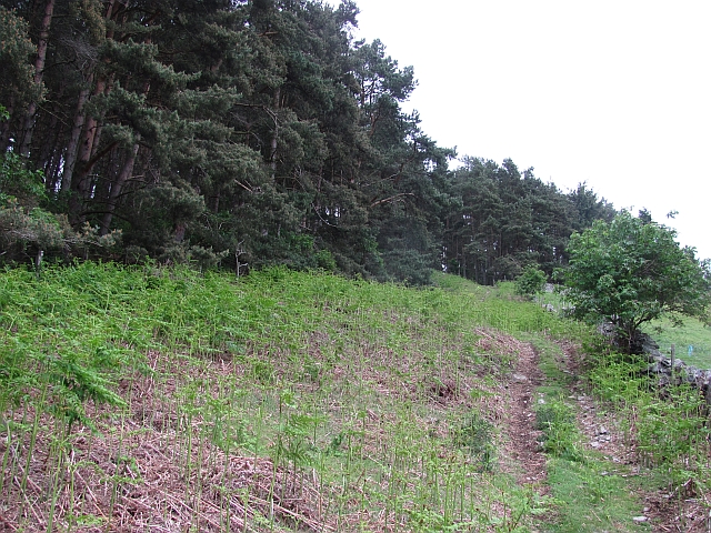
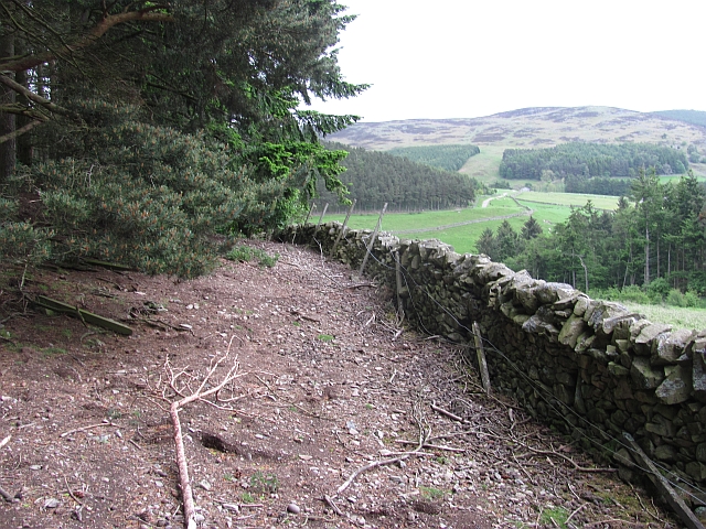
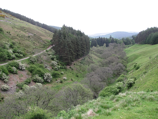
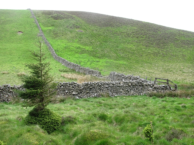
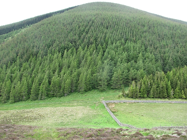
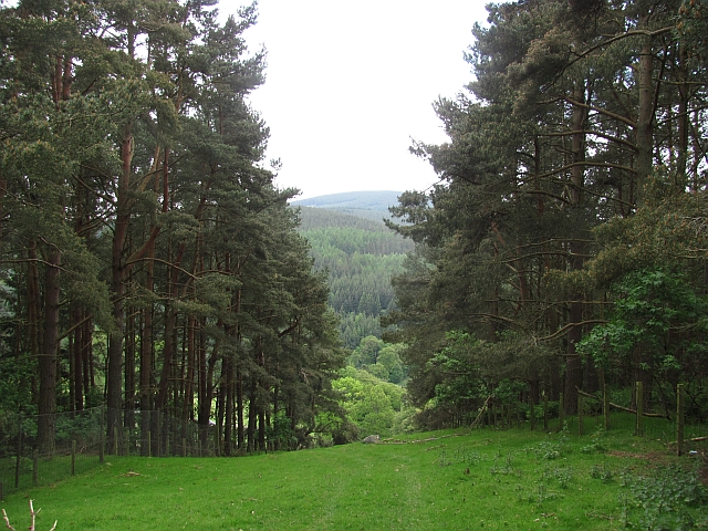
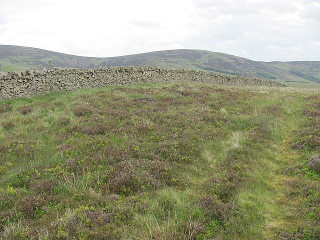
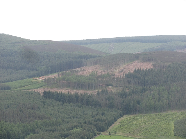
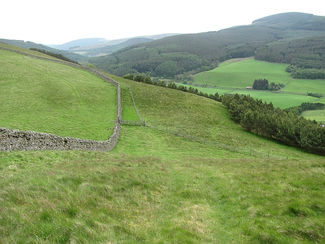
Situated in the southern part of the region, Bier Law is part of the stunning Moorfoot Hills range. Its distinct shape and relatively isolated location make it a recognizable landmark in the area. The hill is characterized by its gentle slopes, covered in heather and grasses, which give it a vibrant hue during the summer months.

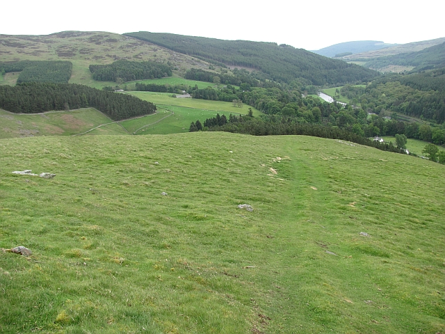
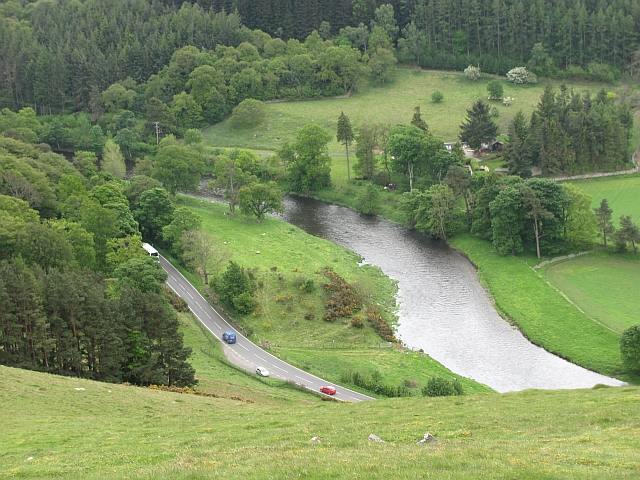
Ascending Bier Law can be achieved via various routes, with most starting from the nearby village of Temple. The climb is moderate in difficulty and suitable for individuals of varying fitness levels. The summit rewards visitors with panoramic views of the surrounding countryside, including rolling hills, moorlands, and the meandering course of the River Tweed.

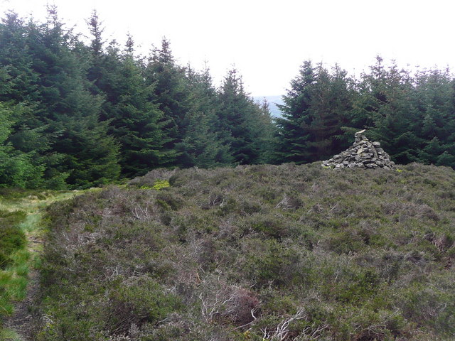
The area surrounding Bier Law is known for its rich biodiversity, with a variety of bird species, including birds of prey, often spotted in the skies above. The hill is also home to a diverse range of flora and fauna, with a mix of grassland and heathland species thriving in the local environment.

Whether you are seeking a peaceful hike, a chance to immerse yourself in nature, or simply want to enjoy the breathtaking views, a visit to Bier Law in Peeblesshire promises to be a memorable experience.

If you have any feedback on the listing, please let us know in the comments section below.

Bier Law Images

Images are sourced within 2km of 55.619467/-2.997116 or Grid Reference NT3736. Thanks to Geograph Open Source API. All images are credited.

Caberston Coffee Shop, Walkerburn This coffee shop is located on the north side of the A72 in the village centre.
Caberston Coffee Shop, Walkerburn
This coffee shop is located on the north side of the A72 in the village centre.
Gorse in exuberant form above Walkerburn
Forest track development above Walkerburn A huge metalled turning area at the end of the forest track has been created here by extensive excavation.  The forest appears mature and this may signify imminent harvesting.
Forest track development above Walkerburn
A huge metalled turning area at the end of the forest track has been created here by extensive excavation. The forest appears mature and this may signify imminent harvesting.
The lower cairn on Cairn Hill
Quad bike track, Gatehopeknowe It runs up Pyat Hill and is a very useful way on to the hill or to Gate Hope avoiding the houses.
Quad bike track, Gatehopeknowe
It runs up Pyat Hill and is a very useful way on to the hill or to Gate Hope avoiding the houses.
Woodland edge, Gatehopeknowe A useful way into Gate Hope, but watch the rabbit holes. This is death to ankles. There must be some well fed buzzards hereabouts.
Woodland edge, Gatehopeknowe
A useful way into Gate Hope, but watch the rabbit holes. This is death to ankles. There must be some well fed buzzards hereabouts.
Gate Hope A well wooded, hidden glen north of the Tweed. A grassy track runs up the west side and the main estate and house access road runs up the eastern side.
Gate Hope
A well wooded, hidden glen north of the Tweed. A grassy track runs up the west side and the main estate and house access road runs up the eastern side.
Gatehopeknowe View down a well wooded stretch of Tweeddale past Gatehopeknowe.
Gatehopeknowe
View down a well wooded stretch of Tweeddale past Gatehopeknowe.
Track, Gate Hope A grassy track runs up the western side of Gate Hope. The main access to the glen is by a bigger, well surfaced road from Holylee on the eastern side.
Track, Gate Hope
A grassy track runs up the western side of Gate Hope. The main access to the glen is by a bigger, well surfaced road from Holylee on the eastern side.
Early Knowe A small sharp hill above the River Tweed. The southern side is heather covered while a field has been cleared to the north.
Early Knowe
A small sharp hill above the River Tweed. The southern side is heather covered while a field has been cleared to the north.
Cairn Hill Plantations on Cairn Hill. View from the heather covered Early Knowe.
Cairn Hill
Plantations on Cairn Hill. View from the heather covered Early Knowe.
Pyat Hill A quad bike track descends Pyat Hill. There is a very good view down Tweeddale from here.
Pyat Hill
A quad bike track descends Pyat Hill. There is a very good view down Tweeddale from here.
River Tweed Looking down on the Tweed and A72 from Pyat Hill.
River Tweed
Looking down on the Tweed and A72 from Pyat Hill.
Gap in woodland A quad bike track to release pens and Pyat Hill passes up this gap between two conifer blocks.
Gap in woodland
A quad bike track to release pens and Pyat Hill passes up this gap between two conifer blocks.
Summit, Early Knowe Moorland on the southern side, grassland over the dyke.
Summit, Early Knowe
Moorland on the southern side, grassland over the dyke.
Middlebar Knowe Trees being harvested in Elibank Forest.
Middlebar Knowe
Trees being harvested in Elibank Forest.
Early Slack Col between Early Knowe and Pyat Hill. Looking towards Pyat Hill
Early Slack
Col between Early Knowe and Pyat Hill. Looking towards Pyat Hill
A72 Walkerburn The A72 east of Walkerburn. View from Pyat Hill.
A72 Walkerburn
The A72 east of Walkerburn. View from Pyat Hill.
Show me another place!

Bier Law is located at Grid Ref: NT3736 (Lat: 55.619467, Lng: -2.997116)

Unitary Authority: The Scottish Borders

Police Authority: The Lothians and Scottish Borders

What 3 Words

///efficient.heartened.amplifier. Near Innerleithen, Scottish Borders

Nearby Locations

Bier Law

Related Wikis

Related Videos

i love you two

nag walking kami s village.

Fiona’s Paw Adventures

Dad and I go up Old Caberston with our group today. Inka Cassie Ozzie Mud Tam and Reuben Aug22.

Glenbenna downhill track

Full run of glenbenna downhill track Rider: Jake EBDON Filmed on GoPro hero 5 session.

Glenbenna and Innerleithen on E-Bike

Was working in Walkerburn for 3 days so decided to take my E-Bike and do a bit of exploring , did a couple of trails at Glenbenna ...

Nearby Amenities

Located within 500m of 55.619467,-2.997116
Power: pole
Lat/Long: 55.6230762/-2.9995442
Power: pole
Lat/Long: 55.6234118/-2.999007
Power: pole
Lat/Long: 55.6237355/-2.998476
The data included in this document is from www.openstreetmap.org. The data is made available under ODbL.

Have you been to Bier Law?

Leave your review of Bier Law below (or comments, questions and feedback).