Fethan Hill

Hill, Mountain in Peeblesshire

Scotland

Fethan Hill

Sheep, Glen Greening up pasture in front of Birks and Birks Hill.
Sheep, Glen Credit: Richard Webb

Fethan Hill is a prominent hill located in Peeblesshire, a historic county in the Scottish Borders region of Scotland. Standing at an elevation of approximately 380 meters (1,250 feet), it offers breathtaking panoramic views of the surrounding countryside.

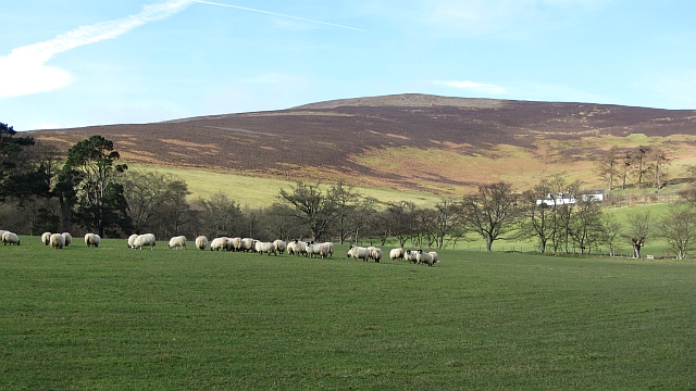
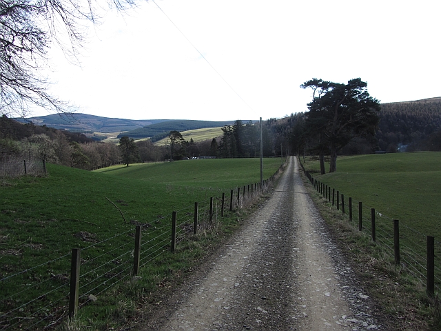
Situated about 3 kilometers (2 miles) northeast of the town of Peebles, Fethan Hill is easily accessible and attracts both locals and tourists. It is a popular destination for outdoor enthusiasts, hikers, and nature lovers. The hill is part of a larger range known as the Moorfoots, which is renowned for its unspoiled natural beauty and diverse wildlife.

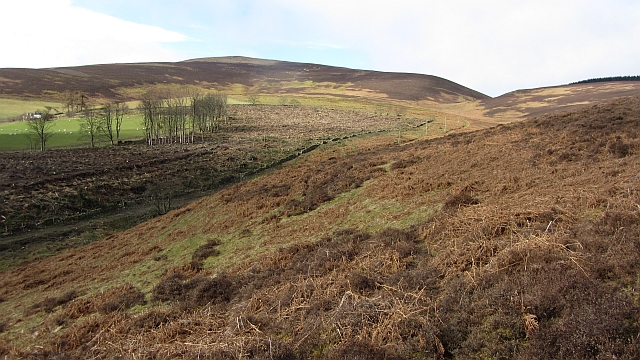
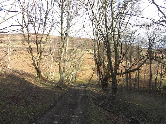
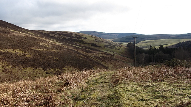
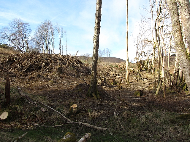
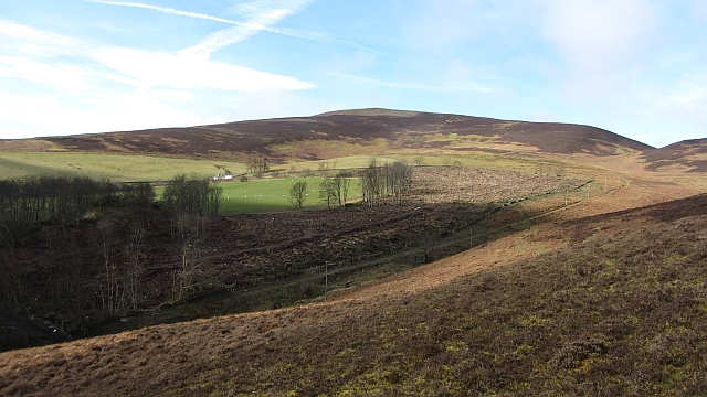
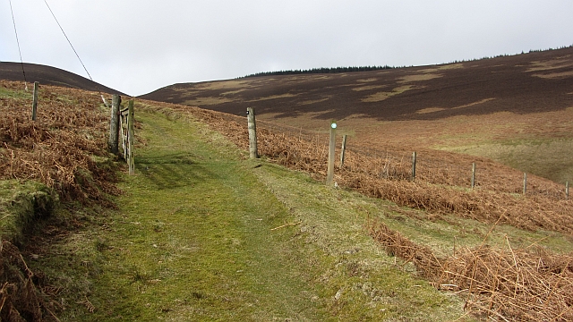
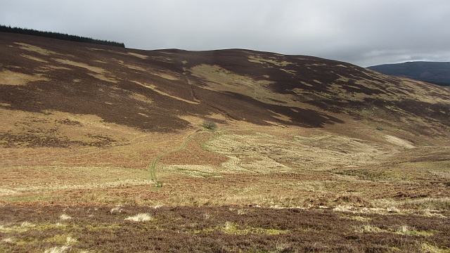
The terrain of Fethan Hill is characterized by rolling slopes and grassy meadows, interspersed with patches of heather and gorse. The landscape is dotted with rocky outcrops, adding a touch of ruggedness to its scenic charm. Visitors can explore its trails, which meander through woodlands and open fields, offering opportunities to spot various bird species, including red grouse, skylarks, and kestrels.

At its peak, Fethan Hill provides magnificent views of the surrounding countryside, including the picturesque Tweed Valley and the nearby hills of the Southern Uplands. On clear days, visitors can even catch a glimpse of the iconic Edinburgh skyline in the distance.

Overall, Fethan Hill is a captivating natural attraction in Peeblesshire, offering a serene and tranquil escape for those seeking to immerse themselves in the beauty of the Scottish countryside.

If you have any feedback on the listing, please let us know in the comments section below.

Fethan Hill Images

Images are sourced within 2km of 55.581564/-3.1031696 or Grid Reference NT3032. Thanks to Geograph Open Source API. All images are credited.

Sheep, Glen Greening up pasture in front of Birks and Birks Hill.
Sheep, Glen
Greening up pasture in front of Birks and Birks Hill.
Glass Burn The Glass Burn descends moorland slopes towards Glen. A plantation containing western hemlock has recently been felled. Paths meet before a pass through the ridgeline nick. From there you can descend through Cardrona Forest, or contour beneath Birks Hill to pick up the drove road to Peebles.
Glass Burn
The Glass Burn descends moorland slopes towards Glen. A plantation containing western hemlock has recently been felled. Paths meet before a pass through the ridgeline nick. From there you can descend through Cardrona Forest, or contour beneath Birks Hill to pick up the drove road to Peebles.
Woodland track An estate road at The Glen. Ongoing paths run over the hill to Tweeddale.
Woodland track
An estate road at The Glen. Ongoing paths run over the hill to Tweeddale.
Hill track, Glass Burn A path, not marked by the Ordnance Survey, but waymarked on the ground leads away from The Glen towards Cardrona Forest and Peebles.
Hill track, Glass Burn
A path, not marked by the Ordnance Survey, but waymarked on the ground leads away from The Glen towards Cardrona Forest and Peebles.
Glen House The centrepiece of the Glen Estate, set in a beautiful wooded valley off Tweeddale.
Glen House
The centrepiece of the Glen Estate, set in a beautiful wooded valley off Tweeddale.
Target Bank Wood Unthinned larch above the Quair Water.
Target Bank Wood
Unthinned larch above the Quair Water.
Eagles Wood There is a brief gap in The Glen woodlands here.
Eagles Wood
There is a brief gap in The Glen woodlands here.
Hannah's Wood Woodland on the south side of The Glen.
Hannah's Wood
Woodland on the south side of The Glen.
Road in The Glen The road from Loch Eddy passes Eagles Wood.
Road in The Glen
The road from Loch Eddy passes Eagles Wood.
Telephone box, The Glen Still there, unusually off the public highway.
Telephone box, The Glen
Still there, unusually off the public highway.
Road to Birks This private road continues as paths over the hill to Peebles.
Road to Birks
This private road continues as paths over the hill to Peebles.
Felled woodland, Birks A recently (2012) felled block of conifers on the Glen Estate.
Felled woodland, Birks
A recently (2012) felled block of conifers on the Glen Estate.
Felled area, Birks A recently (2012) felled conifer wood.
Felled area, Birks
A recently (2012) felled conifer wood.
A path to Peebles A hill path crosses a pass into Cardrona Forest and onwards towards Peebles.
A path to Peebles
A hill path crosses a pass into Cardrona Forest and onwards towards Peebles.
Glass Burn and Orchard Rig Moorland on the Glen Estate.
Glass Burn and Orchard Rig
Moorland on the Glen Estate.
Ruin, Glen Estate There are two gable ends set amongst gathering pens.
Ruin, Glen Estate
There are two gable ends set amongst gathering pens.
Bridge, Glenvalley Road and bridge over the Quair Water, Glen Estate.
Bridge, Glenvalley
Road and bridge over the Quair Water, Glen Estate.
Field, The Glen Woodland gives way to grass fields in a parkland setting.
Field, The Glen
Woodland gives way to grass fields in a parkland setting.
Show me another place!

Fethan Hill is located at Grid Ref: NT3032 (Lat: 55.581564, Lng: -3.1031696)

Unitary Authority: The Scottish Borders

Police Authority: The Lothians and Scottish Borders

What 3 Words

///encounter.scream.putts. Near Innerleithen, Scottish Borders

Nearby Locations

R Strip Fethan Hill

Related Wikis

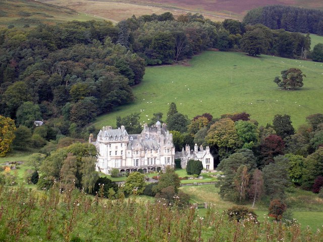
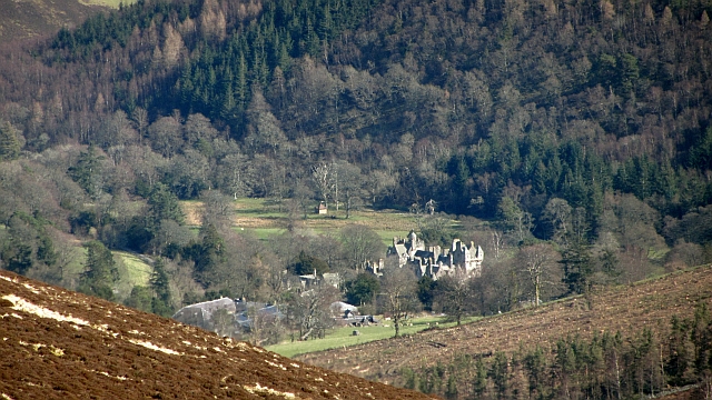
The Glen, Scottish Borders

The Glen, also known as Glen House, is an estate and country house in the parish of Traquair, southern Scotland. It is located in the glen of the Quair...

Traquair

Traquair (Scottish Gaelic: Cille Bhrìghde) is a small village and civil parish in the Scottish Borders; until 1975 it was in the county of Peeblesshire...

Sir Walter Scott Way

The Sir Walter Scott Way is a 92-mile (148 km) long-distance footpath in the Scottish Borders. The route broadly follows the waymarked Southern Upland...

Quair Water

The Quair Water is a tributary of the River Tweed in the Scottish Borders area of Scotland. Its name is related to Traquair. == Etymology == The name Quair...

Nearby Amenities

Located within 500m of 55.581564,-3.1031696
Fethan Hill
Ele: 372
Ele Ft: 1221
Natural: peak
Lat/Long: 55.581838/-3.1026962
The data included in this document is from www.openstreetmap.org. The data is made available under ODbL.

Have you been to Fethan Hill?

Leave your review of Fethan Hill below (or comments, questions and feedback).