Bowbeat Hill

Hill, Mountain in Peeblesshire

Scotland

Bowbeat Hill

Bowbeat Wind Farm from Kings Road Nick, Moorfoot Hills
Bowbeat Wind Farm from Kings Road Nick, Moorfoot Hills Credit: Colin Park

Bowbeat Hill is a prominent hill located in the county of Peeblesshire, in the Scottish Borders region of Scotland. With an elevation of approximately 428 meters (1,404 feet), it stands as a distinctive landmark in the picturesque landscape of the area.

Situated near the village of West Linton, Bowbeat Hill offers breathtaking panoramic views of the surrounding countryside. Its summit is marked by a trig point, providing an excellent vantage point for visitors to enjoy the stunning vistas of rolling hills, lush greenery, and distant mountains that stretch as far as the eye can see. On a clear day, it is even possible to catch glimpses of the Pentland Hills and the Scottish Lowlands.

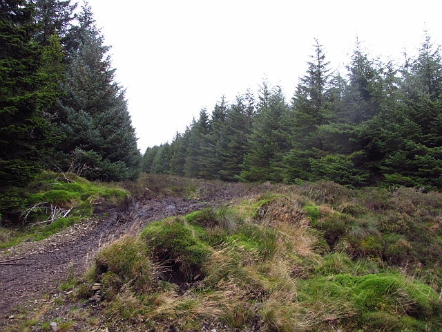
Bowbeat Hill boasts a rich diversity of wildlife and vegetation, making it an attractive destination for nature enthusiasts. The hill is covered with heather, bracken, and grasses, providing a habitat for various species of birds, small mammals, and insects. It is not uncommon to spot buzzards soaring overhead, or to encounter rabbits, deer, and other animals as you explore the area.

For outdoor enthusiasts and hikers, Bowbeat Hill offers a range of walking routes and trails that cater to different levels of difficulty and fitness. The hill can be accessed from various points, with well-defined paths leading up to the summit. It is particularly popular among locals and visitors alike for its peaceful and tranquil atmosphere, providing an ideal escape from the hustle and bustle of everyday life.

Overall, Bowbeat Hill in Peeblesshire is a captivating natural landmark that offers stunning vistas, diverse wildlife, and invigorating walking routes, making it an appealing destination for those seeking to immerse themselves in the beauty of the Scottish Borders landscape.

If you have any feedback on the listing, please let us know in the comments section below.

Bowbeat Hill Images

Images are sourced within 2km of 55.710353/-3.1283149 or Grid Reference NT2946. Thanks to Geograph Open Source API. All images are credited.

Bowbeat Wind Farm from Kings Road Nick, Moorfoot Hills
Track at eastern end of Bowbeat Wind Farm - view to Blackhope Scar
Logging road, Long Grain A forest road below Bowbeat Hill and within earshot of the wind turbines. The road is showing signs of recent use, there is a  big clear fell area nearby.
Logging road, Long Grain
A forest road below Bowbeat Hill and within earshot of the wind turbines. The road is showing signs of recent use, there is a big clear fell area nearby.
Middle Rig A ride through dense woodland is used as an access route to the moorland by a local estate.
Middle Rig
A ride through dense woodland is used as an access route to the moorland by a local estate.
Forest road, Leithen Water This road has been recently upgraded. Much of the forest is ready for felling and a lot of timber will be carried out.
Forest road, Leithen Water
This road has been recently upgraded. Much of the forest is ready for felling and a lot of timber will be carried out.
Foxgloves by the track A touch of colour by the forest track around Totto Hill, Leithenwater Forest. Some of the Bowbeat windfarm turbines are on the skyline.
Foxgloves by the track
A touch of colour by the forest track around Totto Hill, Leithenwater Forest. Some of the Bowbeat windfarm turbines are on the skyline.
Forestry patterns, Leithenwater Forest Looking across the Leithen Water valley from Totto Hill to Lamb Law.
Forestry patterns, Leithenwater Forest
Looking across the Leithen Water valley from Totto Hill to Lamb Law.
Bowbeat windfarm from Leithenwater Forest Some of the 24 turbines comprising the 31MW Bowbeat windfarm, which began generating in 2002.
Bowbeat windfarm from Leithenwater Forest
Some of the 24 turbines comprising the 31MW Bowbeat windfarm, which began generating in 2002.
Forest track, Cape Hill In Leithenwater Forest above Craig Hope with some of the Bowbeat turbines on the skyline. The slope below the track has been replanted.
Forest track, Cape Hill
In Leithenwater Forest above Craig Hope with some of the Bowbeat turbines on the skyline. The slope below the track has been replanted.
Murder Cleuch I wonder what event gave rise to this name - an otherwise unremarkable feature in Leithenwater Forest, the burn draining to Craig Hope Burn.
Murder Cleuch
I wonder what event gave rise to this name - an otherwise unremarkable feature in Leithenwater Forest, the burn draining to Craig Hope Burn.
Standing tree, Craig Hope A few trees are left standing in clear felling as part of the 'deadwood' that is beneficial to nutrient cycling and biodiversity in the growing forest. More information can be found in the publication 'Managing Deadwood in Forests and Woodlands', Forestry Commission at <span class="nowrap"><a title="https://www.forestry.gov.uk/england-managingdeadwood" rel="nofollow ugc noopener" href="https://www.forestry.gov.uk/england-managingdeadwood">Link</a><img style="margin-left:2px;" alt="External link" title="External link - shift click to open in new window" src="https://s1.geograph.org.uk/img/external.png" width="10" height="10"/></span>.
Standing tree, Craig Hope
A few trees are left standing in clear felling as part of the 'deadwood' that is beneficial to nutrient cycling and biodiversity in the growing forest. More information can be found in the publication 'Managing Deadwood in Forests and Woodlands', Forestry Commission at LinkExternal link.
Track at east end of Bowbeat Wind Farm Looking towards the fence and track on Long Edge
Track at east end of Bowbeat Wind Farm
Looking towards the fence and track on Long Edge
Bowbeat Wind Farm Notice board on the approach to the Bowbeat Wind Farm on the approach from Blackhope Scar.
Bowbeat Wind Farm
Notice board on the approach to the Bowbeat Wind Farm on the approach from Blackhope Scar.
Leithenwater Forest track
Craig Hope Looking down the track in Leithenwater Forest.
Craig Hope
Looking down the track in Leithenwater Forest.
From Long Grain to Garvald Punks Not much here except peat, grass, and heather!
From Long Grain to Garvald Punks
Not much here except peat, grass, and heather!
Eastern end of Bowbeat wind farm This turbine has been brought to a halt by rotating the blade tips, which quickly slows down the rotation. The turbines are controlled remotely via a data link.
Eastern end of Bowbeat wind farm
This turbine has been brought to a halt by rotating the blade tips, which quickly slows down the rotation. The turbines are controlled remotely via a data link.
Notice, Bowbeat wind farm At least access on foot is not prohibited, so a few words of caution are given alongside the map.
Notice, Bowbeat wind farm
At least access on foot is not prohibited, so a few words of caution are given alongside the map.
Show me another place!

Bowbeat Hill is located at Grid Ref: NT2946 (Lat: 55.710353, Lng: -3.1283149)

Unitary Authority: The Scottish Borders

Police Authority: The Lothians and Scottish Borders

What 3 Words

///soap.outnumber.region. Near Peebles, Scottish Borders

Related Wikis

Bowbeat Hill

Bowbeat Hill is a hill in the Moorfoot Hills range, part of the Southern Uplands of Scotland. It lends its name to Bowbeat Onshore Wind Farm built on the...

Blackhope Scar

Blackhope Scar is a hill in the Moorfoot Hills range, part of the Southern Uplands of Scotland. It lies to the northeast of the town of Peebles and is...

Glentress Forest

Glentress Forest is located near Peebles in the Scottish Borders, about 30 miles south of Edinburgh. Part of the Tweed Valley Forest Park along with Traquair...

Moorfoot Hills

The Moorfoot Hills are a range of hills south of Edinburgh in east central Scotland, one of the ranges which collectively form the Southern Uplands....

Nearby Amenities

Located within 500m of 55.710353,-3.1283149
Bowbeat Hill
Natural: peak
Wikidata: Q96373869
Wikipedia: en:Bowbeat Hill
Lat/Long: 55.7109836/-3.127708
Generator Method: wind_turbine
Generator Output Electricity: yes
Generator Source: wind
Generator Type: horizontal_axis
Power: generator
Source: Bing
Lat/Long: 55.7084967/-3.1310991
Generator Method: wind_turbine
Generator Output Electricity: yes
Generator Source: wind
Generator Type: horizontal_axis
Power: generator
Source: Bing
Lat/Long: 55.7116368/-3.1240756
Generator Method: wind_turbine
Generator Output Electricity: yes
Generator Source: wind
Generator Type: horizontal_axis
Power: generator
Source: Bing
Lat/Long: 55.709437/-3.1236243
Generator Method: wind_turbine
Generator Output Electricity: yes
Generator Source: wind
Generator Type: horizontal_axis
Power: generator
Source: Bing
Lat/Long: 55.7107789/-3.1324076
Generator Method: wind_turbine
Generator Output Electricity: yes
Generator Source: wind
Generator Type: horizontal_axis
Power: generator
Source: Bing
Lat/Long: 55.7099299/-3.1273109
Generator Method: wind_turbine
Generator Output Electricity: yes
Generator Source: wind
Generator Type: horizontal_axis
Power: generator
Source: Bing
Lat/Long: 55.7071891/-3.1240272
Generator Method: wind_turbine
Generator Output Electricity: yes
Generator Source: wind
Generator Type: horizontal_axis
Power: generator
Source: Bing
Lat/Long: 55.7115967/-3.1358492
The data included in this document is from www.openstreetmap.org. The data is made available under ODbL.

Have you been to Bowbeat Hill?

Leave your review of Bowbeat Hill below (or comments, questions and feedback).