Bleaberry Fell

Hill, Mountain in Cumberland Allerdale

England

Bleaberry Fell

A591 near Rough How Bridge
A591 near Rough How Bridge Credit: Colin Pyle

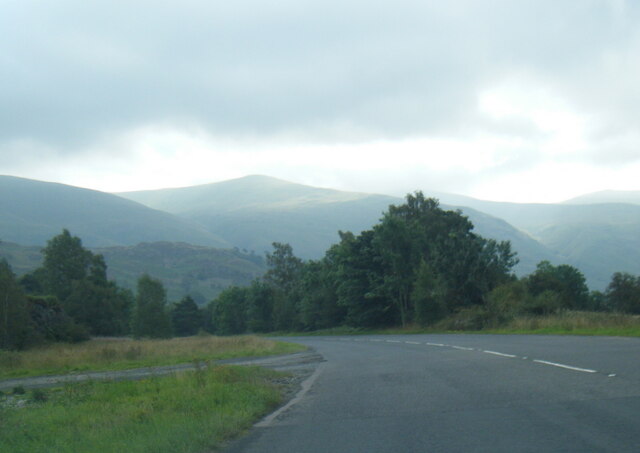
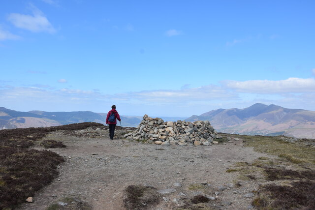
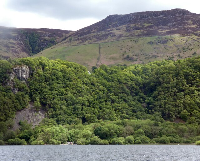
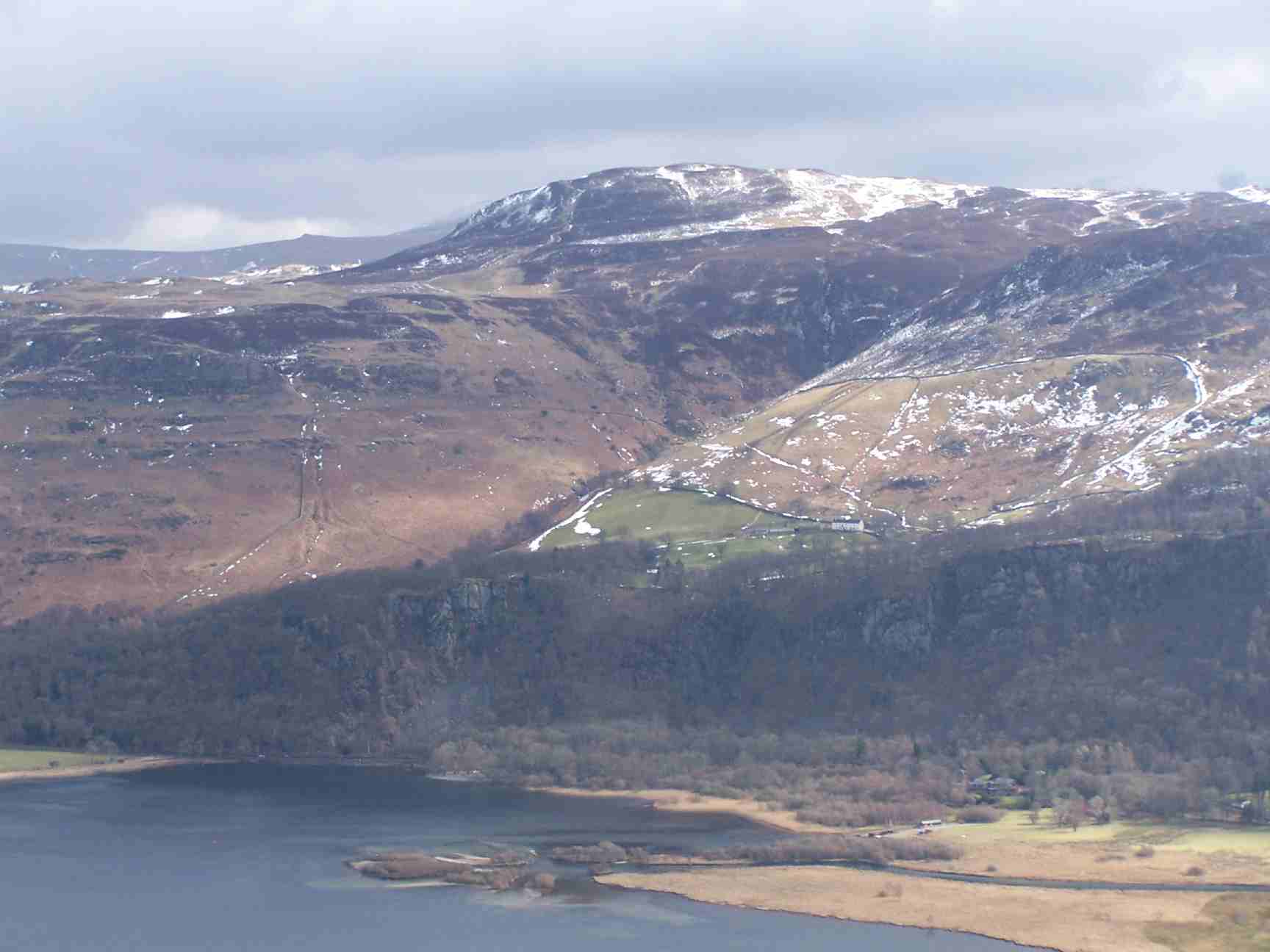
Bleaberry Fell is a prominent hill located in the county of Cumberland, England. It is part of the Lake District National Park, which is known for its stunning landscapes and abundant natural beauty. Standing at an elevation of 590 meters (1,936 feet), Bleaberry Fell offers breathtaking panoramic views of the surrounding area.

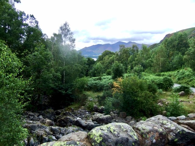
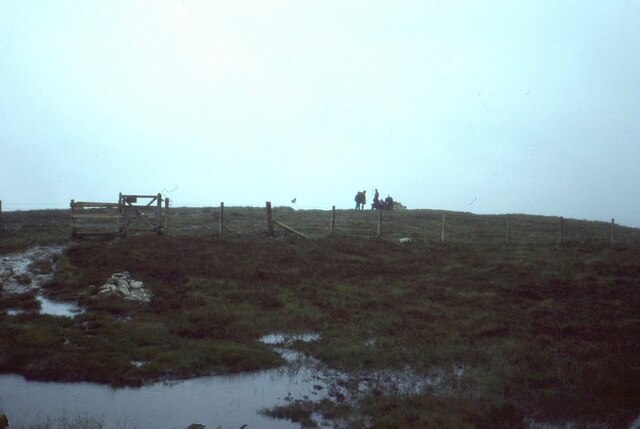
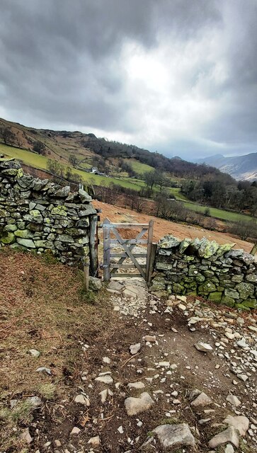
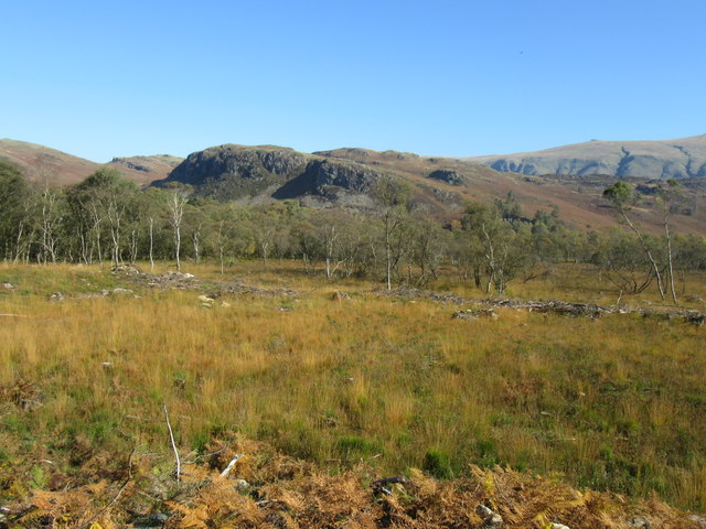
The fell is characterized by its gently sloping terrain, covered in a mix of grasses, heather, and scattered rocks. Its distinct shape and prominent position make it a popular destination for hikers and walkers, who are rewarded with the striking vistas from the summit. On a clear day, one can see the picturesque valleys, rolling hills, and serene lakes that define the Lake District region.

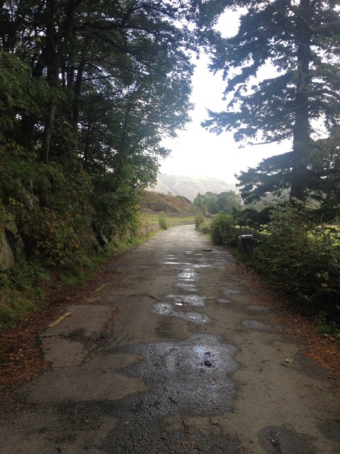
The ascent to Bleaberry Fell can be undertaken from various starting points, with the most common route starting at the village of Threlkeld. The well-marked trail takes hikers through lush green meadows, along stone walls, and up the fell's gentle slopes. The hike is of moderate difficulty, making it accessible to a wide range of outdoor enthusiasts.

Bleaberry Fell is also a favorite spot for birdwatchers, as the area is home to a variety of bird species, including skylarks, buzzards, and peregrine falcons. It offers a peaceful and tranquil environment, away from the hustle and bustle of urban life.

Overall, Bleaberry Fell is a cherished natural landmark in Cumberland, providing visitors with an opportunity to immerse themselves in the stunning beauty of the Lake District while enjoying outdoor activities and appreciating the local wildlife.

If you have any feedback on the listing, please let us know in the comments section below.

Bleaberry Fell Images

Images are sourced within 2km of 54.566253/-3.1064309 or Grid Reference NY2819. Thanks to Geograph Open Source API. All images are credited.

A591 near Rough How Bridge
OS Cut Mark - Rough How Bridge <span class="nowrap"><a title="https://www.bench-marks.org.uk/bm27678" rel="nofollow ugc noopener" href="https://www.bench-marks.org.uk/bm27678">Link</a><img style="margin-left:2px;" alt="External link" title="External link - shift click to open in new window" src="https://s1.geograph.org.uk/img/external.png" width="10" height="10"/></span>
OS Cut Mark - Rough How Bridge
Barrow Beck
Barrow Beck
Summit, Bleaberry Fell
Ashness Bridge On the minor road from Barrow Bay to Watendlath, the Grade II listed Ashness Bridge over Barrow Beck is a popular tourist attraction.
Barrow Beck flows into Derwentwater and thence into the River Derwent.
Ashness Bridge
On the minor road from Barrow Bay to Watendlath, the Grade II listed Ashness Bridge over Barrow Beck is a popular tourist attraction. Barrow Beck flows into Derwentwater and thence into the River Derwent.
Ashness Bridge
Ashness Bridge
Gate on Brown Knotts
Bleaberry Fell The wind shelter on the summit of the fell. Looking north west with Skiddaw in the distance on the right of the shot.
Bleaberry Fell
The wind shelter on the summit of the fell. Looking north west with Skiddaw in the distance on the right of the shot.
Wooded cliffs overlooking Derwentwater 
Between the Bleaberry Fell and the lakeside are cliffs covered in trees. On the left, above a landslide, there seems to be some kind of face.
Wooded cliffs overlooking Derwentwater
Between the Bleaberry Fell and the lakeside are cliffs covered in trees. On the left, above a landslide, there seems to be some kind of face.
Ashness Bridge The one and only!
Ashness Bridge
The one and only!
Artist at work - Ashness Bridge A popular place to linger with a good impression of the view on the canvas.
Artist at work - Ashness Bridge
A popular place to linger with a good impression of the view on the canvas.
Ashness Bridge near Derwentwater Ashness Bridge over Barrow Beck is a highly popular tourist attraction. This is an old packhorse bridge on the single track road to Watendlath. Barrow Beck flows into Derwentwater. This is one of the most photographed bridges in Britain. Viewed on a day in early autumn.
Ashness Bridge near Derwentwater
Ashness Bridge over Barrow Beck is a highly popular tourist attraction. This is an old packhorse bridge on the single track road to Watendlath. Barrow Beck flows into Derwentwater. This is one of the most photographed bridges in Britain. Viewed on a day in early autumn.
Land below Low Strutta Wood The view is along the eastern side of Derwent Water from the Lodore landing stage.
The deciduous trees of Low Strutta Wood rise at the right side of the image, above the reeds.
Buttresses of Falcon Crag are partially sunlit high on the mountain slope.
The distant hills are Lonscale Fell and Latrigg.
Land below Low Strutta Wood
The view is along the eastern side of Derwent Water from the Lodore landing stage. The deciduous trees of Low Strutta Wood rise at the right side of the image, above the reeds. Buttresses of Falcon Crag are partially sunlit high on the mountain slope. The distant hills are Lonscale Fell and Latrigg.
In Naddle Dale An area of cleared and light woodland on the valley floor below The Benn, with Skiddaw in the distance.
In Naddle Dale
An area of cleared and light woodland on the valley floor below The Benn, with Skiddaw in the distance.
The old road now by-passed
The old A591
The old A591
Looking towards Yew Crag Most of the conifers in this area have been felled.
Looking towards Yew Crag
Most of the conifers in this area have been felled.
Rubbish left by the contractors working on the new water pipeline
Show me another place!

Bleaberry Fell is located at Grid Ref: NY2819 (Lat: 54.566253, Lng: -3.1064309)

Administrative County: Cumbria

District: Allerdale

Police Authority: Cumbria

What 3 Words

///notifying.wicked.episode. Near Keswick, Cumbria

Related Wikis

Bleaberry Fell

Bleaberry Fell is a fell in the Lake District in Cumbria, England, with a height of 590 metres (1,936 ft). It stands on the main watershed between Borrowdale...
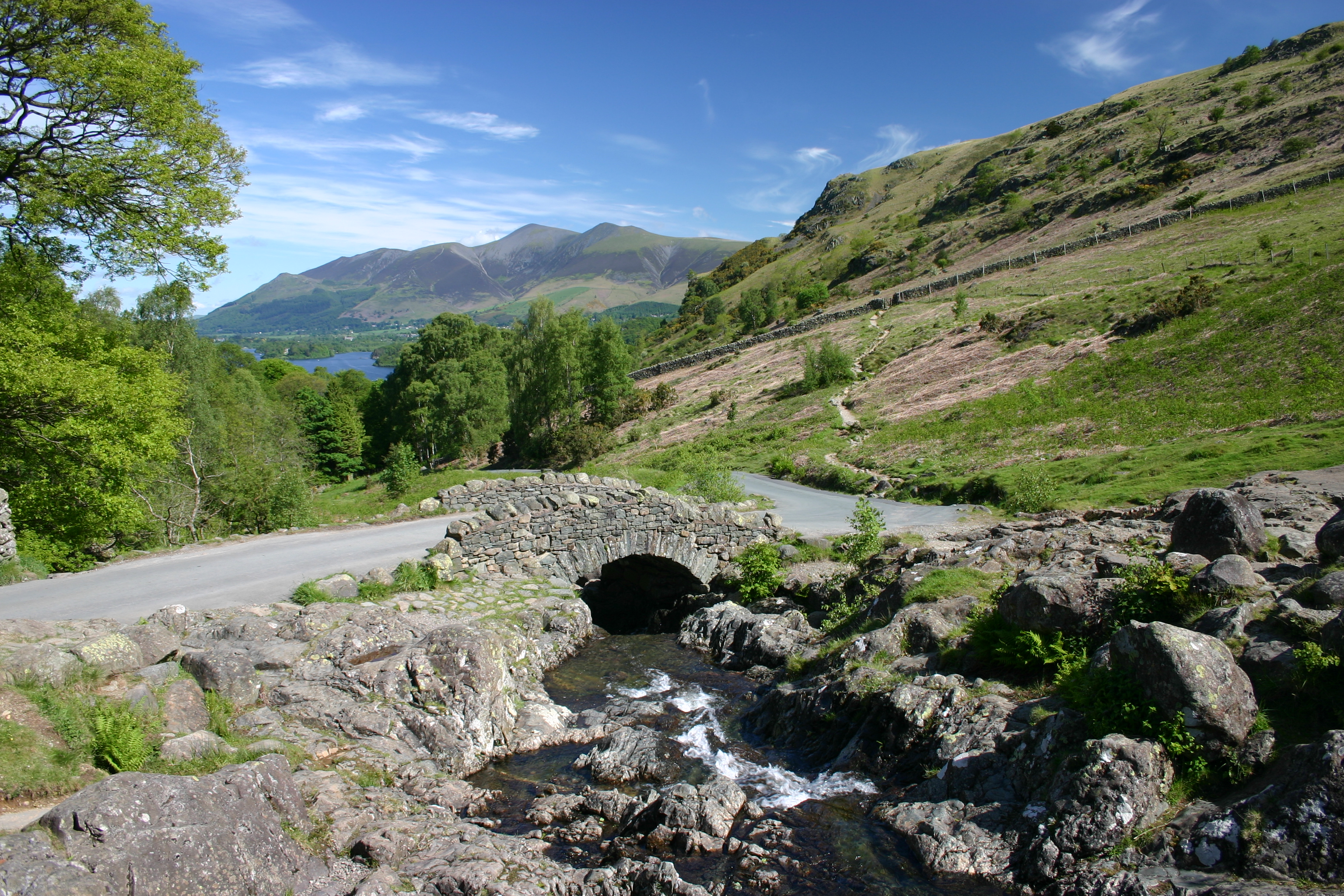
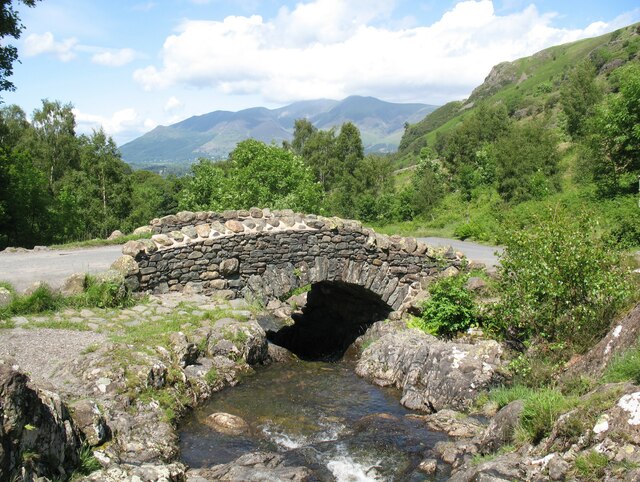
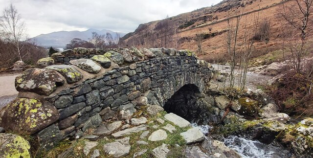
Ashness Bridge

Ashness Bridge is a traditional stone-built bridge on the single-track road from the Borrowdale road (B5289) to Watendlath, in the English Lake District...

High Seat (Lake District)

High Seat is a fell in the centre of the English Lake District. Despite being below 2,000 ft it is the highest point for about 5 miles (8 km) in any direction...

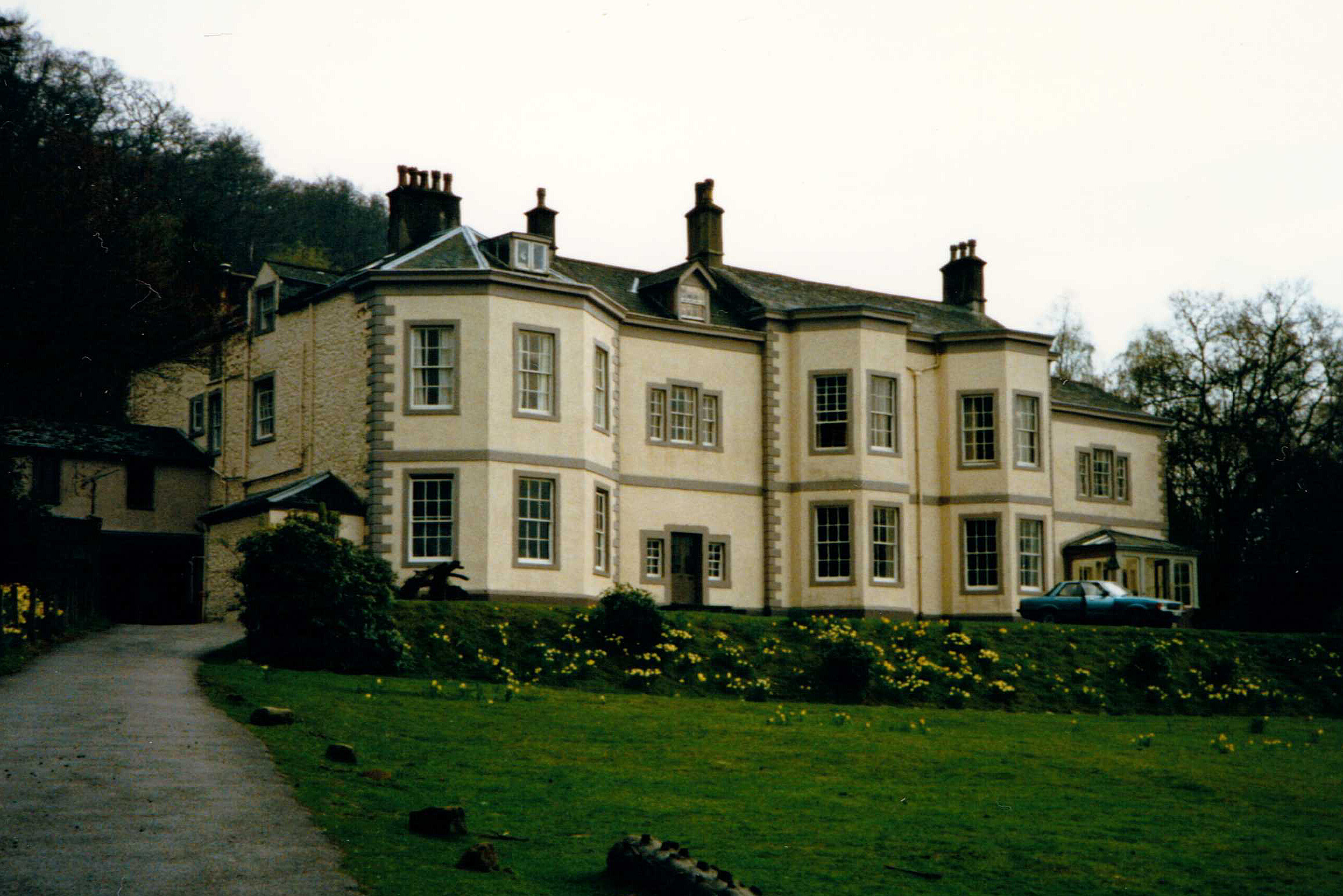
Barrow House, Cumbria

Barrow House is a late 18th-century mansion situated on the eastern shore of Derwentwater in Borrowdale within the Lake District National Park, in the...

Walla Crag

Walla Crag is a fell in the English Lake District, near Keswick. The fell is a short walk from Keswick and overlooks Derwentwater. == Topography == The...

Raven Crag

Raven Crag is a fell in the English Lake District that overlooks Thirlmere reservoir. It has subsidiary summits The Benn and Castle Crag. == Topography... ==

Bell Crags

Bell Crags (also known as Long Moss or Blea Tarn Fell) is a hill of 559.1 metres (1,834 ft) in the Lake District, England. It lies between Borrowdale...

Cataract of Lodore

"The Cataract of Lodore" is a poem written in 1820 by the English poet Robert Southey which describes the Lodore Falls on the Watendlath. == Publication... ==

Nearby Amenities

Located within 500m of 54.566253,-3.1064309
Bleaberry Fell
Ele: 590
Natural: peak
Source: GPS_survey
Wikidata: Q4925709
Wikipedia: en:Bleaberry Fell
Lat/Long: 54.566396/-3.1063336
Barrier: stile
Material: wood
Stile: stepover
Lat/Long: 54.5630939/-3.1032861
The data included in this document is from www.openstreetmap.org. The data is made available under ODbL.

Have you been to Bleaberry Fell?

Leave your review of Bleaberry Fell below (or comments, questions and feedback).