Lundie Craigs

Hill, Mountain in Angus

Scotland

Lundie Craigs

Smith Loch and Smithton Hill Most of this square is a newly planted conifer plantation, broken up by heathery moorland. The swampy area of Smith Loch is the most prominent 'feature' in the landscape. Hard going.
Smith Loch and Smithton Hill Credit: Aleks Scholz

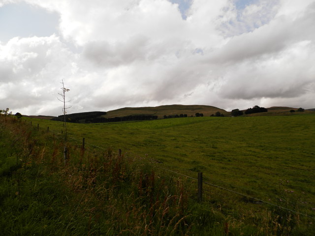
Lundie Craigs is a prominent hill/mountain located in the county of Angus, Scotland. It is part of the Sidlaw Hills range and stands at an elevation of around 450 meters (1,476 feet) above sea level. The hill is situated approximately 8 kilometers (5 miles) northwest of the town of Dundee.

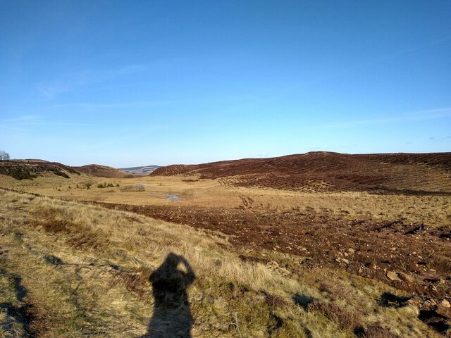
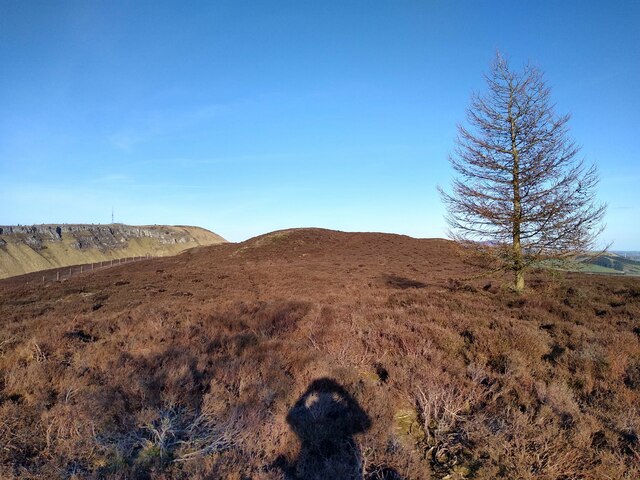
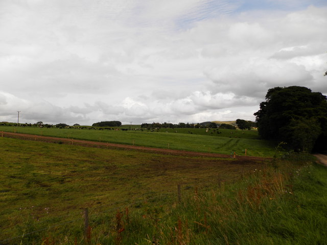
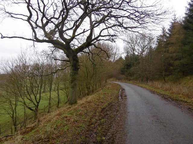
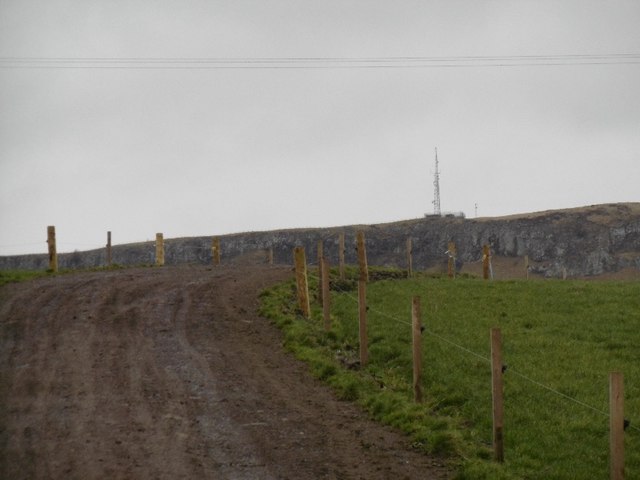
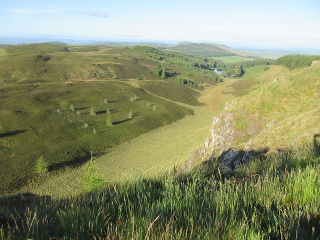
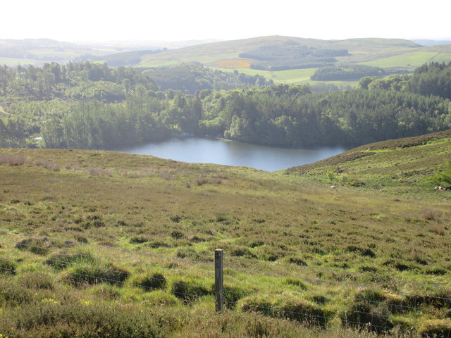
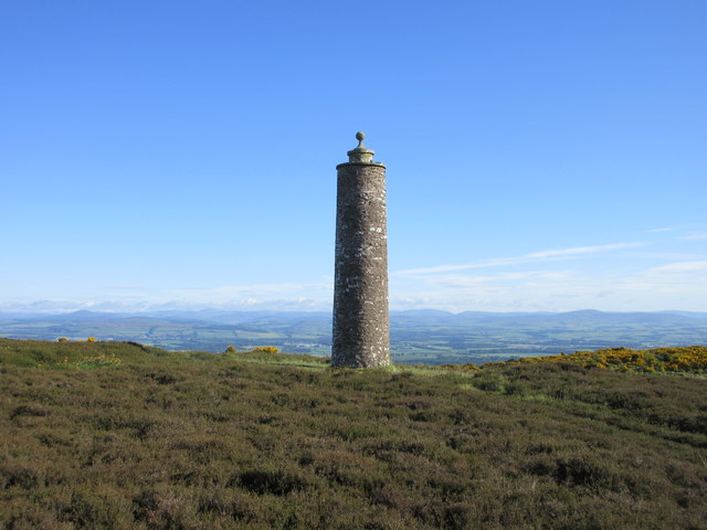
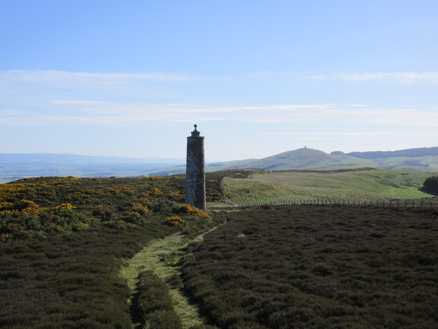
Lundie Craigs is characterized by its rugged and rocky terrain, with steep slopes and craggy outcrops. The hill is predominantly composed of sandstone, which gives it a distinct reddish-brown hue. It is a popular destination for hikers, climbers, and nature enthusiasts, offering breathtaking views of the surrounding landscape.

The hill is covered in a mixture of heather, grasses, and scattered shrubs, providing habitat for a variety of wildlife. Common species found in the area include red grouse, roe deer, and various bird species such as buzzards and kestrels.

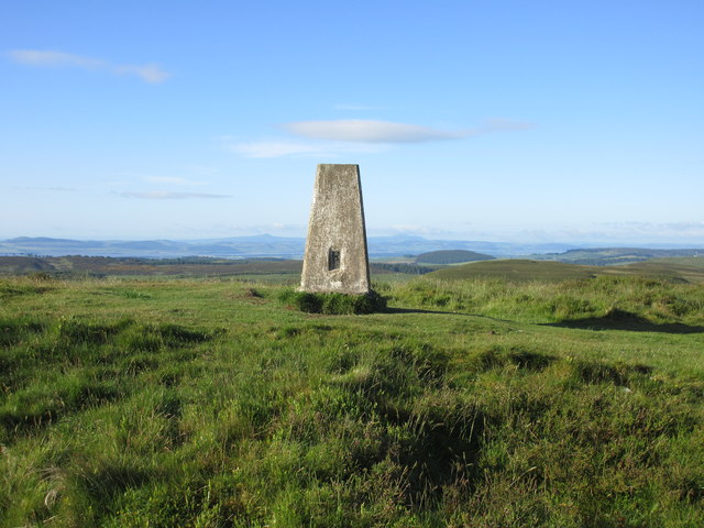
There are several walking paths and trails that lead up to the summit of Lundie Craigs, providing access to its stunning panoramic views. The hill is often visited by locals and tourists alike, seeking a challenging yet rewarding outdoor experience.

Overall, Lundie Craigs is a notable feature of the Angus countryside, offering a picturesque and invigorating natural environment for outdoor enthusiasts to explore and enjoy.

If you have any feedback on the listing, please let us know in the comments section below.

Lundie Craigs Images

Images are sourced within 2km of 56.526886/-3.1703582 or Grid Reference NO2837. Thanks to Geograph Open Source API. All images are credited.

Smith Loch and Smithton Hill Most of this square is a newly planted conifer plantation, broken up by heathery moorland. The swampy area of Smith Loch is the most prominent 'feature' in the landscape. Hard going.
Smith Loch and Smithton Hill
Most of this square is a newly planted conifer plantation, broken up by heathery moorland. The swampy area of Smith Loch is the most prominent 'feature' in the landscape. Hard going.
Ledcrieff Loch The loch seen from the dam at its western edge.
Ledcrieff Loch
The loch seen from the dam at its western edge.
Ardgarth Hill The ridge next to Lundie Craigs is less rock, more heather, and only some isolated trees.
Ardgarth Hill
The ridge next to Lundie Craigs is less rock, more heather, and only some isolated trees.
Farmland at Kirkton of Lundie
Farmland near the village of Lundie
Upland farming near Lundie
Lundie Road out of Lundie.
Lundie
Road out of Lundie.
Wooded roadside, Balshando Below a road into Lundie, the road is on an old alignment (pre 1959) of the A923.
Wooded roadside, Balshando
Below a road into Lundie, the road is on an old alignment (pre 1959) of the A923.
Minor road near Lundie This road was once the A923 before it was rebuilt further up the hill on the right.
Minor road near Lundie
This road was once the A923 before it was rebuilt further up the hill on the right.
Cow path near Lundie Lundie Craigs in the background.
Cow path near Lundie
Lundie Craigs in the background.
Road to Lundie From the west.
Road to Lundie
From the west.
From the top of Lundie Craigs Looking down from the top of Lundie Craigs near the antenna.
From the top of Lundie Craigs
Looking down from the top of Lundie Craigs near the antenna.
Westerkeith Hill Trig Pillar The triangulation pillar on Westerkeith Hill with the Lomond Hills in Fife in the background.
Westerkeith Hill Trig Pillar
The triangulation pillar on Westerkeith Hill with the Lomond Hills in Fife in the background.
The edge of Drumsuldry Wood The last few trees on the eastern edge of Drumsuldry Wood viewed from the track heading towards Keillor Hill.
The edge of Drumsuldry Wood
The last few trees on the eastern edge of Drumsuldry Wood viewed from the track heading towards Keillor Hill.
Long Loch from Keillor Hill Part of Long Loch viewed from Keillor Hill to the north-west.
Long Loch from Keillor Hill
Part of Long Loch viewed from Keillor Hill to the north-west.
Mackenzie Meridian (Privy's Prap) Privy's Prap monument, with Strathmore and the mountains beyond.
Mackenzie Meridian (Privy's Prap)
Privy's Prap monument, with Strathmore and the mountains beyond.
Mackenzie Meridian from the south-west The Privy's Prap monument with Kinpurnie Hill to the right.
Mackenzie Meridian from the south-west
The Privy's Prap monument with Kinpurnie Hill to the right.
Old Direction sign - Signpost Pawn finial - no arms; by the UC road, in parish of Lundie (Angus District), road to Lundie, just West of drive to Balshando, on verge, North side of road.

To be surveyed

Milestone Society National ID: AN_NO2835
Old Direction sign - Signpost
Pawn finial - no arms; by the UC road, in parish of Lundie (Angus District), road to Lundie, just West of drive to Balshando, on verge, North side of road. To be surveyed Milestone Society National ID: AN_NO2835
Show me another place!

Lundie Craigs is located at Grid Ref: NO2837 (Lat: 56.526886, Lng: -3.1703582)

Unitary Authority: Angus

Police Authority: Tayside

What 3 Words

///rushed.clocks.newer. Near Coupar Angus, Perth & Kinross

Related Wikis

Lundie Craigs

Lundie Craigs/Westerkeith Hill is one of the hills of the Sidlaw range in South East Perthshire.Lundie Craigs/Westerkeith Hill is located near Coupar Angus...
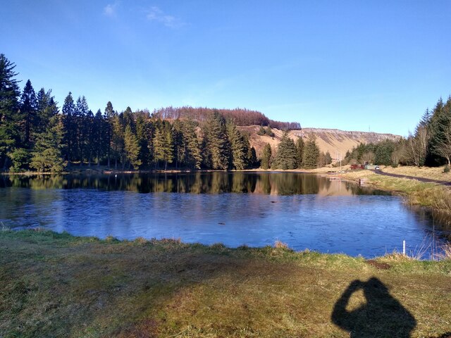
Long Loch (Angus)

Long Loch is a small lowland freshwater loch within the Sidlaw Hills in Angus. It is 1.8 miles south of the village of Newtyle, three miles east-south...

Lundie Kirk

Lundie Kirk was the parish church of Lundie, Angus, in Scotland from the 12th century until 2017. The church was constructed in Romanesque style in the...

Lundie

Lundie is a parish and small settlement in Angus, Scotland, 10 miles (16 km) northwest of Dundee, situated at the head of the Dighty valley in the Sidlaws...

Pitlyal Loch

Pitlyal Loch also known as Round Loch is a small lochan in Sidlaw Hills in Angus. It is located southeast of Long Loch and is almost directly south of...

Newtyle Hill

Newtyle Hill is a mountainous landform in the Sidlaw Hills in Angus, Scotland The vicinity has elements of prehistory including presence of the Eassie...

Kinpurnie Castle

Kinpurnie Castle is a stately home located 12 miles (19 km) west of Dundee, close to Newtyle, near Blairgowrie, Angus in Scotland. The Kinpurnie estate...

Pitcur

Pitcur is a hamlet at the eastern edge of Perth and Kinross, Scotland, about 2.5 miles (4.0 km) southeast of Coupar Angus.It is home to the ruined 16th...

Nearby Amenities

Located within 500m of 56.526886,-3.1703582
Westerkeith Hill
Ele: 353
Man Made: survey_point
Natural: peak
Lat/Long: 56.5268939/-3.1703811
Power: pole
Lat/Long: 56.5242571/-3.1656837
Power: pole
Lat/Long: 56.5245368/-3.1670616
Power: pole
Lat/Long: 56.5249324/-3.1689416
Power: pole
Lat/Long: 56.5254028/-3.1711621
Power: pole
Lat/Long: 56.525116/-3.1727706
Power: pole
Lat/Long: 56.5248165/-3.1744507
Power: pole
Lat/Long: 56.5245128/-3.1761463
Power: pole
Lat/Long: 56.5290827/-3.1639498
Power: pole
Lat/Long: 56.5290601/-3.1650639
Power: pole
Lat/Long: 56.5286744/-3.1662549
Power: pole
Lat/Long: 56.5283609/-3.1672204
Power: pole
Lat/Long: 56.5281038/-3.1680119
Power: pole
Lat/Long: 56.5278057/-3.1689032
Power: pole
Lat/Long: 56.5274427/-3.1700301
Power: pole
Lat/Long: 56.5270641/-3.171157
Power: pole
Lat/Long: 56.5267448/-3.1721738
Power: pole
Lat/Long: 56.5264595/-3.1730446
The data included in this document is from www.openstreetmap.org. The data is made available under ODbL.

Have you been to Lundie Craigs?

Leave your review of Lundie Craigs below (or comments, questions and feedback).