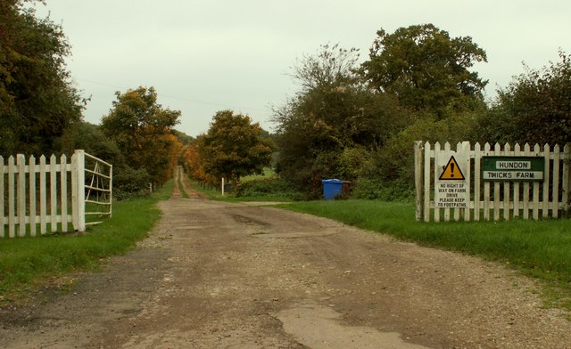
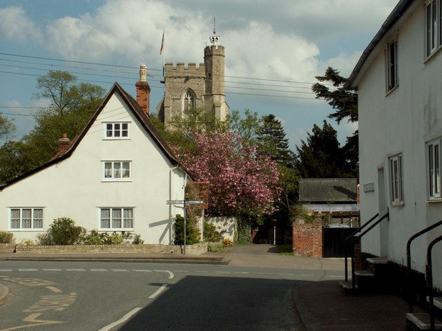
Hundon

Settlement in Suffolk West Suffolk

England

Hundon

Cropmarks on fields near Hundon Hall: aerial 2022
Cropmarks on fields near Hundon Hall: aerial 2022 Credit: Simon Tomson

Hundon is a small village located in the county of Suffolk, in the East of England. Situated approximately 15 miles southeast of Bury St Edmunds and 10 miles west of Sudbury, Hundon is nestled within the picturesque countryside of the Stour Valley.

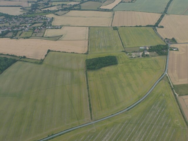
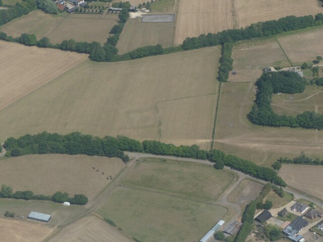
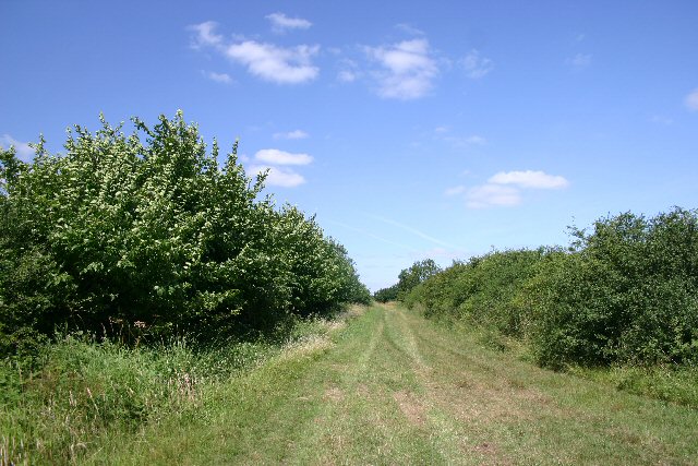
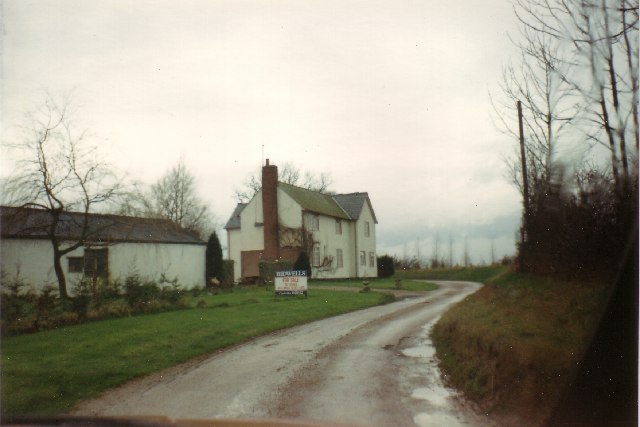
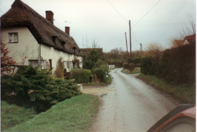
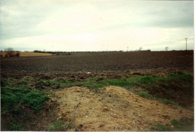
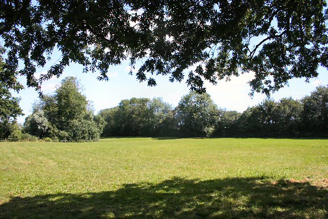
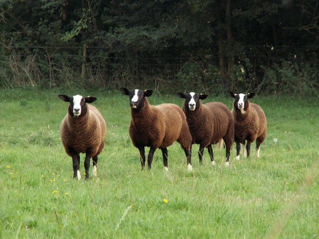
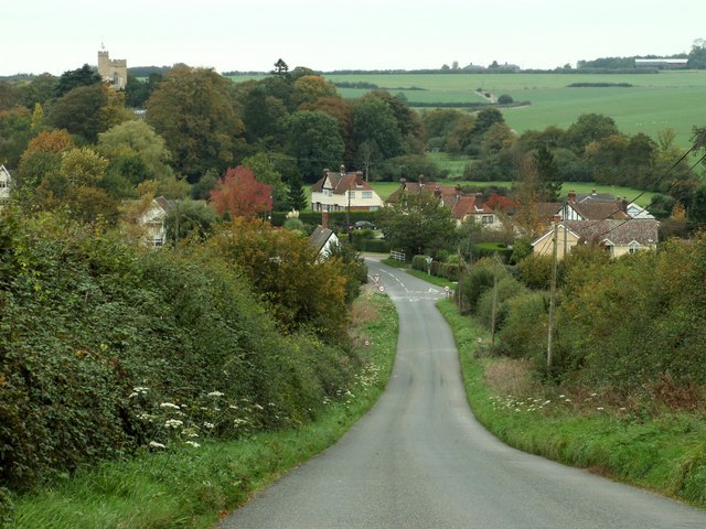
The village is home to a population of around 400 residents. It boasts a charming and quintessentially English setting, with its traditional thatched cottages, village green, and historic church. The surrounding landscape is predominantly agricultural, with rolling fields and meadows stretching out in every direction.

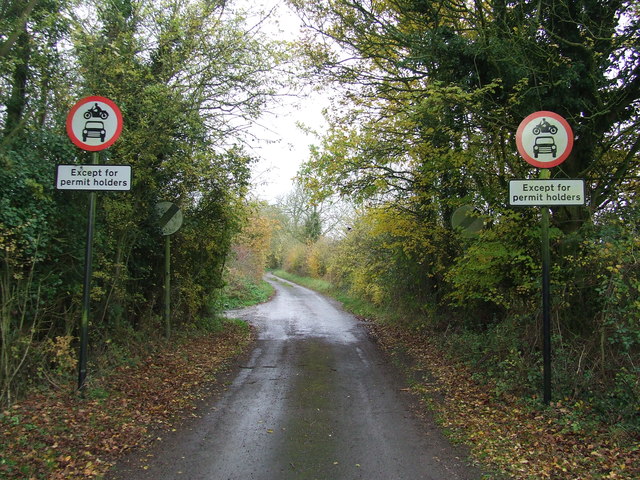
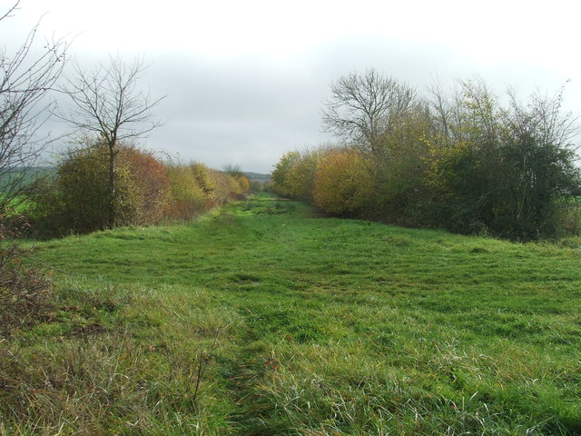
Hundon offers a close-knit community feel, with a range of amenities to cater to its residents. These include a village hall, a primary school, a post office, and a local pub. The village also benefits from a number of footpaths and bridleways, making it an ideal place for countryside walks and outdoor activities.

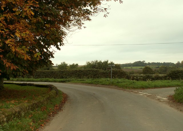
Despite its small size, Hundon is conveniently located near major road networks, with the A143 passing through the neighboring village of Wickhambrook. This allows easy access to nearby towns and cities, such as Cambridge and Ipswich.

Overall, Hundon is a charming and peaceful village that exudes rural beauty and tranquility. Its close-knit community, stunning countryside, and convenient location make it an attractive place to live for those seeking a quieter and slower-paced lifestyle.

If you have any feedback on the listing, please let us know in the comments section below.

Hundon Images

Images are sourced within 2km of 52.109822/0.53644496 or Grid Reference TL7348. Thanks to Geograph Open Source API. All images are credited.

Cropmarks on fields near Hundon Hall: aerial 2022
Cropmark on field west of Hundon: aerial 2022
Except Permit Holders Except permit holders on Steeplechase near to Barnardiston, Suffolk.
Except Permit Holders
Except permit holders on Steeplechase near to Barnardiston, Suffolk.
Cock Lane Cock Lane looking south east near to Barnardiston, Suffolk.
Cock Lane
Cock Lane looking south east near to Barnardiston, Suffolk.
B1063 Stradishall Road Towards Stradishall.
B1063 Stradishall Road
Towards Stradishall.
Track to Appleacre Farm This private farm track leads east from the B1063, north of Hundon.
Track to Appleacre Farm
This private farm track leads east from the B1063, north of Hundon.
Cock Lane, Scotch Green The former hamlet of Scotch Green has now disappeared within a military training area.  This old trackway continues west towards Barnardiston Hall.
Cock Lane, Scotch Green
The former hamlet of Scotch Green has now disappeared within a military training area. This old trackway continues west towards Barnardiston Hall.
The B1063, heading towards Chilton Street
Buntry Lane & Highfield Farm <span class="nowrap"><a title="https://en.wikipedia.org/wiki/Hundon" rel="nofollow ugc noopener" href="https://en.wikipedia.org/wiki/Hundon">Link</a><img style="margin-left:2px;" alt="External link" title="External link - shift click to open in new window" src="https://s1.geograph.org.uk/img/external.png" width="10" height="10"/></span>
Buntry Lane & Highfield Farm
Cottage in Mary Lane, Babel Green <span class="nowrap"><a title="https://en.wikipedia.org/wiki/Babel_Green" rel="nofollow ugc noopener" href="https://en.wikipedia.org/wiki/Babel_Green">Link</a><img style="margin-left:2px;" alt="External link" title="External link - shift click to open in new window" src="https://s1.geograph.org.uk/img/external.png" width="10" height="10"/></span>
Cottage in Mary Lane, Babel Green
Highfield Farmland <span class="nowrap"><a title="https://en.wikipedia.org/wiki/Barnardiston" rel="nofollow ugc noopener" href="https://en.wikipedia.org/wiki/Barnardiston">Link</a><img style="margin-left:2px;" alt="External link" title="External link - shift click to open in new window" src="https://s1.geograph.org.uk/img/external.png" width="10" height="10"/></span>
Highfield Farmland
Hundon village, Suffolk This scene shows the tower of All Saints church.
Hundon village, Suffolk
This scene shows the tower of All Saints church.
Footpath to Cock Lane A path from Bear's Farm leads north-east across this open field.
Footpath to Cock Lane
A path from Bear's Farm leads north-east across this open field.
Sheep at Fox Farm
Sheep at Fox Farm
Road junction next to Hundon Grange Farm The turning on the right leads to Hundon.
Road junction next to Hundon Grange Farm
The turning on the right leads to Hundon.
Hundon village, taken from Mare Hill
Road to Hundon Thicks Farm, Hundon, Suffolk
The farmhouse at Wash Farm
Show me another place!

Hundon is located at Grid Ref: TL7348 (Lat: 52.109822, Lng: 0.53644496)

Administrative County: Suffolk

District: West Suffolk

Police Authority: Suffolk

What 3 Words

///motive.revived.dose. Near Kedington, Suffolk

Related Wikis

Babel Green

Babel Green is a village in Suffolk, England. There are 3969 places (city, towns, hamlets …) within a radius of 100 kilometers / 62 miles from the center...
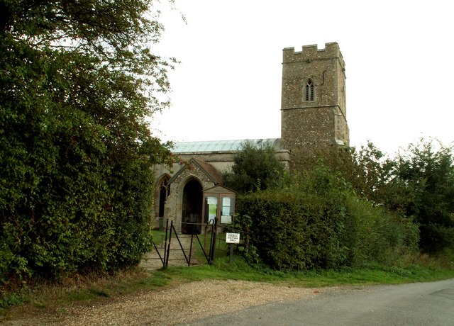
Hundon

Hundon is a village and civil parish in the West Suffolk district in Suffolk, England. The village is about 3 miles (5 km) north-west of the small town...

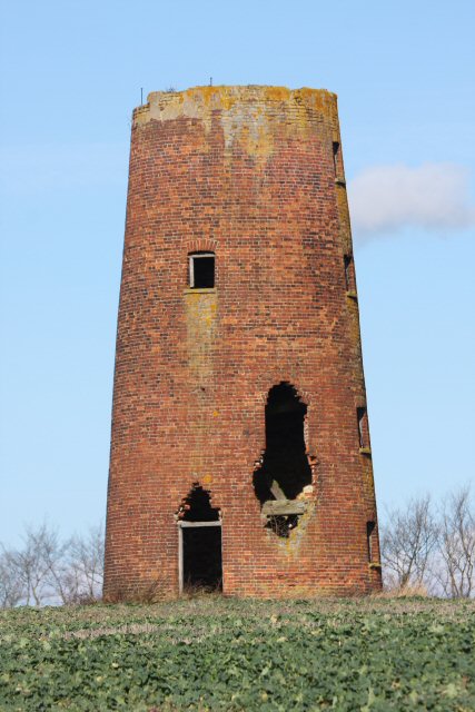
Chilton Street Mill, Clare

Chilton Street Mill is a tower mill at Clare, Suffolk, England which is derelict. == History == Chilton Street Mill was erected in 1846. It ceased work...

Barnardiston

Barnardiston ( bar-nər-DIS-tən) is a village and parish in the West Suffolk district of Suffolk, England. The village is located about four miles north...

Chipley Priory

Chipley Priory was a small Augustine religious house, dedicated to the Blessed Virgin, located about 1 mile (2 km) north-west of the village of Poslingford...

RAF Stradishall

Royal Air Force Stradishall or more simply RAF Stradishall is a former Royal Air Force station located 7 miles (11 km) north east of Haverhill, Suffolk...

Poslingford

Poslingford is a village and civil parish in the West Suffolk district of Suffolk in eastern England, near to a stream that feeds the into the Chilton...

Clare Rural District

Clare Rural District was a rural district in the county of West Suffolk, England. It was created in 1894, comprising those parishes in the Risbridge rural...

Nearby Amenities

Located within 500m of 52.109822,0.53644496
Hundon
Place: village
Population: 3028
Wikidata: Q2304739
Lat/Long: 52.1130766/0.538142
Telephone
Booth: K6
Covered: booth
Listed Status: Grade II
Operator: British Telecom
Payment Credit Cards: yes
Payment Debit Cards: yes
Payment Telephone Cards: yes
Phone: +44 1440 786201
Lat/Long: 52.1094372/0.5365073
Pub
Rose and Crown
Addr Postcode: CO10 8ED
Addr Street: North Street
Addr Village: Hundon
Fhrs Id: 1674922
Source: gps survey
Source Addr: FHRS Open Data
Wikidata: Q26283012
Lat/Long: 52.1093194/0.5368775
Bus Stop
Farmerie Road
Naptan AtcoCode: 390050206
Naptan Bearing: N
Naptan CommonName: Farmerie Road
Naptan Indicator: adj
Naptan Landmark: Farmerie Road
Naptan NaptanCode: sufgdpgw
Naptan Street: Lower North Street
Naptan Verified: no
Source: naptan_import
Lat/Long: 52.1077446/0.5368583
Bus Stop
Farmerie Road
Naptan AtcoCode: 390050207
Naptan Bearing: S
Naptan BusStopType: CUS
Naptan CommonName: Farmerie Road
Naptan Indicator: opp
Naptan Landmark: Farmerie Road
Naptan NaptanCode: sufgdpja
Naptan Street: Lower North Street
Naptan Verified: no
Source: naptan_import
Lat/Long: 52.1076016/0.5370021
Bus Stop
Council Houses
Naptan AtcoCode: 390050208
Naptan Bearing: SE
Naptan BusStopType: CUS
Naptan CommonName: Council Houses
Naptan Indicator: adj
Naptan Landmark: Council Houses
Naptan NaptanCode: sufgdpjd
Naptan Street: Mill Lane
Naptan Verified: no
Source: naptan_import
Lat/Long: 52.1111521/0.5333185
Bus Stop
Council Houses
Naptan AtcoCode: 390050209
Naptan Bearing: NW
Naptan BusStopType: CUS
Naptan CommonName: Council Houses
Naptan Indicator: opp
Naptan Landmark: Council Houses
Naptan NaptanCode: sufgdpjg
Naptan Street: Mill Lane
Naptan Verified: no
Source: naptan_import
Lat/Long: 52.1109898/0.5333385
Man Made: village_sign
Lat/Long: 52.1091466/0.5365438
Historic: memorial
Memorial: war_memorial
Lat/Long: 52.1091472/0.5365661
Defibrillator
Defibrillator Location: outside Hundon Village Hall
Emergency: defibrillator
Indoor: no
Ref GB The Circuit: 5236586B-85A5-42DA-B4C8-ADDD01245BE0
Lat/Long: 52.1115661/0.5358403
Historic: memorial
Memorial: war_memorial
Lat/Long: 52.1113721/0.5362916
The data included in this document is from www.openstreetmap.org. The data is made available under ODbL.

Have you been to Hundon?

Leave your review of Hundon below (or comments, questions and feedback).