Sale How

Hill, Mountain in Cumberland Allerdale

England

Sale How

The Cumbria Way, Skiddaw Forest The Cumbria Way low level alternative route follows the bridleway from Skiddaw House to Bassenthwaite, climbing out of the upper Caldew Valley near Dead Beck (next photograph <a href="https://www.geograph.org.uk/photo/7009530">NY2830 : The Cumbria Way, Skiddaw Forest near Dead Beck</a>).  The mountain in the background is Little Calva.
The Cumbria Way, Skiddaw Forest Credit: Adrian Taylor

The requested URL returned error: 429 Too Many Requests

If you have any feedback on the listing, please let us know in the comments section below.
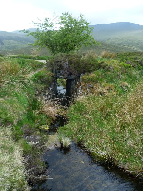
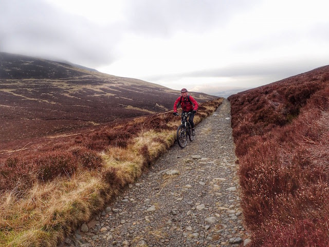
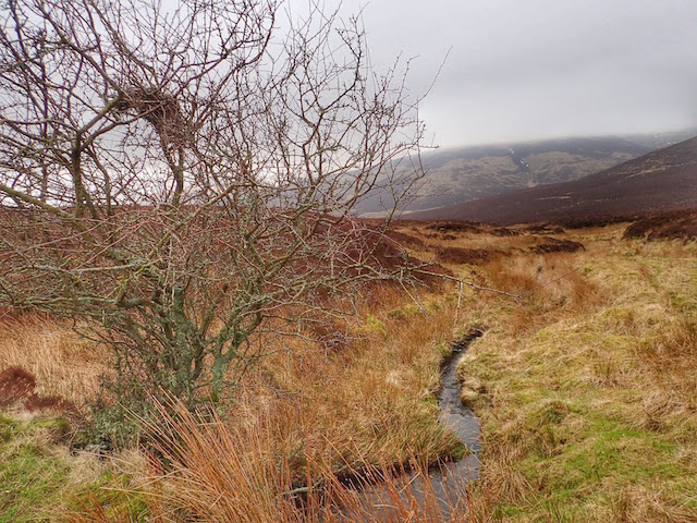
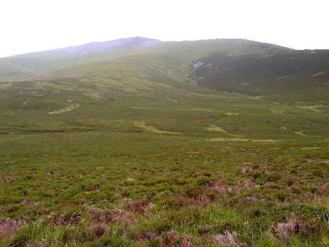
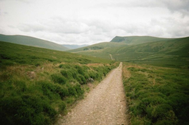
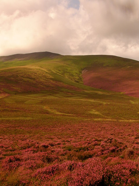
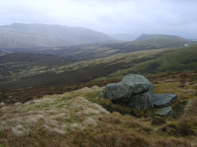
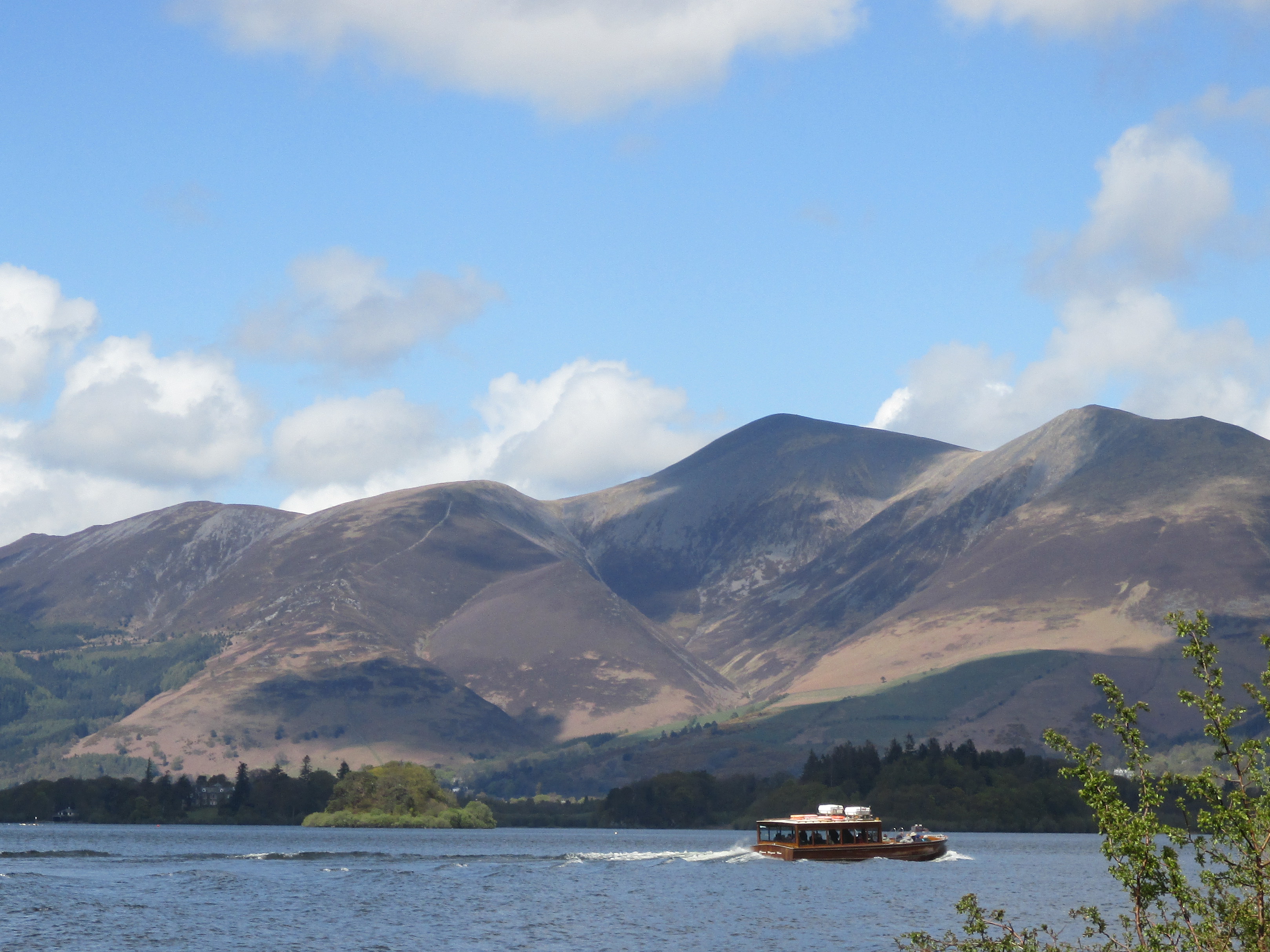
Sale How Images

Images are sourced within 2km of 54.647459/-3.1233433 or Grid Reference NY2728. Thanks to Geograph Open Source API. All images are credited.

The Cumbria Way, Skiddaw Forest The Cumbria Way low level alternative route follows the bridleway from Skiddaw House to Bassenthwaite, climbing out of the upper Caldew Valley near Dead Beck (next photograph <a href="https://www.geograph.org.uk/photo/7009530">NY2830 : The Cumbria Way, Skiddaw Forest near Dead Beck</a>).  The mountain in the background is Little Calva.
The Cumbria Way, Skiddaw Forest
The Cumbria Way low level alternative route follows the bridleway from Skiddaw House to Bassenthwaite, climbing out of the upper Caldew Valley near Dead Beck (next photograph NY2830 : The Cumbria Way, Skiddaw Forest near Dead Beck). The mountain in the background is Little Calva.
The Cumbria Way, Dead Beck The bridleway from Skiddaw House to Bassenthwaite dips down into the small valley of Dead Beck, a tributary of the River Caldew (next photograph <a href="https://www.geograph.org.uk/photo/7013660">NY2830 : The Cumbria Way near Dead Beck</a>).
The Cumbria Way, Dead Beck
The bridleway from Skiddaw House to Bassenthwaite dips down into the small valley of Dead Beck, a tributary of the River Caldew (next photograph NY2830 : The Cumbria Way near Dead Beck).
The Cumbria Way, Skiddaw Forest near Dead Beck The Cumbria Way long distance trail follows the bridleway from Skiddaw House to Bassenthwaite, crossing the lower slopes of Great Calva approaching the valley of Dead Beck (next photograph <a href="https://www.geograph.org.uk/photo/7009523">NY2830 : The Cumbria Way, Dead Beck</a>).  This remote track is the only vehicular access to Skiddaw House Youth Hostel.
The Cumbria Way, Skiddaw Forest near Dead Beck
The Cumbria Way long distance trail follows the bridleway from Skiddaw House to Bassenthwaite, crossing the lower slopes of Great Calva approaching the valley of Dead Beck (next photograph NY2830 : The Cumbria Way, Dead Beck). This remote track is the only vehicular access to Skiddaw House Youth Hostel.
The Cumbria Way near Dead Beck The Cumbria Way low level alternative route follows the bridleway from Skiddaw House to Bassenthwaite as it climbs across the lower slopes of Little Calva (next photograph <a href="https://www.geograph.org.uk/photo/7074080">NY2830 : The Cumbria Way near Dead Beck</a>).
The Cumbria Way near Dead Beck
The Cumbria Way low level alternative route follows the bridleway from Skiddaw House to Bassenthwaite as it climbs across the lower slopes of Little Calva (next photograph NY2830 : The Cumbria Way near Dead Beck).
The Cumbria Way near Dead Beck The Cumbria Way low level alternative route from Skiddaw House to Caldbeck climbs across the slopes of Little Calva near Dead Beck (next photograph <a href="https://www.geograph.org.uk/photo/7074340">NY2830 : The Cumbria Way near Candleseaves Bog</a>).
The Cumbria Way near Dead Beck
The Cumbria Way low level alternative route from Skiddaw House to Caldbeck climbs across the slopes of Little Calva near Dead Beck (next photograph NY2830 : The Cumbria Way near Candleseaves Bog).
The Cumbria Way near Candleseaves Bog The Cumbria Way follows the Skiddaw House access track across the lower slopes of Little Calva (next photograph <a href="https://www.geograph.org.uk/photo/7074378">NY2730 : The Cumbria Way near Candleseaves Bog</a>).
Approximately 488m above sea level, for walkers following the low level alternative route this is the highest point on The Cumbria Way between Ulverston and Carlisle; slightly higher than Stake Pass on the route further south.
The mountain in the left background is Bakestall.
The Cumbria Way near Candleseaves Bog
The Cumbria Way follows the Skiddaw House access track across the lower slopes of Little Calva (next photograph NY2730 : The Cumbria Way near Candleseaves Bog). Approximately 488m above sea level, for walkers following the low level alternative route this is the highest point on The Cumbria Way between Ulverston and Carlisle; slightly higher than Stake Pass on the route further south. The mountain in the left background is Bakestall.
Candleseaves Bog
Candleseaves Bog
Access track to Skiddaw House The only vehicular access to Skiddaw House Youth Hostel is by a rough track across the open moorland of Skiddaw Forest from a minor road near Bassenthwaite.
This section of the track is almost 500m above sea level; it is a public bridleway and the Low Level Alternative route of The Cumbria Way long distance path from Carlisle to Ulverston.
Foule Crag is in profile on the skyline with the summit of Blencathra to the right.
Access track to Skiddaw House
The only vehicular access to Skiddaw House Youth Hostel is by a rough track across the open moorland of Skiddaw Forest from a minor road near Bassenthwaite. This section of the track is almost 500m above sea level; it is a public bridleway and the Low Level Alternative route of The Cumbria Way long distance path from Carlisle to Ulverston. Foule Crag is in profile on the skyline with the summit of Blencathra to the right.
On the Cumbria Way, north of Skiddaw House Skiddaw House <a href="https://www.geograph.org.uk/gridref/NY2829">NY2829</a> can be seen beyond the distant stretch of track in the sunlight. The steep escarpment in the far distance is the east face of Lonscale Fell <a href="https://www.geograph.org.uk/gridref/NY2927">NY2927</a>.
On the Cumbria Way, north of Skiddaw House
Skiddaw House NY2829 can be seen beyond the distant stretch of track in the sunlight. The steep escarpment in the far distance is the east face of Lonscale Fell NY2927.
Above Tod Gill Descending through the heather from Bakestall. Hare Crag in shot.
Above Tod Gill
Descending through the heather from Bakestall. Hare Crag in shot.
Bridge over Dead Beck On the track through the forest under Great Calva. A solitary Hawthorn stands by the track.
Bridge over Dead Beck
On the track through the forest under Great Calva. A solitary Hawthorn stands by the track.
Skiddaw Forest From Bakestall
Skiddaw Forest
From Bakestall
Bridleway Above Candleseaves Bog
Dead Beck With a bird's nest in a lone tree on the bleak moor.
Dead Beck
With a bird's nest in a lone tree on the bleak moor.
The north east face of Skiddaw! Taken from the Whitewater Dash to Skiddaw House footpath looking south westwards.
The north east face of Skiddaw!
Taken from the Whitewater Dash to Skiddaw House footpath looking south westwards.
Track to Skiddaw House The track from Peter House Farm (near Bassenthwaite) to Skiddaw House; the only vehicular access to the former Skiddaw House Youth Hostel
Track to Skiddaw House
The track from Peter House Farm (near Bassenthwaite) to Skiddaw House; the only vehicular access to the former Skiddaw House Youth Hostel
Over Candleseaves Bog
On Blake Hill Looking into the Forest. Blencathra and Lonscale fell in shot.
On Blake Hill
Looking into the Forest. Blencathra and Lonscale fell in shot.
Show me another place!

Sale How is located at Grid Ref: NY2728 (Lat: 54.647459, Lng: -3.1233433)

Administrative County: Cumbria

District: Allerdale

Police Authority: Cumbria

What 3 Words

///highs.sedative.change. Near Keswick, Cumbria

Nearby Locations

Sale How

Related Wikis

Skiddaw Little Man

Skiddaw Little Man also called Little Man is a fell in the English Lake District, it is situated four kilometres north of the town of Keswick and reaches...

Skiddaw

Skiddaw is a mountain in the Lake District National Park in England. Its 931-metre (3,054 ft) summit is the sixth-highest in England. It lies just north...

Lonscale Fell

Lonscale Fell is a hill in the English Lake District. Its pointed second top is instantly recognisable, standing at the eastern end of the Skiddaw massif...

Carl Side

Carl Side is a fell in the English Lake District, forming a part of the Skiddaw "family" near the town of Keswick and prominently visible from its streets...

Nearby Amenities

Located within 500m of 54.647459,-3.1233433
Sale How
Ele: 666
Natural: peak
Lat/Long: 54.6477981/-3.1225518
The data included in this document is from www.openstreetmap.org. The data is made available under ODbL.

Have you been to Sale How?

Leave your review of Sale How below (or comments, questions and feedback).