Eagle Crag

Hill, Mountain in Cumberland Allerdale

England

Eagle Crag

Blackmoss Pot Langstrath Beck, in spate, passes through a narrow cleft in a band of rocks.
Blackmoss Pot Credit: Ian Taylor

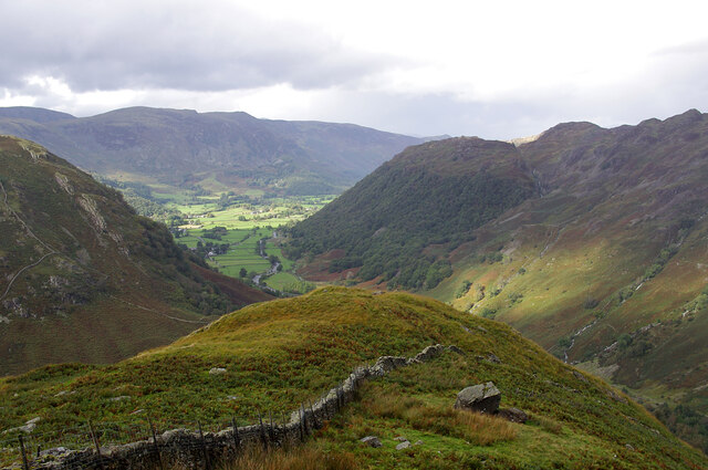
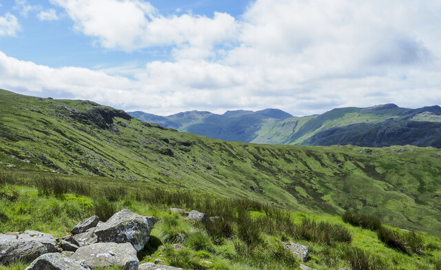
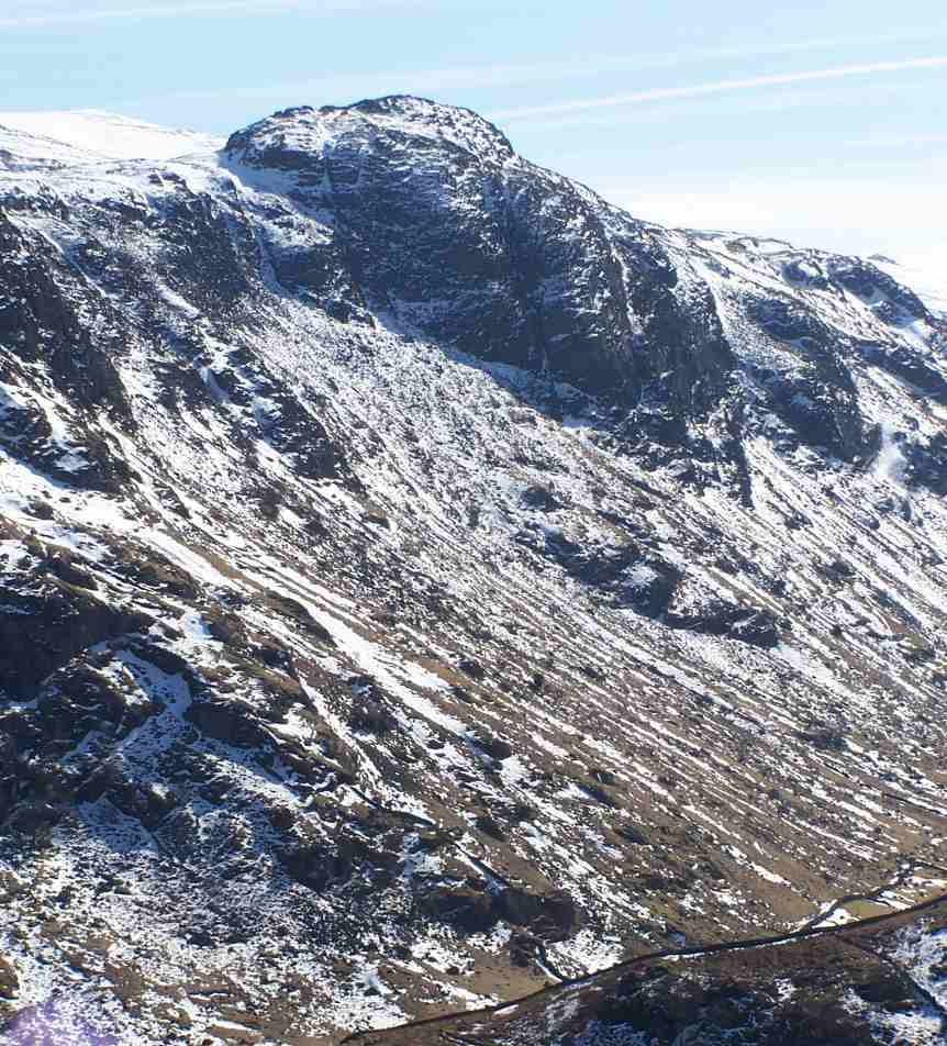
Eagle Crag is a prominent hill located in the county of Cumberland, in the northwest region of England. Situated within the picturesque Lake District National Park, it forms part of the larger range of fells known as the Central Fells. With an elevation of approximately 890 meters (2,920 feet), Eagle Crag offers breathtaking views of the surrounding countryside.

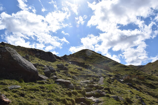
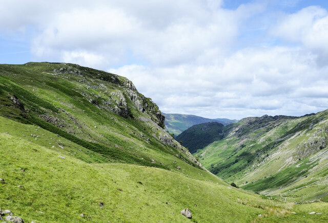
The hill is primarily composed of volcanic rock, which gives it a rugged and dramatic appearance. Its slopes are covered in a variety of vegetation, including heather, grasses, and scattered trees, creating a diverse and visually appealing landscape. The terrain is relatively steep in some sections, making it a popular destination for hikers and outdoor enthusiasts looking for a challenging ascent.

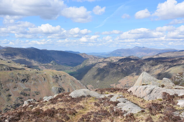
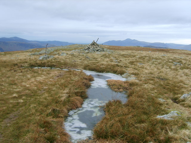
The summit of Eagle Crag provides panoramic vistas of the nearby valleys, lakes, and mountains, including the renowned Helvellyn range. On clear days, it is possible to see as far as the Irish Sea to the west and the Scottish borders to the north. Due to its accessibility and breathtaking scenery, the hill attracts visitors throughout the year, with many choosing to capture its beauty through photography or simply take in the tranquility of the surroundings.

Eagle Crag is a natural habitat for a variety of wildlife, including birds of prey, such as eagles and falcons, from which it derives its name. It is also home to various species of mammals, such as red deer and foxes, as well as a diverse range of flora and fauna.

If you have any feedback on the listing, please let us know in the comments section below.

Eagle Crag Images

Images are sourced within 2km of 54.498604/-3.1192251 or Grid Reference NY2712. Thanks to Geograph Open Source API. All images are credited.

Blackmoss Pot Langstrath Beck, in spate, passes through a narrow cleft in a band of rocks.
Blackmoss Pot
Langstrath Beck, in spate, passes through a narrow cleft in a band of rocks.
Stonethwaite Beck In spate, downstream of the confluence of Langstrath Beck and Greenup Gill. Eagle Crag is in the background.
Stonethwaite Beck
In spate, downstream of the confluence of Langstrath Beck and Greenup Gill. Eagle Crag is in the background.
Bleak How Looking down Borrowdale from the shoulder below Eagle and Heron Crags.
Bleak How
Looking down Borrowdale from the shoulder below Eagle and Heron Crags.
On Sergeant's Crag Looking across Langstrath to White Crag. Fleetwith Pike (left) and Dale Head (centre) are prominent in the background.
On Sergeant's Crag
Looking across Langstrath to White Crag. Fleetwith Pike (left) and Dale Head (centre) are prominent in the background.
Path up the valley of Greenup Gill Below Eagle Crag.
Path up the valley of Greenup Gill
Below Eagle Crag.
View down the valley of Greenup Gill Looking back towards Stonethwaite and the main valley of Borrowdale.
View down the valley of Greenup Gill
Looking back towards Stonethwaite and the main valley of Borrowdale.
A "back door" approach to Eagle Crag There is a path leaving Greenup Gill but that soon disappears on the way up. The height ahead is not the summit of Eagle Crag, which can't be seen yet.
A "back door" approach to Eagle Crag
There is a path leaving Greenup Gill but that soon disappears on the way up. The height ahead is not the summit of Eagle Crag, which can't be seen yet.
On Sergeant's Crag Looking north east across Langstrath towards Borrowdale and beyond.
On Sergeant's Crag
Looking north east across Langstrath towards Borrowdale and beyond.
Eagle Crag fell in front before we began to head up the steep slopes This is an image of Eagle Crag just as we were about to head up the steep slopes. A joy of a walk but certainly needed to take our time and take in the scenery as we made our way up too. Was lucky with the weather, for more on the fell and our walk to the top, check out the link below:

<span class="nowrap"><a title="https://truefreedomseekers.com/eagle-crag-and-sergeants-crag-walk/" rel="nofollow ugc noopener" href="https://truefreedomseekers.com/eagle-crag-and-sergeants-crag-walk/">Link</a><img style="margin-left:2px;" alt="External link" title="External link - shift click to open in new window" src="https://s1.geograph.org.uk/img/external.png" width="10" height="10"/></span>
Eagle Crag fell in front before we began to head up the steep slopes
This is an image of Eagle Crag just as we were about to head up the steep slopes. A joy of a walk but certainly needed to take our time and take in the scenery as we made our way up too. Was lucky with the weather, for more on the fell and our walk to the top, check out the link below: LinkExternal link
Route of Cumbria Way near to Stonethwaite Stonethwaite is a small settlement on the west side of Stonethwaite Beck; it's bypassed by the Cumbria Way which is on the other side of the stream.
Route of Cumbria Way near to Stonethwaite
Stonethwaite is a small settlement on the west side of Stonethwaite Beck; it's bypassed by the Cumbria Way which is on the other side of the stream.
Grassy slope beside Greenup Gill The slope extends towards Eagle Crag with the stream out of view.
The lower Greenup valley is to the right from where the slope rises towards Ullscarf.
Grassy slope beside Greenup Gill
The slope extends towards Eagle Crag with the stream out of view. The lower Greenup valley is to the right from where the slope rises towards Ullscarf.
Grassy slope at head of Greenup valley The rock band beyond the slope at the head of the valley is Long Crag.
Mountains of the Scafell group are seen distantly at the centre of the image.
Grassy slope at head of Greenup valley
The rock band beyond the slope at the head of the valley is Long Crag. Mountains of the Scafell group are seen distantly at the centre of the image.
Evening sunlight on Eagle Crag The path through the gate can be used as an alternative to The Cumbria Way long distance trail, which follows the valley on the opposite side of Stonethwaite Beck.
Evening sunlight on Eagle Crag
The path through the gate can be used as an alternative to The Cumbria Way long distance trail, which follows the valley on the opposite side of Stonethwaite Beck.
From Lining Crag Looking down the valley of Greenup Gill from the vantage point of Lining Crag
From Lining Crag
Looking down the valley of Greenup Gill from the vantage point of Lining Crag
From Lining Crag Looking over the moraine filled bowl at the head of Greenup Gill. Snow dusting the Bowfell Esk Pike ridge and the Scafells beyond.
From Lining Crag
Looking over the moraine filled bowl at the head of Greenup Gill. Snow dusting the Bowfell Esk Pike ridge and the Scafells beyond.
Spring above Langstrath Looking towards the head of Langstrath
Spring above Langstrath
Looking towards the head of Langstrath
Small Tarns above Greenup On the ridge leading to Sergeant's Crag from High Raise
Small Tarns above Greenup
On the ridge leading to Sergeant's Crag from High Raise
On Eagle Crag A walker emerges from the dip between Eagle and Sergeant's Crags. Langstrath Beck in shot.
On Eagle Crag
A walker emerges from the dip between Eagle and Sergeant's Crags. Langstrath Beck in shot.
Show me another place!

Eagle Crag is located at Grid Ref: NY2712 (Lat: 54.498604, Lng: -3.1192251)

Administrative County: Cumbria

District: Allerdale

Police Authority: Cumbria

What 3 Words

///grace.lashed.attending. Near Keswick, Cumbria

Related Wikis

Eagle Crag

Eagle Crag is a fell in the Lake District in Cumbria, England, it is situated near the village of Stonethwaite where the valleys of Langstrath and Greenup...

Sergeant's Crag

Sergeant's Crag is a fell in the English Lake District. It is an intermediate height on the ridge between the Langstrath and Greenup valleys in the Central...

Ullscarf

Ullscarf is a fell in the English Lake District close to the geographical centre of the Cumbrian hills. It forms part of the watershed between the Derwentwater...
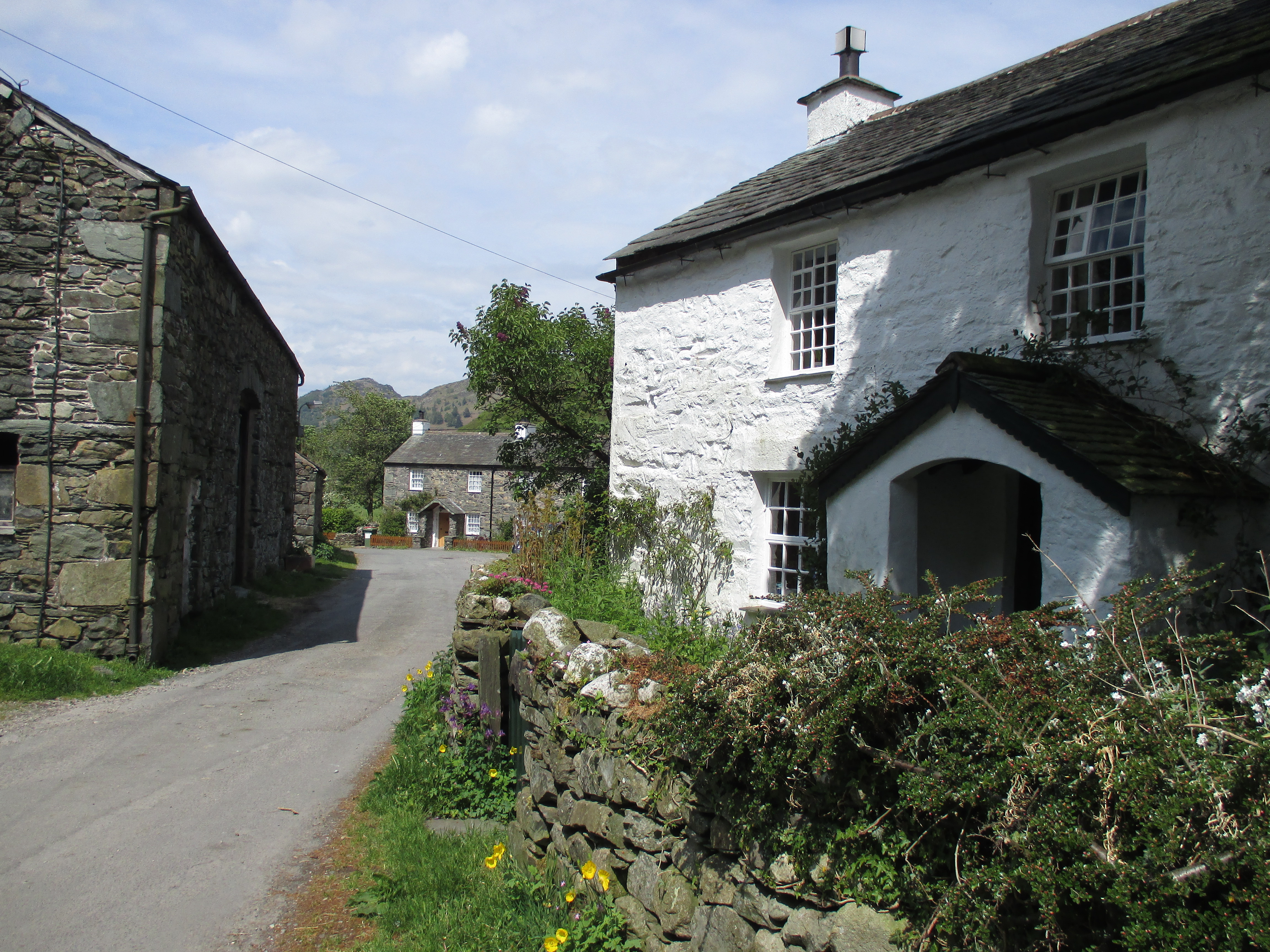
Stonethwaite

Stonethwaite is a small village in the Lake District in the English county of Cumbria, historically part of Cumberland, it is situated in the valley of...

Nearby Amenities

Located within 500m of 54.498604,-3.1192251
Eagle Crag
Ele: 521
Natural: peak
Source: npe
Wikidata: Q5325053
Wikipedia: en:Eagle Crag
Lat/Long: 54.499069/-3.1204518
Bicycle: yes
Foot: yes
Ford: yes
Horse: yes
Lat/Long: 54.4997343/-3.1124658
Barrier: stile
Foot: designated
Lat/Long: 54.5013113/-3.1140144
Bicycle: yes
Foot: yes
Ford: yes
Horse: yes
Lat/Long: 54.4999282/-3.112636
Bicycle: yes
Foot: yes
Ford: yes
Horse: yes
Lat/Long: 54.5019269/-3.1145044
Barrier: stile
Lat/Long: 54.4981803/-3.1200275
Ford: yes
Lat/Long: 54.4995691/-3.11168
Waterway: waterfall
Lat/Long: 54.4996329/-3.113044
Barrier: stile
Lat/Long: 54.5007589/-3.1210771
Waterway: waterfall
Lat/Long: 54.4986326/-3.1124792
The data included in this document is from www.openstreetmap.org. The data is made available under ODbL.

Have you been to Eagle Crag?

Leave your review of Eagle Crag below (or comments, questions and feedback).