Tor Hill

Hill, Mountain in Peeblesshire

Scotland

Tor Hill

Horsburgh Castle ruin with sheep pasture
Horsburgh Castle ruin with sheep pasture Credit: Astrid H

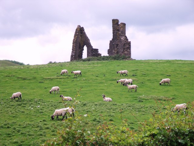
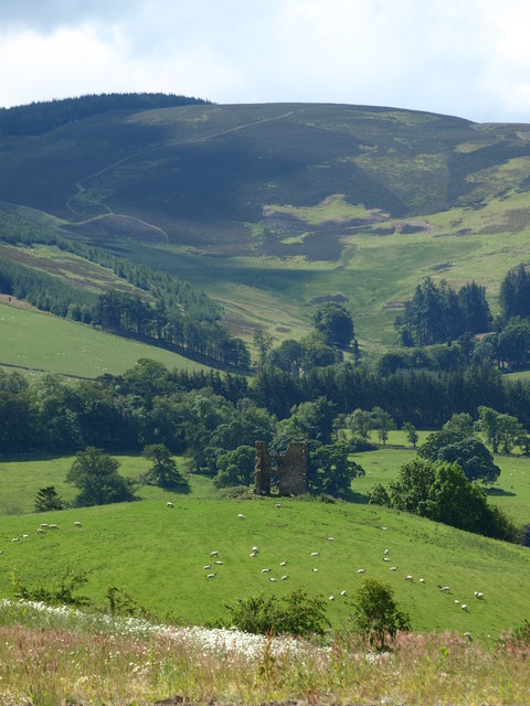
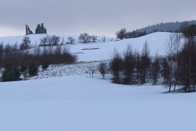
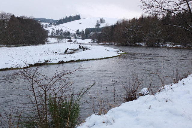
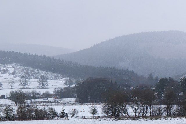
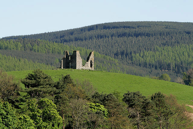
Tor Hill is a prominent hill located in Peeblesshire, Scotland. With an elevation of approximately 412 meters (1,352 feet), it is considered a notable landmark in the region. The hill is situated within the scenic Tweed Valley, offering breathtaking panoramic views of the surrounding countryside.

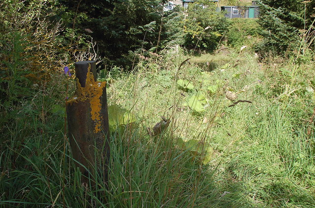
Tor Hill is characterized by its gently sloping terrain and a distinct peak that provides an excellent vantage point for sightseeing. The area is covered in lush green vegetation, including patches of heather, grass, and scattered trees, creating a picturesque landscape. This natural beauty makes Tor Hill a popular destination for hikers, walkers, and nature enthusiasts.

The hill is easily accessible via well-maintained trails that wind their way up the slopes. Along the way, visitors can observe a variety of wildlife, such as birds, rabbits, and occasional deer. The trails are suitable for individuals of all fitness levels, making Tor Hill an attractive option for both experienced hikers and casual strollers.

Once at the summit, visitors are rewarded with stunning views of the surrounding countryside. On clear days, it is possible to see the rolling hills and valleys stretching out for miles, as well as the nearby towns and villages. The panoramic vista provides a sense of tranquility and serenity, making it an ideal spot for relaxation and contemplation.

Overall, Tor Hill in Peeblesshire is a captivating destination that showcases the natural beauty of the Scottish countryside. Its accessibility, diverse flora and fauna, and breathtaking views make it a must-visit location for those seeking a memorable outdoor experience in the region.

If you have any feedback on the listing, please let us know in the comments section below.

Tor Hill Images

Images are sourced within 2km of 55.637047/-3.1553732 or Grid Reference NT2738. Thanks to Geograph Open Source API. All images are credited.

Horsburgh Castle ruin with sheep pasture
Horsburgh Castle Horsburgh Castle seen from the visitors centre on the opposite hillside.  Sheep and hills a plenty.
Horsburgh Castle
Horsburgh Castle seen from the visitors centre on the opposite hillside. Sheep and hills a plenty.
Milestone at Kingsmeadows, Peebles The One Mile marker on Kingsmeadows Road. An overgrown footpath just to the left leads to the riverside.
Milestone at Kingsmeadows, Peebles
The One Mile marker on Kingsmeadows Road. An overgrown footpath just to the left leads to the riverside.
Old summerhouse, Kingsmeadows An old summerhouse or other outbuilding in the grounds of Kingsmeadows House. Kingsmeadows used to belong to the Hay family until its sale in 1920. Much of the surrounding land was compulsorily purchased to build houses in the early 1960s, but the big house and immediate gardens were bought by the current owners, the Standard Life insurance company. See <span class="nowrap"><a title="http://historyofpeebles.com/Page178.html" rel="nofollow ugc noopener" href="http://historyofpeebles.com/Page178.html">Link</a><img style="margin-left:2px;" alt="External link" title="External link - shift click to open in new window" src="https://s1.geograph.org.uk/img/external.png" width="10" height="10"/></span> for more background to Kingsmeadows.
Old summerhouse, Kingsmeadows
An old summerhouse or other outbuilding in the grounds of Kingsmeadows House. Kingsmeadows used to belong to the Hay family until its sale in 1920. Much of the surrounding land was compulsorily purchased to build houses in the early 1960s, but the big house and immediate gardens were bought by the current owners, the Standard Life insurance company. See LinkExternal link for more background to Kingsmeadows.
Remnant of the Wire Bridge, Peebles The post in the foreground appears to be the only surviving part of a former suspension footbridge across the Tweed here. It was a private bridge for the Kingsmeadows estate, connecting with Wire Bridge Cottage, just in view across the river. Further historical background and a photograph of the bridge are given in 'Peebles Remembered' published by The Tweeddale Society in 2005.
Remnant of the Wire Bridge, Peebles
The post in the foreground appears to be the only surviving part of a former suspension footbridge across the Tweed here. It was a private bridge for the Kingsmeadows estate, connecting with Wire Bridge Cottage, just in view across the river. Further historical background and a photograph of the bridge are given in 'Peebles Remembered' published by The Tweeddale Society in 2005.
The Hub Cafe, Glentress Packed out as usual and sadly such a good, fair priced cafe as this just had to go. They were denied the chance to bid for the lease for the shiny new facility over the road and closed down by the Forestry Commission.  Apparently this is normal practice once one of their facilities becomes popular, and I have seen a similar enterprise in the Forest of Dean go the same way.  

The bike shop closed today, so no more good value, and quick services for my bikes.
The Hub Cafe, Glentress
Packed out as usual and sadly such a good, fair priced cafe as this just had to go. They were denied the chance to bid for the lease for the shiny new facility over the road and closed down by the Forestry Commission. Apparently this is normal practice once one of their facilities becomes popular, and I have seen a similar enterprise in the Forest of Dean go the same way. The bike shop closed today, so no more good value, and quick services for my bikes.
The Hub - the last day Having done so much for the success of the bike trails in Glentress Forest, today the shop was closed down by the Forestry Commission. They were not allowed to bid for the lease in the new all singing and all dancing centre across the road which we are expected to pay for (not a penny from me! - I'm parking elsewhere and riding in) and they are to be replaced by one of the big Edinburgh shops.

A legend!
The Hub - the last day
Having done so much for the success of the bike trails in Glentress Forest, today the shop was closed down by the Forestry Commission. They were not allowed to bid for the lease in the new all singing and all dancing centre across the road which we are expected to pay for (not a penny from me! - I'm parking elsewhere and riding in) and they are to be replaced by one of the big Edinburgh shops. A legend!
Horsbrugh Castle A 16th century castle, now a roofless ruin, on a hillock just S of the A72 near Cardrona - see <span class="nowrap"><a title="http://www.scotlandsplaces.gov.uk/search_item/index.php?service=RCAHMS&id=51274" rel="nofollow ugc noopener" href="http://www.scotlandsplaces.gov.uk/search_item/index.php?service=RCAHMS&id=51274">Link</a><img style="margin-left:2px;" alt="External link" title="External link - shift click to open in new window" src="https://s1.geograph.org.uk/img/external.png" width="10" height="10"/></span> for more detail. Horsburgh is an alternative spelling for the name. There is also a ruined tower at Nether Horsburgh in NT3039 to the east.
Horsbrugh Castle
A 16th century castle, now a roofless ruin, on a hillock just S of the A72 near Cardrona - see LinkExternal link for more detail. Horsburgh is an alternative spelling for the name. There is also a ruined tower at Nether Horsburgh in NT3039 to the east.
The Tweed near Kailzie Compare with <a href="https://www.geograph.org.uk/photo/1850309">NT2838 : A bend on the River Tweed near Kailzie</a> which shows the same scene in May 2010.
The Tweed near Kailzie
Compare with NT2838 : A bend on the River Tweed near Kailzie which shows the same scene in May 2010.
Eshiels and Glentress A view from the old railway route between Cardrona and Peebles on a morning with light snow showers.
Eshiels and Glentress
A view from the old railway route between Cardrona and Peebles on a morning with light snow showers.
Decorated trees, Eshiels Community Woodland Trees with a brighter look at the site of the Eshiels Youth Sculpture Project in this part of the woodland by the Tweed - see also <a href="https://www.geograph.org.uk/photo/1306105">NT2739 : Eshiels Youth Sculpture project</a>.
Decorated trees, Eshiels Community Woodland
Trees with a brighter look at the site of the Eshiels Youth Sculpture Project in this part of the woodland by the Tweed - see also NT2739 : Eshiels Youth Sculpture project.
The Tweed near Scotsmill Looking upstream with some of the new houses at Whitehaugh on the edge of Peebles in view.
The Tweed near Scotsmill
Looking upstream with some of the new houses at Whitehaugh on the edge of Peebles in view.
Scotsmill by the Tweed Houses on the S bank upstream of the Kailzie Estate.
Scotsmill by the Tweed
Houses on the S bank upstream of the Kailzie Estate.
Peebles sewage works Filter beds at Eshiels; the path and cycleway from Cardrona passes to the right, following the former Peebles - Galashiels railway line.
Peebles sewage works
Filter beds at Eshiels; the path and cycleway from Cardrona passes to the right, following the former Peebles - Galashiels railway line.
Ready for winter, Eshiels Depot A silo of road salt and several gritting lorries at the Scottish Borders Council road depot at Eshiels, on the site of a former railway yard and sheds.
Ready for winter, Eshiels Depot
A silo of road salt and several gritting lorries at the Scottish Borders Council road depot at Eshiels, on the site of a former railway yard and sheds.
Eshiels Tunnel The former railway tunnel under the A72 road has been opened up for use in the footpath and cycleway from Peebles to Cardrona. <a href="https://www.geograph.org.uk/photo/1306143">NT2739 : Eastern portal of Eshiels Tunnel</a> and <a href="https://www.geograph.org.uk/photo/1306165">NT2739 : Inside Eshiels Tunnel</a> show the tunnel in 2009 before it was opened up.
Eshiels Tunnel
The former railway tunnel under the A72 road has been opened up for use in the footpath and cycleway from Peebles to Cardrona. NT2739 : Eastern portal of Eshiels Tunnel and NT2739 : Inside Eshiels Tunnel show the tunnel in 2009 before it was opened up.
Peel bike shop and cafe, Glentress The shiny new shop and cafe referred to in <a href="https://www.geograph.org.uk/photo/2685512">NT2839 : The Hub Cafe, Glentress</a>, part of a new development at Glentress with car park, visitor centre and offices.
Peel bike shop and cafe, Glentress
The shiny new shop and cafe referred to in NT2839 : The Hub Cafe, Glentress, part of a new development at Glentress with car park, visitor centre and offices.
Sunshine around the corner, Haystoun A frosty January morning in Haystoun Estate on the road to Glen Sax. For a closeup of the sign, please see <a href="https://www.geograph.org.uk/photo/2187833">NT2538 : Sign in Haystoun Estate</a>.
Sunshine around the corner, Haystoun
A frosty January morning in Haystoun Estate on the road to Glen Sax. For a closeup of the sign, please see NT2538 : Sign in Haystoun Estate.
Show me another place!

Tor Hill is located at Grid Ref: NT2738 (Lat: 55.637047, Lng: -3.1553732)

Unitary Authority: The Scottish Borders

Police Authority: The Lothians and Scottish Borders

What 3 Words

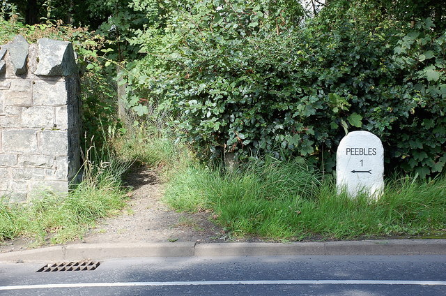
///overtones.trick.regret. Near Peebles, Scottish Borders

Related Wikis

Kailzie Gardens

Kailzie Gardens is a walled garden near Kirkburn in the Scottish Borders area of Scotland, in the Tweed valley, four km east of Peebles, off the B7062...

Horsburgh Castle

Horsburgh Castle, also known as Horsbrugh Castle or Horsbrugh Tower, is a ruined tower house castle by the River Tweed, on the A72 road from Peebles to...

Kirkburn, Scottish Borders

Kirkburn is a village on the B7062, close to Peebles and the River Tweed, in the Scottish Borders area of Scotland, at the edge of the Cardrona Forest...

Whitestone Park

Whitestone Park is a sports ground in Peebles, Scottish Borders, Scotland, used for football and cricket. It has been the home ground of Peebles Rovers...

Peebles Hydro

Peebles Hydro is an early 20th century hotel and spa resort in Peebles, in the historic county of Peebles-shire in the Scottish Borders. It is one of...

Peebles High School, Peeblesshire

Peebles High School is a state run comprehensive school for girls and boys aged 12–18 located in Peebles in the Scottish Borders. It was originally named...

Peebles

Peebles (Scottish Gaelic: Na Pùballan) is a town in the Scottish Borders, Scotland. It was historically a royal burgh and the county town of Peeblesshire...

Cardrona railway station

Cardrona railway station served the village of Cardrona, Scottish Borders, Scotland from 1864 to 1962 on the Peebles Railway. == History == The station...

Nearby Amenities

Located within 500m of 55.637047,-3.1553732
Tor Hill
Ele: 269
Ele Ft: 885
Natural: peak
Source: OS 7Th series historic(NLS)
Lat/Long: 55.6375932/-3.1553644
Power: pole
Lat/Long: 55.6410834/-3.1563342
Power: pole
Lat/Long: 55.640773/-3.1555727
The data included in this document is from www.openstreetmap.org. The data is made available under ODbL.

Have you been to Tor Hill?

Leave your review of Tor Hill below (or comments, questions and feedback).