Stake Law

Hill, Mountain in Peeblesshire

Scotland

Stake Law

Cotton grass on Peat Hill A rough area of flat boggy ground, heather and tussocks with cotton grass as a warning of conditions underfoot. It's clear from the GPS location here that your photographer has wandered off the 'path' in a fruitless attempt to find easier ground.
Cotton grass on Peat Hill Credit: Jim Barton

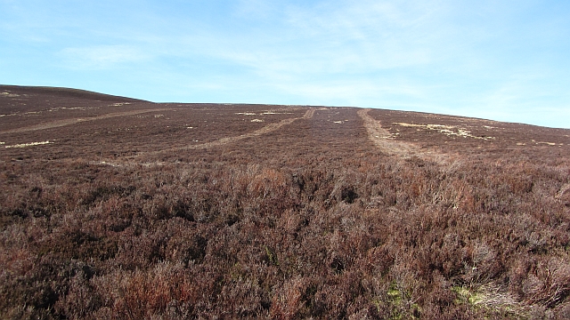
Stake Law is a prominent hill located in Peeblesshire, a county in the Scottish Borders region of Scotland. Standing at an elevation of approximately 522 meters (1,713 feet), it is classified as a hill rather than a mountain.

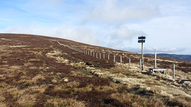
Situated in the southern part of Peeblesshire, Stake Law offers breathtaking panoramic views of the surrounding landscape. Its location makes it an attractive destination for outdoor enthusiasts and nature lovers alike. The hill is easily accessible via various trails and footpaths, making it a popular choice for hikers and walkers.

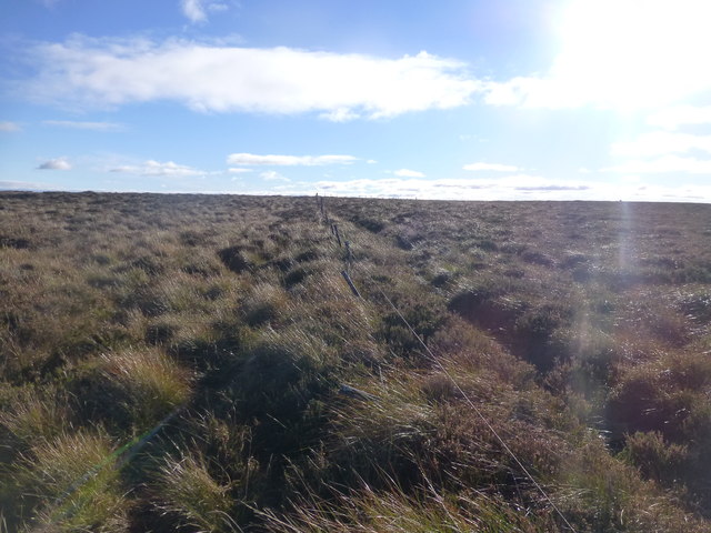
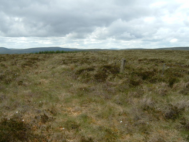
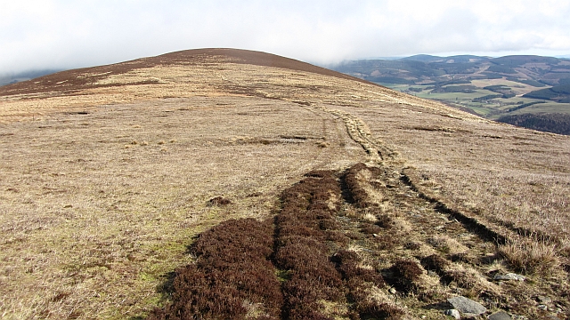
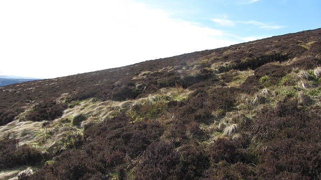
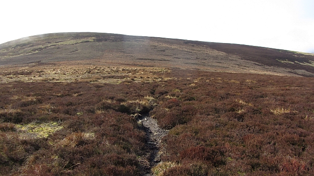
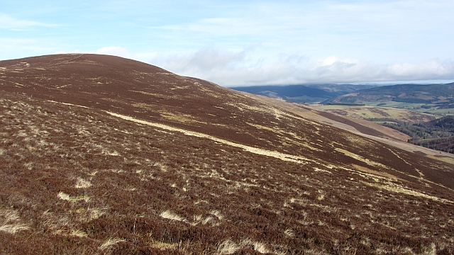
The ascent to Stake Law is moderate in difficulty, with a well-defined path leading to the summit. It typically takes around 1-2 hours to reach the top, depending on one's pace and fitness level. As visitors make their way up, they are treated to stunning vistas of rolling hills, lush green valleys, and charming rural scenery.

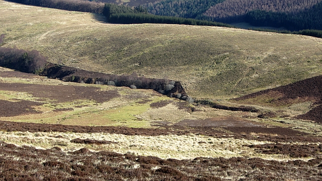
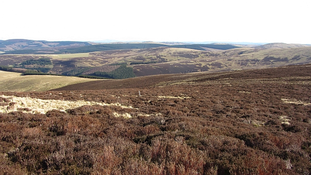
At the summit of Stake Law, visitors are rewarded with uninterrupted views of the surrounding countryside, including the picturesque Tweed Valley. On a clear day, it is also possible to catch glimpses of the nearby Southern Uplands and the majestic peaks of the Scottish Borders.

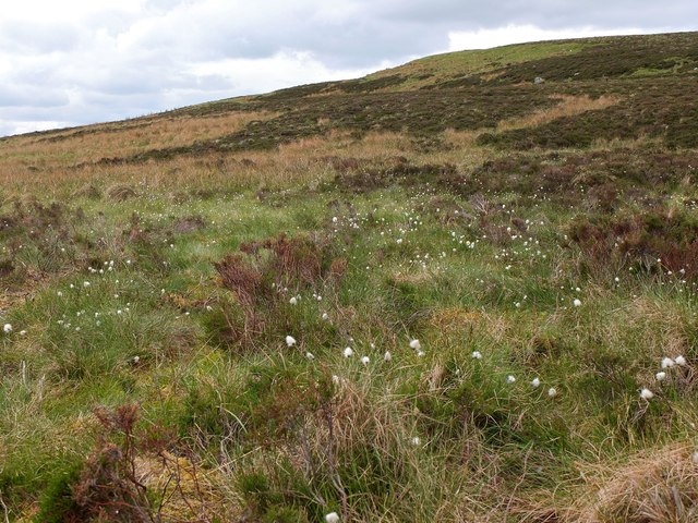
Stake Law is a natural haven, rich in biodiversity. The hill is home to various plant and animal species, including heather, bracken, and a diverse range of birdlife. It offers a serene and peaceful atmosphere, providing an ideal escape from the hustle and bustle of everyday life.

In conclusion, Stake Law in Peeblesshire is a captivating hill that offers a memorable outdoor experience. Its accessibility, stunning vistas, and natural beauty make it a must-visit destination for those seeking a tranquil escape in the Scottish Borders.

If you have any feedback on the listing, please let us know in the comments section below.
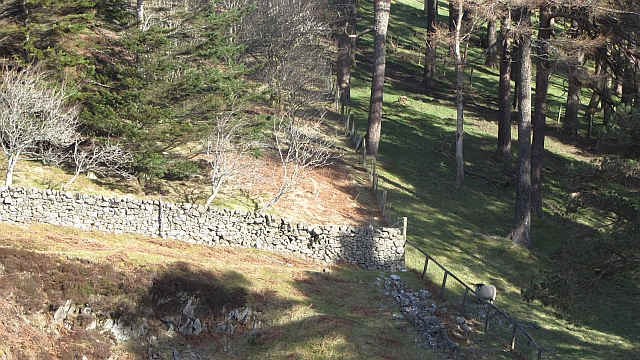
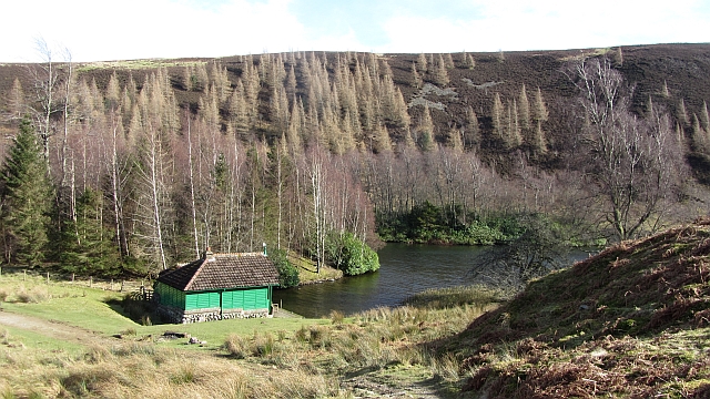
Stake Law Images

Images are sourced within 2km of 55.573495/-3.1576932 or Grid Reference NT2731. Thanks to Geograph Open Source API. All images are credited.

Cotton grass on Peat Hill A rough area of flat boggy ground, heather and tussocks with cotton grass as a warning of conditions underfoot. It's clear from the GPS location here that your photographer has wandered off the 'path' in a fruitless attempt to find easier ground.
Cotton grass on Peat Hill
A rough area of flat boggy ground, heather and tussocks with cotton grass as a warning of conditions underfoot. It's clear from the GPS location here that your photographer has wandered off the 'path' in a fruitless attempt to find easier ground.
Whiteknowe Head Ticked flat moorland plateau with Chris Watson. Parked passed Kirkhouse to use the Southern Upland Way to Blake Muir, Deuhar Law, Whiteknowe Head, Dun Rig, Stake Law and Birkscairn Hill before descending to Glen House Estate Farm to use the minor road back to Kirkhouse.  Summit is on the right of the fence looking towards the sun but very flat heathery plateau.
Name: Whiteknowe Head
Hill number: 7437
Height: 513m / 1683ft
Area: 28B: The River Tweed to the English Border
Class: s5D
Grid ref: NT 26880 29693
Summit feature: no feature: heather
Drop: 28m
Col: 485m  NT265303
Whiteknowe Head
Ticked flat moorland plateau with Chris Watson. Parked passed Kirkhouse to use the Southern Upland Way to Blake Muir, Deuhar Law, Whiteknowe Head, Dun Rig, Stake Law and Birkscairn Hill before descending to Glen House Estate Farm to use the minor road back to Kirkhouse. Summit is on the right of the fence looking towards the sun but very flat heathery plateau. Name: Whiteknowe Head Hill number: 7437 Height: 513m / 1683ft Area: 28B: The River Tweed to the English Border Class: s5D Grid ref: NT 26880 29693 Summit feature: no feature: heather Drop: 28m Col: 485m NT265303
Whiteknowe Head summit fence The vegetation gives away the character of the ground here - heather, tussock grass and bog cotton. The man-eating tussocks down the slope just east of here are particularly recommended.
Whiteknowe Head summit fence
The vegetation gives away the character of the ground here - heather, tussock grass and bog cotton. The man-eating tussocks down the slope just east of here are particularly recommended.
Glensax Burn from above The twists and turns of the burn between Dun Rig (R) and Hundleshope Heights in the upper part of the glen.
Glensax Burn from above
The twists and turns of the burn between Dun Rig (R) and Hundleshope Heights in the upper part of the glen.
Birks Hill The col between Birks Hill and Birkscairn Hill.
Birks Hill
The col between Birks Hill and Birkscairn Hill.
Birkscairn Hill Scottish Rights of Way Society sign on the old drove road between Peebles and the Yarrow Water. The path goes through a gate here and cuts the rather sharp corner shown on Ordnance Survey maps.
Birkscairn Hill
Scottish Rights of Way Society sign on the old drove road between Peebles and the Yarrow Water. The path goes through a gate here and cuts the rather sharp corner shown on Ordnance Survey maps.
Moorland, Stake Law The heather covered southern slopes of Stake Law.
Moorland, Stake Law
The heather covered southern slopes of Stake Law.
Kill Burn A tree lined watercourse on the Glen Estate with grassy Chester Rig beyond.
Kill Burn
A tree lined watercourse on the Glen Estate with grassy Chester Rig beyond.
Moorland, Stake Law Deep heather on the Glen Estate.
Moorland, Stake Law
Deep heather on the Glen Estate.
East side of Dun Rig Looking up the Banks Burn to the heather covered slopes of Dun Rig and the last remaining snow patch from the non-Winter of 2012. This snow patch in a gully is a bit of a landmark from the east on hills which are usually only snow covered for part of the winter.
East side of Dun Rig
Looking up the Banks Burn to the heather covered slopes of Dun Rig and the last remaining snow patch from the non-Winter of 2012. This snow patch in a gully is a bit of a landmark from the east on hills which are usually only snow covered for part of the winter.
Moorland, Glenshiel Banks Looking up to the headwaters of the Gumscleuch Burn. As well as the heather for grouse, the land is managed as a sheep walk.
Moorland, Glenshiel Banks
Looking up to the headwaters of the Gumscleuch Burn. As well as the heather for grouse, the land is managed as a sheep walk.
Dyke - fence junction, Glenshiel Banks Woodland behind Glenshiel Banks.
Dyke - fence junction, Glenshiel Banks
Woodland behind Glenshiel Banks.
Path near Glenshiel Banks The path from the Douglas Water enters the Glenshiel Banks enclosure by a gate amongst pine trees.
Path near Glenshiel Banks
The path from the Douglas Water enters the Glenshiel Banks enclosure by a gate amongst pine trees.
Loch Eddy An artificial loch in a woodland setting. It is named as a memorial to Edward Tennant, heir to the estate who was killed in the 1914-18 war.
Loch Eddy
An artificial loch in a woodland setting. It is named as a memorial to Edward Tennant, heir to the estate who was killed in the 1914-18 war.
Birkscairn Hill Birkscairn Hill seen from the col with Birks Hill.
Birkscairn Hill
Birkscairn Hill seen from the col with Birks Hill.
Birkscairn Hill The Glen Estate grouse moors on the southern side of Birkscairn Hill.
Birkscairn Hill
The Glen Estate grouse moors on the southern side of Birkscairn Hill.
Patterns on Stake Law Loops of trampled or cut heather. I suspect that once the wind dropped the interiors of the loops were burnt. Splotches have taken over from stripes in muirburn fashion, the aim is still the same - young heather for grouse food close to old heather for shelter and concealment.
Patterns on Stake Law
Loops of trampled or cut heather. I suspect that once the wind dropped the interiors of the loops were burnt. Splotches have taken over from stripes in muirburn fashion, the aim is still the same - young heather for grouse food close to old heather for shelter and concealment.
Shelter belt, Glenshiel Banks A line of pine trees surrounds the enclosure containing Glenshiel Banks with Deuchar Law in the background.
Shelter belt, Glenshiel Banks
A line of pine trees surrounds the enclosure containing Glenshiel Banks with Deuchar Law in the background.
Show me another place!

Stake Law is located at Grid Ref: NT2731 (Lat: 55.573495, Lng: -3.1576932)

Unitary Authority: The Scottish Borders

Police Authority: The Lothians and Scottish Borders

What 3 Words

///duties.dissolve.washroom. Near Innerleithen, Scottish Borders

Related Wikis

Dun Rig

Dun Rig is a hill in the Manor Hills range, part of the Southern Uplands of Scotland. It is the highest hill in the northernmost cluster of the Manor Hills...

Manor Hills

The Manor Hills, also known as the Tweedsmuir Hills, are a range of hills south of Peebles in the Scottish Borders, one of the ranges which collectively...

The Glen, Scottish Borders

The Glen, also known as Glen House, is an estate and country house in the parish of Traquair, southern Scotland. It is located in the glen of the Quair...

Cardrona Forest

The Cardrona Forest is a forest in the Scottish Borders area of Scotland, on in Tweed Vally, near Peebles. A nearby forest is Glentress Forest. The forest...

Have you been to Stake Law?

Leave your review of Stake Law below (or comments, questions and feedback).