Saugh Hill

Hill, Mountain in Dumfriesshire

Scotland

Saugh Hill

Clearfell, Shaw Rig
Clearfell, Shaw Rig Credit: Richard Webb

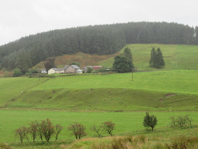
Saugh Hill is a prominent hill located in the region of Dumfriesshire, Scotland. Standing at an elevation of approximately 422 meters (1,385 feet), it offers breathtaking panoramic views of the surrounding countryside. The hill is situated near the small village of Keir, about 8 kilometers (5 miles) northeast of Dumfries.

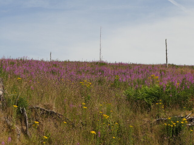
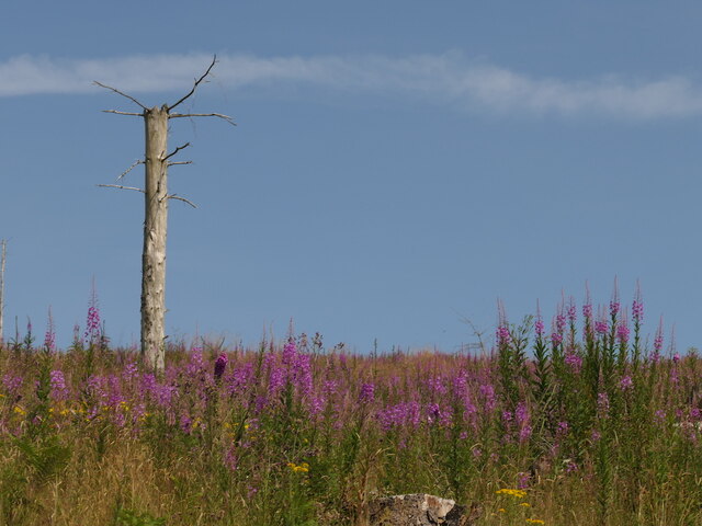
Saugh Hill is characterized by its distinctively rounded shape, covered in lush green vegetation, which adds to its natural beauty. The hill is well-known for its diverse flora and fauna, making it an ideal spot for nature enthusiasts and hikers. Visitors can expect to encounter a variety of plant species, including heather, gorse, and wildflowers, while birdwatchers might spot species such as peregrine falcons and buzzards soaring above.

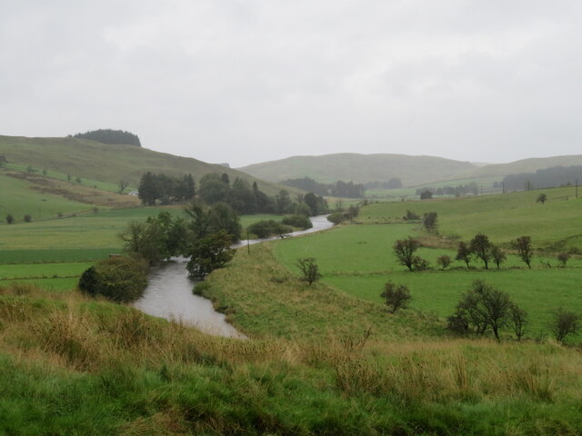
The summit of Saugh Hill offers mesmerizing views across Dumfriesshire and its rolling hills, as well as glimpses of the nearby Nith Valley. On a clear day, it is even possible to catch a glimpse of the Solway Firth and the distant peaks of the Lake District in England.

Access to Saugh Hill is relatively straightforward, with a network of paths and trails leading to the summit. The hill is a popular destination for both locals and tourists, providing a peaceful and tranquil escape from the hustle and bustle of everyday life. Whether it be for a leisurely stroll or a more challenging hike, Saugh Hill offers a rewarding experience for all who venture to its summit.

If you have any feedback on the listing, please let us know in the comments section below.
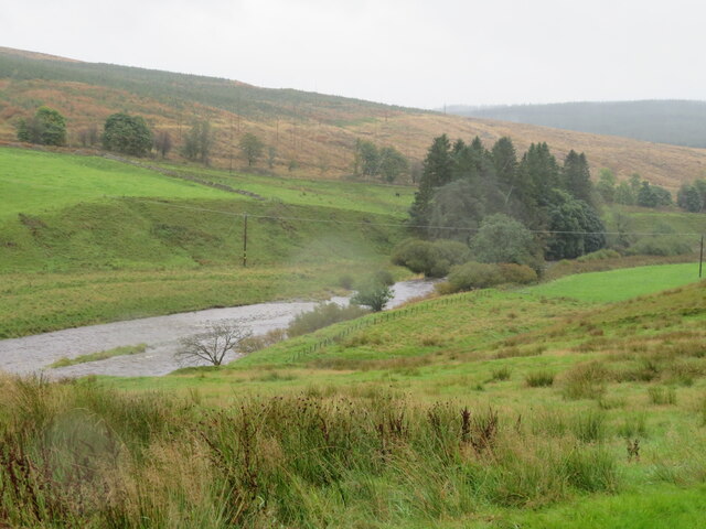
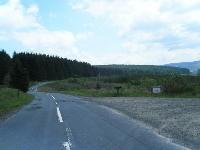
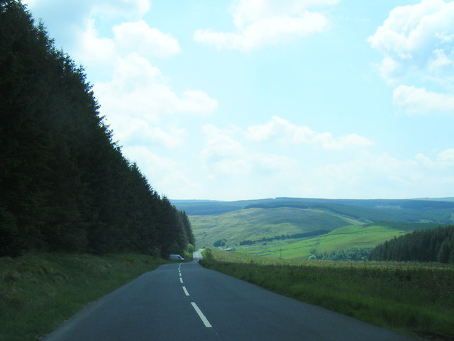
Saugh Hill Images

Images are sourced within 2km of 55.235219/-3.1744668 or Grid Reference NY2594. Thanks to Geograph Open Source API. All images are credited.

Clearfell, Shaw Rig
Clearfell, Shaw Rig
Clearfell, Shaw Rig
Clearfell, Shaw Rig
Cote and Crurie on the B709 Looking across the valley of the White Esk to the oddly named group of buildings, with forestry on Cote Hill beyond.
Cote and Crurie on the B709
Looking across the valley of the White Esk to the oddly named group of buildings, with forestry on Cote Hill beyond.
The White Esk at Hillfoot Looking up the wide valley of the White Esk.
The White Esk at Hillfoot
Looking up the wide valley of the White Esk.
The White Esk at Hillfoot Looking downstream towards Mill Knowe, with cleared and replanted forestry beyond.
The White Esk at Hillfoot
Looking downstream towards Mill Knowe, with cleared and replanted forestry beyond.
Minor road near to Bessie's Hill Car Park Looking south-westward.
Minor road near to Bessie's Hill Car Park
Looking south-westward.
Minor road near to Bessie's Hill Car Park Looking north-eastward.
Minor road near to Bessie's Hill Car Park
Looking north-eastward.
Minor road near to White Haugh Looking north-eastward.
Minor road near to White Haugh
Looking north-eastward.
Minor road approaching Castle O'er Looking southward from the car park entrance.
Minor road approaching Castle O'er
Looking southward from the car park entrance.
The B709 southwest of Allangillfoot
View from B709
View from B709
White Esk near Hillfoot
Bessie's Hill car park The footpath to Bessie's Hill Settlement and Fort starts from here.
Bessie's Hill car park
The footpath to Bessie's Hill Settlement and Fort starts from here.
Minor road by Castle O'er
B709 southbound near Allangillfoot
B709 south of Toothope Hill
B709 southbound near Shaw Rig
Track from Road to Whiteyett Looking eastward towards the White Esk River.
Track from Road to Whiteyett
Looking eastward towards the White Esk River.
Show me another place!

Saugh Hill is located at Grid Ref: NY2594 (Lat: 55.235219, Lng: -3.1744668)

Unitary Authority: Dumfries and Galloway

Police Authority: Dumfries and Galloway

What 3 Words

///intestine.impresses.offshore. Near Bentpath, Dumfries & Galloway

Related Wikis

Castle O'er Forest

Castle O'er Forest is a forest south of Eskdalemuir, Dumfries and Galloway, in southern Scotland.It is bisected by the River Esk. Eskdalemuir Forest adjoins...

Girdle Stanes

The Girdle Stanes (grid reference NY 25351 96153) is a stone circle near Eskdalemuir, Dumfries and Galloway. The western portion of the circle has been...

Loupin Stanes

The Loupin Stanes (grid reference NY25709663) is a stone circle near Eskdalemuir, Dumfries and Galloway. Oval in shape, it consists of twelve stones set...

Holm, Inverness

Holm is a small residential area in the south of the city of Inverness, Scotland. The area lies east of the River Ness. The most prominent structure in...

Nearby Amenities

Located within 500m of 55.235219,-3.1744668
Power: pole
Lat/Long: 55.235779/-3.1821352
Power: pole
Lat/Long: 55.2358447/-3.1805956
Power: pole
Lat/Long: 55.2319171/-3.178938
Power: pole
Lat/Long: 55.2329862/-3.1790131
Power: pole
Lat/Long: 55.2339528/-3.1790507
Power: pole
Lat/Long: 55.2349149/-3.1791204
Power: pole
Lat/Long: 55.2359059/-3.1791687
Power: pole
Lat/Long: 55.2380562/-3.1789005
Power: pole
Lat/Long: 55.2387933/-3.1785625
Power: pole
Lat/Long: 55.2373282/-3.1792384
Power: pole
Lat/Long: 55.2369841/-3.1766582
Power: pole
Lat/Long: 55.2367991/-3.1753144
Power: pole
Lat/Long: 55.2366293/-3.1740323
Power: pole
Lat/Long: 55.236432/-3.1726241
Power: pole
Lat/Long: 55.2362118/-3.1712106
Power: pole
Lat/Long: 55.2359931/-3.1697729
Power: pole
Lat/Long: 55.235834/-3.1685311
Power: pole
Lat/Long: 55.2356551/-3.1671712
The data included in this document is from www.openstreetmap.org. The data is made available under ODbL.

Have you been to Saugh Hill?

Leave your review of Saugh Hill below (or comments, questions and feedback).