Buarth Maen

Hill, Mountain in Monmouthshire

Wales

Buarth Maen

Layby alongside the A472 in Torfaen Ahead for Pontypool. Behind the camera for Hafodyrynys.
Layby alongside the A472 in Torfaen Credit: Jaggery

Buarth Maen is a prominent hill/mountain located in Monmouthshire, Wales. Situated near the town of Abergavenny, it forms part of the southern edge of the Brecon Beacons National Park.

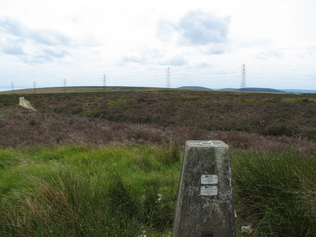
Rising to an elevation of approximately 450 meters (1,480 feet), Buarth Maen offers stunning panoramic views of the surrounding countryside. Its distinct shape and prominence make it a popular destination for hikers and outdoor enthusiasts.

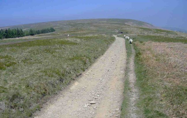
The hill/mountain is characterized by its diverse vegetation, ranging from grassy slopes to heather-covered moorland. It is also home to a variety of wildlife, including birds of prey such as buzzards and kestrels, as well as grazing sheep and wild ponies.

Buarth Maen is crisscrossed by several walking paths and trails, allowing visitors to explore its natural beauty. One of the popular routes is the circular walk from Abergavenny, which takes hikers through scenic valleys and past ancient ruins.

The hill/mountain also holds historical significance, with evidence of prehistoric settlements and Bronze Age burial mounds found in the surrounding area. Additionally, the name "Buarth Maen" translates to "Stone Yard" in English, suggesting the presence of a stone circle or standing stone on the hill at some point in history.

Overall, Buarth Maen offers a captivating blend of natural beauty, wildlife, and historical intrigue, making it a must-visit destination for those seeking outdoor adventure and exploration in Monmouthshire.

If you have any feedback on the listing, please let us know in the comments section below.
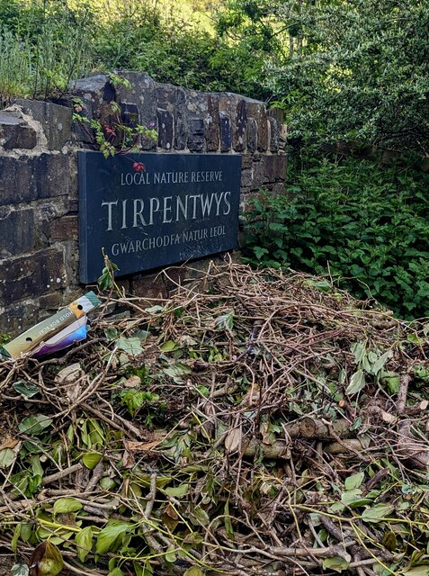
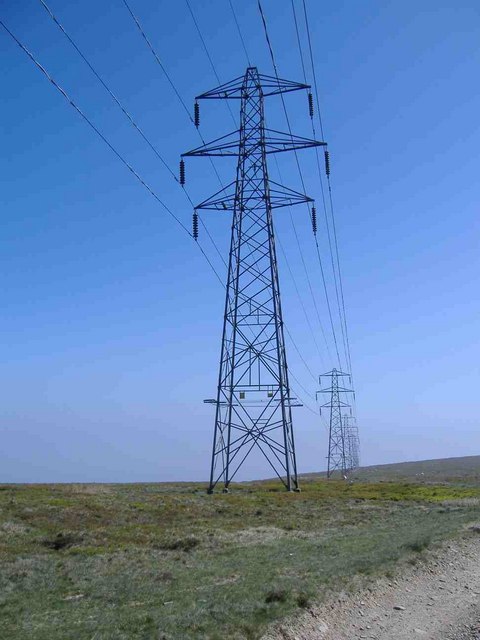
Buarth Maen Images

Images are sourced within 2km of 51.684363/-3.0802694 or Grid Reference ST2598. Thanks to Geograph Open Source API. All images are credited.

Layby alongside the A472 in Torfaen Ahead for Pontypool. Behind the camera for Hafodyrynys.
Layby alongside the A472 in Torfaen
Ahead for Pontypool. Behind the camera for Hafodyrynys.
Pantygasseg - Please drive carefully The sign also shows Welcome and the Welsh Croeso.
Pantygasseg - Please drive carefully
The sign also shows Welcome and the Welsh Croeso.
Bush Terrace, Pantygasseg, Torfaen Ahead for Hafodyrynys. Behind the camera for Pontypool.
Bush Terrace, Pantygasseg, Torfaen
Ahead for Hafodyrynys. Behind the camera for Pontypool.
Side road in Pantygasseg, Torfaen Viewed from Bush Terrace.
Side road in Pantygasseg, Torfaen
Viewed from Bush Terrace.
5-bar gate, Pantygasseg, Torfaen On the right here. <a title="https://www.geograph.org.uk/photo/7488539" href="https://www.geograph.org.uk/photo/7488539">Link</a>
5-bar gate, Pantygasseg, Torfaen
On the right here. Link
Hafodyrynys Coal Washery The washery at Hafodyrynys contained equipment for extracting coal dust from slurry and drying the remaining waste before tipping: processes which were rare before the 1950s. It was built entirely of reinforced concrete with continuous glazed panels. The colliery closed in 1966 and the site was cleared in 1985, but the slimes thickener at the washery was retained at the request of Sir Richard Hanbury-Tenison of Pontypool Park Estate, to which the site reverted. Plans were drawn up at the time to adapt the building as a restaurant. Its futuristic use of reinforced concrete and the splendid isolation in which it now stands have made it a well-known landmark.
Hafodyrynys Coal Washery
The washery at Hafodyrynys contained equipment for extracting coal dust from slurry and drying the remaining waste before tipping: processes which were rare before the 1950s. It was built entirely of reinforced concrete with continuous glazed panels. The colliery closed in 1966 and the site was cleared in 1985, but the slimes thickener at the washery was retained at the request of Sir Richard Hanbury-Tenison of Pontypool Park Estate, to which the site reverted. Plans were drawn up at the time to adapt the building as a restaurant. Its futuristic use of reinforced concrete and the splendid isolation in which it now stands have made it a well-known landmark.
Local nature reserve direction sign, Tirpentwys, Torfaen The sign alongside Pantygasseg Road shows that
'Local nature reserve' is 'Gwarchodfa natur leol" in Welsh
Local nature reserve direction sign, Tirpentwys, Torfaen
The sign alongside Pantygasseg Road shows that 'Local nature reserve' is 'Gwarchodfa natur leol" in Welsh
Tirpentwys Local Nature Reserve, Torfaen Accessed from Pantygasseg Road, Tirpentwys Local Nature Reserve is on the site of a former colliery.
Tirpentwys Local Nature Reserve, Torfaen
Accessed from Pantygasseg Road, Tirpentwys Local Nature Reserve is on the site of a former colliery.
Tirpentwys Local Nature Reserve name sign, Torfaen The text is in English and Welsh.
Tirpentwys Local Nature Reserve name sign, Torfaen
The text is in English and Welsh.
Abergelli Cottages name sign, Torfaen On the corner of Pantygasseg Road and Ty-Bwmpyn Road (on the right).
Abergelli Cottages name sign, Torfaen
On the corner of Pantygasseg Road and Ty-Bwmpyn Road (on the right).
Combined road sign, Pantygasseg Road, Torfaen Combined speed camera and 30 (mph speed limit) sign.
Combined road sign, Pantygasseg Road, Torfaen
Combined speed camera and 30 (mph speed limit) sign.
Cwm Lickey, Pontypool Photograph taken from Northern flank of Mynydd Maen, looking east over Cwm Lickey Pond and Pontypool
Cwm Lickey, Pontypool
Photograph taken from Northern flank of Mynydd Maen, looking east over Cwm Lickey Pond and Pontypool
Cwm Lickey, Pontypool Looking north over Cwm Lickey pond
Cwm Lickey, Pontypool
Looking north over Cwm Lickey pond
Glyn Pits, Pontypool Disused Colliery with 1845 beam pumping engine.
There is a vertical winding engine nearby.
There has been consolidation recently and there is a temporary roof and supporting framework to this building.
Glyn Pits, Pontypool
Disused Colliery with 1845 beam pumping engine. There is a vertical winding engine nearby. There has been consolidation recently and there is a temporary roof and supporting framework to this building.
Mynydd Twyn-Glas Triangulation pillar 472 looking SSW towards hillfort and motte at Twmbarlwm ( 6km) and Mynydd Machen
Mynydd Twyn-Glas
Triangulation pillar 472 looking SSW towards hillfort and motte at Twmbarlwm ( 6km) and Mynydd Machen
Power Lines
Power Lines
Pylons, on Mynydd Maen
Communications masts, Mynydd Maen
Show me another place!

Buarth Maen is located at Grid Ref: ST2598 (Lat: 51.684363, Lng: -3.0802694)

Unitary Authority: Torfaen

Police Authority: Gwent

What 3 Words

///rainy.powers.brands. Near Pontypool, Torfaen

Related Wikis

Mynydd Twyn-glas

Mynydd Twyn-glas is a sprawling 472-metre-high mountain extending into Caerphilly and Torfaen county boroughs in South Wales. It lies southwest of Pontypool...

Torfaen (UK Parliament constituency)

Torfaen is a constituency in Wales represented in the House of Commons of the UK Parliament since 2015 by Nick Thomas-Symonds, a member of the Labour Party...

Torfaen (Senedd constituency)

Torfaen is a constituency of the Senedd. It elects one Member of the Senedd by the first past the post method of election. It is also one of eight constituencies...

Pen Tranch

Pen Tranch is a large village and a community in Torfaen, South East Wales. It lies to the west of Pontypool in the valley leading west to Crumlin. It...

Have you been to Buarth Maen?

Leave your review of Buarth Maen below (or comments, questions and feedback).