Nether Hill

Hill, Mountain in Selkirkshire

Scotland

Nether Hill

Loch of the Lowes reflections Larch tree reflections on a cold still January afternoon.
Loch of the Lowes reflections Credit: Walter Baxter

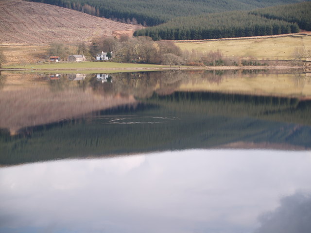
Nether Hill is a prominent hill located in Selkirkshire, Scotland. Situated in the southern part of the country, it forms part of the stunning and picturesque landscape of the Scottish Borders. Nether Hill is known for its natural beauty and is a popular destination for outdoor enthusiasts and nature lovers.

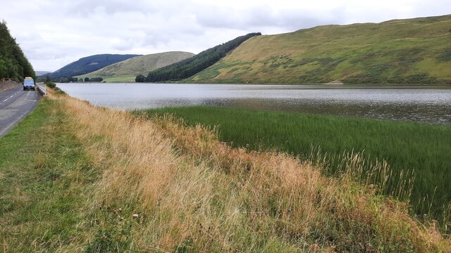
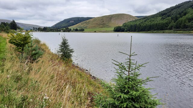
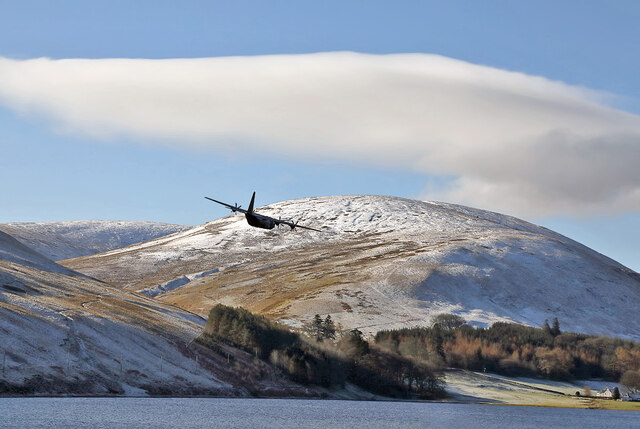
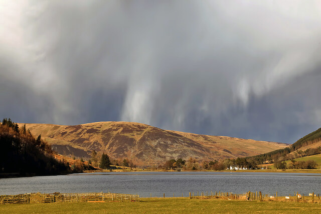
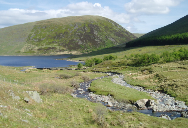
Rising to an elevation of approximately 389 meters (1,276 feet), Nether Hill offers breathtaking panoramic views of the surrounding countryside, including the rolling hills, lush valleys, and meandering rivers that characterize the region. On a clear day, visitors can even catch a glimpse of the distant Cheviot Hills to the south.

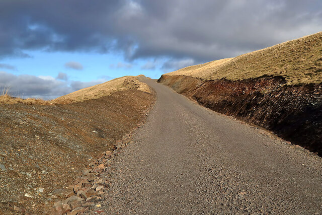
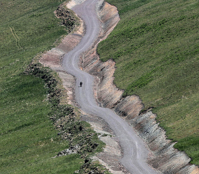
The hill itself is covered in a patchwork of green fields, interspersed with pockets of dense woodland. This diverse habitat supports a wide array of flora and fauna, making it an important site for biodiversity in the area. Walkers and hikers can explore the network of trails that crisscross the hill, providing opportunities to spot wildlife and enjoy the tranquility of the countryside.

Nether Hill is easily accessible, located just a short distance from the charming town of Selkirk. The hill is a popular spot for locals and tourists alike, offering a chance to escape the hustle and bustle of everyday life and immerse oneself in the natural beauty of the Scottish Borders.

With its stunning vistas, diverse wildlife, and peaceful atmosphere, Nether Hill is a must-visit destination for anyone seeking a tranquil retreat in the heart of Scotland.

If you have any feedback on the listing, please let us know in the comments section below.
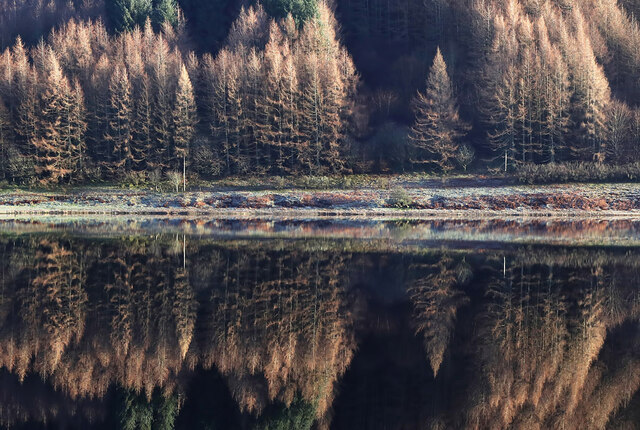
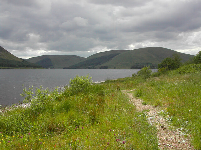
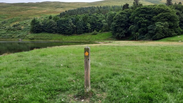
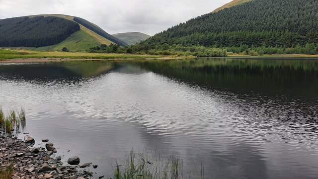
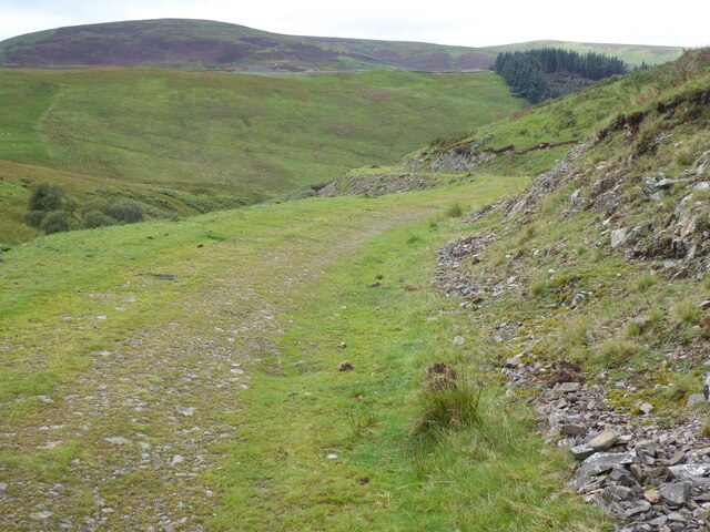
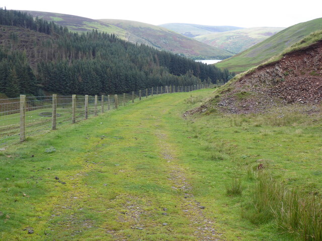
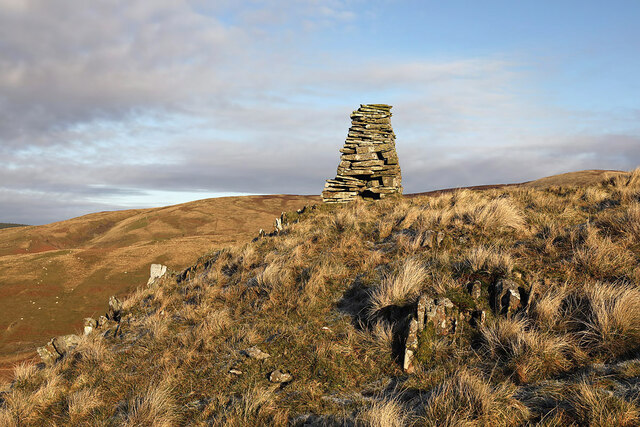
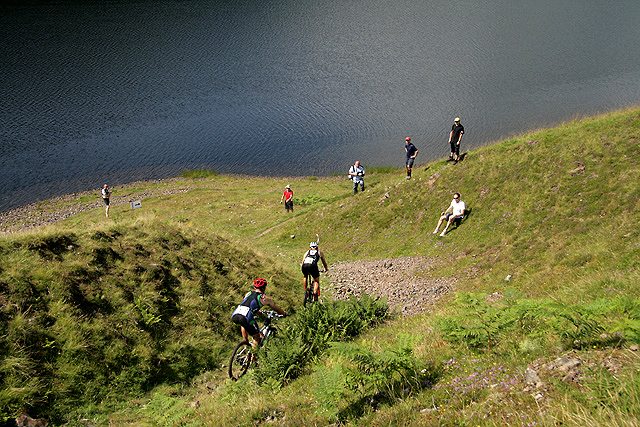
Nether Hill Images

Images are sourced within 2km of 55.474732/-3.1911044 or Grid Reference NT2420. Thanks to Geograph Open Source API. All images are credited.

Loch of the Lowes reflections Larch tree reflections on a cold still January afternoon.
Loch of the Lowes reflections
Larch tree reflections on a cold still January afternoon.
View from north shore of St Mary's Loch to south-west The three hills in the distance are, from left to right, Oxcleuch Rig (518m), Watch Law (521m) and Bridge End Hill (486m)
View from north shore of St Mary's Loch to south-west
The three hills in the distance are, from left to right, Oxcleuch Rig (518m), Watch Law (521m) and Bridge End Hill (486m)
Footpath marker at the southern end of Loch of the Lowes
The southern end of Loch of the Lowes
Loch of the Lowes Looking north east across the Loch from the A708 road towards the southern end of the Loch.
Loch of the Lowes
Looking north east across the Loch from the A708 road towards the southern end of the Loch.
Loch of the Lowes from the A708 roadside Some people paddleboarding on the Loch can be seen in the middle distance.
Loch of the Lowes from the A708 roadside
Some people paddleboarding on the Loch can be seen in the middle distance.
An RAF Hercules over Loch of the Lowes The RAF Hercules fleet is due for retirement in March 2023. They will be a big miss in the valleys where they do some of their low flying operations.
An RAF Hercules over Loch of the Lowes
The RAF Hercules fleet is due for retirement in March 2023. They will be a big miss in the valleys where they do some of their low flying operations.
A new forestry road on Riskinhope Rig
Loch of the Lowes from Riskinhope Snow clouds are prominent over Capper Law in this view from Riskinhope Farm.
Loch of the Lowes from Riskinhope
Snow clouds are prominent over Capper Law in this view from Riskinhope Farm.
A forestry road on Riskinhope Rig This telephoto shot was taken from the lower northern slopes of East Muchra Hill.
A forestry road on Riskinhope Rig
This telephoto shot was taken from the lower northern slopes of East Muchra Hill.
A sign by the A708 at Loch of the Lowes Someone has erased part of the letter L to form SlEEP instead of SHEEP. It would have been more effective if the lower case l had been changed to an upper case L.
A sign by the A708 at Loch of the Lowes
Someone has erased part of the letter L to form SlEEP instead of SHEEP. It would have been more effective if the lower case l had been changed to an upper case L.
A low flying RAF Hercules over Loch of the Lowes I was on East Muchra Hill to catch this Hercules on a low flying sortie in the Selkirk to Moffat Valley. The Hercules was retired from RAF service at the end of June 2023.
A low flying RAF Hercules over Loch of the Lowes
I was on East Muchra Hill to catch this Hercules on a low flying sortie in the Selkirk to Moffat Valley. The Hercules was retired from RAF service at the end of June 2023.
The Southern Upland Way near Longmoor End
The Southern Upland Way near Wester Rig
A cairn on Earl’s Hill
The 2011 Durty Scottish Cross (Off-Road) Triathlon Championships The championships were held at Tibbie Shiels by St Mary’s Loch with the main race consisting of a 1500m swim, 30km mountain bike run with a technical descent and a 10km hill run with a climb of about 800 feet. A supporting race over half of these distances was also held with solo and relay teams taking part in both races. The event attracted almost 400 entries from all over the UK with some coming from Holland, Germany, France and New Zealand. The weather was very good and the winning time for the main race was 2 hours and 18 seconds and 1 hour 8 minutes and 20 seconds for the shorter race. Tweed Valley Mountain Rescue Team and Selkirk Canoe Club were in attendance. These competitors are making their way along the southeast bank of Loch of the Lowes during the mountain bike leg of the triathlon. The competitor car park is in the background.
The 2011 Durty Scottish Cross (Off-Road) Triathlon Championships
The championships were held at Tibbie Shiels by St Mary’s Loch with the main race consisting of a 1500m swim, 30km mountain bike run with a technical descent and a 10km hill run with a climb of about 800 feet. A supporting race over half of these distances was also held with solo and relay teams taking part in both races. The event attracted almost 400 entries from all over the UK with some coming from Holland, Germany, France and New Zealand. The weather was very good and the winning time for the main race was 2 hours and 18 seconds and 1 hour 8 minutes and 20 seconds for the shorter race. Tweed Valley Mountain Rescue Team and Selkirk Canoe Club were in attendance. These competitors are making their way along the southeast bank of Loch of the Lowes during the mountain bike leg of the triathlon. The competitor car park is in the background.
The 2011 Durty Scottish Cross (Off-Road) Triathlon Championships The championships were held at Tibbie Shiels by St Mary’s Loch with the main race consisting of a 1500m swim, 30km mountain bike run with a technical descent and a 10km hill run with a climb of about 800 feet. A supporting race over half of these distances was also held with solo and relay teams taking part in both races. The event attracted almost 400 entries from all over the UK with some coming from Holland, Germany, France and New Zealand. The weather was very good and the winning time for the main race was 2 hours and 18 seconds and 1 hour 8 minutes and 20 seconds for the shorter race. Tweed Valley Mountain Rescue Team and Selkirk Canoe Club were in attendance. These cyclists on the mountain bike course are descending a small gully with some scree at the foot on the southeast side of Loch of the Lowes. Some competitors fell off here.
The 2011 Durty Scottish Cross (Off-Road) Triathlon Championships
The championships were held at Tibbie Shiels by St Mary’s Loch with the main race consisting of a 1500m swim, 30km mountain bike run with a technical descent and a 10km hill run with a climb of about 800 feet. A supporting race over half of these distances was also held with solo and relay teams taking part in both races. The event attracted almost 400 entries from all over the UK with some coming from Holland, Germany, France and New Zealand. The weather was very good and the winning time for the main race was 2 hours and 18 seconds and 1 hour 8 minutes and 20 seconds for the shorter race. Tweed Valley Mountain Rescue Team and Selkirk Canoe Club were in attendance. These cyclists on the mountain bike course are descending a small gully with some scree at the foot on the southeast side of Loch of the Lowes. Some competitors fell off here.
Show me another place!

Nether Hill is located at Grid Ref: NT2420 (Lat: 55.474732, Lng: -3.1911044)

Unitary Authority: The Scottish Borders

Police Authority: The Lothians and Scottish Borders

What 3 Words

///hairstyle.toddler.mended. Near Ettrick, Scottish Borders

Nearby Locations

Nether Hill

Related Wikis

Bowerhope

Bowerhope is a village off the A708, in the Scottish Borders area of Scotland, on the banks of St Mary's Loch in Ettrick Forest. == See also == List of...
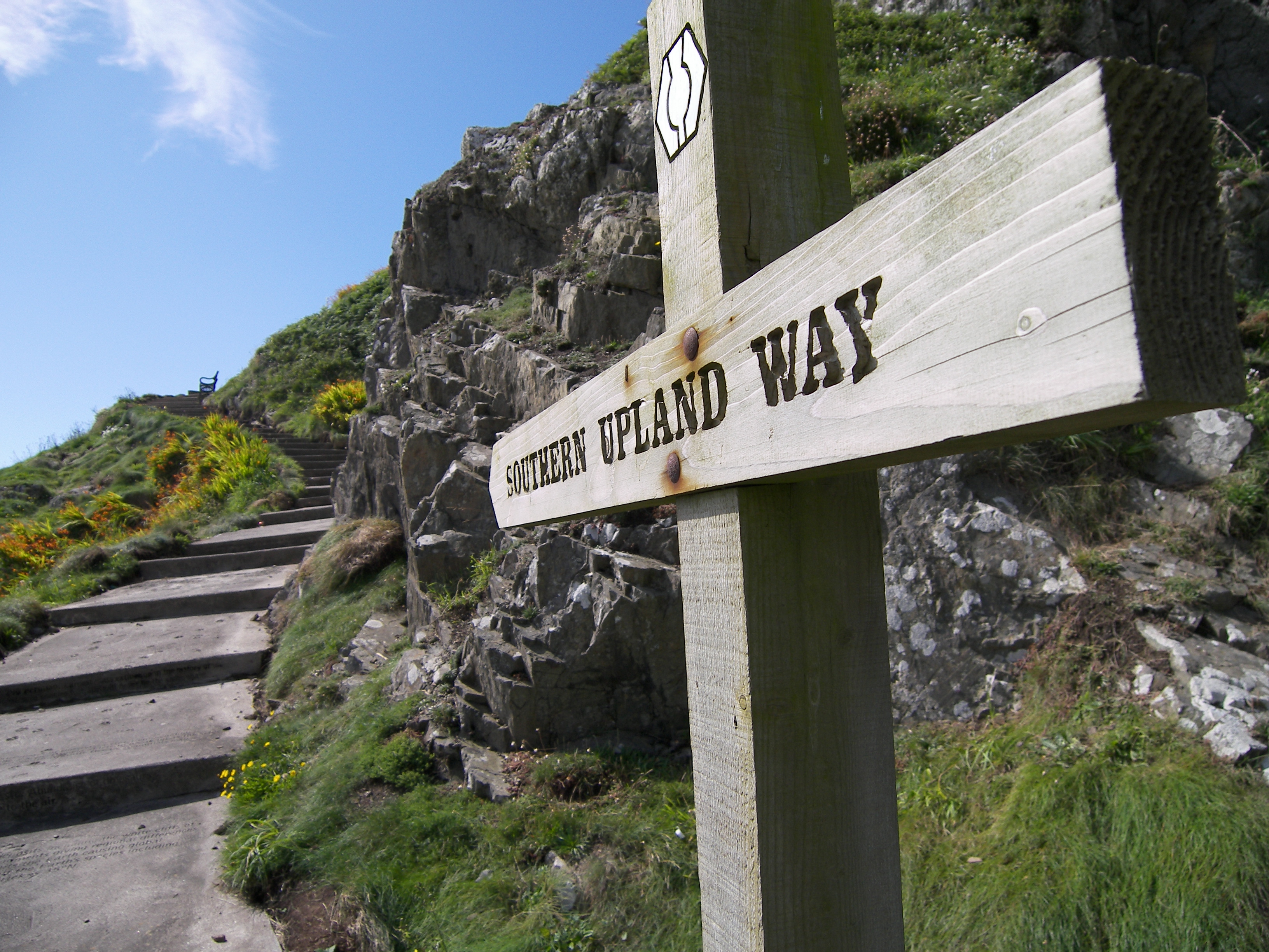
Southern Upland Way

The Southern Upland Way is a 344-kilometre (214 mi) coast-to-coast long-distance footpath in southern Scotland. The route links Portpatrick in the west...

Megget Water

Megget Water is a river in the parish of Yarrow, Selkirkshire in the Scottish Borders area of Scotland. The Water rises at Broad Law (2,760 ft), passes...

St Mary's Loch

St Mary's Loch is the largest natural loch in the Scottish Borders, and is situated on the south side of the A708 road between Selkirk and Moffat, about...

Have you been to Nether Hill?

Leave your review of Nether Hill below (or comments, questions and feedback).