Great Knott

Hill, Mountain in Cumberland Allerdale

England

Great Knott

Field beside minor road The field lies south-east from the village of Bassenthwaite and Bassenthwaite Lake can be seen in the image. Sale Fell is the wooded hill.
Field beside minor road Credit: Trevor Littlewood

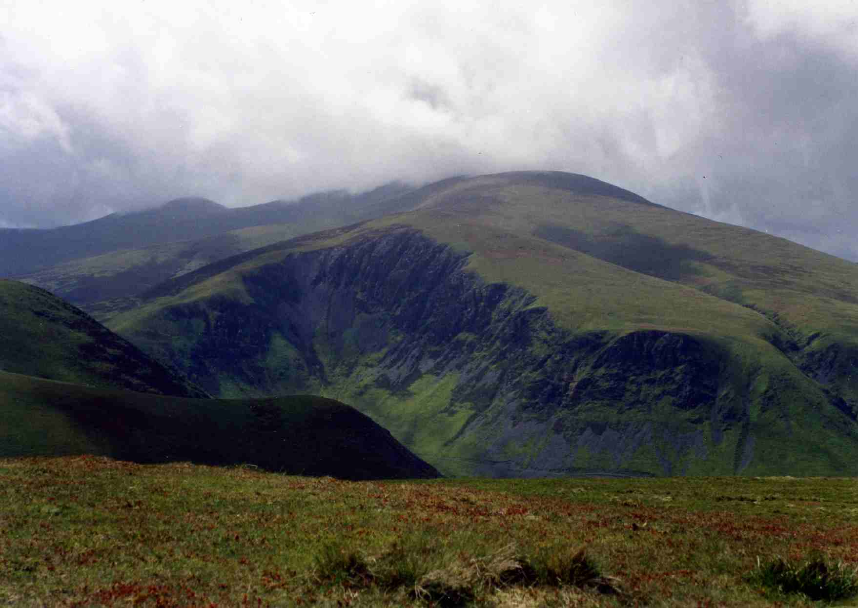
Great Knott is a prominent hill located in the county of Cumberland, in the Lake District National Park, England. Rising to a height of 696 meters (2,283 feet), it is classified as a "Wainwright" fell, named after the famous fell-walker and author Alfred Wainwright.

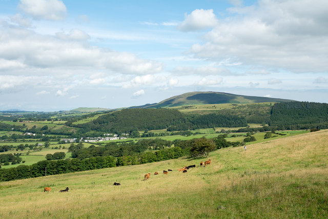
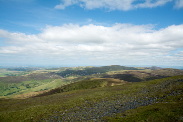
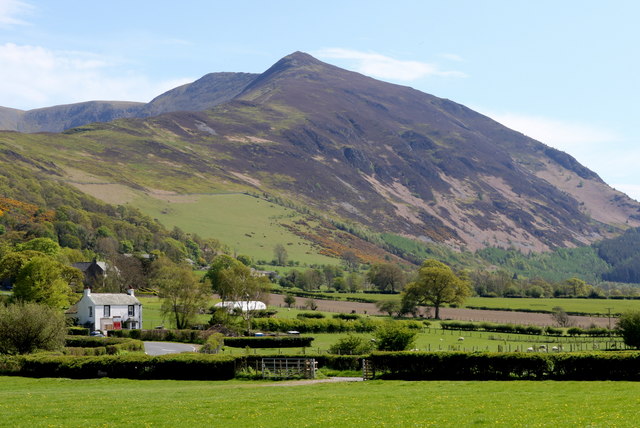
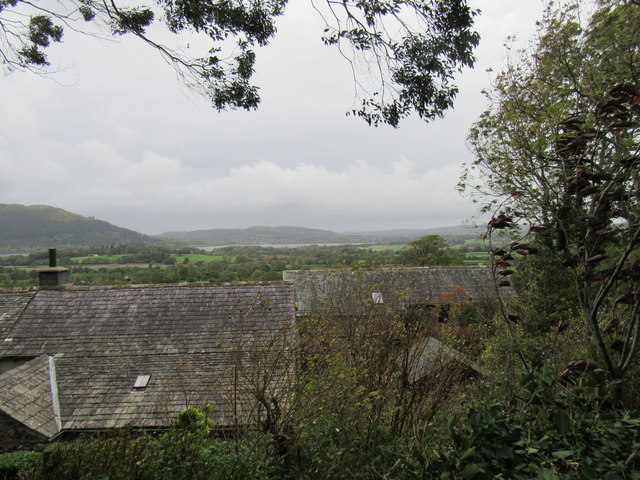
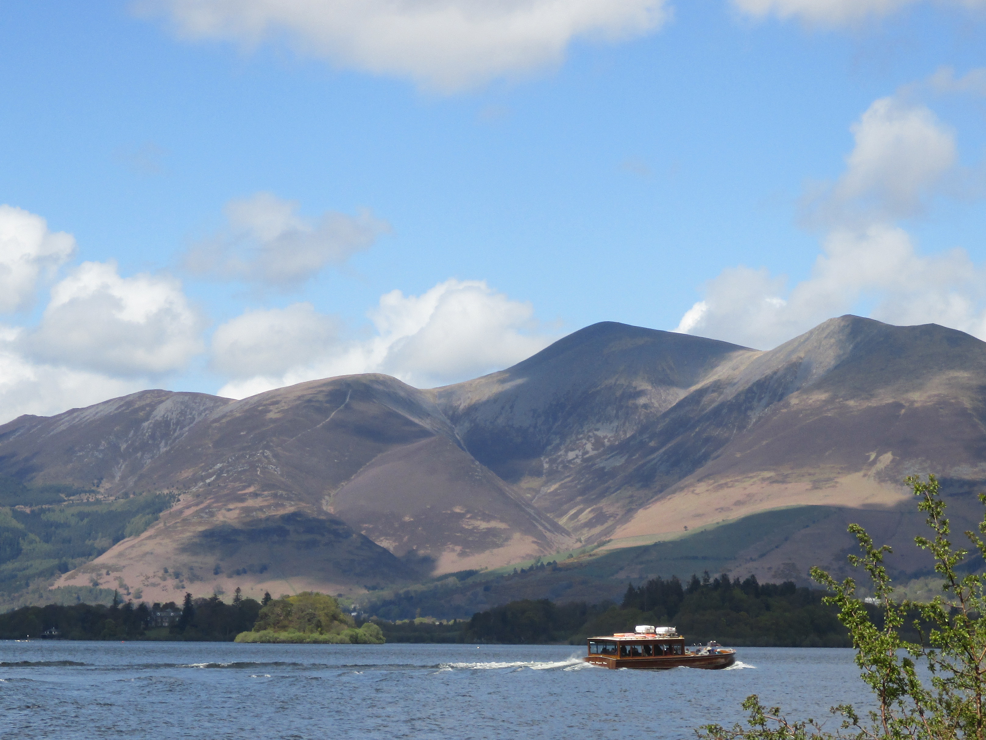
Situated in the southern part of the Lake District, Great Knott is part of a group of fells known as the Coniston Fells. It lies to the southeast of Coniston Water, one of the largest lakes in the region. The hill offers magnificent panoramic views of the surrounding landscape, including the nearby peaks of the Old Man of Coniston and Swirl How.

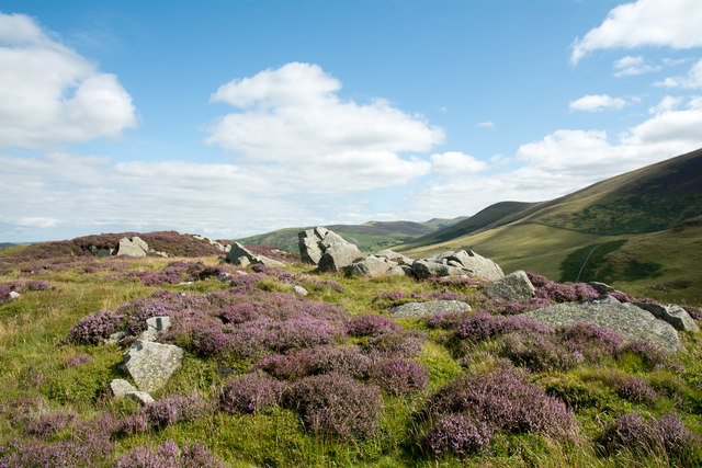
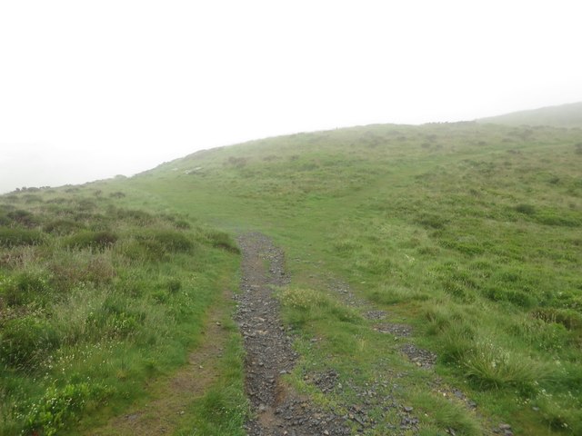
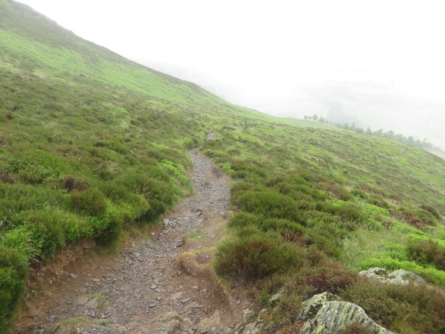
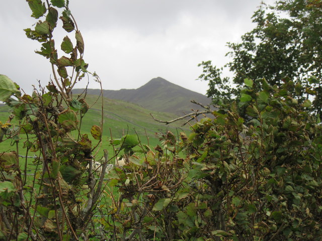
Great Knott is characterized by its rugged and rocky terrain, with steep slopes and craggy outcrops. It is a popular destination for hikers and fell-walkers, who are drawn to the challenge of its ascent and the breathtaking vistas from its summit. The hill can be reached from various starting points, with routes often beginning in the picturesque village of Coniston.

The area surrounding Great Knott is also home to a variety of flora and fauna, including heather, bracken, and a range of bird species. The fell is part of the Lake District's rich natural heritage and is protected as part of the National Park.

Overall, Great Knott offers outdoor enthusiasts an exhilarating and rewarding experience, combining challenging terrain with stunning views of the Lake District's scenic beauty.

If you have any feedback on the listing, please let us know in the comments section below.

Great Knott Images

Images are sourced within 2km of 54.65897/-3.1672217 or Grid Reference NY2429. Thanks to Geograph Open Source API. All images are credited.

Field beside minor road The field lies south-east from the village of Bassenthwaite and Bassenthwaite Lake can be seen in the image. Sale Fell is the wooded hill.
Field beside minor road
The field lies south-east from the village of Bassenthwaite and Bassenthwaite Lake can be seen in the image. Sale Fell is the wooded hill.
Bridleway rising towards north ridge of Ullock Pike The stretch of bridleway seen in this image appears to be little used as the route seems generally to be joined at the camera position by walkers climbing from a road and cutting the angle by crossing a field. Above this location the route is very clear and leads by one variation or another on to Ullock Pike. Binsey is the distant hill.
Bridleway rising towards north ridge of Ullock Pike
The stretch of bridleway seen in this image appears to be little used as the route seems generally to be joined at the camera position by walkers climbing from a road and cutting the angle by crossing a field. Above this location the route is very clear and leads by one variation or another on to Ullock Pike. Binsey is the distant hill.
Rocks and flowering heather at Watches Watches is the curious name for a collection of rocks at a levelling of the north ridge of Ullock Pike at around 330 m. In mid-August the flowering heather is close to its best.
Rocks and flowering heather at Watches
Watches is the curious name for a collection of rocks at a levelling of the north ridge of Ullock Pike at around 330 m. In mid-August the flowering heather is close to its best.
Bakestall Bakestall as seen from the northern slope of Skiddaw - it's the sun-dappled dome immediately beyond the near edge of fellside. The 'Back o' Skiddaw' mountains lie further away centred on the bulk of Knott. Bakestall is of course just a minor rise and is part of Skiddaw itself.
Bakestall
Bakestall as seen from the northern slope of Skiddaw - it's the sun-dappled dome immediately beyond the near edge of fellside. The 'Back o' Skiddaw' mountains lie further away centred on the bulk of Knott. Bakestall is of course just a minor rise and is part of Skiddaw itself.
Slope of Broad End Broad End is the large bulge of ground that is the northern part of Skiddaw; the view is northwards towards several Cockups!
The minor rise on the same slope as the foreground is simply named Cockup. In the middle distance is a hill ridge; Great Cockup is the higher part of it to the right (east); Little Cockup is the lower western part.
Slope of Broad End
Broad End is the large bulge of ground that is the northern part of Skiddaw; the view is northwards towards several Cockups! The minor rise on the same slope as the foreground is simply named Cockup. In the middle distance is a hill ridge; Great Cockup is the higher part of it to the right (east); Little Cockup is the lower western part.
Slope west of Dead Beck Dead Beck drains part of the north side of Skiddaw; it lies just over the crest of the foreground. The central hill is Great Cockup.
Slope west of Dead Beck
Dead Beck drains part of the north side of Skiddaw; it lies just over the crest of the foreground. The central hill is Great Cockup.
Cairn on Cockup Cockup is a minor feature, an interruption of the declining northern end of Skiddaw. It has a trivial amount of rise but it's recognised sufficiently for a cairn to have been built there . Bakestall is the cloud-shadowed feature in the distance - another minor interruption of the northern slope of Skiddaw.
Cairn on Cockup
Cockup is a minor feature, an interruption of the declining northern end of Skiddaw. It has a trivial amount of rise but it's recognised sufficiently for a cairn to have been built there . Bakestall is the cloud-shadowed feature in the distance - another minor interruption of the northern slope of Skiddaw.
Five holiday cottages at Melbecks Converted farm buildings under snow-topped Skiddaw.
Five holiday cottages at Melbecks
Converted farm buildings under snow-topped Skiddaw.
Chapel Beck, downstream of Walk Mill Bridge After heavy rain, when the ground was already waterlogged.
Chapel Beck, downstream of Walk Mill Bridge
After heavy rain, when the ground was already waterlogged.
Footpath at Ling How The footpath descends from Ling How to the Ravenstone Hotel beside the A591.
Footpath at Ling How
The footpath descends from Ling How to the Ravenstone Hotel beside the A591.
Footpath towards the Ravenstone Hotel Looking along the public footpath from Ling How as it descends towards the Ravenstone Hotel.
Footpath towards the Ravenstone Hotel
Looking along the public footpath from Ling How as it descends towards the Ravenstone Hotel.
On top of Cockup
On top of Cockup
Pink houses at High Side Turn off for Orthwaite (3m) from the A591.
View from the top of a bus.
Pink houses at High Side
Turn off for Orthwaite (3m) from the A591. View from the top of a bus.
A view towards Skiddaw You can only get grass this green when there's lots of rainfall!
A view towards Skiddaw
You can only get grass this green when there's lots of rainfall!
View from lane south of Bassenthwaite Village Looking across pasture towards Skiddaw and Ullock Pike (with mist on its flank).
View from lane south of Bassenthwaite Village
Looking across pasture towards Skiddaw and Ullock Pike (with mist on its flank).
High Side Houses at High Side.
High Side
Houses at High Side.
Ullock Pike Looking towards Ullock Pike.
Ullock Pike
Looking towards Ullock Pike.
Junction on the A591 at High Side
Show me another place!

Great Knott is located at Grid Ref: NY2429 (Lat: 54.65897, Lng: -3.1672217)

Administrative County: Cumbria

District: Allerdale

Police Authority: Cumbria

What 3 Words

///stands.displays.flinches. Near Keswick, Cumbria

Nearby Locations

Southerndale Great Knott

Related Wikis

Ullock Pike

Ullock Pike is a fell situated in northern part of the English Lake District. It is located seven kilometres north west of Keswick and achieves a height...

Long Side

Long Side is a fell in the English Lake District, it is situated six kilometres north west of Keswick in the northern sector of the national park and is...

Skiddaw

Skiddaw is a mountain in the Lake District National Park in England. Its 931-metre (3,054 ft) summit is the sixth-highest in England. It lies just north...

Bakestall

Bakestall is a fell in the English Lake District, it is situated seven kilometres (4+1⁄4 miles) north of Keswick in the quieter, even secluded northern...

Nearby Amenities

Located within 500m of 54.65897,-3.1672217
Waterway: waterfall
Lat/Long: 54.6581849/-3.1732814
Bassenthwaite Common
Place: locality
Lat/Long: 54.6567054/-3.1687027
Great Knott
Place: locality
Lat/Long: 54.6586817/-3.1678644
The data included in this document is from www.openstreetmap.org. The data is made available under ODbL.

Have you been to Great Knott?

Leave your review of Great Knott below (or comments, questions and feedback).