Cac Carn Mòr

Hill, Mountain in Aberdeenshire

Scotland

Cac Carn Mòr

Path up Lochnagar
Path up Lochnagar Credit: Steven Brown

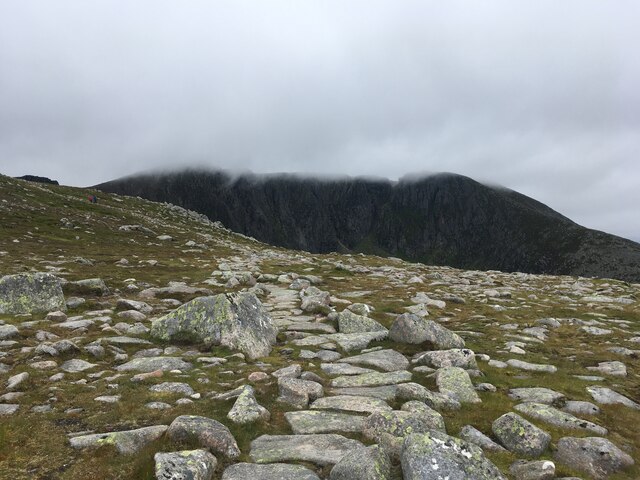
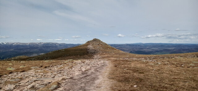
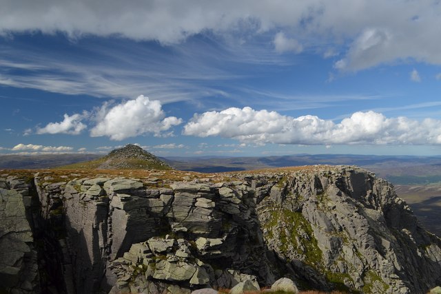
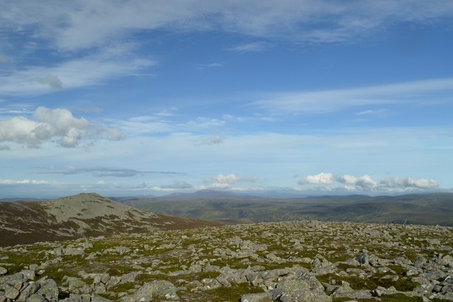
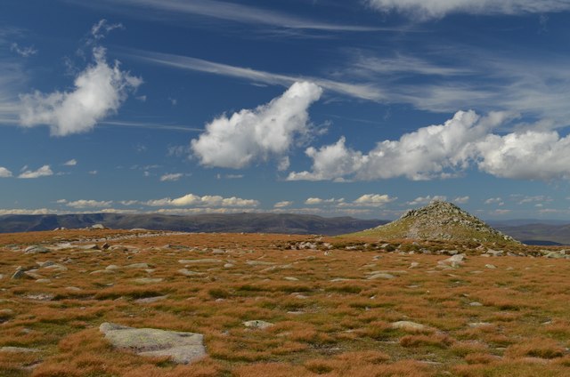
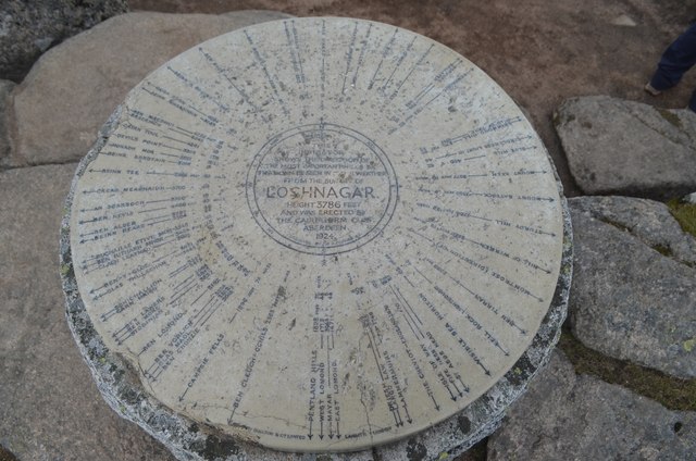
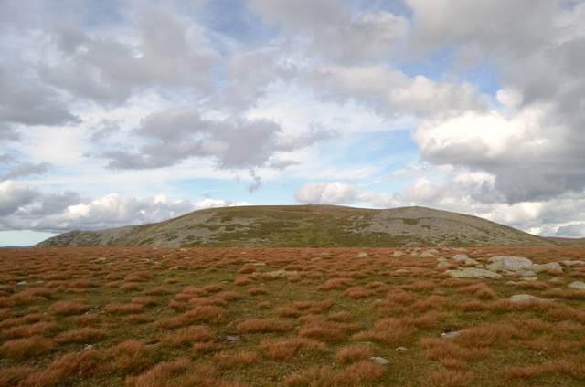
Cac Carn Mòr is a prominent hill located in Aberdeenshire, Scotland. It is part of the Cairngorms range, which is known for its stunning landscapes and diverse wildlife. Standing at an impressive height of 1,179 meters (3,868 feet), Cac Carn Mòr is one of the highest peaks in the region, attracting outdoor enthusiasts and hikers from all over.

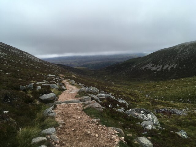
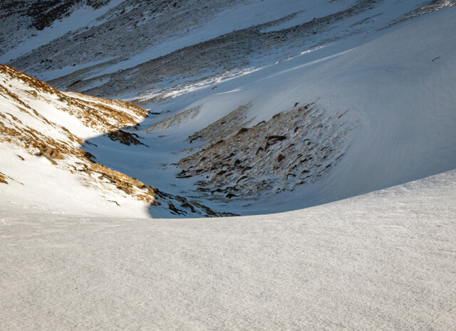
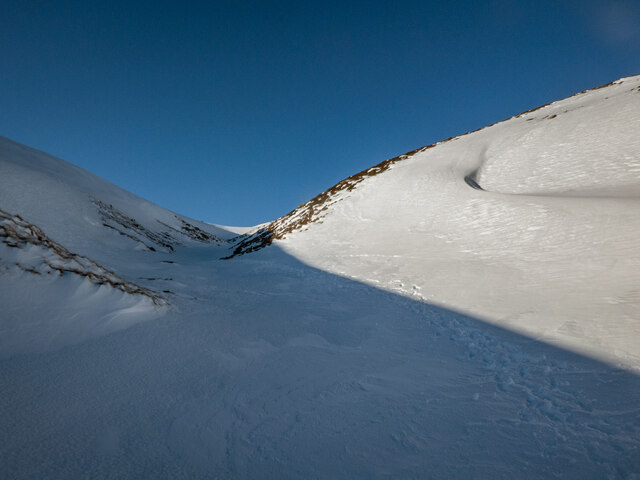
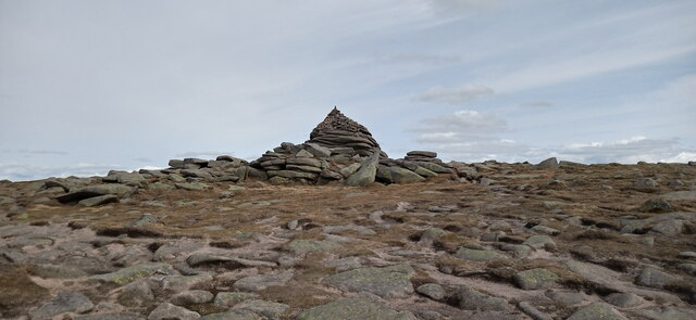
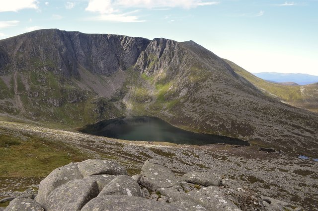
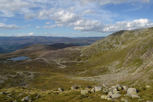
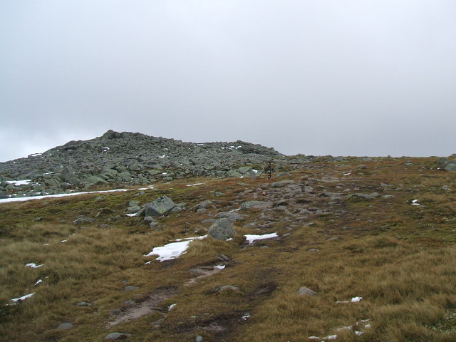
The hill is characterized by its rugged, rocky terrain, which presents a thrilling challenge for experienced climbers and mountaineers. The ascent to the summit is steep and demanding, requiring a good level of fitness and experience. However, the panoramic views from the top are well worth the effort, offering breathtaking vistas across the surrounding countryside.

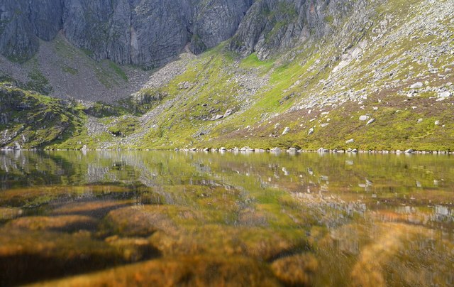
Cac Carn Mòr is also renowned for its unique geological features, including exposed granite rocks and moraines. These formations provide a fascinating insight into the area's glacial past, as well as offering opportunities for geological study and exploration.

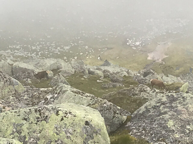
The hill is home to a variety of plant and animal species, with heather, bilberry, and mosses covering the slopes, and birds such as ptarmigans and golden eagles soaring above. It is also a popular spot for wildlife enthusiasts, who may be lucky enough to spot red deer or mountain hares in their natural habitat.

Overall, Cac Carn Mòr is a captivating and challenging destination for nature lovers and adventurers, offering stunning views, unique geological formations, and a chance to connect with the natural beauty of the Cairngorms.

If you have any feedback on the listing, please let us know in the comments section below.

Cac Carn Mòr Images

Images are sourced within 2km of 56.956251/-3.242685 or Grid Reference NO2485. Thanks to Geograph Open Source API. All images are credited.

Path up Lochnagar
Path up Lochnagar
Footpath alongside Glas Allt towards Loch Muick
Coire Boidheach in winter During winter, a narrowing of the coire fills with deep snow, and large cornices form. In February 2023, there was less snow than usual, exposing the stream which would normally be buried under many feet of snow at this time of year
Coire Boidheach in winter
During winter, a narrowing of the coire fills with deep snow, and large cornices form. In February 2023, there was less snow than usual, exposing the stream which would normally be buried under many feet of snow at this time of year
Coire Boidheach in winter A narrowing of Coire Boidheach on the plateau catches snow, and the resulting cornices cast shadow making the coire more readily visible from distance. In summer, the terrain is boggy and unremarkable: was the original meaning of the name "beautiful corrie" conceived in summer or winter?
Coire Boidheach in winter
A narrowing of Coire Boidheach on the plateau catches snow, and the resulting cornices cast shadow making the coire more readily visible from distance. In summer, the terrain is boggy and unremarkable: was the original meaning of the name "beautiful corrie" conceived in summer or winter?
Coire an Daimh Mhoile in winter Around the 1000m contour, Coire an Daimh Mhoile narrows and steepens. In summer the water tumbles down waterfalls here freely, but in winter it is buried in snow, and large cornices form (particularly on the west side).
Coire an Daimh Mhoile in winter
Around the 1000m contour, Coire an Daimh Mhoile narrows and steepens. In summer the water tumbles down waterfalls here freely, but in winter it is buried in snow, and large cornices form (particularly on the west side).
Coire an Daimh Mhoile in winter Looking up Coire an Daimh Mhoile in winter; at this time of year the stream is buried below snow (but can be heard running below). Crampons are advisable at this time of year, and when there is heavy snow there would be avalanche danger here.
Coire an Daimh Mhoile in winter
Looking up Coire an Daimh Mhoile in winter; at this time of year the stream is buried below snow (but can be heard running below). Crampons are advisable at this time of year, and when there is heavy snow there would be avalanche danger here.
Deer at the summit of Cac Carn Beag A Munro defined as a mountain in Scotland with a height over 3,000 feet (914.4 m), and which is on the Scottish Mountaineering Club (SMC) official list of Munros; there is no explicit topographical prominence requirement.
Deer at the summit of Cac Carn Beag
A Munro defined as a mountain in Scotland with a height over 3,000 feet (914.4 m), and which is on the Scottish Mountaineering Club (SMC) official list of Munros; there is no explicit topographical prominence requirement.
Cac Carn Mor Summit cairn on the lower of the two tops on Lochnagar.
Cac Carn Mor
Summit cairn on the lower of the two tops on Lochnagar.
Approaching Cac Carn Beag The highest point on Lochnagar.
Approaching Cac Carn Beag
The highest point on Lochnagar.
The Summit of Lochnagar in the Sunshine The northernmost summit, Cac Carn Beag, on Lochnagar, Scotland, UK (1155 m, 3789 ft).
The Summit of Lochnagar in the Sunshine
The northernmost summit, Cac Carn Beag, on Lochnagar, Scotland, UK (1155 m, 3789 ft).
Reflections of Lochnagar in Lochnagar Reflections of the rocky buttresses that make up the north face of the mountain Lochnagar, as seen in the loch of the same name.  The surface of the loch is at an elevation of 785m (2575 ft), which is high for a water body in Great Britain.  The cliffs of Lochnagar rise up to a high point of 1155m (3789 ft).
Reflections of Lochnagar in Lochnagar
Reflections of the rocky buttresses that make up the north face of the mountain Lochnagar, as seen in the loch of the same name. The surface of the loch is at an elevation of 785m (2575 ft), which is high for a water body in Great Britain. The cliffs of Lochnagar rise up to a high point of 1155m (3789 ft).
View of Lochnagar from the North The north face of the mountain Lochnagar, seen here, comprises a ridge of rocky pinnacles and buttresses with steep gullies in between. The highest summit of Lochnagar is 1155 m (3789 ft) above sea level.
View of Lochnagar from the North
The north face of the mountain Lochnagar, seen here, comprises a ridge of rocky pinnacles and buttresses with steep gullies in between. The highest summit of Lochnagar is 1155 m (3789 ft) above sea level.
On the Summit of Creag a' Ghlas Uillt Creag a' Ghlas Uillt (970 m, 3182 ft) is one of the summits on Lochnagar in the Cairngorm Mountains, Scotland.
On the Summit of Creag a' Ghlas Uillt
Creag a' Ghlas Uillt (970 m, 3182 ft) is one of the summits on Lochnagar in the Cairngorm Mountains, Scotland.
The Summit of Lochnagar in the Sunshine - Cac Carn Mor View from Cac Carn Mor towards Cac Carn Beag on the mountain Lochnagar.
The Summit of Lochnagar in the Sunshine - Cac Carn Mor
View from Cac Carn Mor towards Cac Carn Beag on the mountain Lochnagar.
Lochnagar, Aberdeenshire The loch 'Lochnagar' and the mountain of the same name behind, viewed from Meikle Pap.
Lochnagar, Aberdeenshire
The loch 'Lochnagar' and the mountain of the same name behind, viewed from Meikle Pap.
Coire Lochan nan Eun The Coire Lochan nan Eun on the west side of Lochnagar, Aberdeenshire.
Coire Lochan nan Eun
The Coire Lochan nan Eun on the west side of Lochnagar, Aberdeenshire.
List of Hills Visible from Lochnagar, Aberdeenshire This stone indicator shows the direction and distance of the most important peaks that can be seen in clear weather from the summit of Lochnagar (1155 m, 3786 ft).  Most notable, perhaps, are The Cheviot in England (105 miles to the south) and Morven in Caithness (88 miles to the north).  Morven is only a matter of 20 miles or so from the north coast of Britain, which means that from this one spot it is possible to see almost the length (and the breadth) of mainland Scotland.

The stone indicator was made by Doulton & co., Lambeth, London and was erected by the Cairngorm Club, Aberdeen 1924.  Although heavily chipped, the indicator is not in bad condition, considering it has spent nearly a century on top of a Scottish mountain.  For a closer look at the text in this photo (without the need to climb the hill) try downloading the large version of the photo (<a title="https://www.geograph.org.uk/more.php?id=5109364" href="https://www.geograph.org.uk/more.php?id=5109364">Link</a> ).
List of Hills Visible from Lochnagar, Aberdeenshire
This stone indicator shows the direction and distance of the most important peaks that can be seen in clear weather from the summit of Lochnagar (1155 m, 3786 ft). Most notable, perhaps, are The Cheviot in England (105 miles to the south) and Morven in Caithness (88 miles to the north). Morven is only a matter of 20 miles or so from the north coast of Britain, which means that from this one spot it is possible to see almost the length (and the breadth) of mainland Scotland. The stone indicator was made by Doulton & co., Lambeth, London and was erected by the Cairngorm Club, Aberdeen 1924. Although heavily chipped, the indicator is not in bad condition, considering it has spent nearly a century on top of a Scottish mountain. For a closer look at the text in this photo (without the need to climb the hill) try downloading the large version of the photo (Link ).
South Face of Lochnagar, Aberdeenshire High moorland (over 1km above sea level) to the south of Lochnagar.
South Face of Lochnagar, Aberdeenshire
High moorland (over 1km above sea level) to the south of Lochnagar.
Show me another place!

Cac Carn Mòr is located at Grid Ref: NO2485 (Lat: 56.956251, Lng: -3.242685)

Unitary Authority: Aberdeenshire

Police Authority: North East

What 3 Words

///samplers.bricks.crumples. Near Ballater, Aberdeenshire

Related Wikis

Nearby Amenities

Located within 500m of 56.956251,-3.242685
Cac Càrn Beag
Alt Name En: Lochnagar
Alt Name Gd: Cadha Chùirn Beag
Description: Little loch of the noisy sound (Lochan na Gaire)
Ele: 1156
Marilyn: yes
Munro: yes
Munro Number: M021
Natural: peak
Old Name: Beinn nan Cìochan
Prominence: 670
Source: NPE
Wikidata: Q1867453
Wikipedia: en:Lochnagar
Lat/Long: 56.9602412/-3.245265
Cac Càrn Mòr
Alt Name Gd: Cadha Chùirn Mòr
Ele: 1148
Natural: peak
Lat/Long: 56.9562144/-3.2427693
Lochnagar
Alt Name Gd: Beinn Chìochan
Name Gd: Beinn nan Cìochan
Place: locality
Lat/Long: 56.9547321/-3.2402559
Flickr: https://live.staticflickr.com/7859/47323003281_b707b9082f_o.jpg
Historic: boundary_stone
Information: map
Map Type: toposcope
Tourism: information
Lat/Long: 56.9602672/-3.2452181
The data included in this document is from www.openstreetmap.org. The data is made available under ODbL.

Have you been to Cac Carn Mòr?

Leave your review of Cac Carn Mòr below (or comments, questions and feedback).