Glenrath Heights

Hill, Mountain in Peeblesshire

Scotland

Glenrath Heights

Rock outcrop by Glensax Burn On rare occasions in these hills the underlying rock can be exposed in steep sections like this, where the burn has eroded into the bank. The track up the glen crosses to the other side to avoid this, and recrosses back higher up.
Rock outcrop by Glensax Burn Credit: Jim Barton

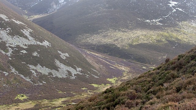
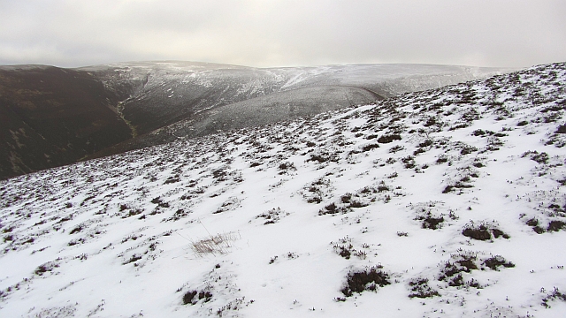
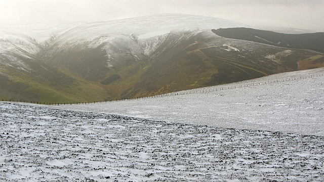
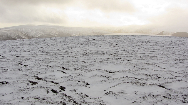
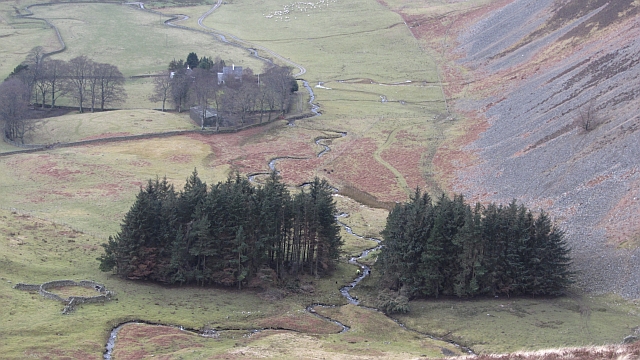
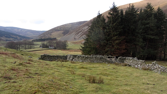
Glenrath Heights, located in Peeblesshire, Scotland, is a stunning hill/mountain region known for its breathtaking natural beauty and picturesque landscapes. Situated in the Southern Uplands, this area offers a unique blend of rolling hills, steep slopes, and panoramic views that attract visitors from far and wide.

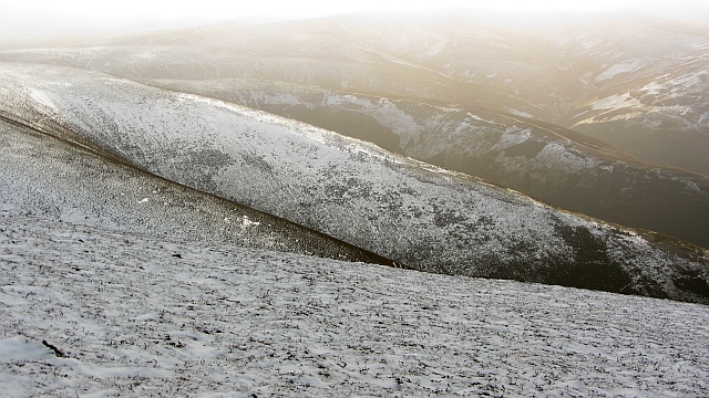
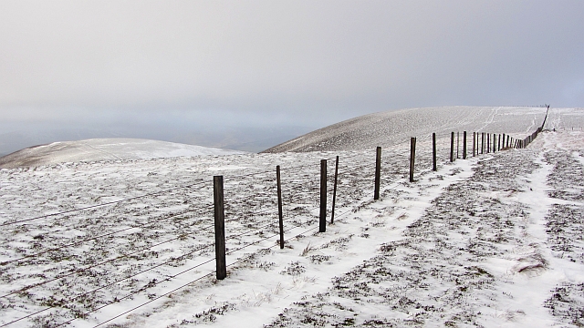
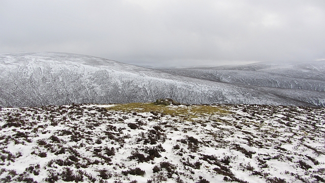
Rising to an impressive height of approximately 567 meters (1,860 feet), Glenrath Heights is a prominent feature in the region's topography. The hill/mountain is characterized by its rugged terrain, with rocky outcrops and a diverse range of vegetation covering its slopes. Heather, grasses, and scattered trees dot the landscape, creating a vibrant and ever-changing scene throughout the seasons.

The summit of Glenrath Heights provides an awe-inspiring vantage point, offering sweeping vistas of the surrounding countryside. On clear days, one can see for miles, with the lush green valleys, glittering rivers, and charming villages of Peeblesshire stretching out before them.

This area is a haven for outdoor enthusiasts and nature lovers alike. Glenrath Heights offers numerous hiking trails, allowing visitors to explore its natural wonders at their own pace. The challenging terrain provides a sense of adventure, attracting both experienced hikers and those seeking a new physical challenge.

Additionally, Glenrath Heights is home to a rich array of wildlife. Various bird species, including red kites and buzzards, can be spotted soaring above the hill/mountain, while smaller creatures such as rabbits and foxes inhabit its lower slopes.

In conclusion, Glenrath Heights in Peeblesshire is a captivating hill/mountain region that encapsulates the beauty of the Scottish countryside. Its dramatic landscapes, stunning views, and abundant wildlife make it a truly remarkable destination for those seeking to immerse themselves in nature's wonders.

If you have any feedback on the listing, please let us know in the comments section below.

Glenrath Heights Images

Images are sourced within 2km of 55.57806/-3.2042882 or Grid Reference NT2432. Thanks to Geograph Open Source API. All images are credited.

Rock outcrop by Glensax Burn On rare occasions in these hills the underlying rock can be exposed in steep sections like this, where the burn has eroded into the bank. The track up the glen crosses to the other side to avoid this, and recrosses back higher up.
Rock outcrop by Glensax Burn
On rare occasions in these hills the underlying rock can be exposed in steep sections like this, where the burn has eroded into the bank. The track up the glen crosses to the other side to avoid this, and recrosses back higher up.
Track in upper Glen Sax There is a small patch of snow lingering in Middle Hinty Cleuch.
Track in upper Glen Sax
There is a small patch of snow lingering in Middle Hinty Cleuch.
Cleuch on Scawd Law A cleuch on the SE side of Scawd Law, not named on the 1:25,000 map. The snow patches are at about 550m.
Cleuch on Scawd Law
A cleuch on the SE side of Scawd Law, not named on the 1:25,000 map. The snow patches are at about 550m.
Upper Glen Sax Steep slopes above the Glensax Burn seen from the hillside N of Middle Hinty Cleuch.
Upper Glen Sax
Steep slopes above the Glensax Burn seen from the hillside N of Middle Hinty Cleuch.
Glensax Burn from above The twists and turns of the burn between Dun Rig (R) and Hundleshope Heights in the upper part of the glen.
Glensax Burn from above
The twists and turns of the burn between Dun Rig (R) and Hundleshope Heights in the upper part of the glen.
Inversion haze layer seen from Hundleshope Heights The characteristic level top of an inversion layer trapping haze in a high pressure system; here and there a few small cumulus clouds are forming where there is some convection. Although it was calm in the glen, at 600m there was a brisk and chilly SW wind.
Inversion haze layer seen from Hundleshope Heights
The characteristic level top of an inversion layer trapping haze in a high pressure system; here and there a few small cumulus clouds are forming where there is some convection. Although it was calm in the glen, at 600m there was a brisk and chilly SW wind.
Frosted heather, Hundleshope Heights The wide open spaces of this high ridge, about 670m, with Middle Hill on the near skyline.
Frosted heather, Hundleshope Heights
The wide open spaces of this high ridge, about 670m, with Middle Hill on the near skyline.
Summit cairn, Hundleshope Heights A January afternoon on this windswept top between Glen Sax and the Manor Valley.
Summit cairn, Hundleshope Heights
A January afternoon on this windswept top between Glen Sax and the Manor Valley.
Bleak Hope and Hundles Hope One of the joys of the Southern Uplands is the network of secretive glens which branch out into hidden corners, no doubt put to bad use in reiving days. Here out of sight of the outside world, the young Hundleshope receives the waters of the Glenfinnin Burn flowing out of Bleak Hope.
Bleak Hope and Hundles Hope
One of the joys of the Southern Uplands is the network of secretive glens which branch out into hidden corners, no doubt put to bad use in reiving days. Here out of sight of the outside world, the young Hundleshope receives the waters of the Glenfinnin Burn flowing out of Bleak Hope.
North ridge of Stob Law A heathery nose descends to Hundes Hope and provides an easy ascent, even without a path or the usual quad bike track. The view is towards Scawd Law at the head of Hundles Hope and Bleak Hope.
North ridge of Stob Law
A heathery nose descends to Hundes Hope and provides an easy ascent, even without a path or the usual quad bike track. The view is towards Scawd Law at the head of Hundles Hope and Bleak Hope.
Glenrath Hill A fence runs across the ridge between Stob Law and Canada Hill. The fence has been there for a long time, yet is still only mapped by Harvey's.
Glenrath Hill
A fence runs across the ridge between Stob Law and Canada Hill. The fence has been there for a long time, yet is still only mapped by Harvey's.
Summit of Stob Law An unmarked heathery summit (there has been an attempt at a cairn, but it is not at the highest point).
Summit of Stob Law
An unmarked heathery summit (there has been an attempt at a cairn, but it is not at the highest point).
Glenrath Heights The western slopes fall steeply to Glenrathhope by a series of heathery spurs. The far spur gives an easy way up or down.
Glenrath Heights
The western slopes fall steeply to Glenrathhope by a series of heathery spurs. The far spur gives an easy way up or down.
Glenrath Heights A fence, still after many years, unmapped by the Ordnance Survey, runs southwards through heather moorland towards Middle Hill.
Glenrath Heights
A fence, still after many years, unmapped by the Ordnance Survey, runs southwards through heather moorland towards Middle Hill.
Bogs on Dun Rig Dun Rig is the highest hill east of the Manor Water. This is the upper end of Glen Sax and appears to be an area of peat bog, which is how I remember it from the one time I have been up there nearly thirty years earlier.
Bogs on Dun Rig
Dun Rig is the highest hill east of the Manor Water. This is the upper end of Glen Sax and appears to be an area of peat bog, which is how I remember it from the one time I have been up there nearly thirty years earlier.
Cairn, Glenrath Heights A cairn sits amongst moss on the spur between Fash Cleuch and Whitson's Cleuch. The cairn has probably attracted perching birds which have affected the local vegetation.  
Cairns like this are used for navigation by shepherds. I once met somebody who admitted to having got lost on his hill farm, even though he had worked there for thirty years.
Cairn, Glenrath Heights
A cairn sits amongst moss on the spur between Fash Cleuch and Whitson's Cleuch. The cairn has probably attracted perching birds which have affected the local vegetation. Cairns like this are used for navigation by shepherds. I once met somebody who admitted to having got lost on his hill farm, even though he had worked there for thirty years.
Woodland, Glenrath Hope Shepherds are moving a ewe which escaped when the hill sheep were being gathered earlier. The woodland has suffered recent storm damage.
Woodland, Glenrath Hope
Shepherds are moving a ewe which escaped when the hill sheep were being gathered earlier. The woodland has suffered recent storm damage.
Stell, Glenrath Hope A ruined fank and sheep shelter beside a small woodland.
Stell, Glenrath Hope
A ruined fank and sheep shelter beside a small woodland.
Show me another place!

Glenrath Heights is located at Grid Ref: NT2432 (Lat: 55.57806, Lng: -3.2042882)

Unitary Authority: The Scottish Borders

Police Authority: The Lothians and Scottish Borders

What 3 Words

///splint.besotted.fury. Near Peebles, Scottish Borders

Related Wikis

Manor Hills

The Manor Hills, also known as the Tweedsmuir Hills, are a range of hills south of Peebles in the Scottish Borders, one of the ranges which collectively...

Dun Rig

Dun Rig is a hill in the Manor Hills range, part of the Southern Uplands of Scotland. It is the highest hill in the northernmost cluster of the Manor Hills...
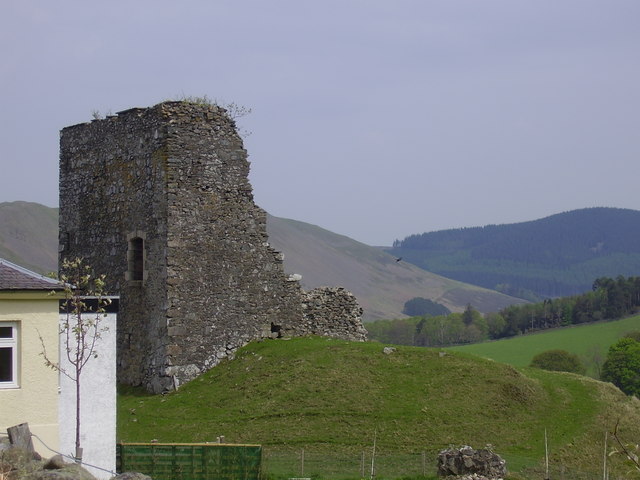
Castlehill Tower

Castlehill Tower, also known as Castle Hill of Manor, is a ruined oblong tower house dating from the end of the 15th century, situated in the parish of...

Posso Tower

Posso Tower is a 16th-century tower house, about 6.0 miles (9.7 km) south and west of Peebles, Scottish Borders, Scotland, and west of Manor Water. �...

Nearby Amenities

Located within 500m of 55.57806,-3.2042882
Middle Hill
Ele: 730
Natural: peak
Lat/Long: 55.5780111/-3.2042579
The data included in this document is from www.openstreetmap.org. The data is made available under ODbL.

Have you been to Glenrath Heights?

Leave your review of Glenrath Heights below (or comments, questions and feedback).