Knotts of the Tongue

Hill, Mountain in Cumberland Copeland

England

Knotts of the Tongue

Scafell Pike (behind) and Scafell from Over Beck
Scafell Pike (behind) and Scafell from Over Beck Credit: Johnny Coop

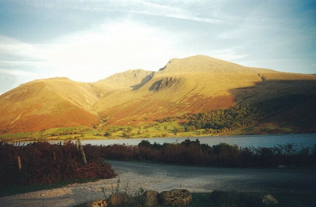
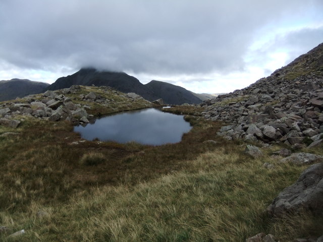
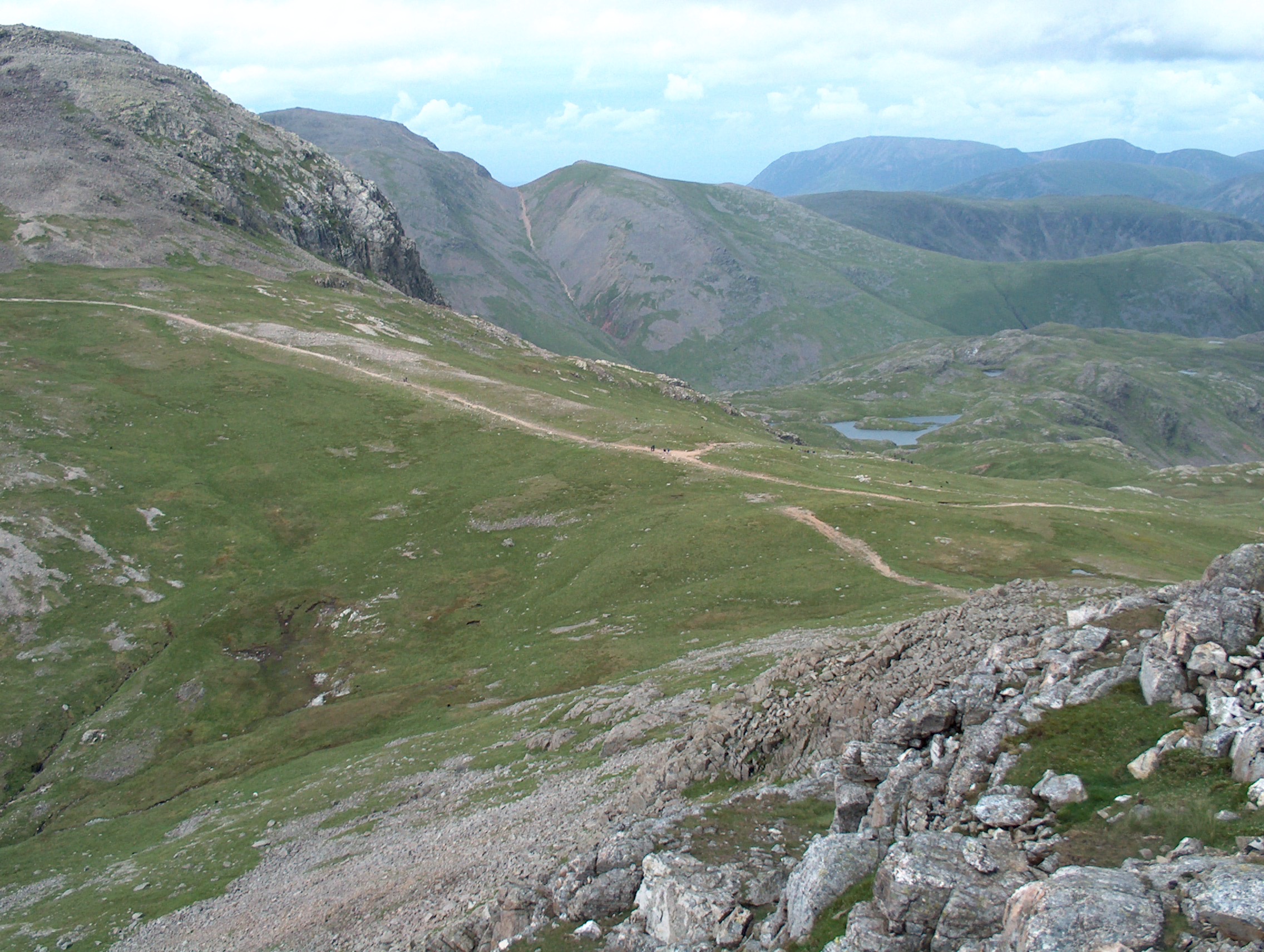
Knotts of the Tongue is a prominent hill located in Cumberland, a historic county in the northwestern part of England. Rising to an elevation of approximately 457 meters (1,499 feet), it stands as one of the highest points in the region, offering breathtaking panoramic views of the surrounding landscape.

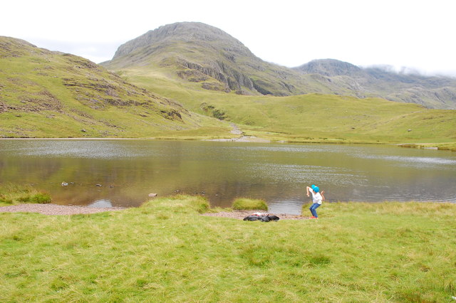
Situated within the Lake District National Park, Knotts of the Tongue is a popular destination for hikers, nature enthusiasts, and outdoor adventurers. Its distinctive name originates from the Old Norse word "knott," meaning a small hill or hillock, and "tongue," referring to the shape of the land formation resembling a protruding piece of land.

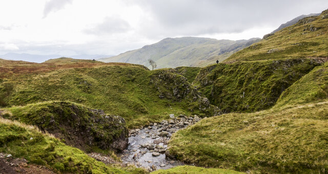
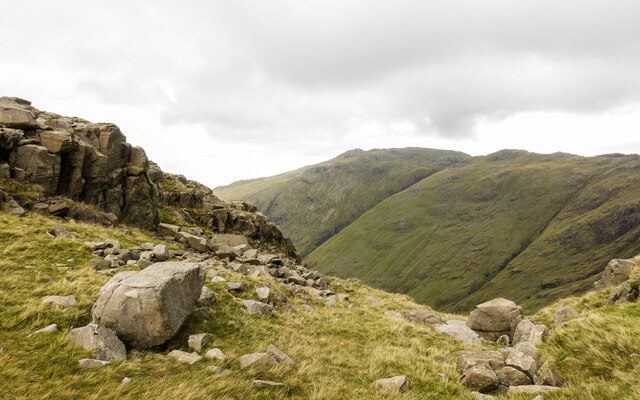
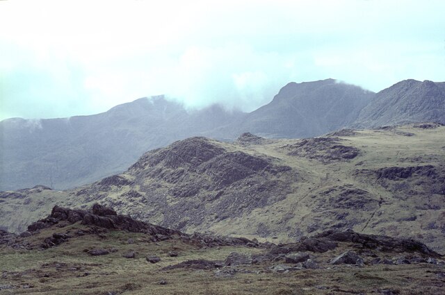
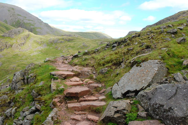
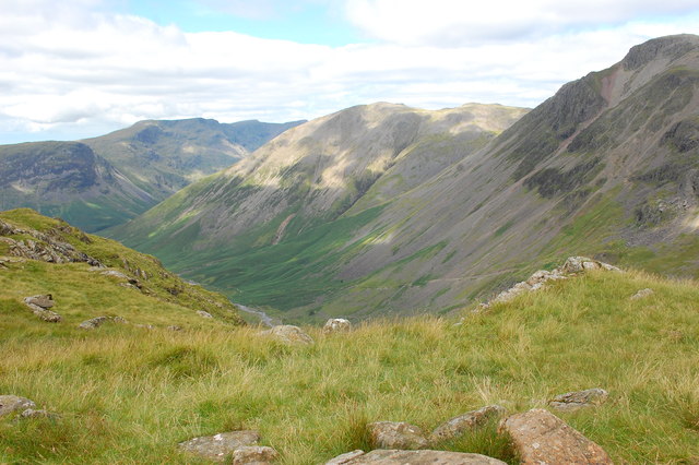
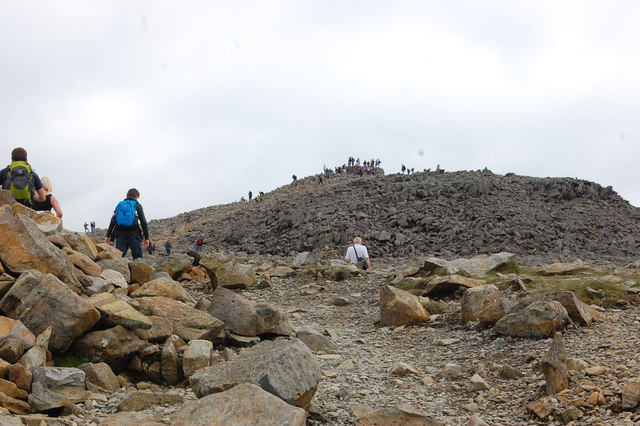
The hill is characterized by its rugged terrain, featuring steep slopes and rocky outcrops. Its ascent can be challenging, but the rewarding vistas from the summit make it well worth the effort. On a clear day, visitors can admire the picturesque valleys, shimmering lakes, and majestic peaks that define the Lake District.

The surrounding area is rich in biodiversity, with Knotts of the Tongue being a haven for a variety of flora and fauna. Rare alpine plants, heather, and grasses carpet the hillside, providing a vibrant display of colors throughout the seasons. It is also home to several bird species, including ravens, buzzards, and peregrine falcons, making it a popular spot for birdwatching.

Visitors to Knotts of the Tongue can explore the hill via a network of footpaths and trails, allowing them to immerse themselves in the natural beauty of the region. Whether it's for a challenging hike or simply to appreciate the breathtaking views, Knotts of the Tongue is a must-visit destination for nature lovers and outdoor enthusiasts alike.

If you have any feedback on the listing, please let us know in the comments section below.

Knotts of the Tongue Images

Images are sourced within 2km of 54.46094/-3.1894701 or Grid Reference NY2207. Thanks to Geograph Open Source API. All images are credited.

Scafell Pike (behind) and Scafell from Over Beck
Borrowdale from Ruddy Gill Looking down the valley from alongside Ruddy Gill. Derwent Water is just visible in the distance.
Borrowdale from Ruddy Gill
Looking down the valley from alongside Ruddy Gill. Derwent Water is just visible in the distance.
Ruddy Gill Ruddy Gill about to enter its gorge which is on the eastern side of Sprinkling Tarn. To the right slopes rise towards Allen Crags, Glaramara is distant at the centre.
Ruddy Gill
Ruddy Gill about to enter its gorge which is on the eastern side of Sprinkling Tarn. To the right slopes rise towards Allen Crags, Glaramara is distant at the centre.
Boulders and rock outcrops on Seathwaite Fell There are many minor outcrops on Seathwaite Fell, topping its knolls and projecting from slopes. The outcrop in the image overlooks the valley of Ruddy Gill / Grains Gill, beyond which is Glaramara.
Boulders and rock outcrops on Seathwaite Fell
There are many minor outcrops on Seathwaite Fell, topping its knolls and projecting from slopes. The outcrop in the image overlooks the valley of Ruddy Gill / Grains Gill, beyond which is Glaramara.
The Scafell range from Bow Fell The grassy hill in the middle distance is Pike de Bield. On the skyline are Sca Fell (in cloud), the gap at Mickledore, and Scafell Pike (clear), with Ill Crag on the right.
The Scafell range from Bow Fell
The grassy hill in the middle distance is Pike de Bield. On the skyline are Sca Fell (in cloud), the gap at Mickledore, and Scafell Pike (clear), with Ill Crag on the right.
Styhead Tarn A stone is about to join the fishes. Great End is seen beyond the tarn but the rest of the Scafell Pike ridge is shrouded in low cloud.
Styhead Tarn
A stone is about to join the fishes. Great End is seen beyond the tarn but the rest of the Scafell Pike ridge is shrouded in low cloud.
On the Corridor Route Looking back towards Sty Head with the slopes of Green Gable beyond.
On the Corridor Route
Looking back towards Sty Head with the slopes of Green Gable beyond.
Sty Head from the Breast Route Looking back down on Sty Head while ascending Great Gable by the Breast Route. The path to Sprinkling Tarn is ahead centre.
Sty Head from the Breast Route
Looking back down on Sty Head while ascending Great Gable by the Breast Route. The path to Sprinkling Tarn is ahead centre.
View into Wasdale From the Corridor Route to Scafell Pike, looking down into upper Wasdale with Great Gable to the right.
View into Wasdale
From the Corridor Route to Scafell Pike, looking down into upper Wasdale with Great Gable to the right.
Scafell Pike Approaching the summit having climbed by the Corridor Route via Lingmell Col. Across the boulder field the summit is ahead.
Scafell Pike
Approaching the summit having climbed by the Corridor Route via Lingmell Col. Across the boulder field the summit is ahead.
On a faint path below Spout Head Marked as a path on some scales of the map, and even as a bridleway a little further downhill, this track is well cairned but little used.
On a faint path below Spout Head
Marked as a path on some scales of the map, and even as a bridleway a little further downhill, this track is well cairned but little used.
Well-built path Deep in the valley below Moses' Trod, another path exists too - this well engineered track finds its way up the southern bank of Spouthead Gill.
Well-built path
Deep in the valley below Moses' Trod, another path exists too - this well engineered track finds its way up the southern bank of Spouthead Gill.
Boulders, one perched The location is the ground between Lingmell and Scafell Pike. Seatallan is the far off peak. The complex of nuclear industries at Sellafield is seen more distantly just left of the perched boulder.
Boulders, one perched
The location is the ground between Lingmell and Scafell Pike. Seatallan is the far off peak. The complex of nuclear industries at Sellafield is seen more distantly just left of the perched boulder.
Boulderfield at northern end of Ill Crag One of the main paths to and from Scafell Pike passes between two satellite tops of the mountain, Broad Crag and Ill Crag. Boulders abound everywhere; those seen here are close to the path as it passes north of Ill Crag. Esk Pike and Bow Fell are the two mountains beyond the boulders.
Boulderfield at northern end of Ill Crag
One of the main paths to and from Scafell Pike passes between two satellite tops of the mountain, Broad Crag and Ill Crag. Boulders abound everywhere; those seen here are close to the path as it passes north of Ill Crag. Esk Pike and Bow Fell are the two mountains beyond the boulders.
Rocks embedded in grass The location is below the north face of Great End and north-west of Esk Hause.
Great Gable and Green Gable are in the distance.
Rocks embedded in grass
The location is below the north face of Great End and north-west of Esk Hause. Great Gable and Green Gable are in the distance.
Small tarn by Round How
Lambfoot Dub Charming. Well worth the detour.
Lambfoot Dub
Charming. Well worth the detour.
Piers Gill from Piers Gill Head
Show me another place!

Knotts of the Tongue is located at Grid Ref: NY2207 (Lat: 54.46094, Lng: -3.1894701)

Administrative County: Cumbria

District: Copeland

Police Authority: Cumbria

What 3 Words

///ignoring.ladders.ballpoint. Near Ambleside, Cumbria

Related Wikis

Esk Hause

Esk Hause is a mountain pass in the English Lake District, England. It is where the paths from Eskdale, Borrowdale, Langdale and Wasdale all meet. Esk...

Great End

Great End is the most northerly mountain in the Scafell chain, in the English Lake District. From the south it is simply a lump continuing this chain....

Esk Pike

Esk Pike is a fell in the English Lake District, one of the cirque of hills forming the head of Eskdale. == Topography == The Southern Fells include the...

Allen Crags

Allen Crags is a fell in the English Lake District, it lies in a group of very popular hills and is regarded as part of the Scafell group of fells. It...

Related Videos

Hiking the Bob Graham Round - Day 1

The Bob Graham Round is a circular route that starts and finishes in Keswick, Cumbria, UK - with 8160m of ascent over 99km and ...

Dangerous? Scafell Pike from Wasdale via Mickledore Wainwright Guided Walk Lake District 4K

The walk up Scafell Pike via Mickledore is an alternative route up Scafell Pike from Wasdale, sharing the initial climb with the ...

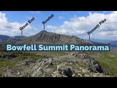
Bowfell - Fully Labelled Summit View Panorama. Lake District Walks & Hiking

A slow 360 degree panorama from the summit of Bowfell in the English Lake District. All main view points labelled.

A Simple Guide to Scafell Pike | Hiking, Camping, Itinerary | Filipino UK Travel

A Simple Guide to Scafell Pike | Hiking, Camping, Itinerary | Filipino UK Travel Hello and welcome to Life Adventure Philippines!

Nearby Amenities

Located within 500m of 54.46094,-3.1894701
Esk Hause
Ele: 761
Natural: saddle
Wikidata: Q5397975
Wikipedia: en:Esk Hause
Lat/Long: 54.4625794/-3.1853733
Calf Cove
Place: locality
Lat/Long: 54.4627645/-3.1935233
Ford: yes
Lat/Long: 54.4618521/-3.1923994
Man Made: cairn
Lat/Long: 54.462565/-3.1854133
The data included in this document is from www.openstreetmap.org. The data is made available under ODbL.

Have you been to Knotts of the Tongue?

Leave your review of Knotts of the Tongue below (or comments, questions and feedback).