Twyn Du

Hill, Mountain in Brecknockshire

Wales

Twyn Du

View to Pen y Gadair Fawr in the Black Mountains Walkers on the summit in chilly conditions, viewed from near the Blacksmith's Anvil on the adjacent Ffawyddog ridge above Capel-y-ffin.
View to Pen y Gadair Fawr in the Black Mountains Credit: Jeremy Bolwell

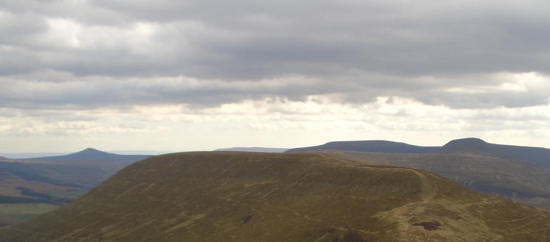
Twyn Du is a prominent hill located in Brecknockshire, Wales. It is a part of the Brecon Beacons National Park, which is renowned for its stunning natural beauty. Standing at an elevation of 642 meters (2,106 ft), Twyn Du offers breathtaking panoramic views of the surrounding landscape.

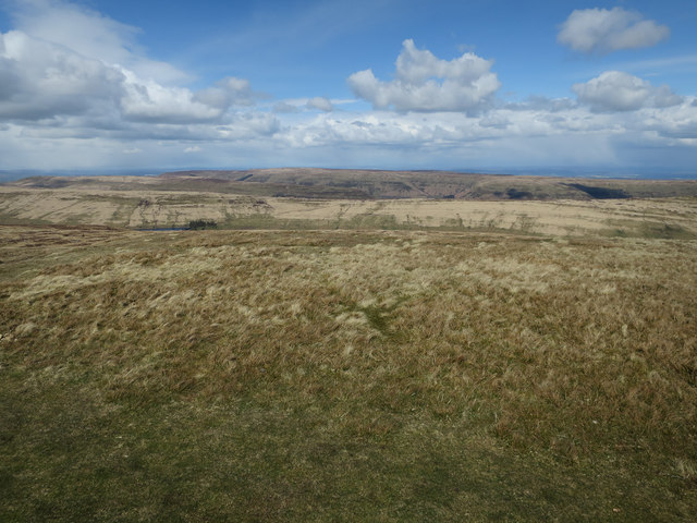
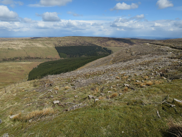
The hill is composed mainly of sandstone and is covered in lush green vegetation, particularly during the summer months when wildflowers adorn its slopes. Its distinct shape and commanding presence make it a popular destination for hikers and nature enthusiasts.

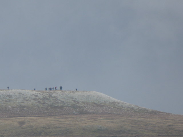
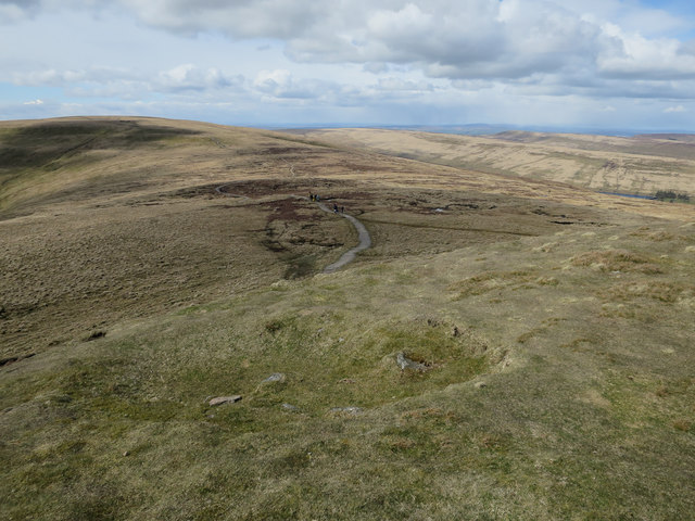
Twyn Du is easily accessible by foot, with several well-defined walking trails leading to its summit. The most common route starts from the nearby village of Talybont-on-Usk, where hikers can follow a well-marked track that winds its way up the hill. Along the way, visitors may encounter various wildlife species, including birds of prey, sheep, and wild ponies that graze on the hillside.

Reaching the summit of Twyn Du rewards hikers with breathtaking views of the surrounding Brecon Beacons, including the nearby Talybont Reservoir and the Usk Valley. On a clear day, it is even possible to catch a glimpse of the distant Black Mountains to the east.

Overall, Twyn Du is a stunning natural landmark that offers a memorable outdoor experience for those who venture to its summit. Its beauty and accessibility make it a popular destination for both locals and tourists seeking to immerse themselves in the scenic wonders of Brecknockshire.

If you have any feedback on the listing, please let us know in the comments section below.
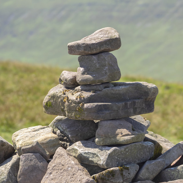
Twyn Du Images

Images are sourced within 2km of 51.93613/-3.1262654 or Grid Reference SO2227. Thanks to Geograph Open Source API. All images are credited.

View to Pen y Gadair Fawr in the Black Mountains Walkers on the summit in chilly conditions, viewed from near the Blacksmith's Anvil on the adjacent Ffawyddog ridge above Capel-y-ffin.
View to Pen y Gadair Fawr in the Black Mountains
Walkers on the summit in chilly conditions, viewed from near the Blacksmith's Anvil on the adjacent Ffawyddog ridge above Capel-y-ffin.
Pen y Gadair Fawr Looking towards Waun Fach along the broad ridge. A path has been made and cut heather has been brought up by helicopter and spread on the exposed peat to help preserve the peat.
Pen y Gadair Fawr
Looking towards Waun Fach along the broad ridge. A path has been made and cut heather has been brought up by helicopter and spread on the exposed peat to help preserve the peat.
Pen y Gadair Fawr Looking east over the ridges of the Black Mountains, from the second highest top in the area.
Pen y Gadair Fawr
Looking east over the ridges of the Black Mountains, from the second highest top in the area.
Harvested plantation The (former) edge of Mynydd Du Forest.
Harvested plantation
The (former) edge of Mynydd Du Forest.
Wild ponies on the col, 1 Looking north-west from the northern slope of Pen Twyn Mawr towards the 8oom 'peak' of Pen y Gadair Fawr seen centre right.
Wild ponies on the col, 1
Looking north-west from the northern slope of Pen Twyn Mawr towards the 8oom 'peak' of Pen y Gadair Fawr seen centre right.
Pen Twyn Mawr Viewed from the path to the south showing as a raised plateau on the central ridge of the Black Mountains.
Pen Twyn Mawr
Viewed from the path to the south showing as a raised plateau on the central ridge of the Black Mountains.
View south from Pen Twyn Mawr Hills in the distance are (left to right) Ysgyryd, Y Fal and the plateau of Blornge
View south from Pen Twyn Mawr
Hills in the distance are (left to right) Ysgyryd, Y Fal and the plateau of Blornge
View west from Pen Twyn Mawr Beyond the trench of the Grwyne Fechan valley is the Pen Cerrig-calch/Pen Allt-mawr plateau.
View west from Pen Twyn Mawr
Beyond the trench of the Grwyne Fechan valley is the Pen Cerrig-calch/Pen Allt-mawr plateau.
Pond on the Pen Twyn Mawr plateau Looking north towards the 'bump' of Pen y Gadair Fawr (800m).
Pond on the Pen Twyn Mawr plateau
Looking north towards the 'bump' of Pen y Gadair Fawr (800m).
Wild ponies on the col, 2 Looking north from the northern slope of Pen Twyn Mawr towards the 'peak' of Pen y Gadair Fawr, 800m, seen centre distance.
Wild ponies on the col, 2
Looking north from the northern slope of Pen Twyn Mawr towards the 'peak' of Pen y Gadair Fawr, 800m, seen centre distance.
Ridge path, 1 Main path along the central Black Mountains ridge, looking north.
Western edge of the Mynydd Du Forest to the right.
Ridge path, 1
Main path along the central Black Mountains ridge, looking north. Western edge of the Mynydd Du Forest to the right.
Ridge path, 2 Main path along the central Black Mountains ridge, looking south with Ysgyryd and Y fal prominent in the far distance.
The edge of Mynydd Du Forest to the left.
Ridge path, 2
Main path along the central Black Mountains ridge, looking south with Ysgyryd and Y fal prominent in the far distance. The edge of Mynydd Du Forest to the left.
Old Boundary Marker Estate Boundary Marker consisting of four flat stones 900 metres north of summit of Pen Twyn Glas. This was the boundary of Llanfihangel-Cwm-Du and Grwyne-Fechan parishes, but now the boundary of Llanfihangel Cwm Du with Bwlch and Cathedine, Talgarth and Vale of Grwyney parishes. Inscribed WBB and M on the centre face.

Milestone Society National ID: BRE_LCBCTG01em
Old Boundary Marker
Estate Boundary Marker consisting of four flat stones 900 metres north of summit of Pen Twyn Glas. This was the boundary of Llanfihangel-Cwm-Du and Grwyne-Fechan parishes, but now the boundary of Llanfihangel Cwm Du with Bwlch and Cathedine, Talgarth and Vale of Grwyney parishes. Inscribed WBB and M on the centre face. Milestone Society National ID: BRE_LCBCTG01em
Mynydd Llysiau from Pen y Gadair Fawr
The path running north from Pen Twyn Mawr towards Pen y Gadair Fawr
Cairn on Pen y Gadair Fawr, 1 No rest for the weary hill walker on the second highest top of the Black Mountains!
Some wasps have made the cairn a temporary home.
Cairn on Pen y Gadair Fawr, 1
No rest for the weary hill walker on the second highest top of the Black Mountains! Some wasps have made the cairn a temporary home.
Cairn on Pen y Gadair Fawr, 2 A great viewpoint. Away to the south the distinctive hills Skirrid, Sugarloaf and Blorenge can be clearly seen.
Cairn on Pen y Gadair Fawr, 2
A great viewpoint. Away to the south the distinctive hills Skirrid, Sugarloaf and Blorenge can be clearly seen.
Eastern slope of Pen y Gadair Fawr The forestry here has been mostly felled.
Looking down on the Skirrid in the distance.
Eastern slope of Pen y Gadair Fawr
The forestry here has been mostly felled. Looking down on the Skirrid in the distance.
Show me another place!

Twyn Du is located at Grid Ref: SO2227 (Lat: 51.93613, Lng: -3.1262654)

Unitary Authority: Powys

Police Authority: Dyfed Powys

What 3 Words

///apples.trout.duet. Near Crickhowell, Powys

Nearby Locations

Twyn Du Maen Llwyd

Related Wikis

Black Mountains, Wales

The Black Mountains (Welsh: Y Mynydd Du or sometimes Y Mynyddoedd Duon) are a group of hills spread across parts of Powys and Monmouthshire in southeast...

Waun Fach

Waun Fach is, with a summit height of 811 metres (2,661 ft), the highest mountain in the Black Mountains in south-eastern Wales. It is one of the three...

Pen Twyn Glas

Pen Twyn Glas is a top of Pen Allt-mawr in the Black Mountains in south-eastern Wales. It lies in between Pen Allt-mawr and Mynydd Llysiau. The summit...

Mynydd Llysiau

Mynydd Llysiau is a subsidiary summit of Waun Fach in the Black Mountains in south-eastern Wales. It lies halfway between Waun Fach and Pen Allt-mawr....

Nearby Amenities

Located within 500m of 51.93613,-3.1262654
Twyn Du
Ele: 536
Natural: peak
Lat/Long: 51.9361978/-3.1261664
The data included in this document is from www.openstreetmap.org. The data is made available under ODbL.

Have you been to Twyn Du?

Leave your review of Twyn Du below (or comments, questions and feedback).