Bawhelps

Hill, Mountain in Angus

Scotland

Bawhelps

A look down Glen Cally The bridge crosses from one side of the stream to the other. Some ruined shielings are seen around that point.
A look down Glen Cally Credit: Aleks Scholz

Bawhelps is a prominent hill/mountain located in the county of Angus, Scotland. It is situated near the town of Kirriemuir, approximately 20 miles north of Dundee. Rising to an elevation of 1,412 feet (430 meters), it is a well-known landmark in the region.

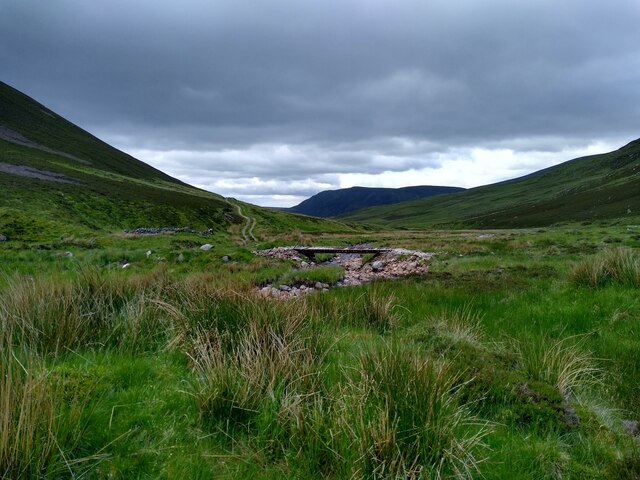
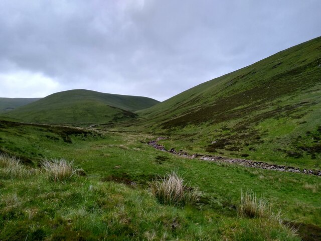
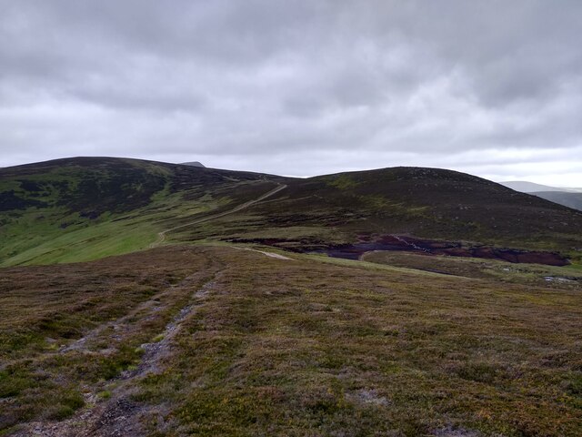
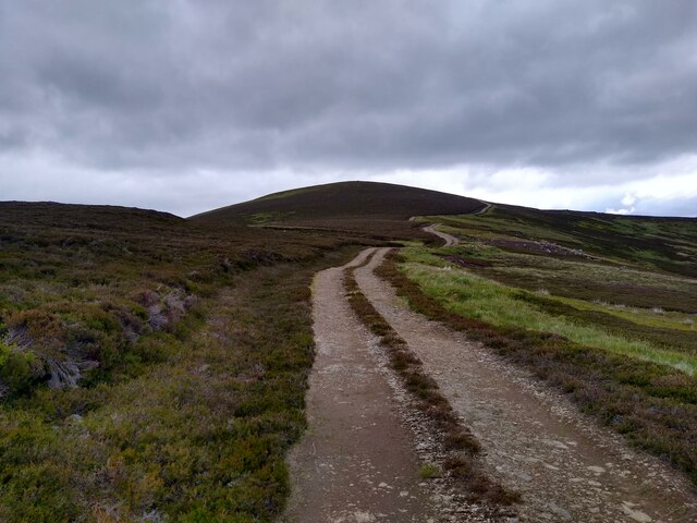
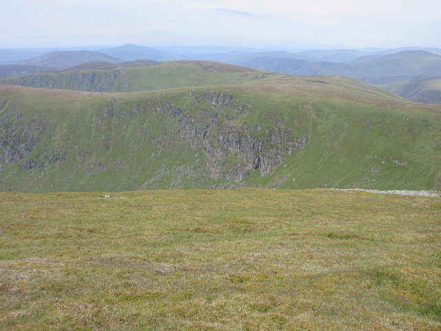
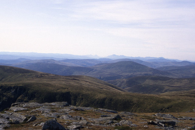
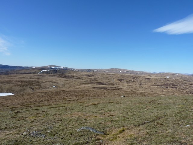
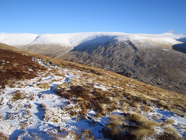
The hill/mountain is characterized by its distinctive shape, with a gently sloping eastern side and a steeper, craggy western face. Bawhelps is a popular destination for hikers and outdoor enthusiasts due to its accessibility and stunning views from the summit. On clear days, one can enjoy panoramic vistas of the surrounding countryside, including the nearby Angus Glens and the Grampian Mountains.

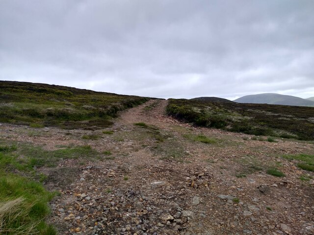
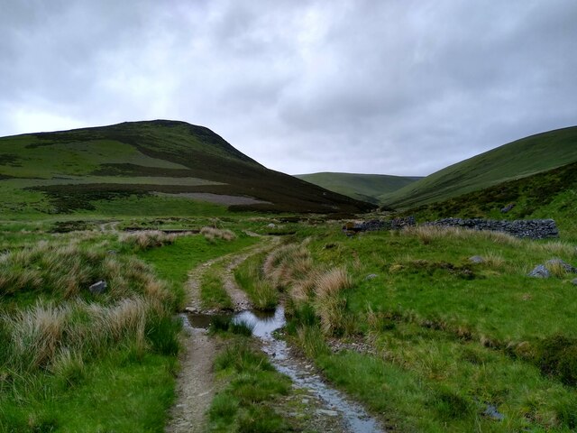
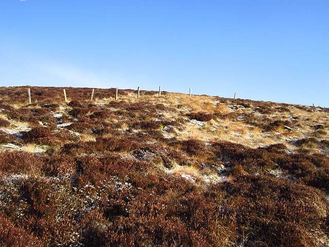
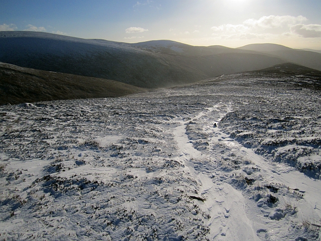
The ascent to the top of Bawhelps is relatively straightforward, with several well-defined paths leading to the summit. The terrain is a mix of grassy slopes, rocky outcrops, and heather-clad sections. As hikers make their way up, they may encounter various wildlife, including birds, rabbits, and deer, which are common in the area.

Historically, Bawhelps has been used as a reference point for navigation by locals, and its name is derived from the Scots word "baw" meaning ball or round, and "helps" meaning hills. The origin of the name is believed to be associated with the hill's round shape when viewed from certain angles.

Overall, Bawhelps offers a rewarding and enjoyable hiking experience for nature lovers and provides an opportunity to appreciate the natural beauty of Angus and its surrounding areas.

If you have any feedback on the listing, please let us know in the comments section below.
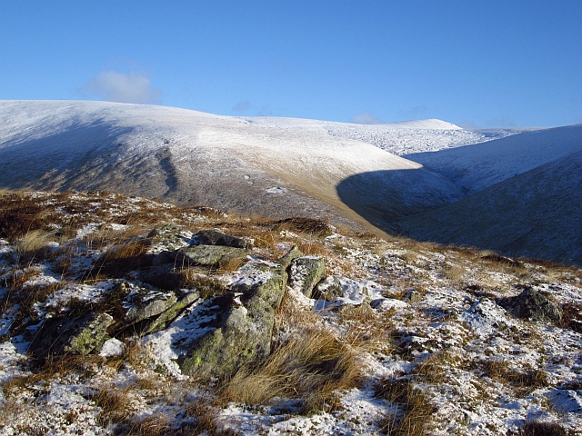
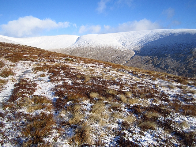
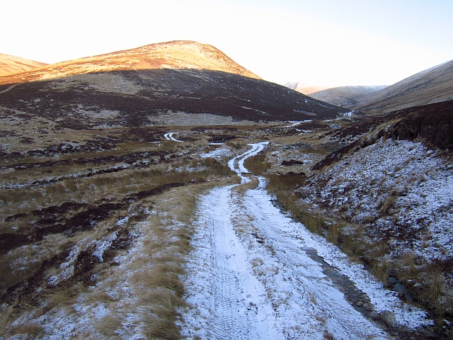
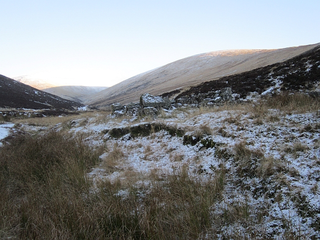
Bawhelps Images

Images are sourced within 2km of 56.834708/-3.2690257 or Grid Reference NO2272. Thanks to Geograph Open Source API. All images are credited.

A look down Glen Cally The bridge crosses from one side of the stream to the other. Some ruined shielings are seen around that point.
A look down Glen Cally
The bridge crosses from one side of the stream to the other. Some ruined shielings are seen around that point.
View up Glen Cally This is the very northern end of Glen Cally, the burn to the right. It divides in two just a hundred metres further up, and then peters out. Or rather springs into existence. The same happens to the path. The spur in the middle of the image leads straight onto the Mayar plateau. Just two miles from here and you are in Corrie Fee, which seems so far away when you are walking in Glen Isla.
View up Glen Cally
This is the very northern end of Glen Cally, the burn to the right. It divides in two just a hundred metres further up, and then peters out. Or rather springs into existence. The same happens to the path. The spur in the middle of the image leads straight onto the Mayar plateau. Just two miles from here and you are in Corrie Fee, which seems so far away when you are walking in Glen Isla.
The plateau at the end of Glen Isla Coming down Mid Hill this is the view towards the next hills, Tarmach Cairn and Bawhelps, which are just little bumps in the large plateau that extends from here to Loch Muick in the north, Glen Shee in the west and who knows what in the east. The nose that shows up in the background is, if I'm not mistaken, part of Mayar.
The plateau at the end of Glen Isla
Coming down Mid Hill this is the view towards the next hills, Tarmach Cairn and Bawhelps, which are just little bumps in the large plateau that extends from here to Loch Muick in the north, Glen Shee in the west and who knows what in the east. The nose that shows up in the background is, if I'm not mistaken, part of Mayar.
Summit of Mid Hill This, I think, is the summit cairn of Mid Hill, a pretty non-descript hill at the end of Glen Isla, which leads onto a large plateau. This cairn is fairly small, not really a cairn. A bit further west is a larger stony structure, but this seems slightly higher.
Summit of Mid Hill
This, I think, is the summit cairn of Mid Hill, a pretty non-descript hill at the end of Glen Isla, which leads onto a large plateau. This cairn is fairly small, not really a cairn. A bit further west is a larger stony structure, but this seems slightly higher.
Track up Mid Hill The last kilometre of the track up Mid Hill. This is a very boring track, bulldozed onto the hill, but it gives easy access to the hills beyond.
Track up Mid Hill
The last kilometre of the track up Mid Hill. This is a very boring track, bulldozed onto the hill, but it gives easy access to the hills beyond.
Four way crossroads The rare four way crossroads of bulldozed hill tracks. The track to the left leads onto the summit of Mid Hill. The one straight circumvents the summit and leads further onto the plateau. The one on the right leads to Craig Lair, and can then be used to get back to Glen Isla.
Four way crossroads
The rare four way crossroads of bulldozed hill tracks. The track to the left leads onto the summit of Mid Hill. The one straight circumvents the summit and leads further onto the plateau. The one on the right leads to Craig Lair, and can then be used to get back to Glen Isla.
Shielings in Glen Cally Some of the two-wheel tracks in this area actually develop quite nicely into beautiful paths. This one is a good example. Others will stay eyesores for many years.
Shielings in Glen Cally
Some of the two-wheel tracks in this area actually develop quite nicely into beautiful paths. This one is a good example. Others will stay eyesores for many years.
South Craig Rocks and cliffs on South Craig, viewed from west of the summit of Mayer.
South Craig
Rocks and cliffs on South Craig, viewed from west of the summit of Mayer.
South Craig and surrounding area as seen from Mayar
Westwards from Mayar Looking across the great moorland sweep of the West Mounth towards Glas Maol, one of the hills above Glen Shee.
Westwards from Mayar
Looking across the great moorland sweep of the West Mounth towards Glas Maol, one of the hills above Glen Shee.
Sròn Meadhonach A fence running across a moorland ridge. There is a very rough track running up the ridge.
Sròn Meadhonach
A fence running across a moorland ridge. There is a very rough track running up the ridge.
Track on Sròn Meadhonach A very muddy churned up vehicle track on a ridge above Glen Cally. It was frozen solid.
Track on Sròn Meadhonach
A very muddy churned up vehicle track on a ridge above Glen Cally. It was frozen solid.
Sròn Meadhonach Looking along a gently sloping and very boggy section of ridge above Sròn Meadhonach. A crude all terrain vehicle track uses the ridge, running up to Finalty Hill.
Sròn Meadhonach
Looking along a gently sloping and very boggy section of ridge above Sròn Meadhonach. A crude all terrain vehicle track uses the ridge, running up to Finalty Hill.
Cairn on Sròn Meadhonach A cairn at the top of the steep pull up Sròn Meadhonach. There is a view over to Mayar just beyond an attractive curved shadow.
Cairn on Sròn Meadhonach
A cairn at the top of the steep pull up Sròn Meadhonach. There is a view over to Mayar just beyond an attractive curved shadow.
Sròn Meadhonach Typical Mounth scenery with a heathery spur running down to a wide glen from a plateau. Here the ground is boggy and heather covered. A crude all terrain vehicle track runs up the ridge.
Sròn Meadhonach
Typical Mounth scenery with a heathery spur running down to a wide glen from a plateau. Here the ground is boggy and heather covered. A crude all terrain vehicle track runs up the ridge.
Glen Cally Sun is shining on Sròn Meadhonach while the glen is in shadow and very cold. There are shieling ruins in this part of the glen.
Glen Cally
Sun is shining on Sròn Meadhonach while the glen is in shadow and very cold. There are shieling ruins in this part of the glen.
Shieling ruin, Glen Cally One of several ruins in the glen.
Shieling ruin, Glen Cally
One of several ruins in the glen.
Glen Cally A view down the glen from a shieling site towards Mount Blair.
Glen Cally
A view down the glen from a shieling site towards Mount Blair.
Show me another place!

Bawhelps is located at Grid Ref: NO2272 (Lat: 56.834708, Lng: -3.2690257)

Unitary Authority: Angus

Police Authority: Tayside

What 3 Words

///aced.retailing.loaders. Near Inverey, Aberdeenshire

Nearby Locations

Bawhelps

Related Wikis

Mayar (mountain)

Mayar is a mountain in the Grampians, in Angus, Scotland. It is usually climbed together with its near neighbour, Driesh. At an elevation of 928 m, it...

Corrie Fee

Corrie Fee is a glacier-carved corrie situated at the head of Glen Clova in the Angus Glens of Scotland. It forms part of Corrie Fee National Nature Reserve...

Driesh

Driesh (Gaelic: Dris) is a mountain located in the Grampians of Scotland. Apart from Mount Keen (939 m/3,080 ft), it is the most easterly of the Munro...

Caenlochan

Caenlochan (Scottish Gaelic: Cadha an Lochain) is a glen in the Grampian Mountains of Scotland. Under EU Natura 2000 legislation it is a Special Area of...

Nearby Amenities

Located within 500m of 56.834708,-3.2690257
Bawhelps
Ele: 828
Natural: peak
Wikidata: Q13129982
Lat/Long: 56.8346418/-3.2687789
Birkentree
Place: locality
Lat/Long: 56.8375903/-3.2745883
The data included in this document is from www.openstreetmap.org. The data is made available under ODbL.

Have you been to Bawhelps?

Leave your review of Bawhelps below (or comments, questions and feedback).