Fafernie

Hill, Mountain in Angus

Scotland

Fafernie

Summit Cairn of Gowal Munro top 983m
Summit Cairn of Gowal Credit: Ralph Greig

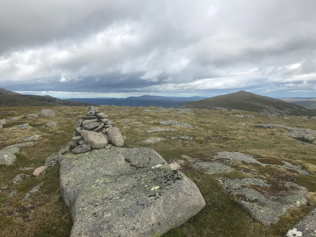
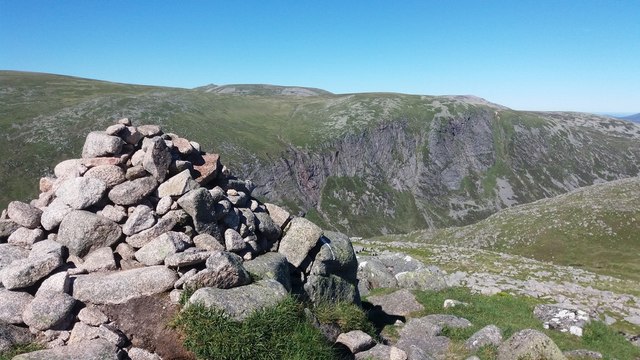
Fafernie, Angus is a prominent hill located in the county of Angus, Scotland. Standing at an elevation of approximately 1,564 feet (476 meters), it is part of the stunning landscape of the Angus Glens. The hill is situated in the southern region of the Cairngorms National Park, making it a popular destination for outdoor enthusiasts and nature lovers.

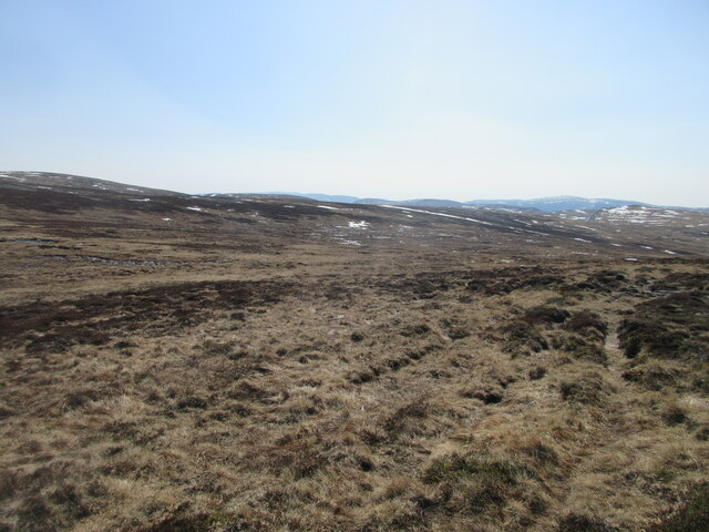
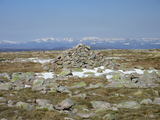
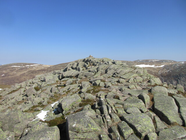
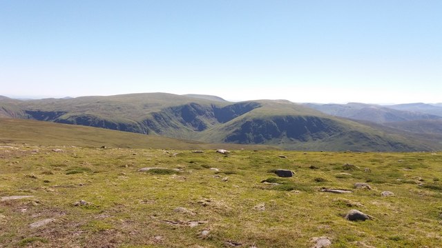
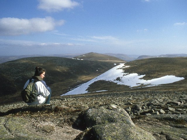
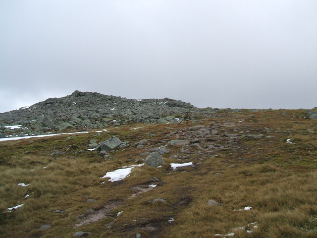
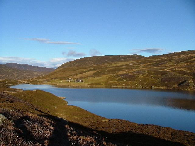
Fafernie offers breathtaking panoramic views of the surrounding area, including the neighboring hills and valleys. Its distinctive shape and rugged terrain make it a challenging yet rewarding climb for hikers and mountaineers. The summit provides a vantage point to admire the vast expanse of the Scottish countryside, with its rolling hills, scattered lochs, and dense forests.

The hill is home to a diverse range of flora and fauna, with heather-covered slopes and scattered patches of birch and pine trees. Wildlife enthusiasts may spot red deer, mountain hares, and various bird species as they explore the hillside.

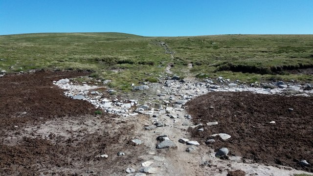
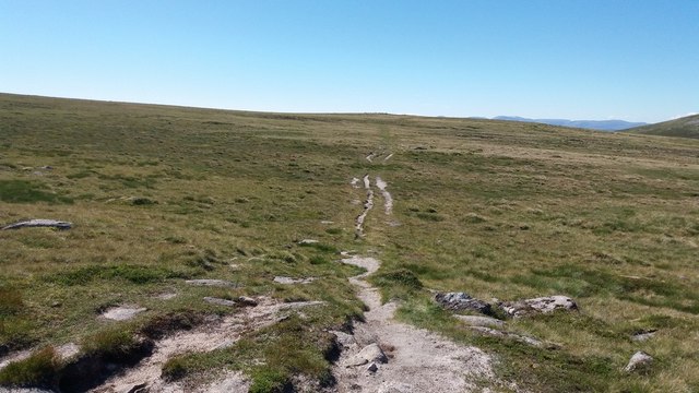
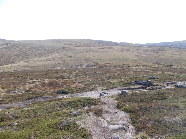
Access to Fafernie, Angus is facilitated by a network of well-maintained trails and paths, ensuring visitors can navigate the area safely. The hill is also within reach of nearby villages and towns, offering opportunities for accommodation and amenities for those wishing to explore the region further.

Fafernie, Angus is a truly remarkable natural landmark, showcasing the beauty of the Scottish Highlands and providing a memorable experience for those who venture to its summit.

If you have any feedback on the listing, please let us know in the comments section below.
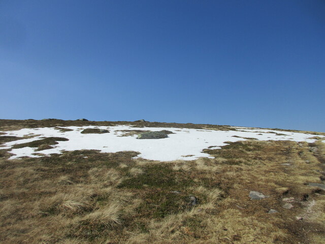
Fafernie Images

Images are sourced within 2km of 56.925466/-3.2910656 or Grid Reference NO2182. Thanks to Geograph Open Source API. All images are credited.

Summit Cairn of Gowal Munro top 983m
Summit Cairn of Gowal
Munro top 983m
Desolate Moorland Moorland stretching away southwards from between Creag Leachdach and the Shank of Fafernie.
Desolate Moorland
Moorland stretching away southwards from between Creag Leachdach and the Shank of Fafernie.
Cairn on Fafernie Looking north to the cairn on Fafernie, with the Alpine-like Cairngorms on the horizon.
Cairn on Fafernie
Looking north to the cairn on Fafernie, with the Alpine-like Cairngorms on the horizon.
Summit of Cairn Bannoch Stony summit of Cairn Bannoch from the south.
Summit of Cairn Bannoch
Stony summit of Cairn Bannoch from the south.
Snow bank on the Cairn of Gowal Snow on the north side of the Cairn of Gowal.
Snow bank on the Cairn of Gowal
Snow on the north side of the Cairn of Gowal.
Looking into Glen Callater From Tolmount.
Looking into Glen Callater
From Tolmount.
View roughly SW from Carn an t-Sagairt Mor Looking to Coire Loch Kander, and in the distance, Glas Maol.
View roughly SW from Carn an t-Sagairt Mor
Looking to Coire Loch Kander, and in the distance, Glas Maol.
Crossing paths on the White Mounth plateau Just to the southeast of Carn an t-Sagairt Mor.
Crossing paths on the White Mounth plateau
Just to the southeast of Carn an t-Sagairt Mor.
Path towards Fafernie
Cairn Bannoch Its position above the Coire Uilleim Mhoir gives a fantastic view of the Eagle's Rock.
Cairn Bannoch
Its position above the Coire Uilleim Mhoir gives a fantastic view of the Eagle's Rock.
Cairn of Gowal
Cairn of Gowal
On Cairn of Gowal
On Cairn of Gowal
Cairn Bannoch summit
Munro path junction One of several path junctions on the main Munro routes throughout this area.
Munro path junction
One of several path junctions on the main Munro routes throughout this area.
Angular rocks on Cairn Bannoch The rocks, surrounded by moss and other low vegetation are just below the summit cairn of Cairn Bannoch.
Eagles Rock is seen in the distance with a minor top of Carn a' Choire Bhoidheach partly misted above it.
Angular rocks on Cairn Bannoch
The rocks, surrounded by moss and other low vegetation are just below the summit cairn of Cairn Bannoch. Eagles Rock is seen in the distance with a minor top of Carn a' Choire Bhoidheach partly misted above it.
Central Gully of Creag an Dubh-loch The view is across the Central Gully of the huge rock feature, Creag an Dubh-loch which is a remote crag with rock climbing routes of up to 300 metres.
Càrn an t-Sagairt Mòr and Càrn an t-Sagairt Beag are the distant, skyline domes.
Central Gully of Creag an Dubh-loch
The view is across the Central Gully of the huge rock feature, Creag an Dubh-loch which is a remote crag with rock climbing routes of up to 300 metres. Càrn an t-Sagairt Mòr and Càrn an t-Sagairt Beag are the distant, skyline domes.
Summit of Cairn Bannoch Approaching the large summit cairn from the west.
Summit of Cairn Bannoch
Approaching the large summit cairn from the west.
Knaps of Fafernie Knaps of Fafernie is a locality along the ridge between Crow Craigies and Fafernie; it's viewed in the image from the summit of Tolmount.
Cairn Bannoch is sunlit in the middle distance at the left side of the image. Cairn of Gowal is to the right along the ridge with a shapely point between them at 991 m. Lochnagar is farthest away.
Knaps of Fafernie
Knaps of Fafernie is a locality along the ridge between Crow Craigies and Fafernie; it's viewed in the image from the summit of Tolmount. Cairn Bannoch is sunlit in the middle distance at the left side of the image. Cairn of Gowal is to the right along the ridge with a shapely point between them at 991 m. Lochnagar is farthest away.
Show me another place!

Fafernie is located at Grid Ref: NO2182 (Lat: 56.925466, Lng: -3.2910656)

Unitary Authority: Angus

Police Authority: Tayside

What 3 Words

///yard.pranced.barmaid. Near Inverey, Aberdeenshire

Related Wikis

Cairn Bannoch

Cairn Bannoch (Scottish Gaelic: Càrn a' Bheannaich) is a mountain in the White Mounth, a mountainous plateau in the Scottish Highlands. It is about seventeen...

Dubh Loch (Glen Muick)

Dubh Loch is a small upland loch situated within the Balmoral Estate, in Aberdeenshire, Scotland. It is at an altitude of 637 metres (2,090 ft), with a...

Broad Cairn

Broad Cairn is a mountain in the Grampians of Scotland, located about sixteen miles south of the River Dee near Balmoral.

Loch Callater

Loch Callater is an upland, freshwater loch lying approximately 5 miles (8 km) south of Braemar, Scotland. The loch trends in a northwest to southeast...

Nearby Amenities

Located within 500m of 56.925466,-3.2910656
Fafernie
Ele: 997
Natural: peak
Source: NPE
Lat/Long: 56.9252623/-3.290743
The data included in this document is from www.openstreetmap.org. The data is made available under ODbL.

Have you been to Fafernie?

Leave your review of Fafernie below (or comments, questions and feedback).