Stickle Pike

Hill, Mountain in Lancashire South Lakeland

England

Stickle Pike

Birks
Birks Credit: Mick Garratt

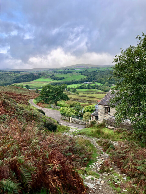
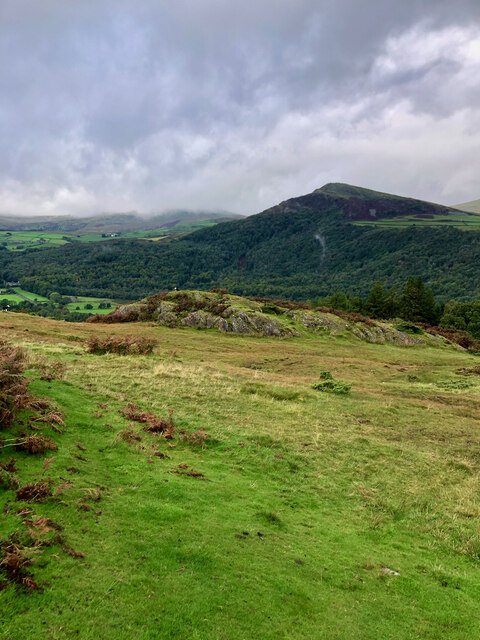
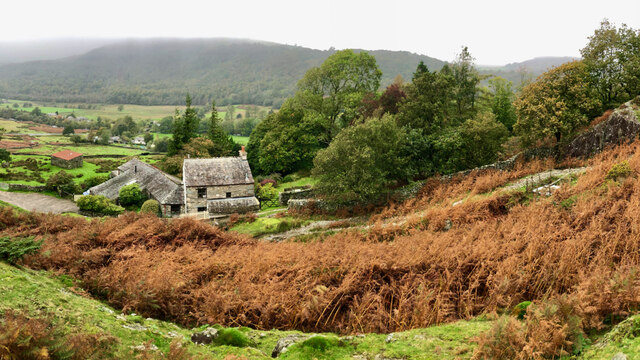
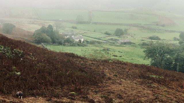
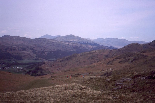
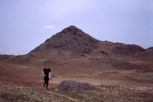
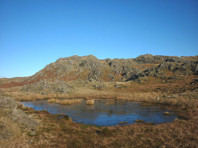
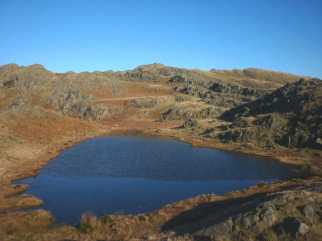
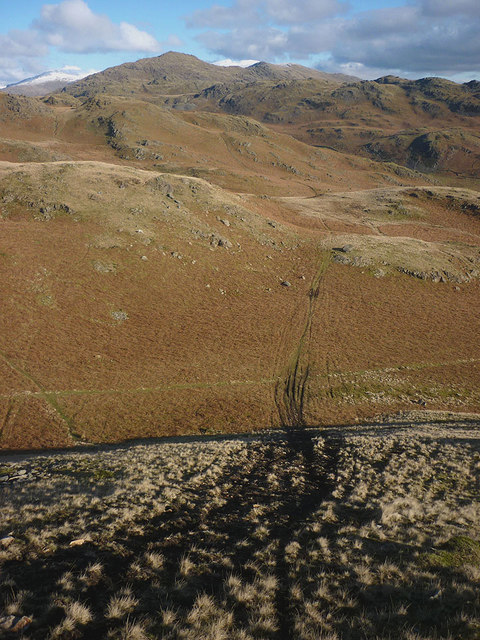
Stickle Pike is a prominent hill located in the county of Lancashire, England. It is situated within the Lake District National Park, near the village of Broughton in Furness. With an elevation of approximately 375 meters (1,230 feet), Stickle Pike offers stunning panoramic views of the surrounding countryside.

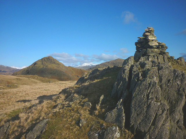
The hill is characterized by its distinctive pointed summit, which is believed to have inspired its name, as "stickle" is an old English word meaning "pointed." Its unique shape makes it a popular destination for hikers and walkers looking to enjoy the picturesque landscape.

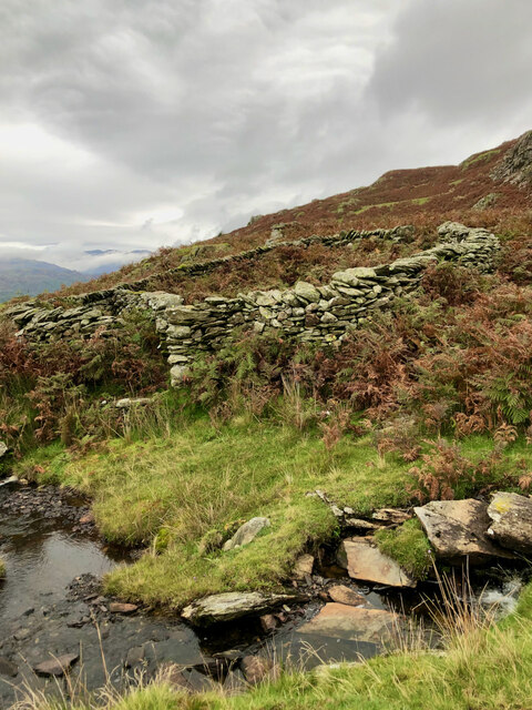
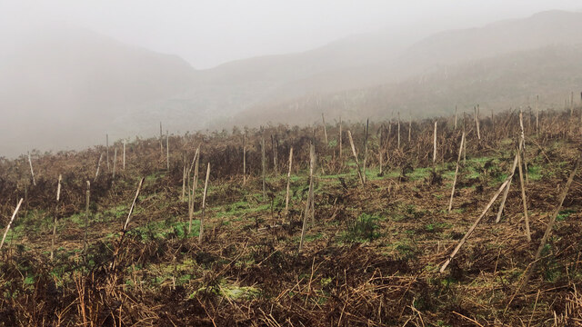
Stickle Pike is composed mainly of igneous rocks such as andesite and basalt, formed from volcanic activity millions of years ago. The hill is covered in heather and grasses, creating a beautiful contrast of colors throughout the year.

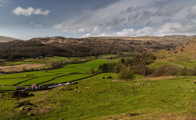
There are a few walking routes to reach the summit of Stickle Pike, including one that begins at Kiln Bank Cross, leading up through woodland before reaching the open hillside. Another popular starting point is the village of Broughton Mills, which offers a more gentle ascent along well-defined paths.

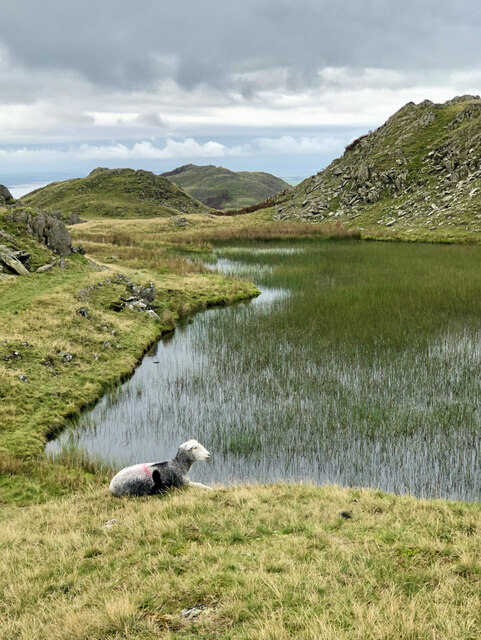
The hill is home to a variety of wildlife, including birds such as curlews, lapwings, and skylarks that can be spotted in the surrounding fields. Stickle Pike also boasts an abundance of wildflowers, adding to its natural beauty.

Overall, Stickle Pike is a remarkable hill that offers both recreational opportunities and a chance to appreciate the scenic beauty of Lancashire's countryside.

If you have any feedback on the listing, please let us know in the comments section below.

Stickle Pike Images

Images are sourced within 2km of 54.324253/-3.2131371 or Grid Reference SD2192. Thanks to Geograph Open Source API. All images are credited.

Washfold, Hollow Moss Beck A pen for holding sheep waiting to be washed. The following is quoted from the Lake District National Park HER see <span class="nowrap"><a title="https://www.heritagegateway.org.uk/Gateway/Results_Single.aspx?uid=2900443&resourceID=801" rel="nofollow ugc noopener" href="https://www.heritagegateway.org.uk/Gateway/Results_Single.aspx?uid=2900443&resourceID=801">Link</a><img style="margin-left:2px;" alt="External link" title="External link - shift click to open in new window" src="https://s1.geograph.org.uk/img/external.png" width="10" height="10"/></span>

"An unusual circular fold 8m diameter with an internal partition forming two chambers. An 11m long driving wall has been built along naturally rocky outcrops to assist driving sheep into the fold. The wash dub measures 3m by 4m and apart from being partially silted up all the features are intact and in excellent condition. There is a dry stone built launching platform just outside the gate and the beck is masonry lined on the bank nearest the fold to prevent undermining of the structure. The remains of a dry stone dam are substantially complete on both banks of the beck. The fold is in excellent condition, walls are intact to full height and cams in place, however approximately half of the driving wall is partially collapsed. The wash dub features are one of the best preserved in the Western valleys and are also in excellent condition."
Washfold, Hollow Moss Beck
A pen for holding sheep waiting to be washed. The following is quoted from the Lake District National Park HER see LinkExternal link "An unusual circular fold 8m diameter with an internal partition forming two chambers. An 11m long driving wall has been built along naturally rocky outcrops to assist driving sheep into the fold. The wash dub measures 3m by 4m and apart from being partially silted up all the features are intact and in excellent condition. There is a dry stone built launching platform just outside the gate and the beck is masonry lined on the bank nearest the fold to prevent undermining of the structure. The remains of a dry stone dam are substantially complete on both banks of the beck. The fold is in excellent condition, walls are intact to full height and cams in place, however approximately half of the driving wall is partially collapsed. The wash dub features are one of the best preserved in the Western valleys and are also in excellent condition."
Stickle Tarn
Stickle Tarn
Fellside above Birks
A far away view of Birks
Stepping stones across the River Duddon
A forest of stakes, no saplings, no tree guards, just stakes
Carter Ground
Carter Ground
Stainton Ground Slate Quarry For further info.: ‘Stainton Ground Slate Quarry’. Heritagegateway.org.uk <<span class="nowrap"><a title="https://www.heritagegateway.org.uk/Gateway/Results_Single.aspx?resourceID=801&uid=2888871" rel="nofollow ugc noopener" href="https://www.heritagegateway.org.uk/Gateway/Results_Single.aspx?resourceID=801&uid=2888871">Link</a><img style="margin-left:2px;" alt="External link" title="External link - shift click to open in new window" src="https://s1.geograph.org.uk/img/external.png" width="10" height="10"/></span> > [accessed 18 October 2023]
Stainton Ground Slate Quarry
For further info.: ‘Stainton Ground Slate Quarry’. Heritagegateway.org.uk <LinkExternal link > [accessed 18 October 2023]
Orienteering, Dunnerdale Fells Looking back towards the start from a climb above Kiln Bank on Lakeland OC&amp;#039;s Stickle Pike map. I had already run and was walking up Stickle Pike.  The runners will have completed a loop north of the road before climbing to the southern part of the competition area here.
Orienteering, Dunnerdale Fells
Looking back towards the start from a climb above Kiln Bank on Lakeland OC's Stickle Pike map. I had already run and was walking up Stickle Pike. The runners will have completed a loop north of the road before climbing to the southern part of the competition area here.
Stickle Pike Taken during an orienteering event.  A small sharp summit of great character.
Stickle Pike
Taken during an orienteering event. A small sharp summit of great character.
Kiln Bank The Duddon Valley seen from Kiln Bank.
Kiln Bank
The Duddon Valley seen from Kiln Bank.
Minor road in Dunnerdale The road is heading north, passing close to the farm at Knott End
Minor road in Dunnerdale
The road is heading north, passing close to the farm at Knott End
Small tarn, Tarn Hill One of a collection of gems that gives the hill its name and makes this an ideal place to wander at will.
Small tarn, Tarn Hill
One of a collection of gems that gives the hill its name and makes this an ideal place to wander at will.
Tarn on Tarn Hill One of a collection of gems that gives the hill its name and makes this an ideal place to wander at will. This is one of the larger tarns and the view is towards the summit cairn of Tarn Hill.
Tarn on Tarn Hill
One of a collection of gems that gives the hill its name and makes this an ideal place to wander at will. This is one of the larger tarns and the view is towards the summit cairn of Tarn Hill.
Tarn by the summit of Tarn Hill This is actually the western of two tarns which lie either side of the summit. Stickle Pike rears its conical peak into view and the higher fells of central Lakeland can be seen to the north.
Tarn by the summit of Tarn Hill
This is actually the western of two tarns which lie either side of the summit. Stickle Pike rears its conical peak into view and the higher fells of central Lakeland can be seen to the north.
Summit cairn, Tarn Hill A small neat pile on the topmost outcrop at 313m asl. Beyond is the neat little cone of Stickle Pike.
Summit cairn, Tarn Hill
A small neat pile on the topmost outcrop at 313m asl. Beyond is the neat little cone of Stickle Pike.
Vandalism on the fells Ruts and scoring of the hillside by illegal trail bike riding. The Dunnerdale Fells are quiet (I saw no-one up here despite the glorious Sunday weather) and so the riders probably ride here thinking that no-one will observe them.
Vandalism on the fells
Ruts and scoring of the hillside by illegal trail bike riding. The Dunnerdale Fells are quiet (I saw no-one up here despite the glorious Sunday weather) and so the riders probably ride here thinking that no-one will observe them.
Show me another place!

Stickle Pike is located at Grid Ref: SD2192 (Lat: 54.324253, Lng: -3.2131371)

Administrative County: Cumbria

District: South Lakeland

Police Authority: Cumbria

What 3 Words

///tribe.sloping.negotiators. Near Millom, Cumbria

Related Wikis

Dunnerdale Fells

Dunnerdale Fells is an upland area in the English Lake District, between Ulpha and Broughton Mills, Cumbria. It is the subject of a chapter of Wainwright...

Great Stickle

Great Stickle is a fell located in the southern Lake District of England with an altitude of 305 m (1,001 ft). Alfred Wainwright included it in the Stickle...

Ulpha

Ulpha is a small village and civil parish in the Duddon Valley in the Lake District National Park in Cumbria, England. Historically in Cumberland, it forms...

Caw (hill)

Caw is a hill in Cumbria, England, near the village of Seathwaite above the Duddon Valley, reaching 1,735 feet (529 m) and having a trig point at the summit...

Blacksmiths Arms, Broughton Mills

The Blacksmiths Arms is a Grade II listed public house at Broughton Mills, Cumbria, England.It is on the Campaign for Real Ale's National Inventory of...

Broughton Mills

Broughton Mills is a village in Cumbria, England, located 3.5 kilometres from the larger town of Broughton-in-furness. The village consists of about 40...
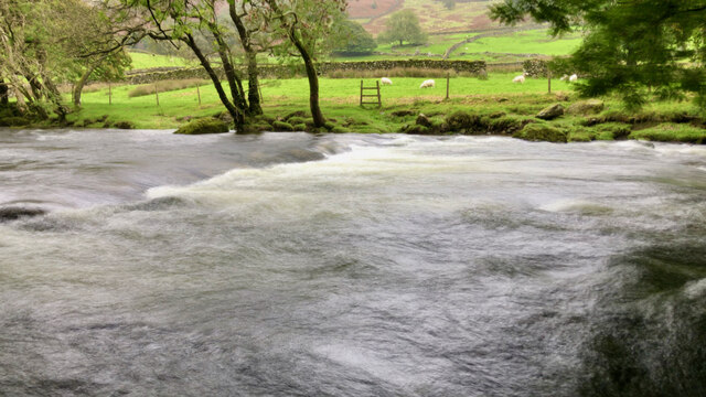
Duddon Valley

The Duddon Valley is a valley in the southern Lake District National Park in Cumbria, England. The River Duddon flows through the valley, rising in the...

Broughton West

Broughton West is a civil parish in the Westmorland and Furness district of Cumbria, England. In the 2001 census the parish had a population of 954, decreasing...

Nearby Amenities

Located within 500m of 54.324253,-3.2131371
Stickle Pike
Ele: 375
Natural: peak
Wikidata: Q7616267
Wikipedia: en:Stickle Pike
Lat/Long: 54.3244963/-3.2131834
Archaeological Site: ring_cairn
Historic: archaeological_site
Lat/Long: 54.3216222/-3.214122
Archaeological Site: tumulus
Historic: archaeological_site
Lat/Long: 54.3218506/-3.2149052
Ford: yes
Lat/Long: 54.322628/-3.2115459
Ford: yes
Lat/Long: 54.3246644/-3.2101194
Ford: yes
Lat/Long: 54.3261167/-3.2190438
Hollowscar Hill End
Ele: 312
Natural: peak
Lat/Long: 54.3232218/-3.2102399
Ford: yes
Lat/Long: 54.3238703/-3.2070964
Ford: yes
Lat/Long: 54.3258644/-3.2187118
Direction: 290
Man Made: adit
Lat/Long: 54.3236931/-3.209112
Power: pole
Lat/Long: 54.3238521/-3.20589
The data included in this document is from www.openstreetmap.org. The data is made available under ODbL.

Have you been to Stickle Pike?

Leave your review of Stickle Pike below (or comments, questions and feedback).