Brunt Fell

Downs, Moorland in Lancashire South Lakeland

England

Brunt Fell

Dunnerdale Fells above Stonestar There is an old postcard of this scene called "Dunnerdale Fells". This is a recent picture of the same from the same location. Peaks include Cat's Crag and Raven's Crag, and what rock-climbers call Stonestar Crag.
This picture is a reverse view of <a href="https://www.geograph.org.uk/photo/7300826">SD1992 : Duddon Valley south of Ulpha</a>.
Dunnerdale Fells above Stonestar Credit: Alan Jolley

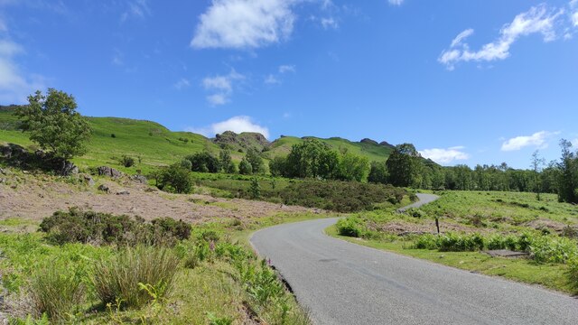
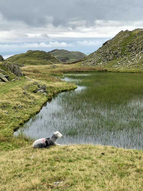
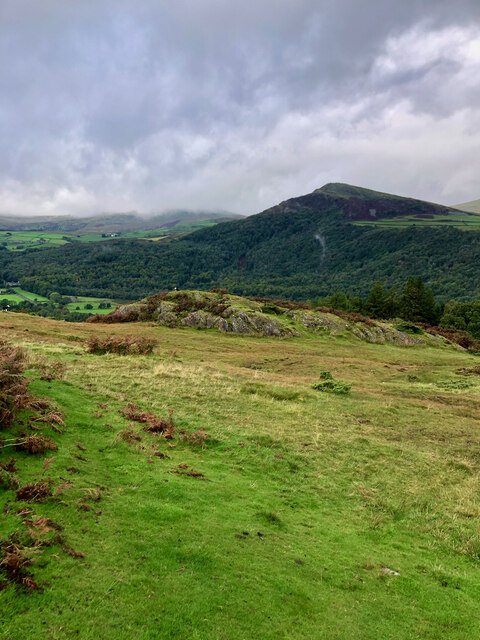
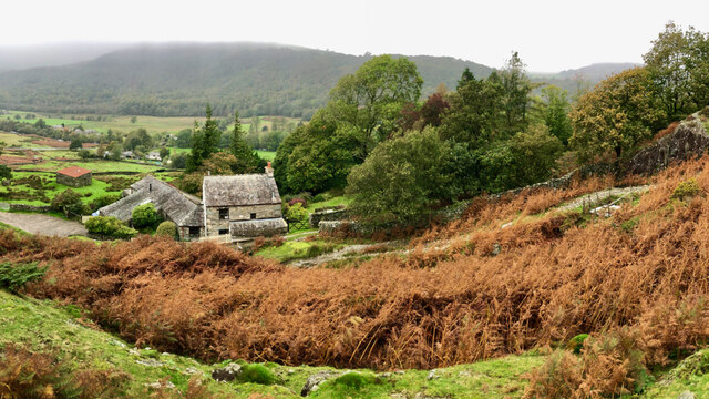
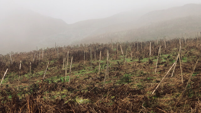
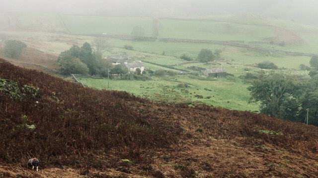
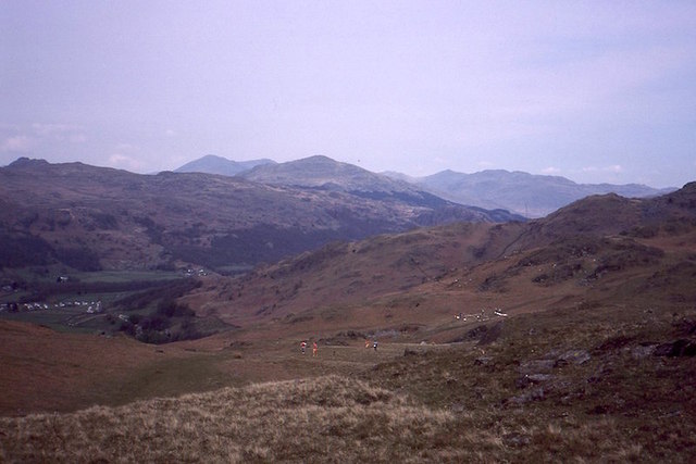
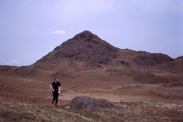
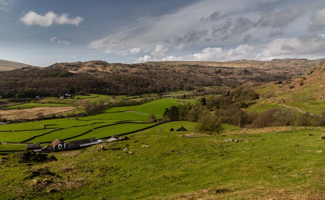
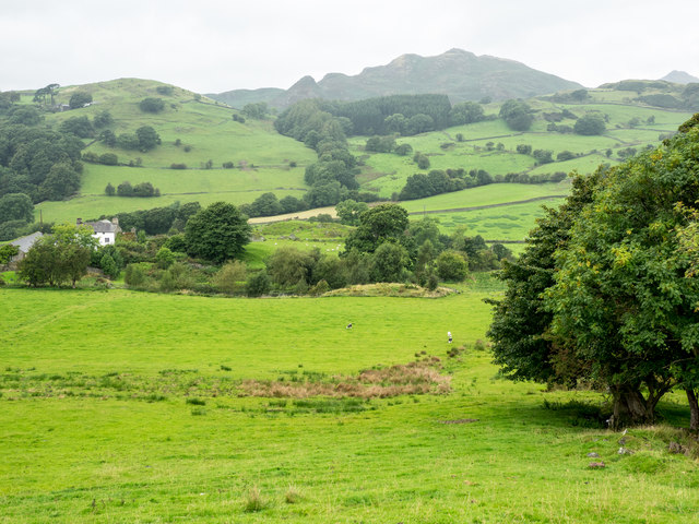
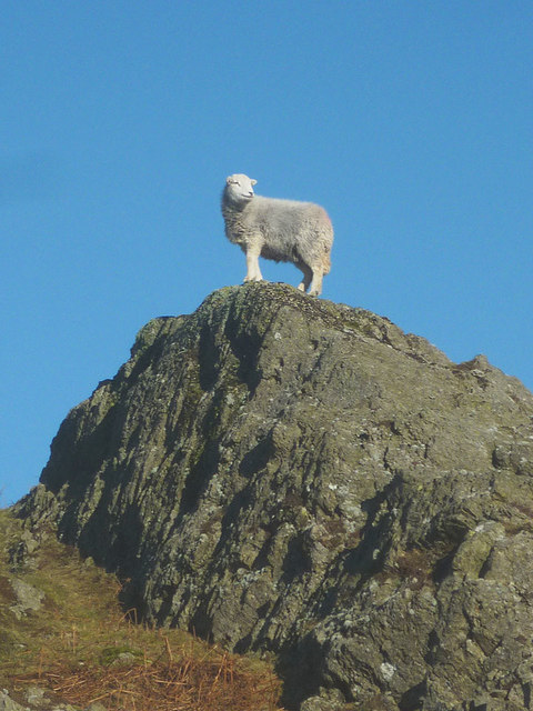
Brunt Fell is a prominent geographical feature located in the county of Lancashire, England. Situated within the picturesque landscape of the Lancashire Downs, this elevated area is characterized by its expansive moorland and rolling hills. Brunt Fell stands at an impressive height, providing breathtaking views of the surrounding countryside.

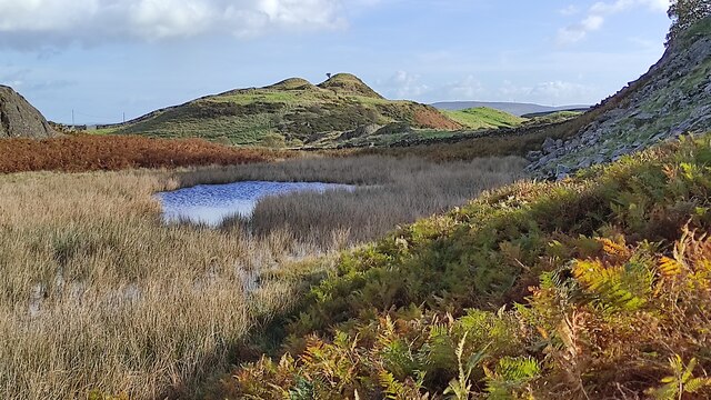
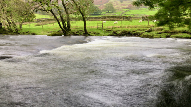
The moorland of Brunt Fell boasts a diverse array of flora and fauna, making it a haven for nature enthusiasts. The heather-covered terrain, interspersed with patches of grassland, creates a visually stunning landscape. This area is home to a variety of wildlife, including birds such as curlews, lapwings, and red grouse, as well as mammals like hares, foxes, and deer.

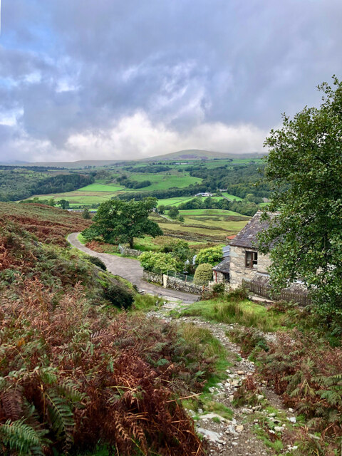
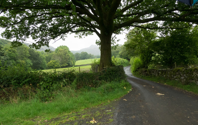
Visitors to Brunt Fell can partake in a range of outdoor activities, such as hiking, birdwatching, and photography. The network of footpaths and trails allows for exploration of the area's natural beauty, with winding paths leading to stunning viewpoints and hidden valleys.

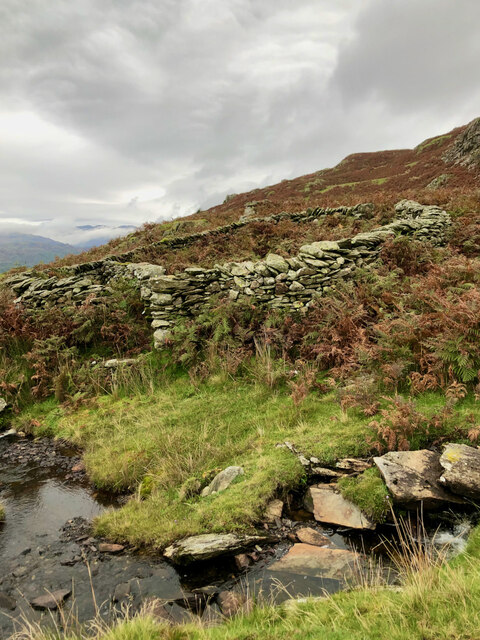
In addition to its natural attractions, Brunt Fell holds historical significance. The remains of ancient settlements and burial mounds can be found scattered across the moorland, offering glimpses into the area's past. These archaeological sites provide valuable insights into the lives of the people who once inhabited this rugged landscape.

Overall, Brunt Fell in Lancashire offers a captivating blend of natural beauty and historical intrigue. Its moorland and downs provide a tranquil escape for those seeking solace in nature, while also offering opportunities for exploration and discovery.

If you have any feedback on the listing, please let us know in the comments section below.

Brunt Fell Images

Images are sourced within 2km of 54.318597/-3.2098958 or Grid Reference SD2192. Thanks to Geograph Open Source API. All images are credited.

Dunnerdale Fells above Stonestar There is an old postcard of this scene called "Dunnerdale Fells". This is a recent picture of the same from the same location. Peaks include Cat's Crag and Raven's Crag, and what rock-climbers call Stonestar Crag.
This picture is a reverse view of <a href="https://www.geograph.org.uk/photo/7300826">SD1992 : Duddon Valley south of Ulpha</a>.
Dunnerdale Fells above Stonestar
There is an old postcard of this scene called "Dunnerdale Fells". This is a recent picture of the same from the same location. Peaks include Cat's Crag and Raven's Crag, and what rock-climbers call Stonestar Crag. This picture is a reverse view of SD1992 : Duddon Valley south of Ulpha.
On Dunnerdale Fells near Gowther Barrow I can't work out what these mounds are called. They might be part of Potherilt Hill or Gowther Barrow. They don't seem to be so distinctive when viewed from other angles.
On Dunnerdale Fells near Gowther Barrow
I can't work out what these mounds are called. They might be part of Potherilt Hill or Gowther Barrow. They don't seem to be so distinctive when viewed from other angles.
Washfold, Hollow Moss Beck A pen for holding sheep waiting to be washed. The following is quoted from the Lake District National Park HER see <span class="nowrap"><a title="https://www.heritagegateway.org.uk/Gateway/Results_Single.aspx?uid=2900443&resourceID=801" rel="nofollow ugc noopener" href="https://www.heritagegateway.org.uk/Gateway/Results_Single.aspx?uid=2900443&resourceID=801">Link</a><img style="margin-left:2px;" alt="External link" title="External link - shift click to open in new window" src="https://s1.geograph.org.uk/img/external.png" width="10" height="10"/></span>

"An unusual circular fold 8m diameter with an internal partition forming two chambers. An 11m long driving wall has been built along naturally rocky outcrops to assist driving sheep into the fold. The wash dub measures 3m by 4m and apart from being partially silted up all the features are intact and in excellent condition. There is a dry stone built launching platform just outside the gate and the beck is masonry lined on the bank nearest the fold to prevent undermining of the structure. The remains of a dry stone dam are substantially complete on both banks of the beck. The fold is in excellent condition, walls are intact to full height and cams in place, however approximately half of the driving wall is partially collapsed. The wash dub features are one of the best preserved in the Western valleys and are also in excellent condition."
Washfold, Hollow Moss Beck
A pen for holding sheep waiting to be washed. The following is quoted from the Lake District National Park HER see LinkExternal link "An unusual circular fold 8m diameter with an internal partition forming two chambers. An 11m long driving wall has been built along naturally rocky outcrops to assist driving sheep into the fold. The wash dub measures 3m by 4m and apart from being partially silted up all the features are intact and in excellent condition. There is a dry stone built launching platform just outside the gate and the beck is masonry lined on the bank nearest the fold to prevent undermining of the structure. The remains of a dry stone dam are substantially complete on both banks of the beck. The fold is in excellent condition, walls are intact to full height and cams in place, however approximately half of the driving wall is partially collapsed. The wash dub features are one of the best preserved in the Western valleys and are also in excellent condition."
Stickle Tarn
Stickle Tarn
Fellside above Birks
A far away view of Birks
Stepping stones across the River Duddon
A forest of stakes, no saplings, no tree guards, just stakes
Carter Ground
Carter Ground
Stainton Ground Slate Quarry For further info.: ‘Stainton Ground Slate Quarry’. Heritagegateway.org.uk <<span class="nowrap"><a title="https://www.heritagegateway.org.uk/Gateway/Results_Single.aspx?resourceID=801&uid=2888871" rel="nofollow ugc noopener" href="https://www.heritagegateway.org.uk/Gateway/Results_Single.aspx?resourceID=801&uid=2888871">Link</a><img style="margin-left:2px;" alt="External link" title="External link - shift click to open in new window" src="https://s1.geograph.org.uk/img/external.png" width="10" height="10"/></span> > [accessed 18 October 2023]
Stainton Ground Slate Quarry
For further info.: ‘Stainton Ground Slate Quarry’. Heritagegateway.org.uk <LinkExternal link > [accessed 18 October 2023]
Ordnance Survey Cut Mark This OS cut mark can be found on the north face of Holy Innocents Church. It marks a point 45.245m above mean sea level.
Ordnance Survey Cut Mark
This OS cut mark can be found on the north face of Holy Innocents Church. It marks a point 45.245m above mean sea level.
Orienteering, Dunnerdale Fells Looking back towards the start from a climb above Kiln Bank on Lakeland OC&amp;#039;s Stickle Pike map. I had already run and was walking up Stickle Pike.  The runners will have completed a loop north of the road before climbing to the southern part of the competition area here.
Orienteering, Dunnerdale Fells
Looking back towards the start from a climb above Kiln Bank on Lakeland OC's Stickle Pike map. I had already run and was walking up Stickle Pike. The runners will have completed a loop north of the road before climbing to the southern part of the competition area here.
Stickle Pike Taken during an orienteering event.  A small sharp summit of great character.
Stickle Pike
Taken during an orienteering event. A small sharp summit of great character.
Kiln Bank The Duddon Valley seen from Kiln Bank.
Kiln Bank
The Duddon Valley seen from Kiln Bank.
Minor road in Dunnerdale The road is heading north, passing close to the farm at Knott End
Minor road in Dunnerdale
The road is heading north, passing close to the farm at Knott End
Field descending from minor road in Dunnerdale The field descends towards the River Duddon with Great Stickle the hill in the distance.
Field descending from minor road in Dunnerdale
The field descends towards the River Duddon with Great Stickle the hill in the distance.
The queen of all she surveys A Herdwick ewe surveys her surroundings atop an outcrop above the Duddon Valley.
The queen of all she surveys
A Herdwick ewe surveys her surroundings atop an outcrop above the Duddon Valley.
Show me another place!

Brunt Fell is located at Grid Ref: SD2192 (Lat: 54.318597, Lng: -3.2098958)

Administrative County: Cumbria

District: South Lakeland

Police Authority: Cumbria

What 3 Words

///situation.twisty.stance. Near Millom, Cumbria

Related Wikis

Great Stickle

Great Stickle is a fell located in the southern Lake District of England with an altitude of 305 m (1,001 ft). Alfred Wainwright included it in the Stickle...

Dunnerdale Fells

Dunnerdale Fells is an upland area in the English Lake District, between Ulpha and Broughton Mills, Cumbria. It is the subject of a chapter of Wainwright...

Blacksmiths Arms, Broughton Mills

The Blacksmiths Arms is a Grade II listed public house at Broughton Mills, Cumbria, England.It is on the Campaign for Real Ale's National Inventory of...

Ulpha

Ulpha is a small village and civil parish in the Duddon Valley in the Lake District National Park in Cumbria, England. Historically in Cumberland, it forms...

Nearby Amenities

Located within 500m of 54.318597,-3.2098958
Ford: yes
Lat/Long: 54.3167649/-3.2109254
Archaeological Site: ring_cairn
Historic: archaeological_site
Lat/Long: 54.3216222/-3.214122
Archaeological Site: tumulus
Historic: archaeological_site
Lat/Long: 54.3218506/-3.2149052
Tarn Hill
Ele: 313
Natural: peak
Lat/Long: 54.3185333/-3.2165286
Brunt Fell
Place: locality
Lat/Long: 54.3186132/-3.2108694
Brunt Fell
Place: locality
Lat/Long: 54.3154535/-3.2075119
Hare Hall
Place: locality
Lat/Long: 54.3191473/-3.2060959
Ford: yes
Lat/Long: 54.3180393/-3.2072939
Ford: yes
Lat/Long: 54.322628/-3.2115459
Power: pole
Lat/Long: 54.3212461/-3.2036607
Power: pole
Lat/Long: 54.3205518/-3.2038846
Power: pole
Lat/Long: 54.3194855/-3.2042728
Power: pole
Lat/Long: 54.3184464/-3.2046481
Power: pole
Lat/Long: 54.3181674/-3.2039893
The data included in this document is from www.openstreetmap.org. The data is made available under ODbL.

Have you been to Brunt Fell?

Leave your review of Brunt Fell below (or comments, questions and feedback).