Hill of Whitefield

Hill, Mountain in Caithness

Scotland

Hill of Whitefield

Thurdistoft A farm behind the dunes at Dunnet Bay.
Thurdistoft Credit: Bill Boaden

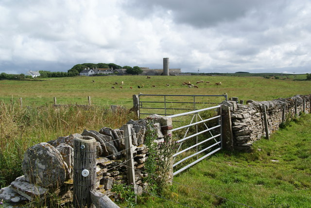
Hill of Whitefield is a prominent landmark located in the county of Caithness, in the northernmost part of Scotland. Rising to an elevation of approximately 200 meters (656 feet), it is considered a relatively small hill by geological standards. However, its strategic position and distinctive appearance make it a notable feature in the surrounding landscape.

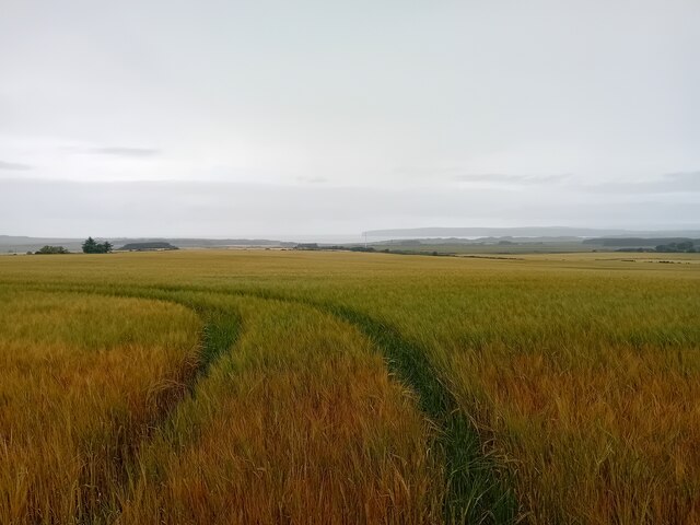
Situated about 7 kilometers (4.3 miles) southeast of the town of Thurso, Hill of Whitefield is characterized by its gently sloping sides and a relatively flat summit. Its formation is largely composed of sedimentary rocks, typical of this region, which were deposited millions of years ago during the Devonian period. This geological composition gives the hill a unique reddish hue, adding to its visual appeal.

From the summit of Hill of Whitefield, visitors are rewarded with breathtaking panoramic views of the surrounding countryside. On a clear day, the vista stretches out across the rolling hills, fertile farmland, and distant mountains. The hill is also home to a diverse array of flora and fauna, making it an attractive destination for nature enthusiasts and birdwatchers.

In addition to its natural beauty, Hill of Whitefield holds historical significance. It is believed that the hill was used as a vantage point during ancient times, providing a strategic lookout over the surrounding area. Today, it remains a popular spot for hiking and walking, with well-marked trails leading to the summit.

Overall, Hill of Whitefield is a picturesque and historically rich hill in Caithness, offering visitors a chance to immerse themselves in the natural beauty and cultural heritage of the region.

If you have any feedback on the listing, please let us know in the comments section below.

Hill of Whitefield Images

Images are sourced within 2km of 58.5745/-3.3791161 or Grid Reference ND1965. Thanks to Geograph Open Source API. All images are credited.

Thurdistoft A farm behind the dunes at Dunnet Bay.
Thurdistoft
A farm behind the dunes at Dunnet Bay.
Olrig Free Church of Scotland, Castletown Olrig is the name of the parish and the word is of Norwegian origin, and may be interpreted as “the son of Erick”. 
For the parish church which is on the other side of Main Street see <a title="https://www.geograph.org.uk/photo/2715492" href="https://www.geograph.org.uk/photo/2715492">Link</a> .
Olrig Free Church of Scotland, Castletown
Olrig is the name of the parish and the word is of Norwegian origin, and may be interpreted as “the son of Erick”. For the parish church which is on the other side of Main Street see Link .
Royal Bank of Scotland, Main Street, Castletown A notice says that it is open on Mondays and Fridays between 10am and 12.30pm.
Royal Bank of Scotland, Main Street, Castletown
A notice says that it is open on Mondays and Fridays between 10am and 12.30pm.
Farmland south-east of the Hill of Olrig
The old graveyard of St Trothan's church, Olrig The remains of the church are behind.
The old graveyard of St Trothan's church, Olrig
The remains of the church are behind.
Olrig Cemetery There are now three (large) sections to this cemetery. This is the most recent, but is already well used. I was impressed by the relative uniformity of the tombstones - a bit of a contrast to the oldest section, seen in <a href="https://www.geograph.org.uk/photo/4554862">ND1867 : The old graveyard of St Trothan's church, Olrig</a>! I don't know whether this is a result of some church ordnance, or just the way in which people feel these days.
Olrig Cemetery
There are now three (large) sections to this cemetery. This is the most recent, but is already well used. I was impressed by the relative uniformity of the tombstones - a bit of a contrast to the oldest section, seen in ND1867 : The old graveyard of St Trothan's church, Olrig! I don't know whether this is a result of some church ordnance, or just the way in which people feel these days.
The drive to Olrig House The sign reads "Olrig House. Drive to house only", with the last word underlined.
The drive to Olrig House
The sign reads "Olrig House. Drive to house only", with the last word underlined.
Road (B876) at Lochside Looking northward.
Road (B876) at Lochside
Looking northward.
Minor road near to Thurdistoft Looking north-eastward.
Minor road near to Thurdistoft
Looking north-eastward.
Ordnance Survey Cut Mark This mark can be fond on a stone post in a roadside wall at Lochside.
The recorded details give a height of 42.4556 metres above sea level,
For more detail see :<span class="nowrap"><a title="https://www.bench-marks.org.uk/bm179454" rel="nofollow ugc noopener" href="https://www.bench-marks.org.uk/bm179454">Link</a><img style="margin-left:2px;" alt="External link" title="External link - shift click to open in new window" src="https://s1.geograph.org.uk/img/external.png" width="10" height="10"/></span>
Ordnance Survey Cut Mark
This mark can be fond on a stone post in a roadside wall at Lochside. The recorded details give a height of 42.4556 metres above sea level, For more detail see :LinkExternal link
The vale of Burn of Durran
Crop Field Near Lochside.
Crop Field
Near Lochside.
Crop Field Nice colours on a rainy afternoon.
Crop Field
Nice colours on a rainy afternoon.
Millhill Bridge A view looking east along the B876 towards Millhill Bridge over the Burn of Garth.
Millhill Bridge
A view looking east along the B876 towards Millhill Bridge over the Burn of Garth.
Road for Greenland
Road for Greenland
Disused Castletown airfield A view looking to the southeast over the grazing land on the site of the former Castletown airfield.
Disused Castletown airfield
A view looking to the southeast over the grazing land on the site of the former Castletown airfield.
Farmland at Tain Tain is a district of small farms inland from Dunnet Bay.
Farmland at Tain
Tain is a district of small farms inland from Dunnet Bay.
Loch of Durran This marshy basin still holds pools of water and it floods in winter. It formerly held the Loch of Durran which was drained in the 19th century.
Loch of Durran
This marshy basin still holds pools of water and it floods in winter. It formerly held the Loch of Durran which was drained in the 19th century.
Show me another place!

Hill of Whitefield is located at Grid Ref: ND1965 (Lat: 58.5745, Lng: -3.3791161)

Unitary Authority: Highland

Police Authority: Highlands and Islands

What 3 Words

///swerving.detriment.roughness. Near Thurso, Highland

Related Wikis

Castletown, Highland

Castletown (Scottish Gaelic: Baile a' Chaisteil) is a village on the north coast of the Highland council area of Scotland, situated near Dunnet Bay. It...

RAF Castletown

Royal Air Force Castletown or more simply RAF Castletown, is a former Royal Air Force station that operated during the Second World War. Built near to...

Olrig

Olrig is a parish in Caithness, Scotland. The main settlement in the parish is Castletown. Prior to the 19th century, the parish was sub-divided into...

Murkle

Murkle (Murchill) is a small scattered hamlet, made up of East Murkle and West Murkle located one mile (1.6 km) east of Thurso, in Caithness, Scottish...

Have you been to Hill of Whitefield?

Leave your review of Hill of Whitefield below (or comments, questions and feedback).