Buckland Hill

Hill, Mountain in Somerset Somerset West and Taunton

England

Buckland Hill

Pitminster : Lowton Road Lowton Road off Blackdown Hill.
Pitminster : Lowton Road Credit: Lewis Clarke

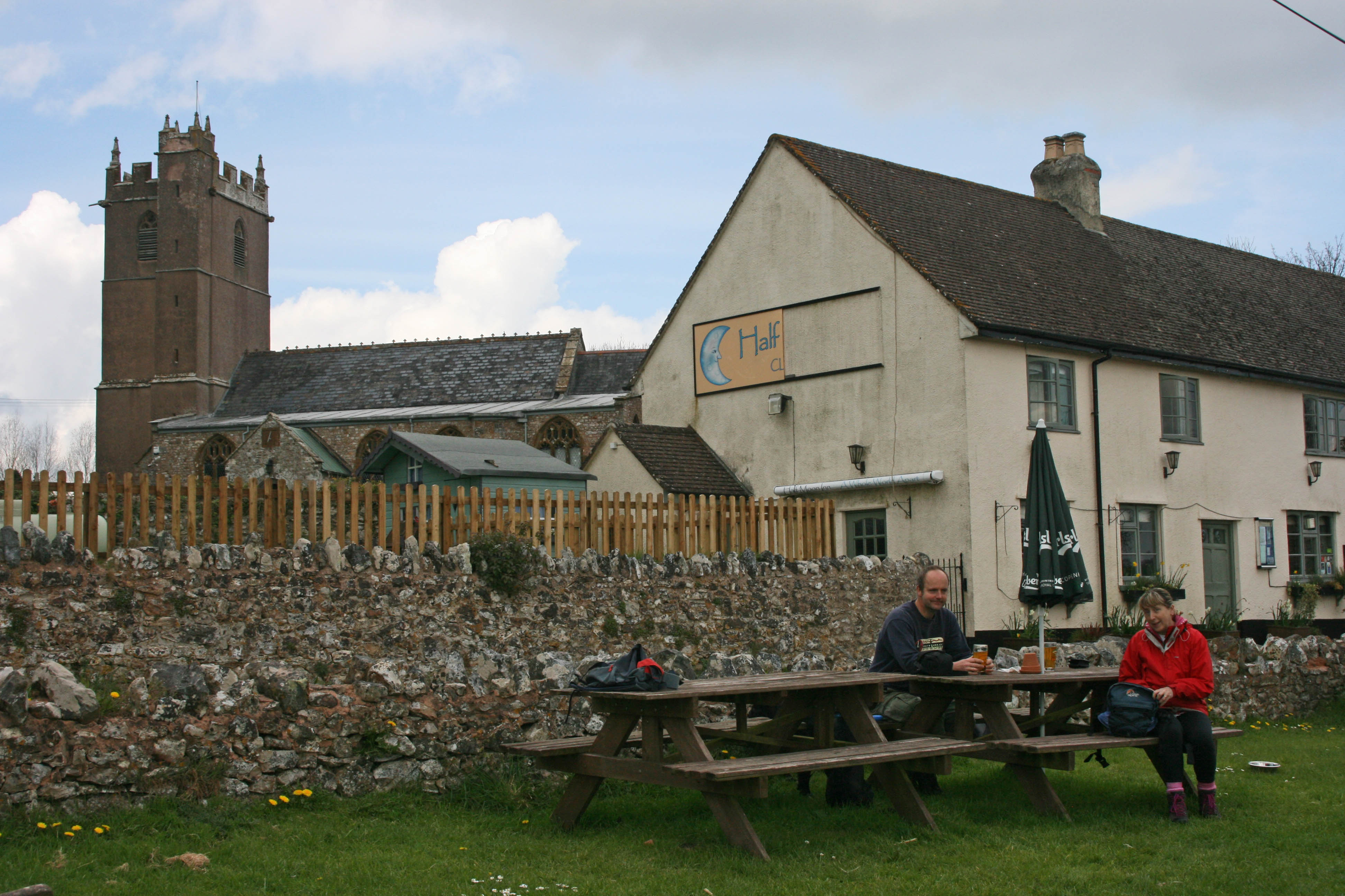
Buckland Hill is a prominent landmark located in Somerset, England. Standing at approximately 105 meters above sea level, it is classified as a hill rather than a mountain. It is situated near the village of Buckland St Mary, about 12 miles southwest of the county town of Taunton.

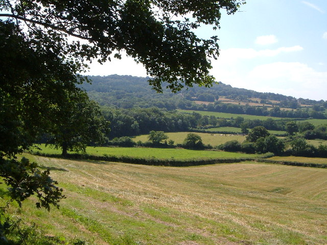
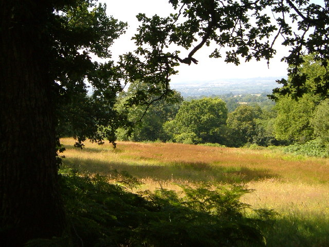
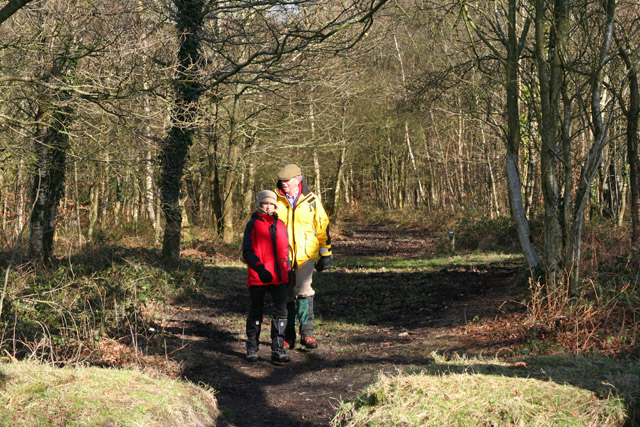
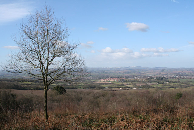
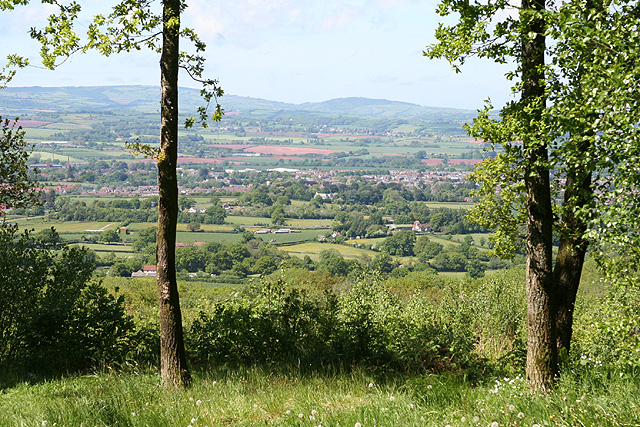
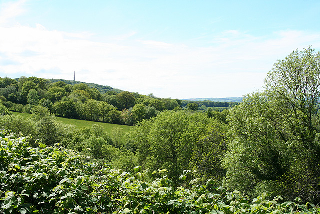
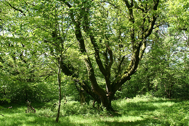
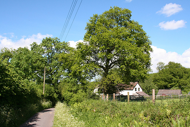
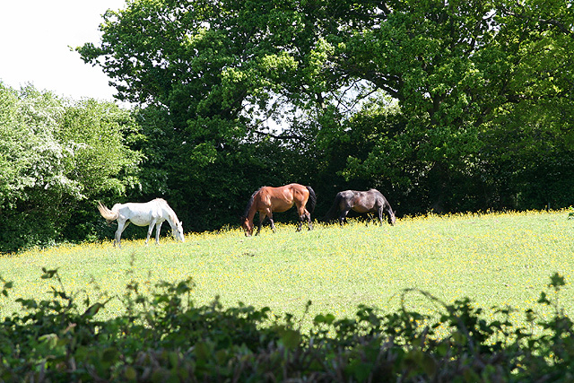
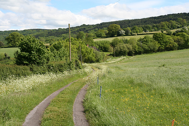
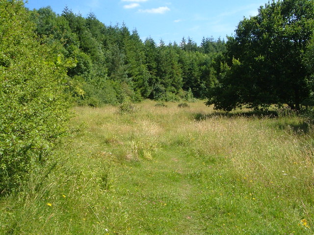
The hill is made up of limestone, a characteristic feature of the region, and offers picturesque views of the surrounding countryside. It is covered in lush green vegetation, with patches of trees and shrubs dotting its slopes. The terrain is relatively gentle, making it accessible to visitors who wish to explore its beauty on foot.

Buckland Hill has historical significance as it is believed to have been used as a defensive position during various conflicts throughout history. The remnants of ancient fortifications, including earthworks and ditches, can still be seen today.

The hill is a haven for wildlife enthusiasts, as it provides a habitat for a diverse range of flora and fauna. It is home to several species of birds, mammals, and insects, making it an ideal spot for birdwatching and nature walks.

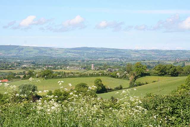
Visitors to Buckland Hill can enjoy stunning panoramic views from the summit, which stretches as far as the eye can see. On a clear day, one can see the rolling hills, picturesque villages, and even the distant coastline.

Overall, Buckland Hill offers a tranquil and scenic environment, providing a perfect escape for those seeking a connection with nature and a glimpse into the historical past of Somerset.

If you have any feedback on the listing, please let us know in the comments section below.

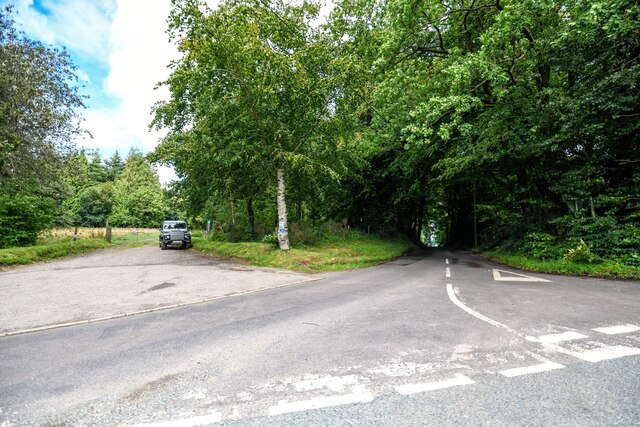
Buckland Hill Images

Images are sourced within 2km of 50.950725/-3.1867963 or Grid Reference ST1617. Thanks to Geograph Open Source API. All images are credited.

Pitminster : Lowton Road Lowton Road off Blackdown Hill.
Pitminster : Lowton Road
Lowton Road off Blackdown Hill.
Farmland SE of Ruggin Looking WSW across the northern slopes of the Blackdown Hills, with Buckland Wood and Hill behind
Farmland SE of Ruggin
Looking WSW across the northern slopes of the Blackdown Hills, with Buckland Wood and Hill behind
Woodland meadow near Farm Wood Bungalow Here the lower north-facing slopes of the Blackdown Hills form a patchwork of woods (here oak) and fields. Looking northwards, with a view across the Vale of Taunton Deane in the background.
Woodland meadow near Farm Wood Bungalow
Here the lower north-facing slopes of the Blackdown Hills form a patchwork of woods (here oak) and fields. Looking northwards, with a view across the Vale of Taunton Deane in the background.
Wellington Without: Quarts Moor A couple walking near the National Trust car park: the estate here is National Trust property. Looking east from the edge of the car park
Wellington Without: Quarts Moor
A couple walking near the National Trust car park: the estate here is National Trust property. Looking east from the edge of the car park
Wellington Without: north from Quarts Moor Quarts Moor is a National Trust estate to the east of the Wellington Monument. Looking north towards the town of Wellington
Wellington Without: north from Quarts Moor
Quarts Moor is a National Trust estate to the east of the Wellington Monument. Looking north towards the town of Wellington
Hemyock: the entrance to Wallace’s Farm shop and restaurant opposite Quarts Moor. On the top of the Blackdown Hills. See <span class="nowrap"><a title="http://www.welcometowallaces.co.uk/index.php3?UID=" rel="nofollow ugc noopener" href="http://www.welcometowallaces.co.uk/index.php3?UID=">Link</a><img style="margin-left:2px;" alt="External link" title="External link - shift click to open in new window" src="https://s1.geograph.org.uk/img/external.png" width="10" height="10"/></span>
Hemyock: the entrance to Wallace’s
Farm shop and restaurant opposite Quarts Moor. On the top of the Blackdown Hills. See LinkExternal link
Clayhidon: near Barpark Corner Looking south east across a side valley of the river Culm. On the Blackdown Hills
Clayhidon: near Barpark Corner
Looking south east across a side valley of the river Culm. On the Blackdown Hills
Clayhidon: St Andrew’s church
West Buckland: Gerbestone Manor A house for hire, offering facilities for well-heeled groups of up to two dozen. The present building dates from circa 1612; there was a manor here in the 13th century. Looking south west. For further details see <span class="nowrap"><a title="http://www.gerbestonemanor.com/" rel="nofollow ugc noopener" href="http://www.gerbestonemanor.com/">Link</a><img style="margin-left:2px;" alt="External link" title="External link - shift click to open in new window" src="https://s1.geograph.org.uk/img/external.png" width="10" height="10"/></span>
West Buckland: Gerbestone Manor
A house for hire, offering facilities for well-heeled groups of up to two dozen. The present building dates from circa 1612; there was a manor here in the 13th century. Looking south west. For further details see LinkExternal link
West Buckland: towards Gortnell Common A view towards the Blackdown Hills. Looking south east from the road at the top of Ford Street
West Buckland: towards Gortnell Common
A view towards the Blackdown Hills. Looking south east from the road at the top of Ford Street
Wellington: view from Quarts Moor Looking north-north-west to the town from the National Trust car park at Quarts Moor. The chimneys of the woollen factory at Tonedale can be seen on the left
Wellington: view from Quarts Moor
Looking north-north-west to the town from the National Trust car park at Quarts Moor. The chimneys of the woollen factory at Tonedale can be seen on the left
Wellington: near White Barn Looking west-south-west to the Wellington Monument by the entrance to White Barn on the road from Ford Street. The wood in mid distance is on Quarts Moor, partly owned by the National Trust
Wellington: near White Barn
Looking west-south-west to the Wellington Monument by the entrance to White Barn on the road from Ford Street. The wood in mid distance is on Quarts Moor, partly owned by the National Trust
Wellington: on Quarts Moor Woodland owned by the National Trust. Looking north
Wellington: on Quarts Moor
Woodland owned by the National Trust. Looking north
West Buckland: nearing Bridge Cottage Looking north east on the lane to Blackmoor from Ford Street
West Buckland: nearing Bridge Cottage
Looking north east on the lane to Blackmoor from Ford Street
West Buckland: Blackmoor Looking north-north-east towards West Buckland church from a point near Crosses Farm
West Buckland: Blackmoor
Looking north-north-east towards West Buckland church from a point near Crosses Farm
West Buckland: three horses grazing Looking south-south-east from a lane near Crosses Farm
West Buckland: three horses grazing
Looking south-south-east from a lane near Crosses Farm
West Buckland: track to Perry Meade The track also serves as a public footpath to Ruggin. The thatched roof of Perry Meade is just visible beyond trees. Looking south-south-east on the edge of the Blackdown Hills
West Buckland: track to Perry Meade
The track also serves as a public footpath to Ruggin. The thatched roof of Perry Meade is just visible beyond trees. Looking south-south-east on the edge of the Blackdown Hills
West Buckland: on Buckland Hill Looking south west near Trees Farm
West Buckland: on Buckland Hill
Looking south west near Trees Farm
Show me another place!

Buckland Hill is located at Grid Ref: ST1617 (Lat: 50.950725, Lng: -3.1867963)

Administrative County: Somerset

District: Somerset West and Taunton

Police Authority: Avon and Somerset

What 3 Words

///wound.duties.ruin. Near Hemyock, Devon

Related Wikis

Quants Reserve

Quants Reserve is a nature reserve north west of Burnworthy in Somerset, England. It consists of a grassland clearing in a forestry plantation. It is well...

Clayhidon

Clayhidon () is a village and civil parish in Mid Devon, England. The parish church is St. Andrews. The parish is in the Blackdown Hills and its northern...
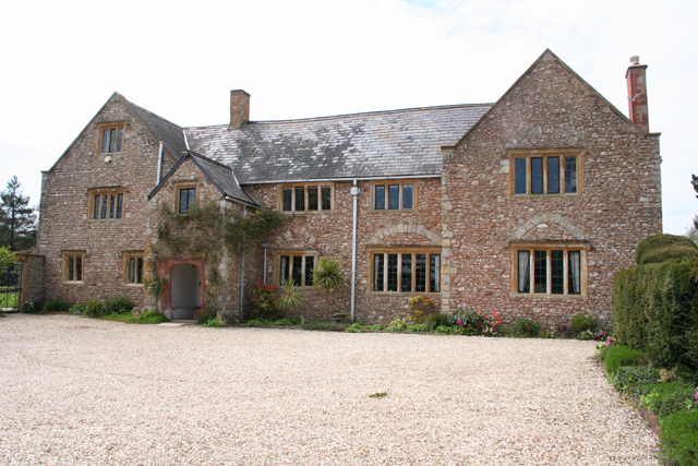
Gerbestone Manor

Gerbestone Manor in West Buckland, Somerset, England was largely rebuilt in the late 16th century, although some fabric from the 13th century house remains...

Ringdown SSSI, Somerset

Ringdown (grid reference ST178155) is a 4.0 hectare (9.9 acre) biological Site of Special Scientific Interest west of Burnworthy in the Blackdown Hills...

South West England

South West England, or the South West of England, is one of the nine official regions of England in the United Kingdom. It consists of the counties of...

Wellington Rural District, Somerset

Wellington was a rural district in Somerset, England, from 1894 to 1974. It was created in 1894 under the Local Government Act 1894. In 1974 it was abolished...

Wellington Without

Wellington Without is a civil parish in Somerset, England. It lies south of Wellington and has a population of 727. The parish includes the hamlet of Ford...

Leigh Reservoir

Leigh Reservoir, or Leigh Hill Reservoir, is a small reservoir in Somerset, England. It was built in 1893 to supply water to the town of Taunton, Somerset...

Nearby Amenities

Located within 500m of 50.950725,-3.1867963
Hunters Lodge Farm
Place: locality
Lat/Long: 50.9474377/-3.1904338
The data included in this document is from www.openstreetmap.org. The data is made available under ODbL.

Have you been to Buckland Hill?

Leave your review of Buckland Hill below (or comments, questions and feedback).