Green Law

Hill, Mountain in Midlothian

Scotland

Green Law

Stile on Scroggy Hill The Pentland Way is a 32 km long-distance path along the length of the Pentland Hills, established in 2015. The section from Nine Mile Burn to West Kip follows a relatively new path up Monk's Rigg (seen here) which does not appear as yet on OS maps.
Stile on Scroggy Hill Credit: Oliver Dixon

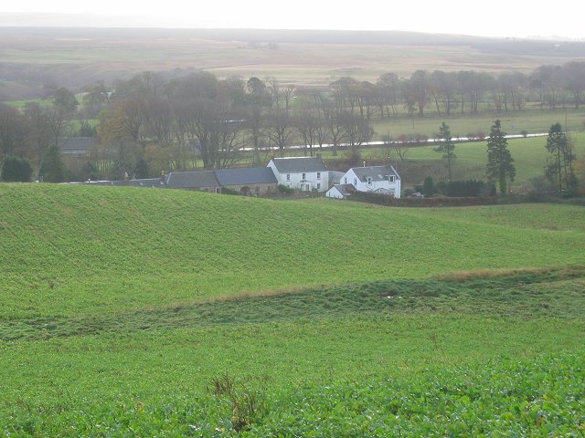
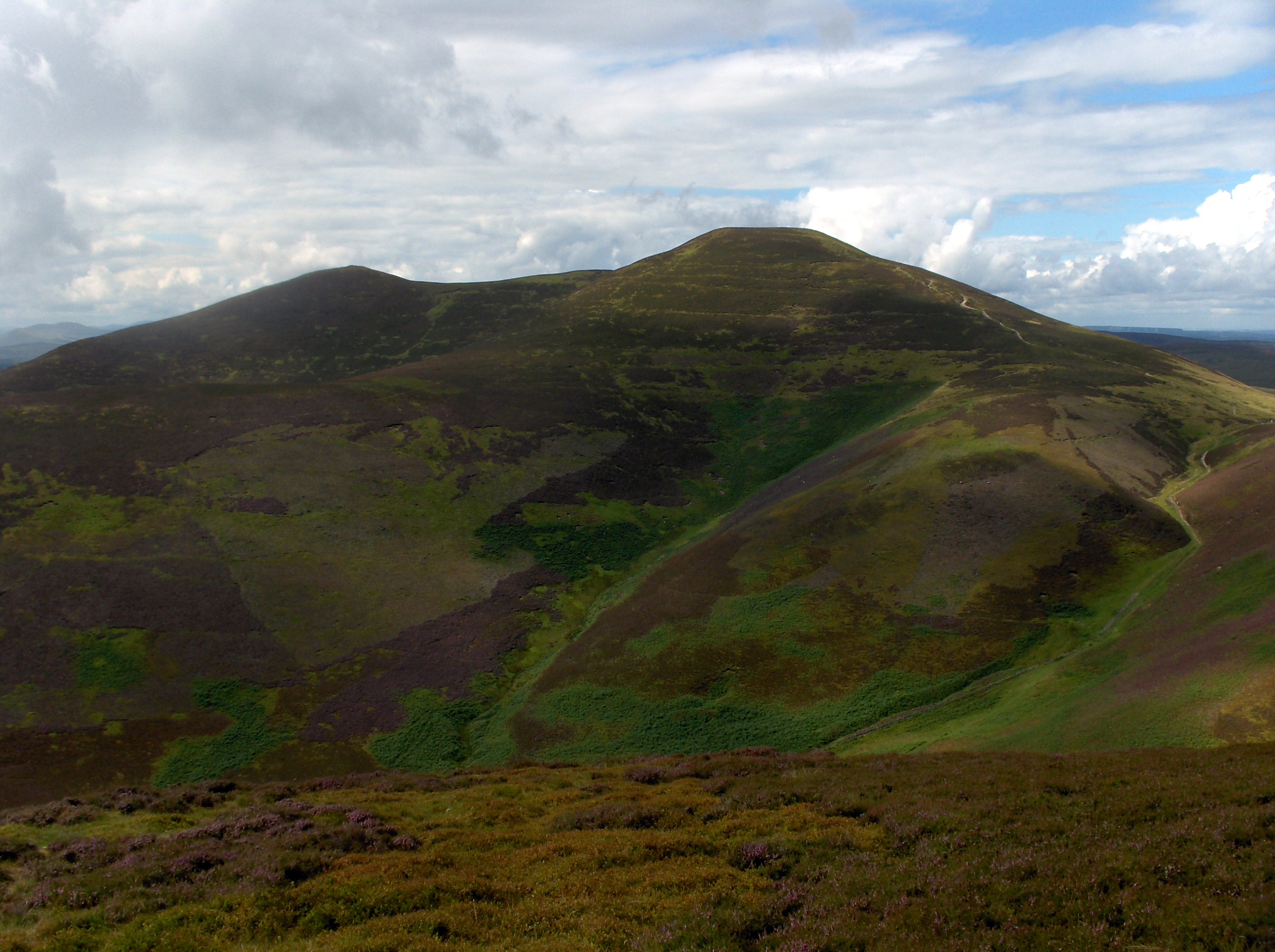
Green Law is a prominent hill located in Midlothian, Scotland. Rising to an elevation of approximately 571 meters (1,873 feet), it is considered one of the notable peaks in the area. Situated in the Pentland Hills, Green Law offers breathtaking views of the surrounding countryside and serves as a popular destination for hikers, walkers, and nature enthusiasts.

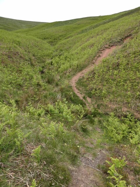
The hill is known for its distinctive green landscape, adorned with lush vegetation, particularly during the summer months. Its slopes are covered with a variety of grasses, heather, and wildflowers, creating a picturesque scene. As visitors ascend the hill, they can witness a gradual change in the vegetation, with hardy plants and shrubs becoming more prevalent.

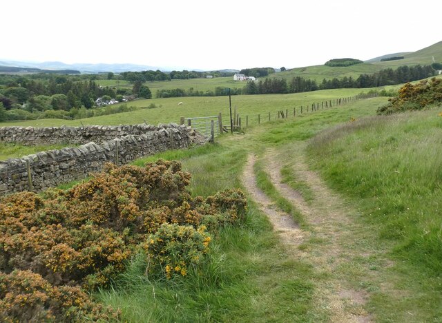
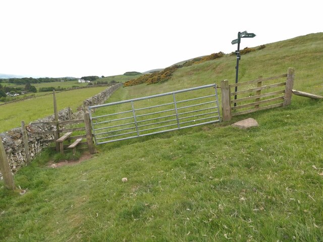
Green Law is easily accessible, with several well-marked trails leading to its summit. The most common route starts from the Flotterstone Information Centre, where ample parking and facilities are available. From there, the path winds through scenic valleys, past tranquil reservoirs, and gradually ascends towards the summit.

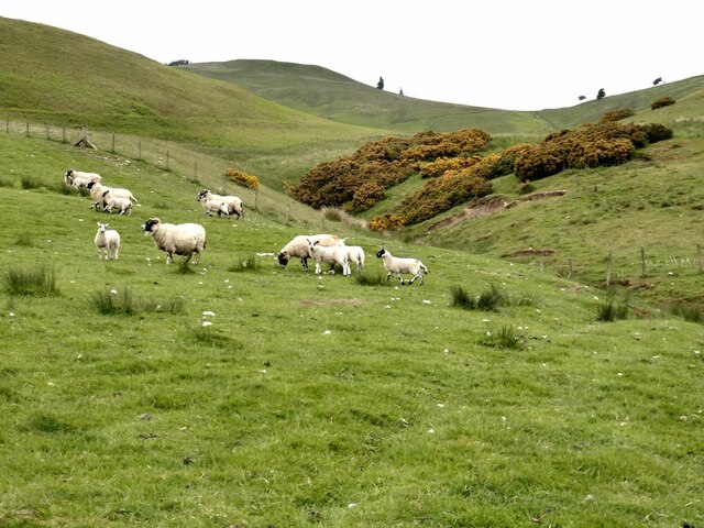
Reaching the top of Green Law rewards visitors with panoramic views stretching across the Pentland Hills and beyond. On a clear day, it is possible to see as far as Edinburgh and the Firth of Forth. The hill also boasts an abundance of wildlife, including various bird species, hares, and occasionally deer.

Green Law is a cherished natural landmark in Midlothian, attracting outdoor enthusiasts and nature lovers from near and far. Its tranquil ambiance, diverse flora, and stunning vistas make it an ideal destination for those seeking a peaceful escape into the Scottish countryside.

If you have any feedback on the listing, please let us know in the comments section below.

Green Law Images

Images are sourced within 2km of 55.821676/-3.3306058 or Grid Reference NT1659. Thanks to Geograph Open Source API. All images are credited.

Stile on Scroggy Hill The Pentland Way is a 32 km long-distance path along the length of the Pentland Hills, established in 2015. The section from Nine Mile Burn to West Kip follows a relatively new path up Monk's Rigg (seen here) which does not appear as yet on OS maps.
Stile on Scroggy Hill
The Pentland Way is a 32 km long-distance path along the length of the Pentland Hills, established in 2015. The section from Nine Mile Burn to West Kip follows a relatively new path up Monk's Rigg (seen here) which does not appear as yet on OS maps.
Stile on the Pentland Way Looking across the valley of the Monk's Burn.
Stile on the Pentland Way
Looking across the valley of the Monk's Burn.
Track above Nine Mile Burn
Gate on track above Nine Mile Burn The signpost points to alternative routes up to the summit of West Kip - Monk's Rigg (to the right) and Braid Law (towards the camera).
Gate on track above Nine Mile Burn
The signpost points to alternative routes up to the summit of West Kip - Monk's Rigg (to the right) and Braid Law (towards the camera).
Wool gathering On a fence above Walstone Farm.
Wool gathering
On a fence above Walstone Farm.
Sheep in the valley of the Walstone Burn Cap Law on the skyline.
Sheep in the valley of the Walstone Burn
Cap Law on the skyline.
Path in the valley  of the Quarrel Burn Heading up Braid Law.
Path in the valley of the Quarrel Burn
Heading up Braid Law.
Path across the Quarrel Burn Quarrel Burn Reservoir in the background.
Path across the Quarrel Burn
Quarrel Burn Reservoir in the background.
North Esk Reservoir Built to ensure a water flow in the North Esk to power the paper mills.  Now the mills have gone, the water has been drawn down to a level needing less dam maintenance and the loch is managed as a nature reserve.
North Esk Reservoir
Built to ensure a water flow in the North Esk to power the paper mills. Now the mills have gone, the water has been drawn down to a level needing less dam maintenance and the loch is managed as a nature reserve.
Path beside North Esk Reservoir
North Esk Reservoir Built to ensure a water flow in the North Esk to power the paper mills.  Now the mills have gone, the water has been drawn down to a level needing less dam maintenance and the loch is managed as a nature reserve.
North Esk Reservoir
Built to ensure a water flow in the North Esk to power the paper mills. Now the mills have gone, the water has been drawn down to a level needing less dam maintenance and the loch is managed as a nature reserve.
Spittal Hill View from the North Esk Reservoir.
Spittal Hill
View from the North Esk Reservoir.
Path beside North Esk Reservoir Heading for the Boar Stane.
Path beside North Esk Reservoir
Heading for the Boar Stane.
North Esk Reservoir The surrounding hillsides have been partly covered in new plantations and there are some game crops. The reservoir ensured a water flow in the North Esk to power the paper mills.  Now the mills have gone, the water has been drawn down to a level needing less dam maintenance and the loch is managed as a nature reserve.
North Esk Reservoir
The surrounding hillsides have been partly covered in new plantations and there are some game crops. The reservoir ensured a water flow in the North Esk to power the paper mills. Now the mills have gone, the water has been drawn down to a level needing less dam maintenance and the loch is managed as a nature reserve.
One man and his mutt View looking down the side Cap Law to a reservoir.  The shadows are me and my dog!
One man and his mutt
View looking down the side Cap Law to a reservoir. The shadows are me and my dog!
Farmland near Nine Mile Burn Barns near Walstone Steading seen from the path to Monks Rig. Traprain Law is on the horizon above centre.
Farmland near Nine Mile Burn
Barns near Walstone Steading seen from the path to Monks Rig. Traprain Law is on the horizon above centre.
Looking south from Monks Rig A view to the grassland on the lower slopes of this Pentlands ridge from the path up Monks Rig.
Looking south from Monks Rig
A view to the grassland on the lower slopes of this Pentlands ridge from the path up Monks Rig.
Monks Burn, Pentland Hills An old sheepfold near the head of this burn below Monks Rig.
Monks Burn, Pentland Hills
An old sheepfold near the head of this burn below Monks Rig.
Show me another place!

Green Law is located at Grid Ref: NT1659 (Lat: 55.821676, Lng: -3.3306058)

Unitary Authority: Midlothian

Police Authority: The Lothians and Scottish Borders

What 3 Words

///headers.contoured.twinkling. Near Penicuik, Midlothian

Nearby Locations

Green Law

Related Wikis

Nine Mile Burn

Nine Mile Burn is a hamlet in Midlothian, Scotland, the last in Midlothian when heading south on the A702 road. It is located at the foot of the Pentland...

Eight Mile Burn

Eight Mile Burn is a small settlement in Midlothian, South East Scotland, at the base of Pentland Hills Regional Park. It is approximately 11 miles from...

South Black Hill

South Black Hill is a hill in the Pentland Hills range of Scotland. It is located in the west of Midlothian on the east flank of the approximately 25 km...

Scald Law

Scald Law is a hill in Midlothian, Scotland. At 579 metres (1,900 ft) it is the highest of the Pentland Hills. The hill is composed of Devonian volcanic...

Nearby Amenities

Located within 500m of 55.821676,-3.3306058
Green Law
Ele: 526
Natural: peak
Wikidata: Q19284351
Lat/Long: 55.8216163/-3.330898
The data included in this document is from www.openstreetmap.org. The data is made available under ODbL.

Have you been to Green Law?

Leave your review of Green Law below (or comments, questions and feedback).