Crossall Hill
Hill, Mountain in West Lothian
Scotland
Crossall Hill

Crossall Hill is a prominent hill located in West Lothian, Scotland. It sits approximately 6 miles northeast of Bathgate and 4 miles southeast of Linlithgow. Standing at an elevation of 393 meters (1,289 feet), it is considered a significant landmark in the region.
The hill is known for its distinctive shape and is easily recognizable due to its rounded summit and steep slopes. It is mainly composed of sedimentary rocks, including sandstone and shale, which are characteristic of the local geology.
Crossall Hill offers stunning panoramic views of the surrounding countryside, making it a popular destination for hikers and nature enthusiasts. On clear days, visitors can enjoy vistas that stretch across West Lothian and neighboring counties, taking in the beauty of the rolling hills, farmland, and woodlands.
The hill is also home to a diverse range of flora and fauna. The lower slopes are covered in grasses and heather, while the higher areas support a variety of moorland plants. Wildlife species such as red grouse, kestrels, and skylarks can often be spotted in the area.
Crossall Hill has historical significance as well. It is believed to have been used as a burial site during the Bronze Age, with several ancient cairns and burial mounds found on its slopes.
Overall, Crossall Hill offers a blend of natural beauty, recreational opportunities, and historical interest, making it an attractive destination for both locals and tourists alike.
If you have any feedback on the listing, please let us know in the comments section below.
Crossall Hill Images
Images are sourced within 2km of 55.986253/-3.3656038 or Grid Reference NT1477. Thanks to Geograph Open Source API. All images are credited.


Crossall Hill is located at Grid Ref: NT1477 (Lat: 55.986253, Lng: -3.3656038)
Unitary Authority: City of Edinburgh
Police Authority: Edinburgh
What 3 Words
///casino.brave.class. Near Queensferry, Edinburgh
Nearby Locations
Related Wikis
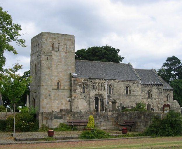
Dalmeny
Dalmeny () is a village and civil parish in Scotland. It is located on the south side of the Firth of Forth, 1 mile (1.6 km) southeast of South Queensferry...
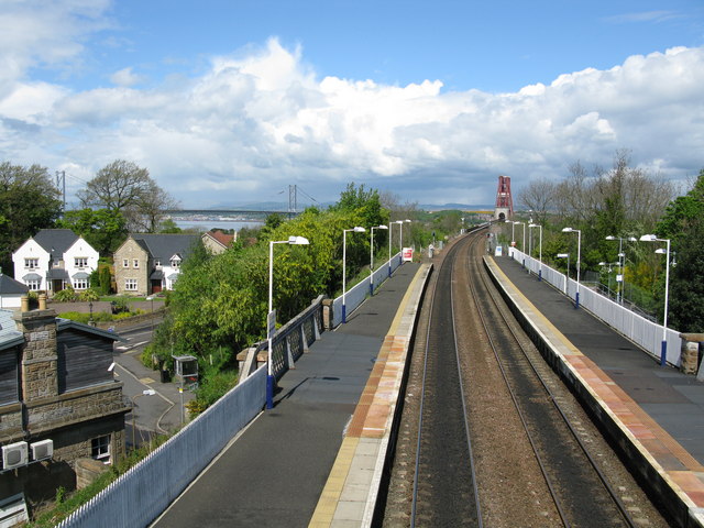
Dalmeny railway station
Dalmeny railway station is a railway station serving the towns of Dalmeny and South Queensferry, about 8 miles (13 km) west of Edinburgh city centre. It...
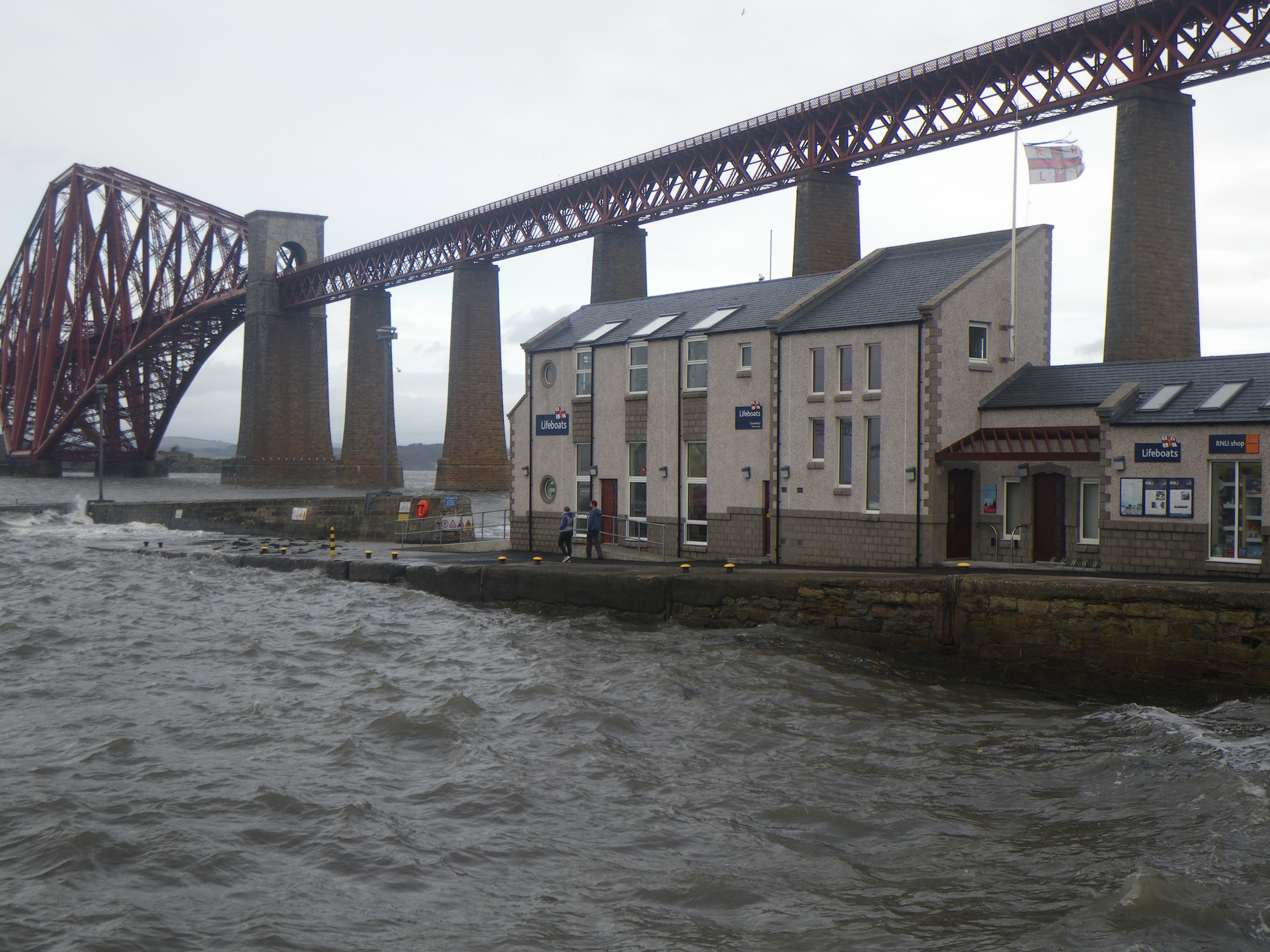
Queensferry Lifeboat Station
Queensferry Lifeboat Station is an RNLI station located in the town of South Queensferry within the boundary of the city of Edinburgh, Scotland in the...
Queensferry High School
Queensferry High School (also known as Queensferry Community High School) is a six-year comprehensive school in the town of South Queensferry, Scotland...
Nearby Amenities
Located within 500m of 55.986253,-3.3656038Have you been to Crossall Hill?
Leave your review of Crossall Hill below (or comments, questions and feedback).