Buckbarrow

Hill, Mountain in Cumberland Copeland

England

Buckbarrow

Wasdale Woodland Private woodland. Sadly, due to disease, all rhododendron, larch and sweet chestnut in the wood have to be felled by May 2022.
Wasdale Woodland Credit: Peter Trimming

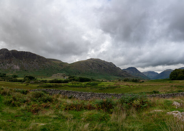
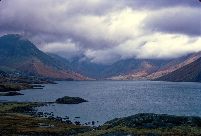
Buckbarrow is a prominent hill located in the county of Cumberland, in the northwest region of England. It forms part of the Lake District National Park, known for its stunning landscapes and scenic beauty. Standing at an elevation of 423 meters (1,388 feet), Buckbarrow offers breathtaking panoramic views of the surrounding countryside.

The hill is composed mainly of volcanic rocks from the Ordovician period, giving it a distinctive rugged appearance. It is a popular destination for hikers and nature enthusiasts, with several well-marked trails leading to its summit. The climb is moderate in difficulty, making it accessible to a wide range of visitors.

At the summit of Buckbarrow, visitors are treated to a magnificent vista that encompasses the nearby fells and valleys. On a clear day, one can admire the spectacular sights of the Scafell Range, including the towering peaks of Scafell Pike and Scafell. The Irish Sea and the Isle of Man can also be spotted in the distance.

The hill is surrounded by lush vegetation, including heather, bracken, and various species of trees, adding to its scenic charm. Wildlife is abundant in the area, with many species of birds, such as peregrine falcons and buzzards, making their home on the slopes of Buckbarrow.

Overall, Buckbarrow is a captivating destination for nature lovers and outdoor enthusiasts, offering a rewarding experience with its stunning views and serene surroundings.

If you have any feedback on the listing, please let us know in the comments section below.
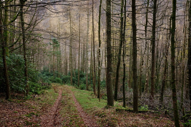
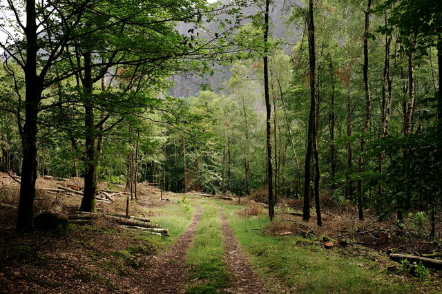
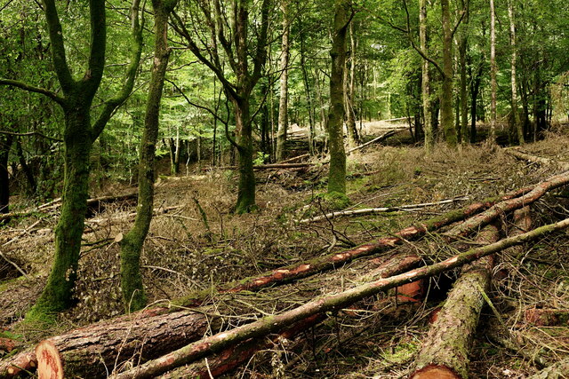
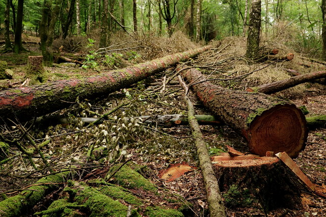
Buckbarrow Images

Images are sourced within 2km of 54.443111/-3.3337836 or Grid Reference NY1306. Thanks to Geograph Open Source API. All images are credited.

Wasdale Woodland Private woodland. Sadly, due to disease, all rhododendron, larch and sweet chestnut in the wood have to be felled by May 2022.
Wasdale Woodland
Private woodland. Sadly, due to disease, all rhododendron, larch and sweet chestnut in the wood have to be felled by May 2022.
Wasdale Woodland Private woodland. Due to disease, all rhododendron and larch has been felled, with sweet chestnut to follow.
Wasdale Woodland
Private woodland. Due to disease, all rhododendron and larch has been felled, with sweet chestnut to follow.
Wasdale Woodland Private woodland. Due to disease, all rhododendron and larch has been felled, with sweet chestnut to follow.
Wasdale Woodland
Private woodland. Due to disease, all rhododendron and larch has been felled, with sweet chestnut to follow.
Wasdale Woodland Private woodland. Due to disease, all rhododendron and larch has been felled, with sweet chestnut to follow.
Wasdale Woodland
Private woodland. Due to disease, all rhododendron and larch has been felled, with sweet chestnut to follow.
Nether Wasdale Valley
How Gates Used To Be Done, Nether Wasdale Ok maybe not the cable tied sign.
How Gates Used To Be Done, Nether Wasdale
Ok maybe not the cable tied sign.
Wast Water with brooding cloud Perhaps not the day to climb the hills.
Wast Water with brooding cloud
Perhaps not the day to climb the hills.
Wasdale Youth Hostel The entrance and lodge, with The Screes in the background. The gates, on the right, lead into Low Wood.
Wasdale Youth Hostel
The entrance and lodge, with The Screes in the background. The gates, on the right, lead into Low Wood.
Wasdale Youth Hostel The entrance and lodge, with a strategically-placed puddle.
Wasdale Youth Hostel
The entrance and lodge, with a strategically-placed puddle.
View of Wastwater  View of Wastwater with the mountains of Wasdale Head in the background.
View of Wastwater
View of Wastwater with the mountains of Wasdale Head in the background.
Beside Wast Water With overnight camping not permitted, this group seemed to go to a great deal of trouble to make a coffee and a bacon sandwich.
Beside Wast Water
With overnight camping not permitted, this group seemed to go to a great deal of trouble to make a coffee and a bacon sandwich.
Beside Wast Water With overnight camping not permitted, this group seemed to go to a great deal of trouble to make a coffee and a bacon sandwich.
Beside Wast Water
With overnight camping not permitted, this group seemed to go to a great deal of trouble to make a coffee and a bacon sandwich.
Beside Wast Water With overnight camping not permitted, this group seemed to go to a great deal of trouble to make a coffee and a bacon sandwich.
Beside Wast Water
With overnight camping not permitted, this group seemed to go to a great deal of trouble to make a coffee and a bacon sandwich.
Wast Water Looking up the lake, with Yewbarrow to the left of picture and Great Gable to the right.
Wast Water
Looking up the lake, with Yewbarrow to the left of picture and Great Gable to the right.
Wast Water Looking up the lake to the distant Great Gable, on a damp autumn afternoon.
Wast Water
Looking up the lake to the distant Great Gable, on a damp autumn afternoon.
Direction Sign - Signpost beside Wast Water Located on the southwest side of the junctions of the Wasdale Head and Greendale roads, in Wasdale parish. 3 arms and annulus finial. For an older photo before it was refurbished, see  <a title="https://www.geograph.org.uk/photo/6102831," href="https://www.geograph.org.uk/photo/6102831,">Link</a> and also <a title="https://www.geograph.org.uk/photo/3197897" href="https://www.geograph.org.uk/photo/3197897">Link</a> and <a title="https://www.geograph.org.uk/photo/2162941" href="https://www.geograph.org.uk/photo/2162941">Link</a>.

Milestone Society National ID: CU_NY1505
Direction Sign - Signpost beside Wast Water
Located on the southwest side of the junctions of the Wasdale Head and Greendale roads, in Wasdale parish. 3 arms and annulus finial. For an older photo before it was refurbished, see Link and also Link and Link. Milestone Society National ID: CU_NY1505
Greendale Tarn Below Middle Fell looking to Greendale Tarn
Greendale Tarn
Below Middle Fell looking to Greendale Tarn
Wall, Greendale Backed with the impressive Buckbarrow which looks like a smaller version of Pike o Stickle
Wall, Greendale
Backed with the impressive Buckbarrow which looks like a smaller version of Pike o Stickle
Show me another place!

Buckbarrow is located at Grid Ref: NY1306 (Lat: 54.443111, Lng: -3.3337836)

Administrative County: Cumbria

District: Copeland

Police Authority: Cumbria

What 3 Words

///eradicate.cookie.plots. Near Seascale, Cumbria

Nearby Locations

Glade How Buckbarrow

Related Wikis

Buckbarrow

Buckbarrow is a small fell in the English Lake District overlooking the western end of Wastwater. It is featured in Alfred Wainwright’s Pictorial Guide...

Middle Fell

Middle Fell is a hill or fell in the English Lake District. It is a satellite of Seatallan standing above the northern shore of Wastwater. Middle Fell...

Wasdale, Eskdale and Duddon

Wasdale, Eskdale and Duddon is an area of protected countryside, now held as National Trust property: it is part of the Lake District, located in south...

Wasdale

Wasdale (; traditionally ) is a valley and civil parish in the western part of the Lake District National Park in Cumbria, England. The River Irt flows...

Nearby Amenities

Located within 500m of 54.443111,-3.3337836
Buckbarrow
Ele: 420
Natural: peak
Source: npe
Wikidata: Q4982997
Wikipedia: en:Buckbarrow
Lat/Long: 54.4431535/-3.3342407
Description: Glade How cairn
Ele: 430
Natural: peak
Tourism: viewpoint
Lat/Long: 54.4456427/-3.3372799
Glade How
Place: locality
Lat/Long: 54.4464176/-3.3356698
The data included in this document is from www.openstreetmap.org. The data is made available under ODbL.

Have you been to Buckbarrow?

Leave your review of Buckbarrow below (or comments, questions and feedback).