Glade How

Hill, Mountain in Cumberland Copeland

England

Glade How

Nether Wasdale Valley
Nether Wasdale Valley Credit: Brian Deegan

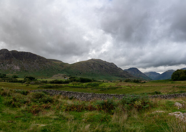
Glade How is a picturesque hill located in Cumberland, a district in the county of Cumbria, England. With an elevation of approximately 478 meters (1,568 feet), it is classified as a hill rather than a mountain. Glade How is situated in the Lake District National Park, a renowned area of natural beauty and a popular destination for outdoor enthusiasts.

The hill offers stunning panoramic views of the surrounding landscape, including the nearby valleys, lakes, and other hills. From the summit of Glade How, visitors can admire the breathtaking vistas of the Lake District, with its rolling green hills, serene lakes, and charming villages.

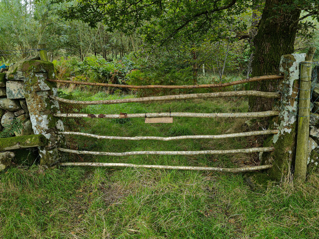
Glade How is a favorite spot for hikers and nature lovers, as it provides a range of walking routes and trails that cater to different abilities. The ascent to the summit is relatively gentle, making it suitable for families and beginners. The hill’s paths wind through scenic meadows, woodlands, and heather-clad slopes, offering an opportunity to explore the diverse flora and fauna of the area.

Due to its location within the Lake District National Park, Glade How is also a haven for wildlife. Visitors may encounter various bird species, such as redstarts, curlews, and peregrine falcons, as well as small mammals like red squirrels and voles.

Glade How provides a tranquil escape from the bustling city life, inviting visitors to immerse themselves in the natural beauty of the Lake District while enjoying a peaceful hike and breathtaking views.

If you have any feedback on the listing, please let us know in the comments section below.

Glade How Images

Images are sourced within 2km of 54.445511/-3.3361749 or Grid Reference NY1306. Thanks to Geograph Open Source API. All images are credited.

Nether Wasdale Valley
How Gates Used To Be Done, Nether Wasdale Ok maybe not the cable tied sign.
How Gates Used To Be Done, Nether Wasdale
Ok maybe not the cable tied sign.
Direction Sign - Signpost beside Wast Water Located on the southwest side of the junctions of the Wasdale Head and Greendale roads, in Wasdale parish. 3 arms and annulus finial. For an older photo before it was refurbished, see  <a title="https://www.geograph.org.uk/photo/6102831," href="https://www.geograph.org.uk/photo/6102831,">Link</a> and also <a title="https://www.geograph.org.uk/photo/3197897" href="https://www.geograph.org.uk/photo/3197897">Link</a> and <a title="https://www.geograph.org.uk/photo/2162941" href="https://www.geograph.org.uk/photo/2162941">Link</a>.

Milestone Society National ID: CU_NY1505
Direction Sign - Signpost beside Wast Water
Located on the southwest side of the junctions of the Wasdale Head and Greendale roads, in Wasdale parish. 3 arms and annulus finial. For an older photo before it was refurbished, see Link and also Link and Link. Milestone Society National ID: CU_NY1505
Greendale Tarn Below Middle Fell looking to Greendale Tarn
Greendale Tarn
Below Middle Fell looking to Greendale Tarn
Wall, Greendale Backed with the impressive Buckbarrow which looks like a smaller version of Pike o Stickle
Wall, Greendale
Backed with the impressive Buckbarrow which looks like a smaller version of Pike o Stickle
Violet The fells are studded with violets at this time of year
Violet
The fells are studded with violets at this time of year
Greendale Gill Gorse coming into flower by the gill
Greendale Gill
Gorse coming into flower by the gill
Old Fold By Tongues Gills on the steep west bank of Greendale Gill
Old Fold
By Tongues Gills on the steep west bank of Greendale Gill
On Buckbarrow On Broad Crag, Buckbarrow. Looking towards The Scafells
On Buckbarrow
On Broad Crag, Buckbarrow. Looking towards The Scafells
On Buckbarrow Looking towards Middle Fell
On Buckbarrow
Looking towards Middle Fell
On Seatallen On the extensive southern slope. There are several rudimentary bields in the sprinkling of boulders on the flank.
On Seatallen
On the extensive southern slope. There are several rudimentary bields in the sprinkling of boulders on the flank.
On Seatallan Mickledore on Scafell Pike in shot beyond Middle Fell from the grassy southern flank of Seatallan.
On Seatallan
Mickledore on Scafell Pike in shot beyond Middle Fell from the grassy southern flank of Seatallan.
On Middle Fell Looking towards Buckbarrow
On Middle Fell
Looking towards Buckbarrow
Descending Middle Fell Heading for Greendale which is aptly named with emerald green fields at the foot of the fell.
Descending Middle Fell
Heading for Greendale which is aptly named with emerald green fields at the foot of the fell.
View down Wastwater With Great Gable in the distance, Yewbarrow to the left, and Lingmell on the right.
View down Wastwater
With Great Gable in the distance, Yewbarrow to the left, and Lingmell on the right.
Shelter in Wasdale Cleverly designed to provide shelter no matter which direction the wind is coming from.
Shelter in Wasdale
Cleverly designed to provide shelter no matter which direction the wind is coming from.
Tributary stream of Greendale Gill A number of streams feed Greendale Gill from the Seatallan side in the vicinity of Buckbarrow Moss; they seem to be given the group name Tongue Gills. This is one of the more significant of them as seen from the ridge rising north-west for Middle Fell.
Tributary stream of Greendale Gill
A number of streams feed Greendale Gill from the Seatallan side in the vicinity of Buckbarrow Moss; they seem to be given the group name Tongue Gills. This is one of the more significant of them as seen from the ridge rising north-west for Middle Fell.
Above Greendale Gill Looking towards The Screes
Above Greendale Gill
Looking towards The Screes
Show me another place!

Glade How is located at Grid Ref: NY1306 (Lat: 54.445511, Lng: -3.3361749)

Administrative County: Cumbria

District: Copeland

Police Authority: Cumbria

What 3 Words

///cheetahs.awards.unsettled. Near Seascale, Cumbria

Nearby Locations

Glade How Buckbarrow

Related Wikis

Buckbarrow

Buckbarrow is a small fell in the English Lake District overlooking the western end of Wastwater. It is featured in Alfred Wainwright’s Pictorial Guide...

Middle Fell

Middle Fell is a hill or fell in the English Lake District. It is a satellite of Seatallan standing above the northern shore of Wastwater. Middle Fell...

Seatallan

Seatallan is a mountain in the western part of the English Lake District. It is rounded, grassy and fairly unassuming, occupying a large amount of land...

Wasdale, Eskdale and Duddon

Wasdale, Eskdale and Duddon is an area of protected countryside, now held as National Trust property: it is part of the Lake District, located in south...

Nearby Amenities

Located within 500m of 54.445511,-3.3361749
Buckbarrow
Ele: 420
Natural: peak
Source: npe
Wikidata: Q4982997
Wikipedia: en:Buckbarrow
Lat/Long: 54.4431535/-3.3342407
Joss Naylor Cairn
Historic: monument
Wikidata: Q6291051
Wikipedia: en:Joss Naylor
Lat/Long: 54.4470889/-3.3297964
Description: Glade How cairn
Ele: 430
Natural: peak
Tourism: viewpoint
Lat/Long: 54.4456427/-3.3372799
Glade How
Place: locality
Lat/Long: 54.4464176/-3.3356698
The data included in this document is from www.openstreetmap.org. The data is made available under ODbL.

Have you been to Glade How?

Leave your review of Glade How below (or comments, questions and feedback).