Carn nam Mult

Hill, Mountain in Banffshire

Scotland

Carn nam Mult

Ben Avon In the foreground is Càrn Dearg, with the River Gairn below it. Ben Avon is the nearest part of the snow-covered Cairngorm Mountains. Geographically speaking this is a dissected plateau, and it is easy to see that from this angle.
Ben Avon Credit: Anne Burgess

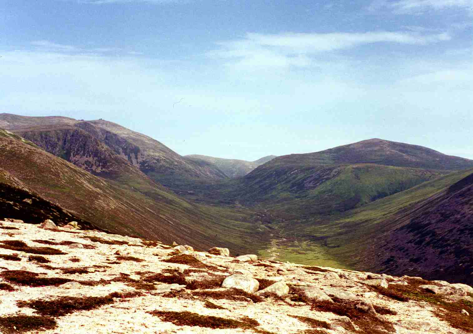
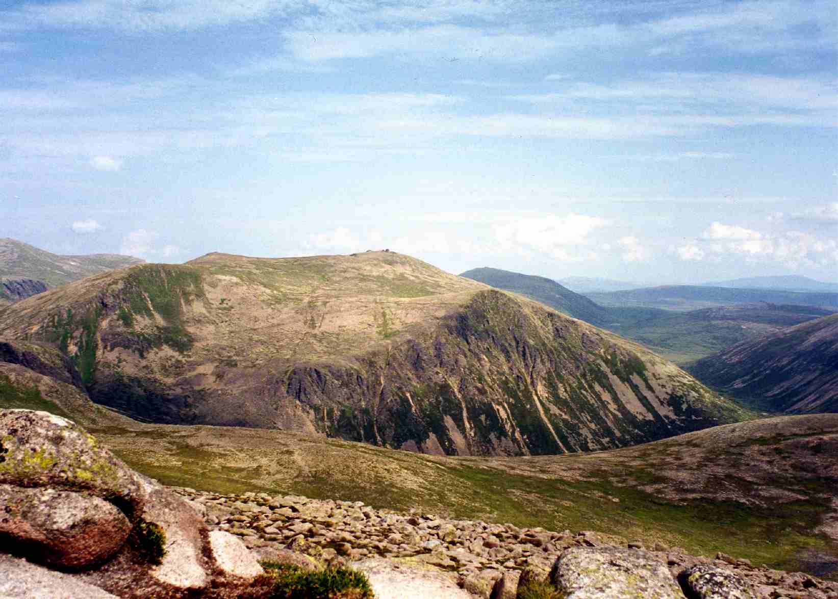
Carn nam Mult is a prominent hill located in Banffshire, Scotland. It is part of the Grampian Mountains range and is situated approximately 10 miles southeast of the town of Keith. Standing at a height of 1,210 feet (369 meters), it offers stunning panoramic views of the surrounding countryside.

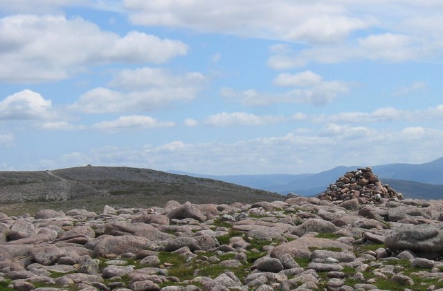
The hill is characterized by its rugged terrain, with steep slopes covered in heather and scattered boulders. It is primarily composed of sandstone, which gives it a distinctive reddish appearance. The summit of Carn nam Mult is marked by a cairn, a man-made pile of stones traditionally used as a marker or memorial.

Hiking and walking enthusiasts are drawn to Carn nam Mult due to its accessibility and relatively easy ascent. There are several established trails that lead to the summit, providing both experienced and novice hikers with a rewarding journey. Along the way, visitors can enjoy the diverse flora and fauna found in the area, including wildflowers, hare, and various bird species.

During the summer months, Carn nam Mult attracts outdoor enthusiasts seeking adventure and tranquility. The hill offers ample opportunities for photography, birdwatching, and picnicking. On clear days, climbers are rewarded with breathtaking views of the Cairngorms National Park to the west and the Moray Firth to the north.

Overall, Carn nam Mult is a picturesque and accessible hill in Banffshire, providing visitors with a chance to appreciate Scotland's natural beauty and enjoy outdoor activities in a serene environment.

If you have any feedback on the listing, please let us know in the comments section below.

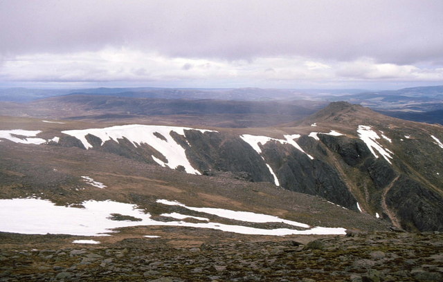
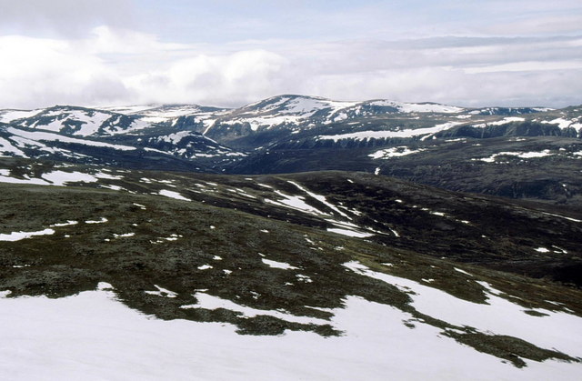
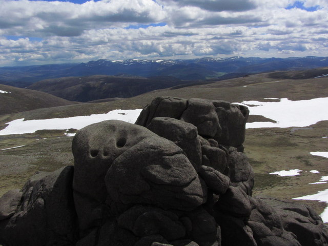
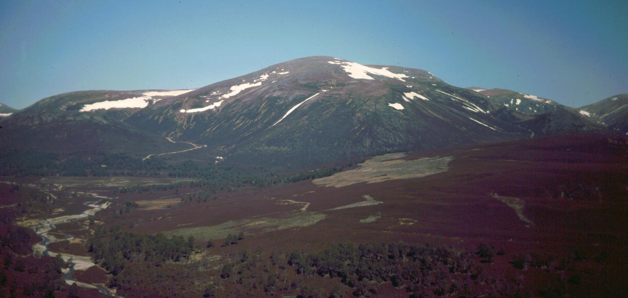
Carn nam Mult Images

Images are sourced within 2km of 57.106242/-3.4607468 or Grid Reference NJ1102. Thanks to Geograph Open Source API. All images are credited.

Ben Avon In the foreground is Càrn Dearg, with the River Gairn below it. Ben Avon is the nearest part of the snow-covered Cairngorm Mountains. Geographically speaking this is a dissected plateau, and it is easy to see that from this angle.
Ben Avon
In the foreground is Càrn Dearg, with the River Gairn below it. Ben Avon is the nearest part of the snow-covered Cairngorm Mountains. Geographically speaking this is a dissected plateau, and it is easy to see that from this angle.
Ben Avon Thanks to GPS, I can be sure exactly where this was taken from, but I am less certain about what it shows, other than that it's part of Ben Avon. Taken from a motor glider.
Ben Avon
Thanks to GPS, I can be sure exactly where this was taken from, but I am less certain about what it shows, other than that it's part of Ben Avon. Taken from a motor glider.
Garbh Choire from Cnap a' Chleirich With Stob an t-Sluichd beyond.
Garbh Choire from Cnap a' Chleirich
With Stob an t-Sluichd beyond.
Garbh Choire The Sneck, the low point between Beinn a' Bhuird and Ben Avon, just right of centre.
Garbh Choire
The Sneck, the low point between Beinn a' Bhuird and Ben Avon, just right of centre.
Garbh Choire With the tors of Leabaidh an Daimh Bhuidhe on the left.
Garbh Choire
With the tors of Leabaidh an Daimh Bhuidhe on the left.
Summit cairn on Stob an t-Sluichd Looking south across the Garbh Choire to Cnap a' Chleirich.
Summit cairn on Stob an t-Sluichd
Looking south across the Garbh Choire to Cnap a' Chleirich.
View north from summit of Stob an t-Sluichd Across the Forest of Glenavon.
View north from summit of Stob an t-Sluichd
Across the Forest of Glenavon.
Summit tor of Cnap à Chlèirich
On the barren summit plateau of Ben Avon The granite tor of Leabaidh an Daimh Bhuidhe (the bed of the yellow stag) is the summit of this remote mountain in the eastern Cairngorms.
On the barren summit plateau of Ben Avon
The granite tor of Leabaidh an Daimh Bhuidhe (the bed of the yellow stag) is the summit of this remote mountain in the eastern Cairngorms.
View across The Sneck to Ben Avon A flat gravelly area on this high wind-swept plateau before the descent into the narrow neck called The Sneck
View across The Sneck to Ben Avon
A flat gravelly area on this high wind-swept plateau before the descent into the narrow neck called The Sneck
Descending from Beinn a' Bhuird into The Sneck A steep gravelly, rocky shoulder leads on to Ben Avon
Descending from Beinn a' Bhuird into The Sneck
A steep gravelly, rocky shoulder leads on to Ben Avon
Steep section of the descent into The Sneck Snow-streaked slopes of Ben Avon rise above Slochd Mor
Steep section of the descent into The Sneck
Snow-streaked slopes of Ben Avon rise above Slochd Mor
East side of Cnap a' Chleirich Viewed from The Sneck
East side of Cnap a' Chleirich
Viewed from The Sneck
Ben Avon - finally reaching the summit The summit of this remote mountain in the eastern Cairngorms is the granite tor called Leabaidh an Daimh Bhuidhe ('bed of the yellow stag').  A short scramble up a rocky groove and then over some slabs leads to the very top.
Ben Avon - finally reaching the summit
The summit of this remote mountain in the eastern Cairngorms is the granite tor called Leabaidh an Daimh Bhuidhe ('bed of the yellow stag'). A short scramble up a rocky groove and then over some slabs leads to the very top.
Standing Granite Boulder, The Sneck Distinctive landmark near the bealach between Ben Avon and Beinn a' Bhuird.  In the background is Garbh Choire (the rough corrie).
Standing Granite Boulder, The Sneck
Distinctive landmark near the bealach between Ben Avon and Beinn a' Bhuird. In the background is Garbh Choire (the rough corrie).
Nearing the summit of Ben Avon from the SW
On the summit of Ben Avon - View towards Lochnagar
View towards Beinn a' Bhuird from the summit of Ben Avon
Show me another place!

Carn nam Mult is located at Grid Ref: NJ1102 (Lat: 57.106242, Lng: -3.4607468)

Unitary Authority: Moray

Police Authority: North East

What 3 Words

///flaking.unopposed.armrests. Near Inverey, Aberdeenshire

Related Wikis

Ben Avon

Ben Avon (Scottish Gaelic: Beinn Athfhinn, 'mountain of the Avon') is a mountain in the Cairngorms of Scotland. It is a sprawling mountain with a broad...

Beinn a' Bhùird

Beinn a' Bhùird is a Munro in the Cairngorm mountain range of Scotland. In Watson (1975) the author suggests the mountain should be named Beinn Bòrd -...

Beinn a' Chaorainn (Cairngorms)

Beinn a' Chaorainn is a Scottish mountain in the heart of the Cairngorms range. It is quite a remote hill, being located roughly 19 kilometres south east...

Beinn Bhreac (Glen Derry)

Beinn Bhreac is a twin-peaked Scottish mountain located above Glen Derry in the Cairngorm Mountains approximately 11 kilometres (7 mi) north-west of Braemar...

Bynack More

Bynack More (Scottish Gaelic: A' Bheithneag Mhòr or Beinn Bheithneag) is a Scottish Mountain that is situated in the Cairngorms range, 16 kilometres east...

Lairig an Laoigh

The Lairig an Laoigh ( LAR-ig ən LOO-ee; Scottish Gaelic: Làirig Laoigh) is a mountain pass through the Highlands of Scotland. In speech and sometimes...

Culardoch

Culardoch (900 m) is a mountain in the Cairngorms of Scotland, located northeast of Braemar in Aberdeenshire. A smooth and heathery peak southeast of the...

Beinn Mheadhoin (Cairngorms)

Beinn Mheadhoin or Beinn Meadhain (Scottish Gaelic for 'middle mountain') is a mountain in the Highlands of Scotland. It is a Munro with a height of 1...

Nearby Amenities

Located within 500m of 57.106242,-3.4607468
Stob an t-Sluichd
Ele: 1104
Natural: peak
Lat/Long: 57.1070566/-3.4676625
The data included in this document is from www.openstreetmap.org. The data is made available under ODbL.

Have you been to Carn nam Mult?

Leave your review of Carn nam Mult below (or comments, questions and feedback).