Pen-yr-eryr

Hill, Mountain in Denbighshire

Wales

Pen-yr-eryr

Two out of three disused The chapel at Pentre is no longer used regularly, BT have decided that the telephone box is uneconomical - but the post box still has a collection daily, including Saturday.
Two out of three disused Credit: Richard Green

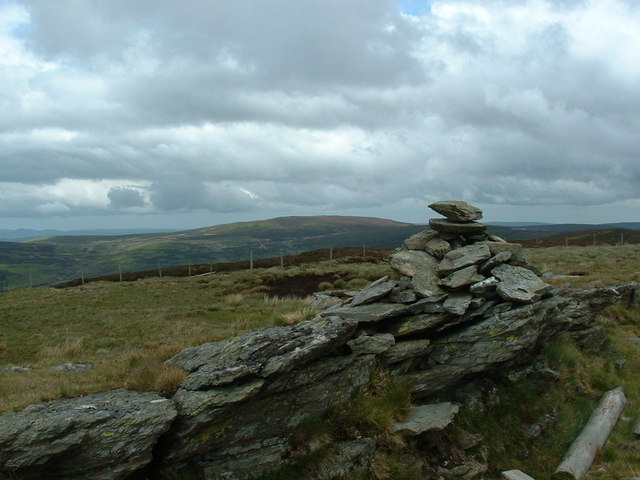
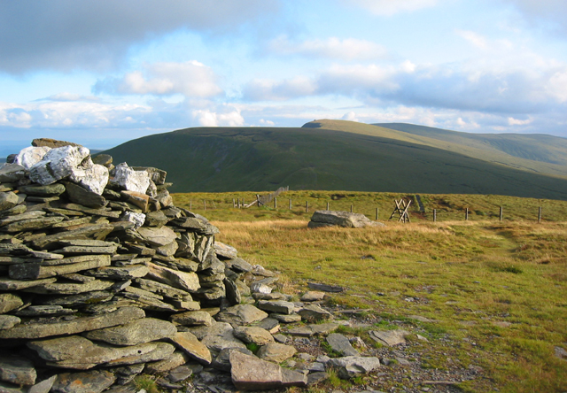
Pen-yr-eryr, located in Denbighshire, Wales, is a prominent hill/mountain that stands at an elevation of 526 meters (1,726 feet) above sea level. It is situated in the Clwydian Range, a designated Area of Outstanding Natural Beauty. The hill/mountain is renowned for its stunning panoramic views of the surrounding countryside.

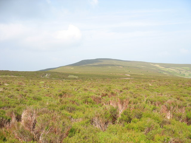
Pen-yr-eryr is characterized by its rugged terrain, with rocky outcrops and steep slopes. The hill/mountain is predominantly covered in heather and grasses, providing habitat for a variety of plant and animal species. The area is particularly rich in birdlife, with species such as the red grouse, peregrine falcon, and short-eared owl being commonly sighted.

The summit of Pen-yr-eryr offers breathtaking vistas, allowing visitors to admire the rolling hills and valleys of Denbighshire, as well as glimpses of the distant Snowdonia National Park. On clear days, it is even possible to see the Irish Sea in the distance.

Due to its accessible location and well-marked trails, Pen-yr-eryr attracts a considerable number of hikers and nature enthusiasts. The hill/mountain provides a range of walking routes, catering to both novice and experienced walkers. It is a popular destination for outdoor activities such as hillwalking, orienteering, and nature photography.

In addition to its natural beauty, Pen-yr-eryr holds historical significance. The hill/mountain is dotted with remnants of ancient settlements, including Bronze Age burial mounds and Iron Age hillforts. These archaeological sites add an extra layer of intrigue to the area, attracting history enthusiasts and researchers.

Overall, Pen-yr-eryr in Denbighshire is a captivating destination that offers a combination of natural splendor, wildlife diversity, and historical intrigue, making it a must-visit location for those seeking an immersive outdoor experience.

If you have any feedback on the listing, please let us know in the comments section below.

Pen-yr-eryr Images

Images are sourced within 2km of 52.905211/-3.315571 or Grid Reference SJ1135. Thanks to Geograph Open Source API. All images are credited.

Two out of three disused The chapel at Pentre is no longer used regularly, BT have decided that the telephone box is uneconomical - but the post box still has a collection daily, including Saturday.
Two out of three disused
The chapel at Pentre is no longer used regularly, BT have decided that the telephone box is uneconomical - but the post box still has a collection daily, including Saturday.
A view of the Berwyns from Pentre Looking towards Foel Wen.
A view of the Berwyns from Pentre
Looking towards Foel Wen.
Part of the Upper Ceiriog Valley A series of waterfalls occur upstream.
Part of the Upper Ceiriog Valley
A series of waterfalls occur upstream.
Stone sheepfold in the Ceiriog Valley Viewed from the hillside above.
Stone sheepfold in the Ceiriog Valley
Viewed from the hillside above.
Still standing... This tin shooting hut beside the track has stood the test of time (and weather) rather better than many of its age - it's been here in a sheltered nook of the Nant Rhydwilym since the days that the moors were managed for grouse shooting rather more than they now are.
Still standing...
This tin shooting hut beside the track has stood the test of time (and weather) rather better than many of its age - it's been here in a sheltered nook of the Nant Rhydwilym since the days that the moors were managed for grouse shooting rather more than they now are.
The 'railway sleeper' section This section of the track, crossing boggy ground, has been reinforced with old railway sleepers. There are other parts that could do with the same treatment.
The 'railway sleeper' section
This section of the track, crossing boggy ground, has been reinforced with old railway sleepers. There are other parts that could do with the same treatment.
A watersplash by the bridge We were pretty wet by this stage of the ride from Cynwyd, so taking the watersplash at speed seemed a good idea. All part of the fun.
A watersplash by the bridge
We were pretty wet by this stage of the ride from Cynwyd, so taking the watersplash at speed seemed a good idea. All part of the fun.
Ruined sheepfold above the Nant Rhydwilym Little remains of these sheepfolds on the far bank of the stream, apart from some very collapsed walls and piles of rubble.
Ruined sheepfold above the Nant Rhydwilym
Little remains of these sheepfolds on the far bank of the stream, apart from some very collapsed walls and piles of rubble.
In the valley of the Nant Rhydwilym A charming little river that effectively becomes the Ceiriog further down, the Nant Rhydwilym drains an area on the eastern side of the Berwyns ridge, and provides several potential wild campsites on its banks. You'd have to watch that your water didn't come from the main stream, as it takes drainage from the 4x4 track up to Bwlch Llandrillo; the side streams such as the one on the right would probably be OK for drinking.
In the valley of the Nant Rhydwilym
A charming little river that effectively becomes the Ceiriog further down, the Nant Rhydwilym drains an area on the eastern side of the Berwyns ridge, and provides several potential wild campsites on its banks. You'd have to watch that your water didn't come from the main stream, as it takes drainage from the 4x4 track up to Bwlch Llandrillo; the side streams such as the one on the right would probably be OK for drinking.
The valley of the Nant Rhidwilym
Giving the bike a rest After the long climb up from Cynwyd, and the long (and, at times, rough) descent down this track from the Wayfarer's memorial at Bwlch Llandrillo, a chance to sit in the sunshine and enjoy the view of the valley near Swch-cae-rhiw.
Giving the bike a rest
After the long climb up from Cynwyd, and the long (and, at times, rough) descent down this track from the Wayfarer's memorial at Bwlch Llandrillo, a chance to sit in the sunshine and enjoy the view of the valley near Swch-cae-rhiw.
Damaged track & derelict shooters hut
Drovers trail and bridge
Drovers trail in upper Ceiriog
The valley and Swch-cae-rhiw
Footbridge and sheepfold
Path into the Upper Ceiriog Valley in winter Always great walking.
Path into the Upper Ceiriog Valley in winter
Always great walking.
Pentre, settlement A small settlement with farm, a couple of cottages, disused chapel (right), postbox and phone box, on the minor road to the hills.
Pentre, settlement
A small settlement with farm, a couple of cottages, disused chapel (right), postbox and phone box, on the minor road to the hills.
Show me another place!

Pen-yr-eryr is located at Grid Ref: SJ1135 (Lat: 52.905211, Lng: -3.315571)

Unitary Authority: Wrexham

Police Authority: North Wales

What 3 Words

///happen.practical.tinted. Near Llandrillo, Denbighshire

Nearby Locations

Pen-yr-eryr

Related Wikis

Pen Bwlch Llandrillo

Moel yr Henfaes, also listed by the Nuttall's as Pen Bwlch Llandrillo Top and sometimes known as Moel yr Henfaes, is a mountain in North Wales and forms...

Cadair Bronwen

Cadair Bronwen is a mountain in North Wales and forms part of the Berwyn range. To the south are the higher Berwyn summits, including Cadair Berwyn. To...

Ceiriog Ucha

Ceiriog Ucha, also spelled as Ceiriog Uchaf (meaning "Upper Ceiriog"), is a community in Wrexham County Borough, Wales. The community lies in the Ceiriog...

Moel Fferna

Moel Fferna is a mountain in Denbighshire, Wales and forms part of the Berwyn range. It is the most northern outpost of the range. The summit is covered...

Nearby Amenities

Located within 500m of 52.905211,-3.315571
Pen-yr-eryr
Ele: 590
Natural: peak
Source: npe
Wikidata: Q106709535
Lat/Long: 52.9055889/-3.3138911
The data included in this document is from www.openstreetmap.org. The data is made available under ODbL.

Have you been to Pen-yr-eryr?

Leave your review of Pen-yr-eryr below (or comments, questions and feedback).