Carn Shalag

Hill, Mountain in Morayshire

Scotland

Carn Shalag

Carn na Dubh-chlais, Speyside The valley in the middle distance heading to the right is the beginning of the Blarnish Burn that flows Northwest. The turbine on the right is part of the Paul's Hill windfarm.
Carn na Dubh-chlais, Speyside Credit: David G Campbell

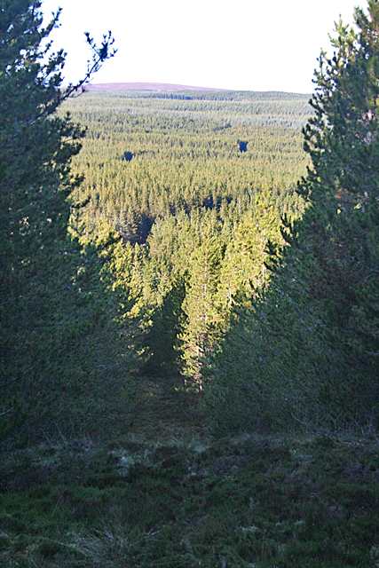
Carn Shalag is a prominent hill located in Morayshire, Scotland. It is situated approximately 6 miles southeast of the town of Forres and stands at an elevation of 1,332 feet (406 meters). The hill is part of the larger Culbin Forest, which covers a vast area of sand dunes, woodlands, and heathlands.

Carn Shalag offers breathtaking panoramic views of the surrounding countryside and the Moray Firth coastline. Its distinctive conical shape and rugged terrain make it a popular destination for hikers and nature enthusiasts. The hill is accessible via several walking trails that traverse through the forest, leading visitors to the summit.

The climb to the top of Carn Shalag is relatively moderate, with a well-defined path that becomes steeper towards the summit. Along the way, walkers can find a diverse range of flora and fauna, including heather, mosses, and a variety of bird species. The hill is also known for its numerous archaeological sites, including ancient cairns and burial mounds, which add to its historical significance.

Carn Shalag is a perfect destination for those seeking a peaceful escape in nature, offering opportunities for recreational activities such as walking, birdwatching, and photography. Its accessibility and close proximity to Forres make it an ideal day trip for both locals and tourists. With its natural beauty and rich history, Carn Shalag stands as a testament to the diverse and captivating landscapes of Morayshire.

If you have any feedback on the listing, please let us know in the comments section below.

Carn Shalag Images

Images are sourced within 2km of 57.466306/-3.4759196 or Grid Reference NJ1142. Thanks to Geograph Open Source API. All images are credited.

Carn na Dubh-chlais, Speyside The valley in the middle distance heading to the right is the beginning of the Blarnish Burn that flows Northwest. The turbine on the right is part of the Paul's Hill windfarm.
Carn na Dubh-chlais, Speyside
The valley in the middle distance heading to the right is the beginning of the Blarnish Burn that flows Northwest. The turbine on the right is part of the Paul's Hill windfarm.
Moorland at Paul's Hill Windfarm, Speyside Sparse growth of heather and rough grass on stony moorland. Paul's Hill <a href="https://www.geograph.org.uk/gridref/NJ1140">NJ1140</a>, 457m, and its windfarm is in the background.
Moorland at Paul's Hill Windfarm, Speyside
Sparse growth of heather and rough grass on stony moorland. Paul's Hill NJ1140, 457m, and its windfarm is in the background.
Caochann Calltuinn, Speyside The Caochann Calltuinn burn is in the small valley running left to centre, then directly away. The few small trees and shrubs help to mark out the line of the stream.
Caochann Calltuinn, Speyside
The Caochann Calltuinn burn is in the small valley running left to centre, then directly away. The few small trees and shrubs help to mark out the line of the stream.
Looking towards the Loch of the Cowlatt The loch itself is in the next square, but there are several hundred metres of unrelieved heather moor in the foreground.
Looking towards the Loch of the Cowlatt
The loch itself is in the next square, but there are several hundred metres of unrelieved heather moor in the foreground.
Birth of a Burn This boggy patch is the start of one of several burns that run into the Loch of the Cowlatt in the next square. The boulders on the right aren't boulders at all - they are in fact lumps of peat which have apparently been eroded out of the bank of the burn. In over two hours walking here I saw just one solitary boulder - everything else was peat or water.
Birth of a Burn
This boggy patch is the start of one of several burns that run into the Loch of the Cowlatt in the next square. The boulders on the right aren't boulders at all - they are in fact lumps of peat which have apparently been eroded out of the bank of the burn. In over two hours walking here I saw just one solitary boulder - everything else was peat or water.
A Pool on the Moor This whole area is full of wet holes and partly hidden pools waiting to trap the unwary walker - though walkers are probably fairly scarce on this ground anyway. This is one of the largest ones, and it looks as if it is natural.
A Pool on the Moor
This whole area is full of wet holes and partly hidden pools waiting to trap the unwary walker - though walkers are probably fairly scarce on this ground anyway. This is one of the largest ones, and it looks as if it is natural.
Burn in the Bog This is one of several burns which drain this expanse of bog into the Loch of the Cowlatt, in the next grid square.
Burn in the Bog
This is one of several burns which drain this expanse of bog into the Loch of the Cowlatt, in the next grid square.
Bog Pool There are scattered pools all over the boggy moorland here. Most of the square is forested, and the edge of the plantation is in the background.
Bog Pool
There are scattered pools all over the boggy moorland here. Most of the square is forested, and the edge of the plantation is in the background.
Pool and Loch The ice-covered pool in the foreground has had some help from man and machinery, which have excavated a quantity of peat, presumably to provide water for grouse. In the background is a small lochan which may be an extension of the Loch of the Cowlatt, though now separated from it by vegetation.
Pool and Loch
The ice-covered pool in the foreground has had some help from man and machinery, which have excavated a quantity of peat, presumably to provide water for grouse. In the background is a small lochan which may be an extension of the Loch of the Cowlatt, though now separated from it by vegetation.
Boundary Stone The stone marks the march of the estates of Knockando and Dallas, and of the parishes of the same name. The remains of the old boundary fence are beyond the stone, and to the left is the new fence recently erected on the Knockando side of the march.
Boundary Stone
The stone marks the march of the estates of Knockando and Dallas, and of the parishes of the same name. The remains of the old boundary fence are beyond the stone, and to the left is the new fence recently erected on the Knockando side of the march.
Firebreak and Burn The firebreak in this section of the forest coincides, sensibly, with the course of one of the burns which form the headwaters of Black Stripe. The burn has cut down through the peat layer, but has become indistinct among the vegetation in its course.
Firebreak and Burn
The firebreak in this section of the forest coincides, sensibly, with the course of one of the burns which form the headwaters of Black Stripe. The burn has cut down through the peat layer, but has become indistinct among the vegetation in its course.
Firebreak on Little Ben Shalag This firebreak is one of several provided in the forest plantations. It climbs the north slope of Little Ben Shalag, and provides a view north to the rest of the forest.
Firebreak on Little Ben Shalag
This firebreak is one of several provided in the forest plantations. It climbs the north slope of Little Ben Shalag, and provides a view north to the rest of the forest.
Loch of Little Benshalag There are several lochs of Little Benshalag on the south slope of Little Ben Shalag. Some of them drain to the north-west via the Stripe of Little Benshalag, while this one, the largest, drains via the Black Stripe. In the background are the tips of some of the turbines of the wind farm on Paul's Hill.
Loch of Little Benshalag
There are several lochs of Little Benshalag on the south slope of Little Ben Shalag. Some of them drain to the north-west via the Stripe of Little Benshalag, while this one, the largest, drains via the Black Stripe. In the background are the tips of some of the turbines of the wind farm on Paul's Hill.
Forest Boundary Looking uphill from the Lochs of Little Benshalag to the edge of the forest plantation on Little Ben Shalag.
Forest Boundary
Looking uphill from the Lochs of Little Benshalag to the edge of the forest plantation on Little Ben Shalag.
Loch of Little Benshalag This is the largest of the lochs of Little Benshalag, and, with the forest as its backdrop, probably the most picturesque. Most of the loch is actually in the next square, but the foreground and nearer part of the loch are in this square.
Loch of Little Benshalag
This is the largest of the lochs of Little Benshalag, and, with the forest as its backdrop, probably the most picturesque. Most of the loch is actually in the next square, but the foreground and nearer part of the loch are in this square.
End of the Deer Fence To the right are several kilometres of deer fencing, but to the left the fence is only normal height. I can't help thinking that any deer wishing to get inside the deer fence only has to go west until this point, after which it can easily jump the lower fence. But no doubt the people who planned it know more about the habits of deer than I do. In the background is the forest-covered Little Ben Shalag, and part of the largest of the Lochs of Little Benshalag.
End of the Deer Fence
To the right are several kilometres of deer fencing, but to the left the fence is only normal height. I can't help thinking that any deer wishing to get inside the deer fence only has to go west until this point, after which it can easily jump the lower fence. But no doubt the people who planned it know more about the habits of deer than I do. In the background is the forest-covered Little Ben Shalag, and part of the largest of the Lochs of Little Benshalag.
Lochs of Little Benshalag This is the largest of several small lochs on the south side of Little Ben Shalag. It is just inside the fence which indicates the march between Knockando and Dallas.
Lochs of Little Benshalag
This is the largest of several small lochs on the south side of Little Ben Shalag. It is just inside the fence which indicates the march between Knockando and Dallas.
Anchoring the Fence The march fence makes a dog-leg here, and the ground is very wet and boggy. The strainer in the angle is anchored by a wire round a short post. Two boards lie on either side of the short anchor post, and two more short posts give additional strength to the whole assembly. I wonder how long it will take for the boards and the short post to rot - but by then I suppose the bottoms of the strainer and posts will have rotted too, so the whole thing will have to be replaced anyway.
Anchoring the Fence
The march fence makes a dog-leg here, and the ground is very wet and boggy. The strainer in the angle is anchored by a wire round a short post. Two boards lie on either side of the short anchor post, and two more short posts give additional strength to the whole assembly. I wonder how long it will take for the boards and the short post to rot - but by then I suppose the bottoms of the strainer and posts will have rotted too, so the whole thing will have to be replaced anyway.
Show me another place!

Carn Shalag is located at Grid Ref: NJ1142 (Lat: 57.466306, Lng: -3.4759196)

Unitary Authority: Moray

Police Authority: North East

What 3 Words

///normal.hospitals.butternut. Near Charlestown of Aberlour, Moray

Nearby Locations

Carn Shalag

Related Wikis

Knockando Woolmill

The Knockando Woolmill is a historic woolmill in Moray, Scotland. Wool production has taken place at the site since at least the eighteenth century, and...
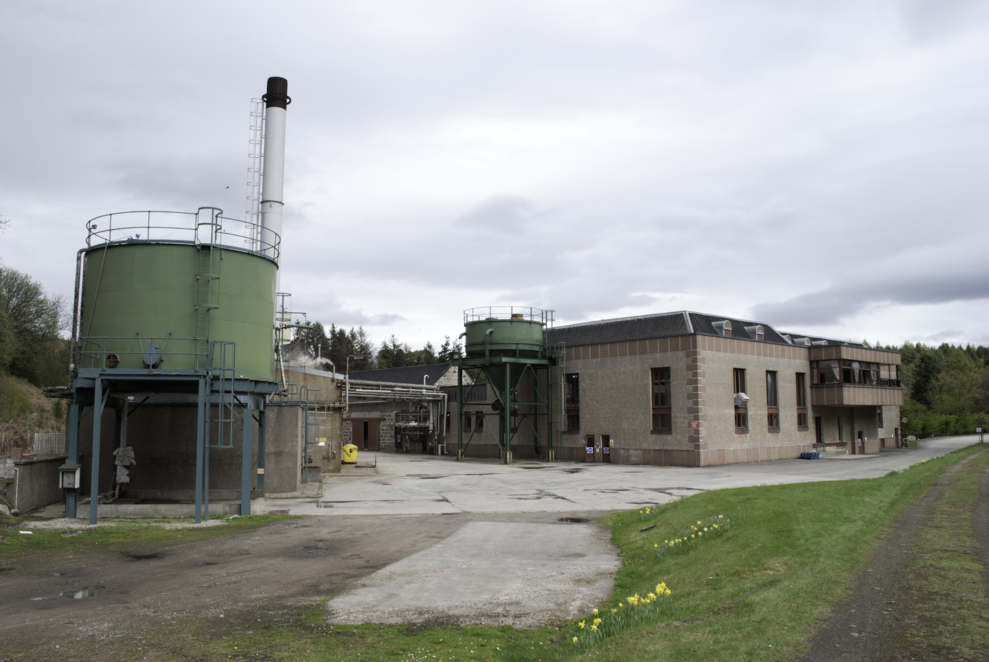
Tamdhu distillery

Tamdhu distillery is a single malt Scotch Speyside whisky distillery, located in the village of Knockando in Banffshire, Scotland. Tamdhu comes from Gaelic...
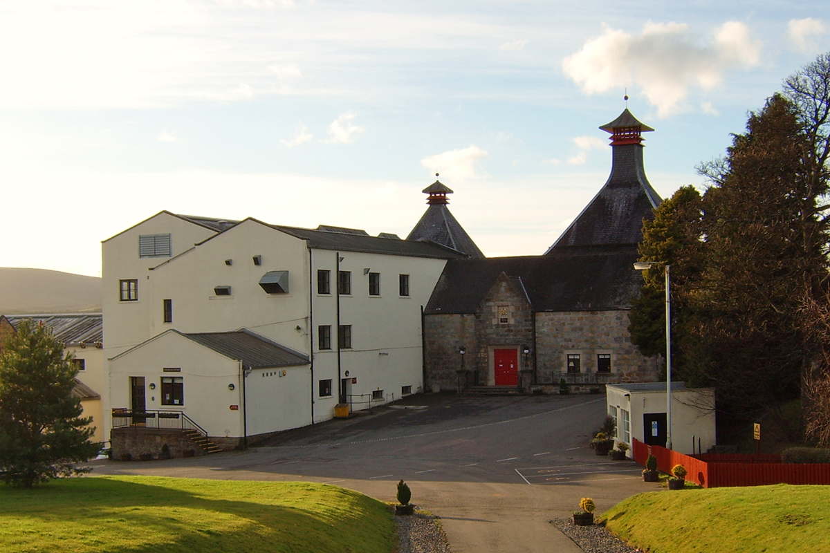
Cardhu distillery

Cardhu distillery is a Speyside distillery near Archiestown, Moray, Scotland, founded in 1824 by whisky smuggler John Cumming and his wife Helen. The distillery...

Knockando, Moray

Knockando (Scottish Gaelic: Cnoc Cheannachd) is a village in Moray, Scotland. It is a farming centre and the location of both the Knockando distillery...

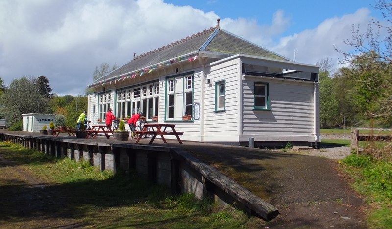
Knockando (Dalbeallie) railway station

Knockando railway station served the village of Knockando, Moray, Scotland, from 1899 to 1965 on the Strathspey Railway. == History == The station opened...

Blacksboat railway station

Blacksboat railway station served the village of Ballindalloch, Banffshire, Scotland from 1863 to 1965 on the Strathspey Railway. == History == The station...

Cragganmore distillery

Cragganmore distillery is a Scotch whisky distillery situated in the village of Ballindalloch in Banffshire, Scotland. == History == The distillery was...

Gilbey's Cottages Halt railway station

Gilbey's Cottages Halt railway station was one of four halts, Imperial Cottages, Gilbey's Cottages, Dalvey Farm, and Ballifurth Farm, opened on the Speyside...

Nearby Amenities

Located within 500m of 57.466306,-3.4759196
Càrn Shalag
Ele: 470
Natural: peak
Lat/Long: 57.4669183/-3.4722056
The data included in this document is from www.openstreetmap.org. The data is made available under ODbL.

Have you been to Carn Shalag?

Leave your review of Carn Shalag below (or comments, questions and feedback).