West Cairn Hill

Hill, Mountain in Midlothian

Scotland

West Cairn Hill

Balloon litter, Pentland Hills A twentieth birthday somewhere.  The "2" balloon deflated and brought down the heart and "0" right in front of me.  I tied the two surviving balloons to my pack for amusement on the way out.

What is not funny is the litter and the waste of helium. It ends up in space and there is only so much down here on Earth. What there is is thanks to radioactive decay of thorium and uranium - it is spent alpha particles.
Balloon litter, Pentland Hills Credit: Richard Webb

The requested URL returned error: 429 Too Many Requests

If you have any feedback on the listing, please let us know in the comments section below.

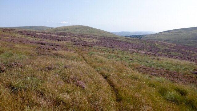
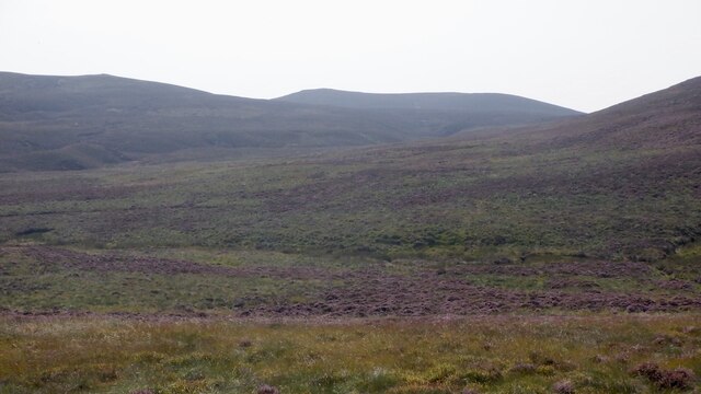
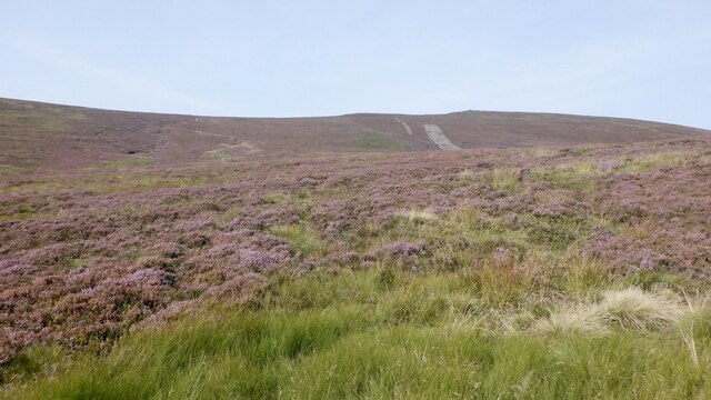
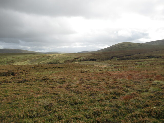
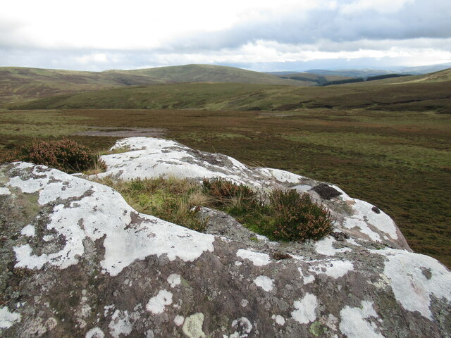
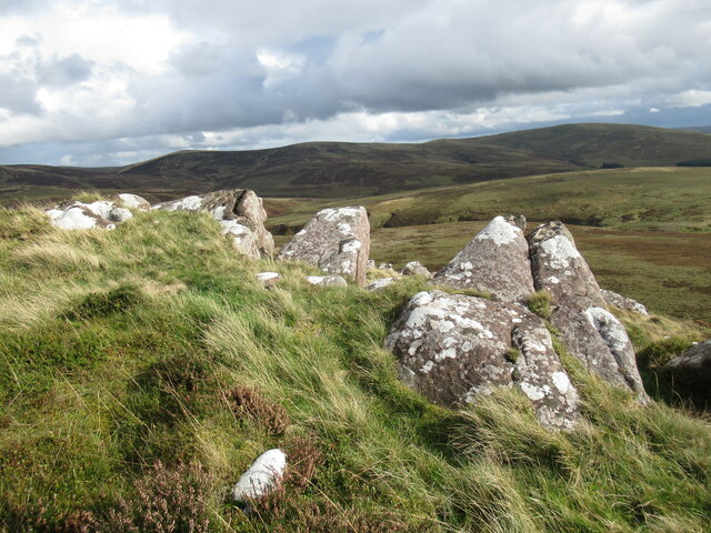
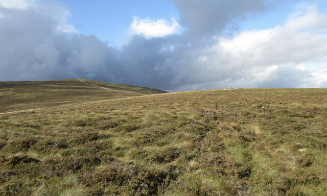
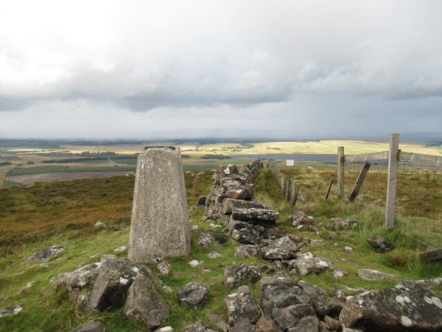
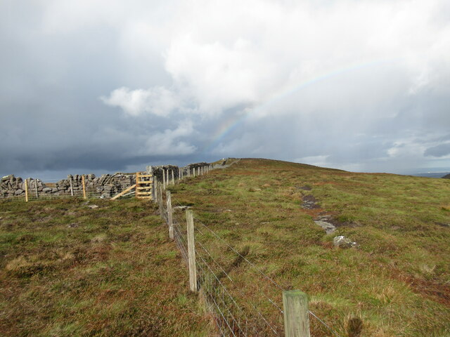
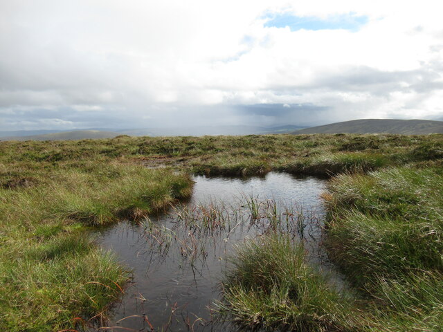
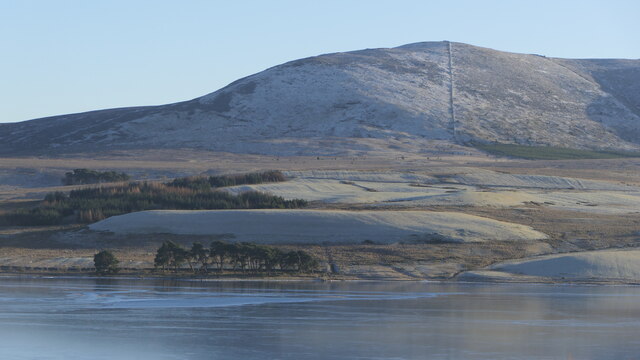
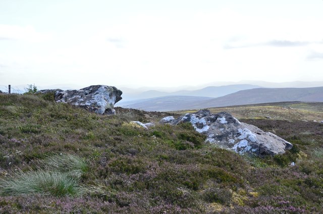
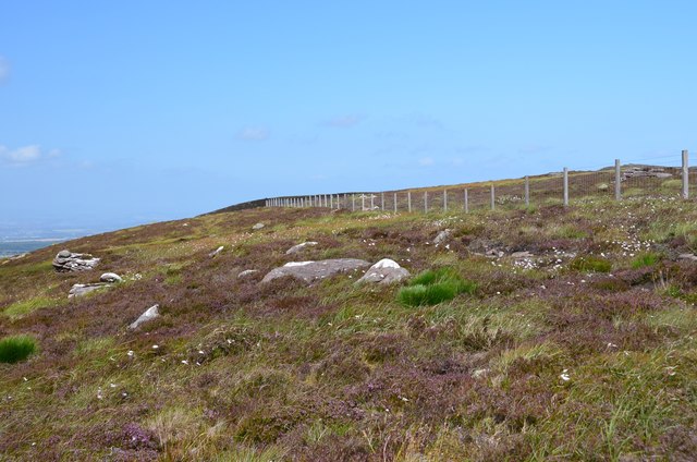
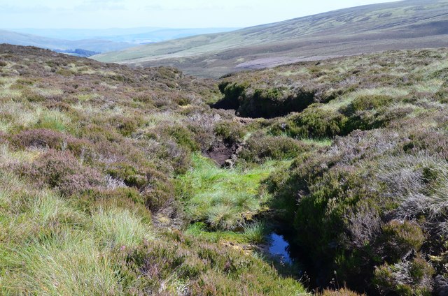
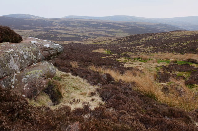
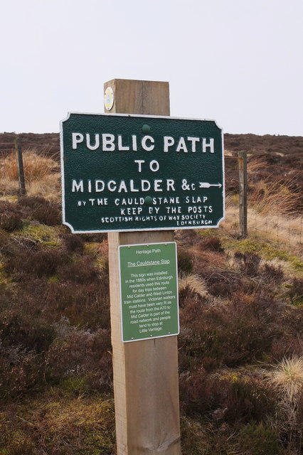
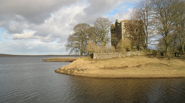
West Cairn Hill Images

Images are sourced within 2km of 55.810315/-3.4262318 or Grid Reference NT1058. Thanks to Geograph Open Source API. All images are credited.

Balloon litter, Pentland Hills A twentieth birthday somewhere.  The "2" balloon deflated and brought down the heart and "0" right in front of me.  I tied the two surviving balloons to my pack for amusement on the way out.

What is not funny is the litter and the waste of helium. It ends up in space and there is only so much down here on Earth. What there is is thanks to radioactive decay of thorium and uranium - it is spent alpha particles.
Balloon litter, Pentland Hills
A twentieth birthday somewhere. The "2" balloon deflated and brought down the heart and "0" right in front of me. I tied the two surviving balloons to my pack for amusement on the way out. What is not funny is the litter and the waste of helium. It ends up in space and there is only so much down here on Earth. What there is is thanks to radioactive decay of thorium and uranium - it is spent alpha particles.
Moorland, Baddinsgill View towards Muckle Knock.
Moorland, Baddinsgill
View towards Muckle Knock.
Moorland, Baddinsgill View towards Craigengar.
Moorland, Baddinsgill
View towards Craigengar.
West Cairn Hill The south (Baddinsgill side).
West Cairn Hill
The south (Baddinsgill side).
Heather moorland near the Ravendean Burn Viewed from the Thieves' Road, the old drove road that crosses this tract of moorland.
Heather moorland near the Ravendean Burn
Viewed from the Thieves' Road, the old drove road that crosses this tract of moorland.
Lichen-covered outcrop at White Craigs The name 'White Craigs' is certainly appropriate, and made me wonder whether these rocks were colonised by this white lichen when they acquired their name a great many years ago.
Lichen-covered outcrop at White Craigs
The name 'White Craigs' is certainly appropriate, and made me wonder whether these rocks were colonised by this white lichen when they acquired their name a great many years ago.
Rocks at White Craigs The name 'White Craigs' made me wonder whether these rocks were colonised by this white lichen when they acquired their name a great many years ago.
Rocks at White Craigs
The name 'White Craigs' made me wonder whether these rocks were colonised by this white lichen when they acquired their name a great many years ago.
On the eastern spur of West Cairn Hill A shower of rain and hail is passing through.
On the eastern spur of West Cairn Hill
A shower of rain and hail is passing through.
Trig pillar and summit area, West Cairn Hill The sign warns of a live firing range. I couldn't recall this from my last visit here, about seven years ago (although I might've just forgotten), but there has been military training activity in some other parts of the Pentland Hills for a long time.
Trig pillar and summit area, West Cairn Hill
The sign warns of a live firing range. I couldn't recall this from my last visit here, about seven years ago (although I might've just forgotten), but there has been military training activity in some other parts of the Pentland Hills for a long time.
Fence junction on West Cairn Hill A faint rainbow is visible, on a day of sunshine and showers.
Fence junction on West Cairn Hill
A faint rainbow is visible, on a day of sunshine and showers.
Boggy pool on West Cairn Hill A shower of rain and hail is passing through.
Boggy pool on West Cairn Hill
A shower of rain and hail is passing through.
Path near Cauldstane Slap Looking towards Harperrig Reservoir.
Path near Cauldstane Slap
Looking towards Harperrig Reservoir.
West Cairn Hill Above a frozen Harperrig Reservoir.
West Cairn Hill
Above a frozen Harperrig Reservoir.
Rock outcrops in the heather Very much the open heather moorland of the wilder part of the SW area of the Pentland Hills between West Cairn Hill, Byrehope Mount and Craigengar.
Rock outcrops in the heather
Very much the open heather moorland of the wilder part of the SW area of the Pentland Hills between West Cairn Hill, Byrehope Mount and Craigengar.
Boundary fence south of West Cairn Hill The boundary between Scottish Borders and South Lanarkshire on the moorland ridge.
Boundary fence south of West Cairn Hill
The boundary between Scottish Borders and South Lanarkshire on the moorland ridge.
Gully in the peat near White Craig Hill Starting point of one of the burns in the catchment of the Baddinsgill Burn.
Gully in the peat near White Craig Hill
Starting point of one of the burns in the catchment of the Baddinsgill Burn.
An unnamed burn below Cauldstane Slap One of the headwaters of the Lyne Water, a tributary of the Tweed.
An unnamed burn below Cauldstane Slap
One of the headwaters of the Lyne Water, a tributary of the Tweed.
A Victorian footpath sign, Cauldstane Slap A sign originally put up in the 1880s by the Scottish Rights of Way Society, in the days when pedestrians took the train to West Linton and walked over this route to Midcalder station.
A Victorian footpath sign, Cauldstane Slap
A sign originally put up in the 1880s by the Scottish Rights of Way Society, in the days when pedestrians took the train to West Linton and walked over this route to Midcalder station.
Show me another place!

West Cairn Hill is located at Grid Ref: NT1058 (Lat: 55.810315, Lng: -3.4262318)

Unitary Authority: West Lothian

Police Authority: The Lothians and Scottish Borders

What 3 Words

///prowl.lighters.rams. Near West Linton, Scottish Borders

Nearby Locations

West Cairn Hill

Related Wikis

West Cairn Hill

West Cairn Hill is a hill in the Pentland Hills range of Scotland. With a height of 562 m (1,844 ft), it is the fifth highest elevation and lies on the...

Cauldstane Slap

Cauldstane Slap is a pass located in the Pentland Hills of Scotland. It marks the border between the neighboring council areas of West Lothian and Scottish...

East Cairn Hill

East Cairn Hill is a hill in the Pentland Hills range of Scotland. With a height of 567 m (1,860 ft), it is the highest hill in Edinburgh and is located...

Cairns Castle

Cairns Castle is a ruined keep, dating from the 15th century. It is located on the northern slope of the Pentland Hills, around 6.5 miles (10.5 km) south...

Nearby Amenities

Located within 500m of 55.810315,-3.4262318
West Cairn Hill
Ele: 562
Natural: peak
Wikidata: Q20850716
Lat/Long: 55.8106154/-3.4258876
West Cairn Hill
Man Made: survey_point
Ref: S3084
Lat/Long: 55.8105941/-3.4259629
Natural: rock
Lat/Long: 55.8090578/-3.4272382
The data included in this document is from www.openstreetmap.org. The data is made available under ODbL.

Have you been to West Cairn Hill?

Leave your review of West Cairn Hill below (or comments, questions and feedback).