Birk Craigs

Hill, Mountain in Peeblesshire

Scotland

Birk Craigs

Taking Flight Two geese have just taken flight after I surprised them at the edge of Fruid Reservoir. The hill to the left of the prominent wall is called Big Knock.
Taking Flight Credit: Adam Ward

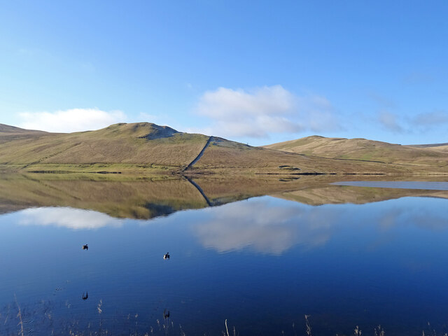
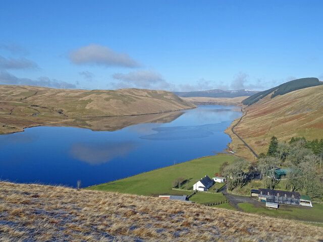
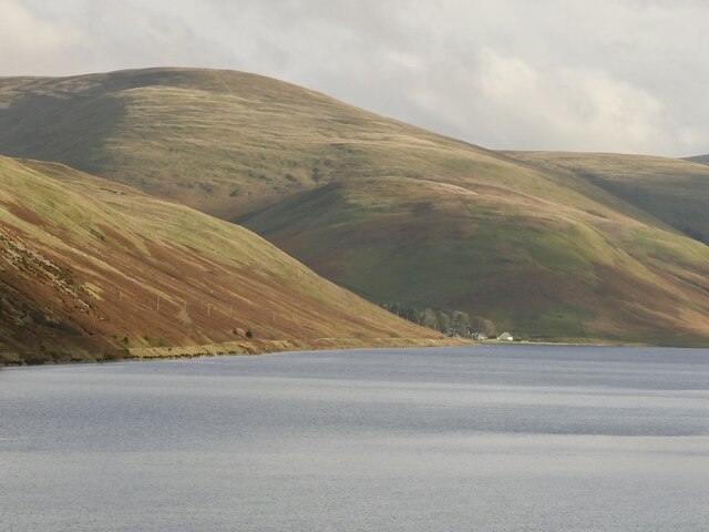
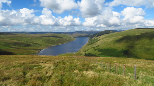
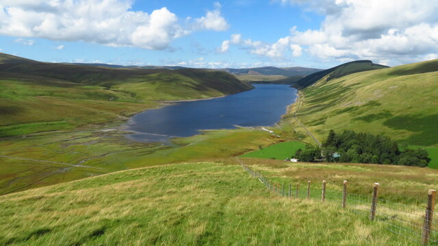
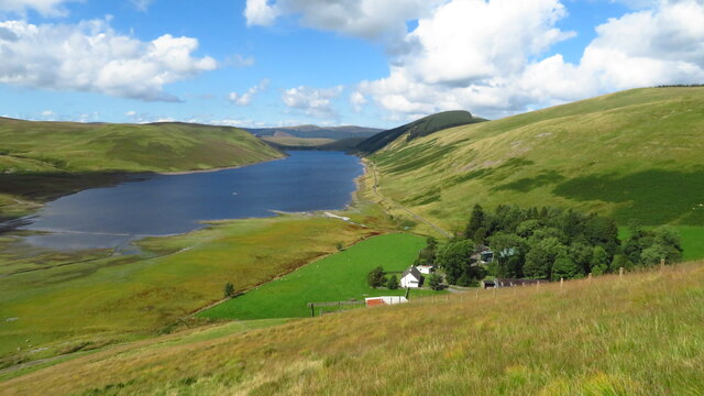
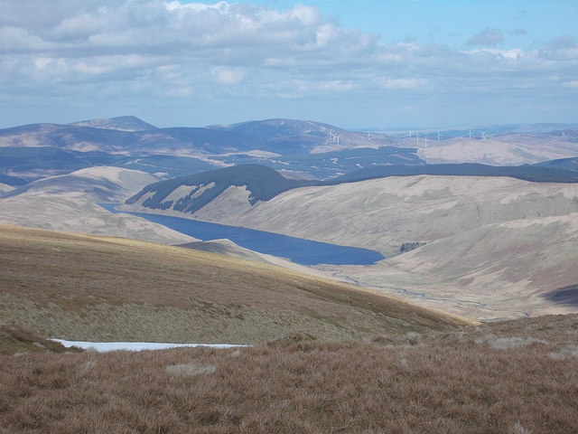
Birk Craigs is a prominent hill located in Peeblesshire, Scotland. Rising to an elevation of approximately 480 meters (1575 feet), it is recognized as one of the notable peaks in the area. Situated within the scenic Scottish Borders region, Birk Craigs offers breathtaking views of the surrounding landscape.

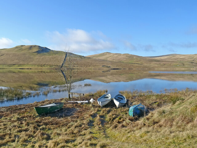
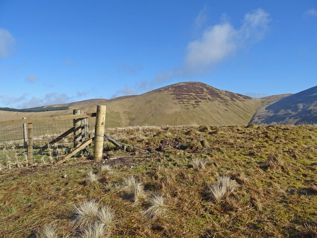
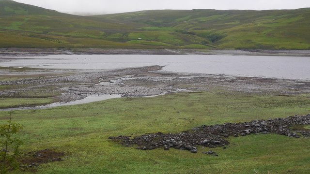
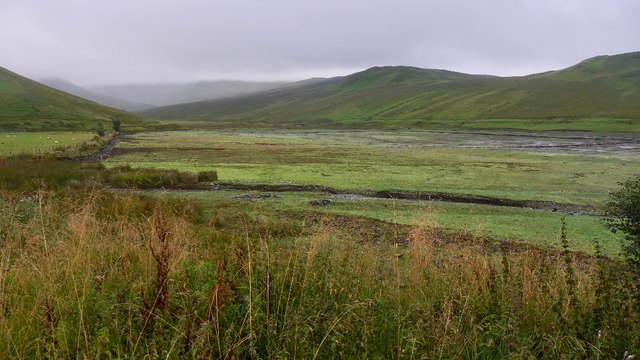
The hill is characterized by its distinctive shape and rugged terrain. It features steep slopes covered in heather, grasses, and scattered boulders, adding to its natural charm. Birk Craigs is part of the larger Moorfoot Hills range and is a popular destination for hikers and outdoor enthusiasts.

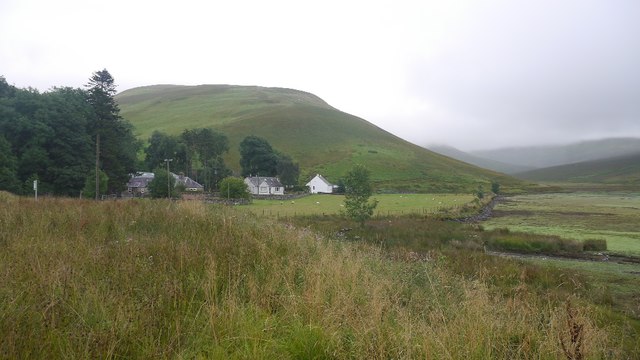
Access to Birk Craigs is relatively accessible, with several walking routes leading to the summit. The ascent can be moderate to challenging, depending on the chosen path, but the reward is the awe-inspiring vista from the top. On a clear day, one can enjoy panoramic views of the rolling countryside, nearby hills, and even distant mountain ranges.

The hill is also home to a diverse range of flora and fauna. Visitors may encounter various bird species, such as red grouse and peregrine falcons, as well as smaller mammals like rabbits and hares. The hillside vegetation is known to support a variety of wildflowers, including heather, foxgloves, and bluebells, creating a vibrant display during the blooming season.

Birk Craigs is a fantastic destination for nature lovers and those seeking a peaceful escape amidst the Scottish countryside. Its natural beauty and challenging trails make it a must-visit for anyone exploring the Peeblesshire region.

If you have any feedback on the listing, please let us know in the comments section below.
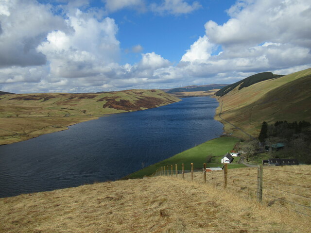
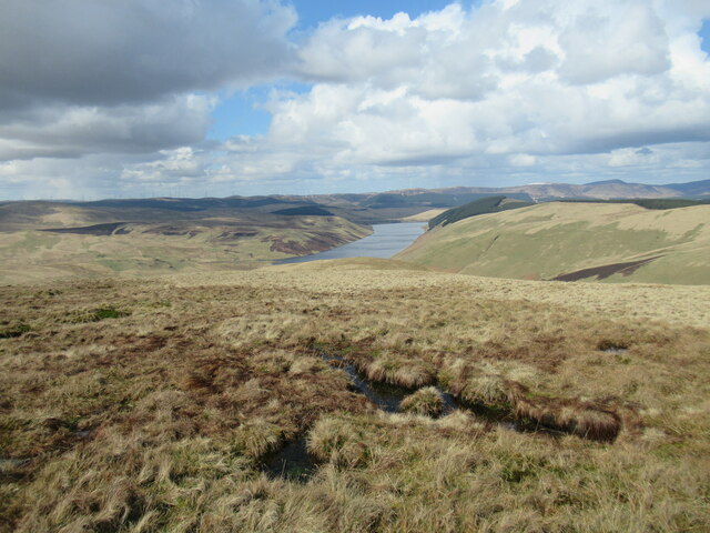
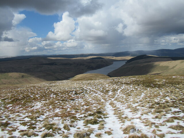
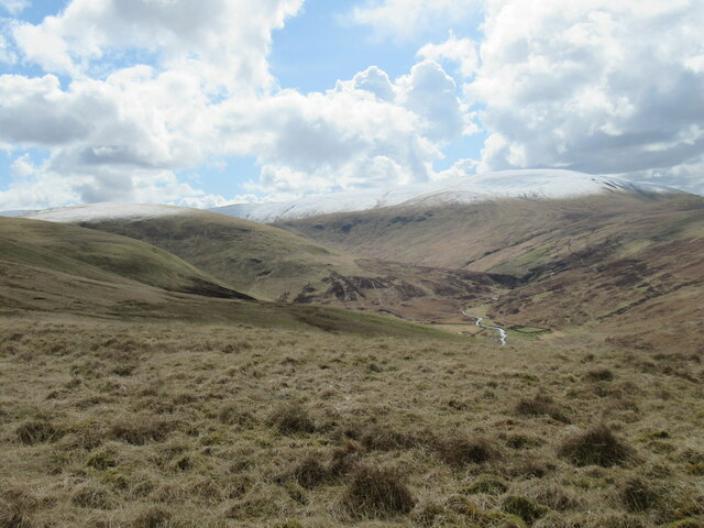
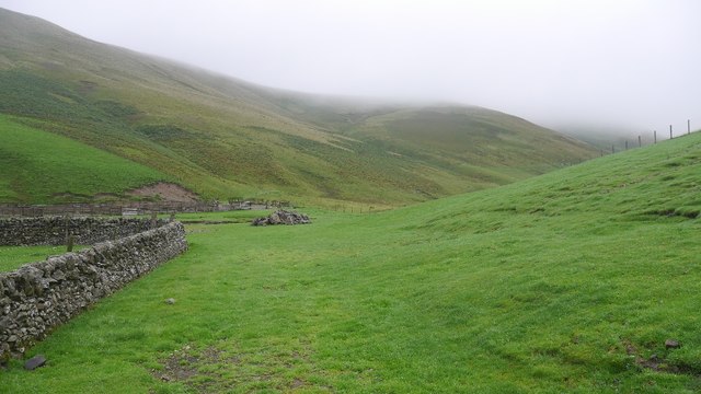
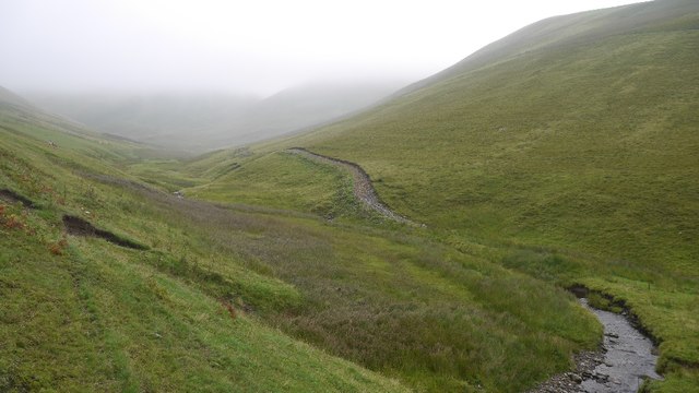
Birk Craigs Images

Images are sourced within 2km of 55.434624/-3.4179934 or Grid Reference NT1016. Thanks to Geograph Open Source API. All images are credited.

Taking Flight Two geese have just taken flight after I surprised them at the edge of Fruid Reservoir. The hill to the left of the prominent wall is called Big Knock.
Taking Flight
Two geese have just taken flight after I surprised them at the edge of Fruid Reservoir. The hill to the left of the prominent wall is called Big Knock.
Boats by the Water Several dinghies are pulled up on the shores of Fruid Reservoir. The hills are reflected on the first day of spring.
Boats by the Water
Several dinghies are pulled up on the shores of Fruid Reservoir. The hills are reflected on the first day of spring.
Above Fruid Looking down the length of Fruid Reservoir from the lower slopes of Strawberry Hill with Fruid Farm at the bottom of the picture.
Above Fruid
Looking down the length of Fruid Reservoir from the lower slopes of Strawberry Hill with Fruid Farm at the bottom of the picture.
Erie Hill from Strawberry Hill From the summit of the curiously named Strawberry Hill above Fruid Reservoir looking across to the shapely Erie Hill. A glorious early spring day.
Erie Hill from Strawberry Hill
From the summit of the curiously named Strawberry Hill above Fruid Reservoir looking across to the shapely Erie Hill. A glorious early spring day.
Fruid Reservoir viewed from Strawberry Hill The farm buildings at Fruid are visible below, with some of the turbines of the vast Clyde Wind Farm on the distant horizon.
Fruid Reservoir viewed from Strawberry Hill
The farm buildings at Fruid are visible below, with some of the turbines of the vast Clyde Wind Farm on the distant horizon.
Spur leading from Garelet Dod to Strawberry Hill The Fruid Reservoir is visible in the distance.
Spur leading from Garelet Dod to Strawberry Hill
The Fruid Reservoir is visible in the distance.
Wintry showers passing over Fruid Reservoir A cold day of snow and hail flurries and sunny intervals in a northerly airflow.
Wintry showers passing over Fruid Reservoir
A cold day of snow and hail flurries and sunny intervals in a northerly airflow.
The upper Fruid Water from Strawberry Hill Looking towards the Hart Fell group of hills, where a spell of cold northerly winds with snow showers has left decent snow cover above 600m. or so.
The upper Fruid Water from Strawberry Hill
Looking towards the Hart Fell group of hills, where a spell of cold northerly winds with snow showers has left decent snow cover above 600m. or so.
Fruid The farm at the head of the reservoir. Other farms like Hawkshaw were destroyed.
Fruid
The farm at the head of the reservoir. Other farms like Hawkshaw were destroyed.
On Strawberry Hill - view to Fruid Reservoir
On Strawberry Hill - view to Fruid Reservoir & Farm
Fruid Reservoir from Hart Fell View of the reservoir from the lower slopes of the hill.
Fruid Reservoir from Hart Fell
View of the reservoir from the lower slopes of the hill.
Low water, Fruid Reservoir Fruid Reservoir in the dry Summer of 2018.  The reservoir opened in 1968 and covered three farms: Hawkshaw, Carterhope, Nether Fruid and the haughs along the Fruid Water.
Low water, Fruid Reservoir
Fruid Reservoir in the dry Summer of 2018. The reservoir opened in 1968 and covered three farms: Hawkshaw, Carterhope, Nether Fruid and the haughs along the Fruid Water.
The exposed head of Fruid Reservoir A long stretch of the Fruid Water was inundated by a dam in 1968. After a dry Summer the water level had dropped. It was raining as I took this.
The exposed head of Fruid Reservoir
A long stretch of the Fruid Water was inundated by a dam in 1968. After a dry Summer the water level had dropped. It was raining as I took this.
Fruid Farm and houses at the head of the Fruid Reservoir.
Fruid
Farm and houses at the head of the Fruid Reservoir.
Field, Fern Hope Improved grassland at Fruid, surrounded by steep grassy hills.
Field, Fern Hope
Improved grassland at Fruid, surrounded by steep grassy hills.
Fern Hope At the head of the Fruid Reservoir with hills almost 700m high lurking in low cloud.  Unlike Games Hope, over the ridge, the hills here are still grazed by sheep.
Fern Hope
At the head of the Fruid Reservoir with hills almost 700m high lurking in low cloud. Unlike Games Hope, over the ridge, the hills here are still grazed by sheep.
Show me another place!

Birk Craigs is located at Grid Ref: NT1016 (Lat: 55.434624, Lng: -3.4179934)

Unitary Authority: The Scottish Borders

Police Authority: The Lothians and Scottish Borders

What 3 Words

///easy.euphoric.multiply. Near Moffat, Dumfries & Galloway

Related Wikis

Moffat Hills

The Moffat Hills are a range of hills in the Southern Uplands of Scotland. They form a roughly triangular shape with a west facing side, a north facing...

Fruid Reservoir

Fruid is a small reservoir in the Scottish Borders area of Scotland, UK, near Menzion. It is formed by damming the Fruid Water, and supplements the contents...

Hart Fell

Hart Fell is a hill in the Moffat Hills range, part of the Southern Uplands of Scotland. It lies north of the town of Moffat on the border with the Scottish...

Talla Water

Talla Water is a river in the Scottish Borders area of Scotland, near Tweedsmuir. It feeds the Talla Reservoir, and is a tributary of the River Tweed....

Have you been to Birk Craigs?

Leave your review of Birk Craigs below (or comments, questions and feedback).