Merecleuch Hill

Hill, Mountain in Dumfriesshire

Scotland

Merecleuch Hill

Forestry road in Craigieburn Wood
Forestry road in Craigieburn Wood Credit: Steven Brown

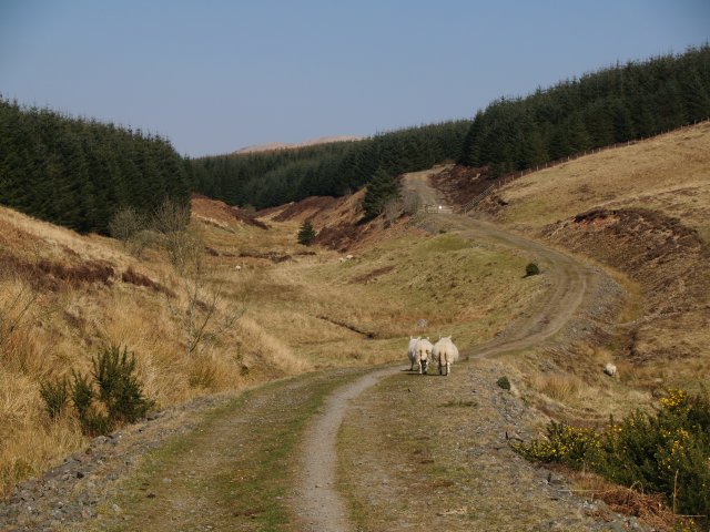
Merecleuch Hill is a prominent hill located in Dumfriesshire, Scotland. It is part of the larger Southern Uplands range and is situated near the village of Moffat. The hill stands at an elevation of approximately 482 meters (1,581 feet) and offers stunning panoramic views of the surrounding countryside.

Merecleuch Hill is characterized by its gentle slopes and rounded summit, making it a relatively easy and popular destination for hikers and outdoor enthusiasts. The hill is covered in lush green vegetation, primarily consisting of heather, grasses, and scattered trees, which provide a picturesque backdrop for visitors.

The ascent to the summit of Merecleuch Hill is accessible via well-marked trails that wind through the rolling landscape. Along the way, hikers can expect to encounter diverse wildlife, including birds, rabbits, and deer, adding to the natural charm of the area.

Once at the top, visitors are rewarded with breathtaking views that extend across the Moffat Valley and surrounding hills, showcasing the natural beauty of Dumfriesshire. On clear days, it is even possible to catch a glimpse of the distant hills of the Scottish Borders.

Merecleuch Hill offers a peaceful retreat for those seeking a tranquil and scenic outdoor experience. Whether it's a leisurely walk or a more challenging hike, this hill is a wonderful destination for nature lovers and those looking to escape the hustle and bustle of city life.

If you have any feedback on the listing, please let us know in the comments section below.

Merecleuch Hill Images

Images are sourced within 2km of 55.353616/-3.4152379 or Grid Reference NT1007. Thanks to Geograph Open Source API. All images are credited.

Forestry road in Craigieburn Wood
The Birnock Water View from the forest edge, upstream from here the glen is full of trees. Horrible weather.
The Birnock Water
View from the forest edge, upstream from here the glen is full of trees. Horrible weather.
Rough grazing upstream of Blaebeck Above the Birnock Water.
Rough grazing upstream of Blaebeck
Above the Birnock Water.
Bench along the forest trail of Craigieburn Hill The second bench along the footpaths around the forest of Craigieburn Hill, near Moffat, Scotland.
Bench along the forest trail of Craigieburn Hill
The second bench along the footpaths around the forest of Craigieburn Hill, near Moffat, Scotland.
Sheep farming
Sheep farming
Moffat Well Discovered in 1633, the waters of this well were said to cure rheumatism, affections of the lungs and diseases of the skin.   In the last century visitors to the town would come to drink the waters.
Moffat Well
Discovered in 1633, the waters of this well were said to cure rheumatism, affections of the lungs and diseases of the skin. In the last century visitors to the town would come to drink the waters.
Forrest Road, Hind Gill Hind Gill is the small burn crossed by the road in the middle distance.
Forrest Road, Hind Gill
Hind Gill is the small burn crossed by the road in the middle distance.
Hind Gill, near Moffat The Gill becomes a narrow ravine a few hundred metres downstream, spanned by the bridge at Archbank.
Hind Gill, near Moffat
The Gill becomes a narrow ravine a few hundred metres downstream, spanned by the bridge at Archbank.
Blaebeck, near Moffat A small farm just past the end of the public road at Moffat Well.
Blaebeck, near Moffat
A small farm just past the end of the public road at Moffat Well.
Ruined wall and forest, Greygill Head. Although quite steep-sided and rocky to the S, the summit of Greygill Head is flat and boggy, with an old wall breaking through the heather.
Ruined wall and forest, Greygill Head.
Although quite steep-sided and rocky to the S, the summit of Greygill Head is flat and boggy, with an old wall breaking through the heather.
Disused quarry, Greygill Head. Quite extensive workings, this must have been the source of some of the building stone for the town of Moffat
Disused quarry, Greygill Head.
Quite extensive workings, this must have been the source of some of the building stone for the town of Moffat
Gates, walls and fences, Stot Knowe The division between the rough grazing on the left and the heather slopes on the right is very distinctive.  Swatte Fell is seen in the far distance.
Gates, walls and fences, Stot Knowe
The division between the rough grazing on the left and the heather slopes on the right is very distinctive. Swatte Fell is seen in the far distance.
Birnock Water, near Merecleuch Hill Looking downstream.  The burn at this point is almost roofed over with small bushes of willow or alder.
Birnock Water, near Merecleuch Hill
Looking downstream. The burn at this point is almost roofed over with small bushes of willow or alder.
Forest edge, Merecleuch Hill
Birnock Water The site of a small ford.  Looking upstream towards Swatte Fell in the far distance
Birnock Water
The site of a small ford. Looking upstream towards Swatte Fell in the far distance
Gate and fence, Auldton Fell
Valley of the Birnock Water Looking towards Swatte Fell and Birnock Cloves
Valley of the Birnock Water
Looking towards Swatte Fell and Birnock Cloves
Show me another place!

Merecleuch Hill is located at Grid Ref: NT1007 (Lat: 55.353616, Lng: -3.4152379)

Unitary Authority: Dumfries and Galloway

Police Authority: Dumfries and Galloway

What 3 Words

///redouble.meanings.forgiven. Near Moffat, Dumfries & Galloway

Nearby Locations

Merecleuch Hill

Related Wikis

Moffat

Moffat (Scottish Gaelic: Mofad) is a burgh and parish in Dumfriesshire, now part of the Dumfries and Galloway local authority area in Scotland. It lies...
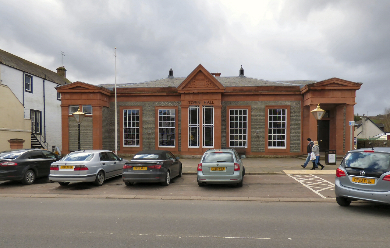
Moffat Town Hall

Moffat Town Hall is a municipal building in the High Street in Moffat, Dumfries and Galloway, Scotland. The structure, which is used as community events...

Moffat Museum

Moffat Museum is a community museum in Moffat, Scotland. It was established in the Old Moffat Bakehouse in 1984. The museum expanded into a neighbouring...

Moffat Academy

Moffat Academy is a school in Moffat, Dumfries and Galloway, Scotland. It educates children from nursery to Secondary 6. == History == Moffat Academy traces...

Moffat railway station

Moffat railway station was a station and the terminus of a short branch line which served Moffat, in the Scottish county of Dumfries and Galloway. It was...
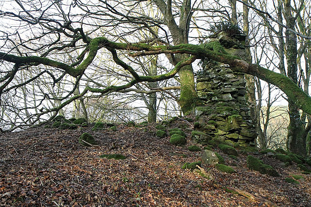
Cornal Tower

Cornal Tower is the ruins of a tower house located near Moffat, Dumfries-shire, Scotland. Alternative names are Polcornare, Cornal Burn, or Logan. The...

Crown of Scotland (hill)

The Crown of Scotland is a hill in the Scottish Borders, Scotland. At a relatively small elevation from the surrounding peaks, it is situated to the north...

Auchencastle railway station

Auchencastle railway station was a private station which served Auchencastle, near Beattock, in the Scottish county of Dumfries and Galloway. It was used...

Have you been to Merecleuch Hill?

Leave your review of Merecleuch Hill below (or comments, questions and feedback).