Carn Fiaclach

Hill, Mountain in Aberdeenshire

Scotland

Carn Fiaclach

Winter camp in Upper Glen Quoich
Winter camp in Upper Glen Quoich Credit: Alan Reid

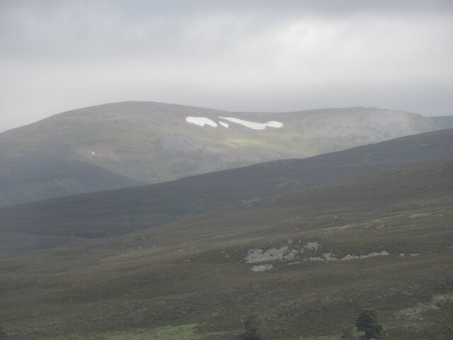
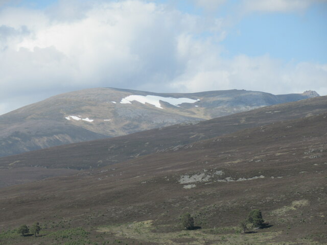
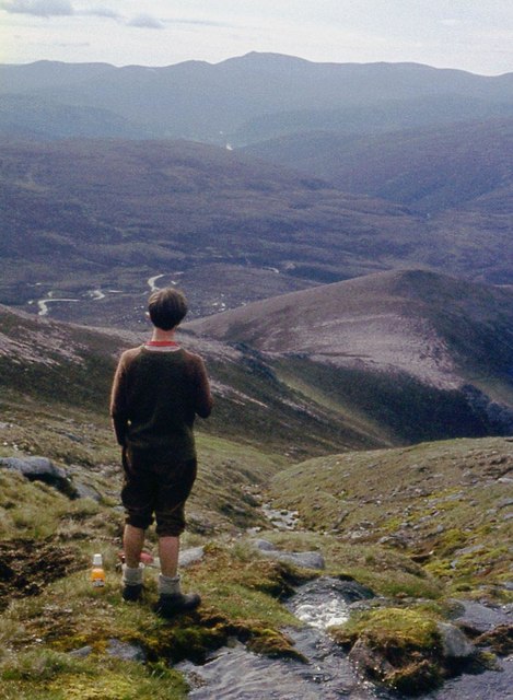
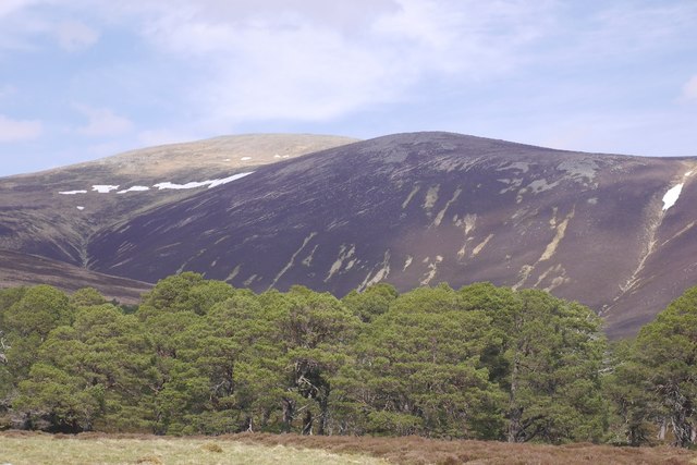
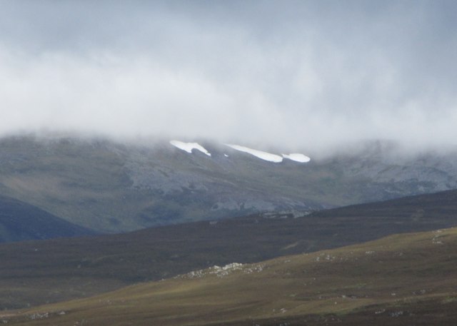
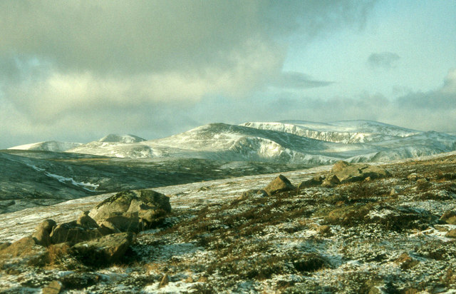
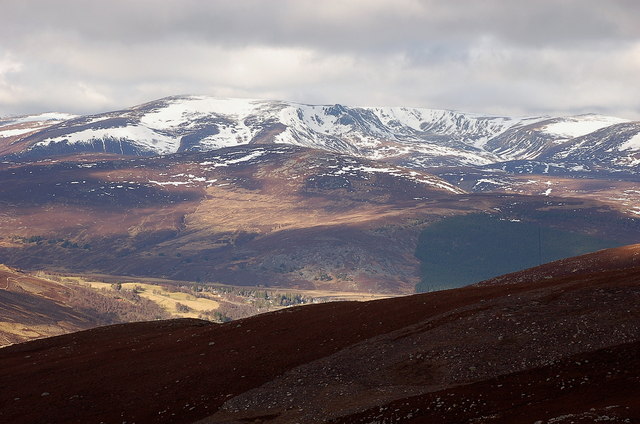
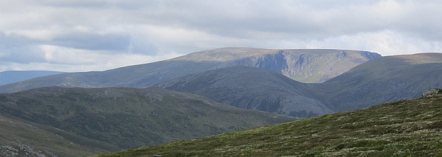
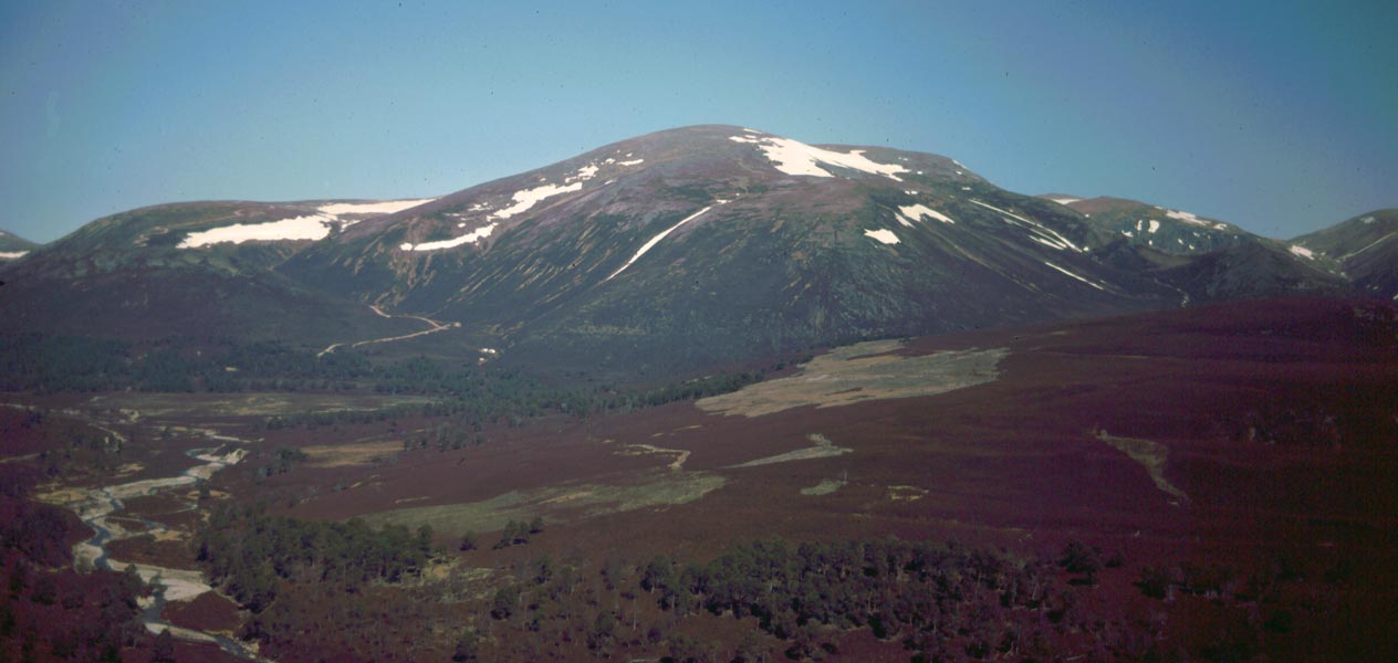
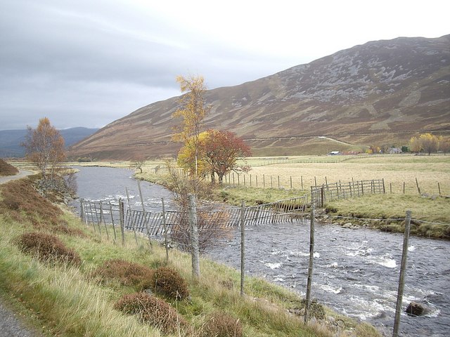
Carn Fiaclach is a prominent hill located in the Aberdeenshire region of Scotland. It stands at an elevation of approximately 678 meters (2,224 feet) above sea level and is part of the Cairngorms National Park. The hill is situated in a remote and rugged area, offering breathtaking panoramic views of the surrounding landscapes.

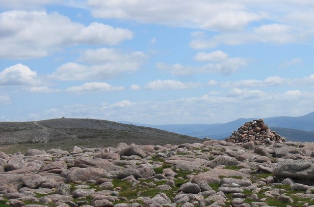
Carn Fiaclach is characterized by its rocky terrain, with steep slopes covered in heather and grasses. It is a popular destination for hikers and outdoor enthusiasts, as it provides a challenging but rewarding climb. The ascent to the summit is often steep and requires a good level of fitness, but the views from the top make it all worthwhile.

At the summit of Carn Fiaclach, visitors are rewarded with expansive vistas of the surrounding countryside, including the nearby mountains and glens. On a clear day, it is possible to see as far as the Cairngorms and the Grampian Mountains.

The hill is home to a variety of wildlife, including red deer, ptarmigan, and mountain hares. Birdwatchers may also spot birds of prey, such as golden eagles and peregrine falcons, soaring above the cliffs.

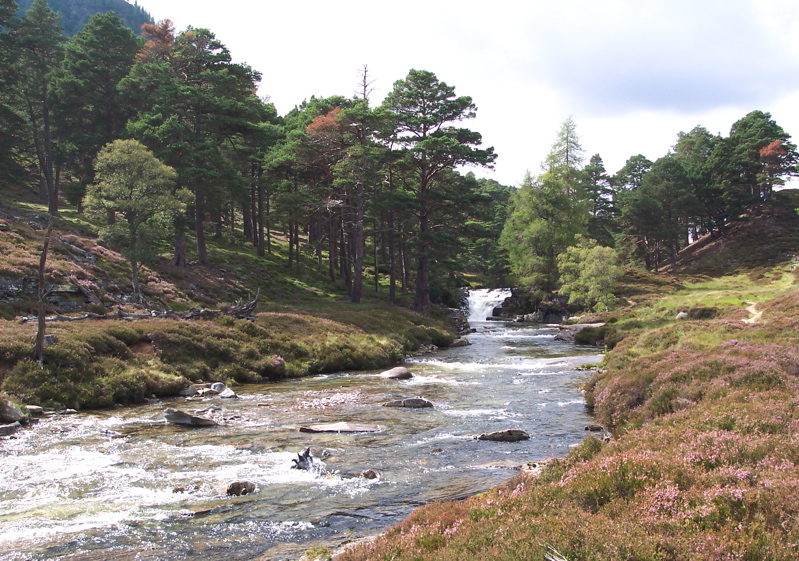
Due to its remote location, Carn Fiaclach offers a sense of tranquility and solitude, making it a perfect escape from the hustle and bustle of daily life. Whether you are an experienced hiker or simply looking to enjoy the beauty of nature, Carn Fiaclach provides a memorable outdoor experience.

If you have any feedback on the listing, please let us know in the comments section below.

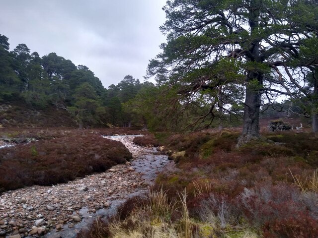
Carn Fiaclach Images

Images are sourced within 2km of 57.054891/-3.4795694 or Grid Reference NO1096. Thanks to Geograph Open Source API. All images are credited.

Winter camp in Upper Glen Quoich
Snow patches in Ear-choire Sneachdach, Beinn a' Bhuird Patches of snow usually linger in Ear-choire Sneachdach ('the east snowy corrie') well into summer or, occasionally, autumn. Climate change has led to a trend towards reduction in snow at this site and an earlier melt date, and there was noticeably less snow here on this day than when I passed by a week earlier.

The longest of the patches has traditionally been nicknamed the Laird's Tablecloth.
Snow patches in Ear-choire Sneachdach, Beinn a' Bhuird
Patches of snow usually linger in Ear-choire Sneachdach ('the east snowy corrie') well into summer or, occasionally, autumn. Climate change has led to a trend towards reduction in snow at this site and an earlier melt date, and there was noticeably less snow here on this day than when I passed by a week earlier. The longest of the patches has traditionally been nicknamed the Laird's Tablecloth.
Snow patches in Ear-choire Sneachdach, Beinn a' Bhuird Ear-choire Sneachdach means the 'east snowy corrie'. The longest patch is known as the Laird's Tablecloth, and usually lasts well into summer (or occasionally autumn).
Snow patches in Ear-choire Sneachdach, Beinn a' Bhuird
Ear-choire Sneachdach means the 'east snowy corrie'. The longest patch is known as the Laird's Tablecloth, and usually lasts well into summer (or occasionally autumn).
Southern slopes of Beinn a' Bhuird
Snow patch, Alltan Tarsuinn 850m above sea level on the southern slopes of Beinn a' Bhuird.
Snow patch, Alltan Tarsuinn
850m above sea level on the southern slopes of Beinn a' Bhuird.
Beinn a' Bhuird Snow patches in Coire Gorm on the southern side of the hill.  The summit is a long way north of here, at the other end of a vast plateau.
Beinn a' Bhuird
Snow patches in Coire Gorm on the southern side of the hill. The summit is a long way north of here, at the other end of a vast plateau.
Bruach Mhòr Southern slopes of Beinn a' Bhuird.
Bruach Mhòr
Southern slopes of Beinn a' Bhuird.
Snow patches in Ear-choire Sneachdach, Beinn a' Bhuird Patches of snow usually linger in Ear-choire Sneachdach ('the east snowy corrie') well into summer or, occasionally, autumn.  Despite limited winter snowfall, a cold and snowy spring and a cool early summer have ensured that a reasonable amount of snow remains at this location in early July 2019.

The longest of the patches has traditionally been nicknamed the Laird's Tablecloth.
Snow patches in Ear-choire Sneachdach, Beinn a' Bhuird
Patches of snow usually linger in Ear-choire Sneachdach ('the east snowy corrie') well into summer or, occasionally, autumn. Despite limited winter snowfall, a cold and snowy spring and a cool early summer have ensured that a reasonable amount of snow remains at this location in early July 2019. The longest of the patches has traditionally been nicknamed the Laird's Tablecloth.
Rocks at the head of the bealach Rocks and moorland at the high point of the path between Gleann an t-Slugain and the upper reaches of the Quoich. In the distance are the eastern corries of Beinn a' Bhuird.
Rocks at the head of the bealach
Rocks and moorland at the high point of the path between Gleann an t-Slugain and the upper reaches of the Quoich. In the distance are the eastern corries of Beinn a' Bhuird.
North slopes of Carn na Criche
River Quoich in Caledonian forest The path fords the river further up, continues on the north side, and then crosses again a few hundred metres downstream. In between, the southern side of the river (from which this picture was taken) is trackless sparse woodland.
River Quoich in Caledonian forest
The path fords the river further up, continues on the north side, and then crosses again a few hundred metres downstream. In between, the southern side of the river (from which this picture was taken) is trackless sparse woodland.
High Cairngorms from Beinn a' Bhuird A thin year for snow cover
High Cairngorms from Beinn a' Bhuird
A thin year for snow cover
The corries of Beinn a' Bhuird The sweep of E-facing corries seen from spot height 795m on the E side of Glen Callater. Much of the skyline in view here is above 1100m.
The corries of Beinn a' Bhuird
The sweep of E-facing corries seen from spot height 795m on the E side of Glen Callater. Much of the skyline in view here is above 1100m.
Beinn a' Bhuird The southern end of the vast Beinn a' Bhuird with a sunlit Coire na Ciche.
Beinn a' Bhuird
The southern end of the vast Beinn a' Bhuird with a sunlit Coire na Ciche.
Coire na Ciche Coire na Ciche is the southernmost of the Beinn a' Bhuird corries.  On the north side of the corrie is the distinctive rock feature of A' Chioch.
Coire na Ciche
Coire na Ciche is the southernmost of the Beinn a' Bhuird corries. On the north side of the corrie is the distinctive rock feature of A' Chioch.
Caledonian pine woods in upper Glen Quoich
Pines in upper Glen Quoich
Burn descending from A' Chioch of Beinn a' Bhuird Taken from a Hi-8 video of a ski trip round Beinn a' Bhuird - date may be out by a year or so!
Burn descending from A' Chioch of Beinn a' Bhuird
Taken from a Hi-8 video of a ski trip round Beinn a' Bhuird - date may be out by a year or so!
Show me another place!

Carn Fiaclach is located at Grid Ref: NO1096 (Lat: 57.054891, Lng: -3.4795694)

Unitary Authority: Aberdeenshire

Police Authority: North East

What 3 Words

///prospered.seaweed.scanner. Near Inverey, Aberdeenshire

Nearby Locations

Carn Fiaclach

Related Wikis

Beinn a' Bhùird

Beinn a' Bhùird is a Munro in the Cairngorm mountain range of Scotland. In Watson (1975) the author suggests the mountain should be named Beinn Bòrd -...

Beinn Bhreac (Glen Derry)

Beinn Bhreac is a twin-peaked Scottish mountain located above Glen Derry in the Cairngorm Mountains approximately 11 kilometres (7 mi) north-west of Braemar...

Ben Avon

Ben Avon (Scottish Gaelic: Beinn Athfhinn, 'mountain of the Avon') is a mountain in the Cairngorms of Scotland. It is a sprawling mountain with a broad...

Linn of Quoich

Linn of Quoich is a waterfall of Scotland. == See also == Waterfalls of Scotland == References ==

River Quoich

The River Quoich is a tributary of the River Dee in Aberdeenshire, Scotland. It flows in a generally southerly direction and is about 15 km long (including...

Mar Lodge Estate

Mar Lodge Estate is a highland estate in western Aberdeenshire, Scotland, which has been owned and managed by the National Trust for Scotland (NTS) since...

Allanaquoich

Allanaquoich is a locality on Mar Lodge Estate, Aberdeenshire, Scotland. Allanaquoich is little more than a farm house now although it once could have...

Clunie Water

Clunie Water is a river of Aberdeenshire, Scotland. It is a tributary of the River Dee, joining the river at Braemar, among grey stone buildings. Callater...

Nearby Amenities

Located within 500m of 57.054891,-3.4795694
Carn Fiaclach
Ele: 807
Natural: peak
Lat/Long: 57.0545725/-3.4790183
The data included in this document is from www.openstreetmap.org. The data is made available under ODbL.

Have you been to Carn Fiaclach?

Leave your review of Carn Fiaclach below (or comments, questions and feedback).