Little Black Cleuch

Valley in Peeblesshire

Scotland

Little Black Cleuch

Wintry showers passing over Fruid Reservoir A cold day of snow and hail flurries and sunny intervals in a northerly airflow.
Wintry showers passing over Fruid Reservoir Credit: Alan O'Dowd

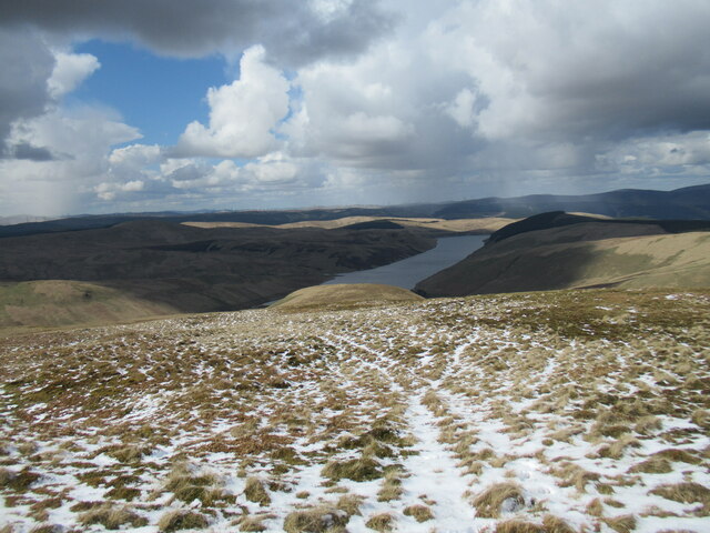
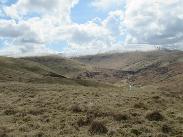
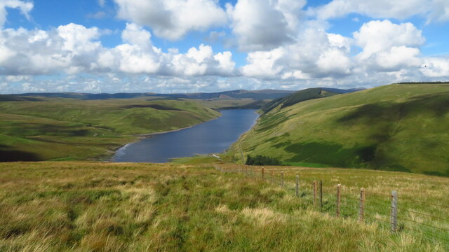
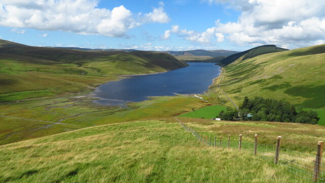
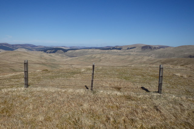
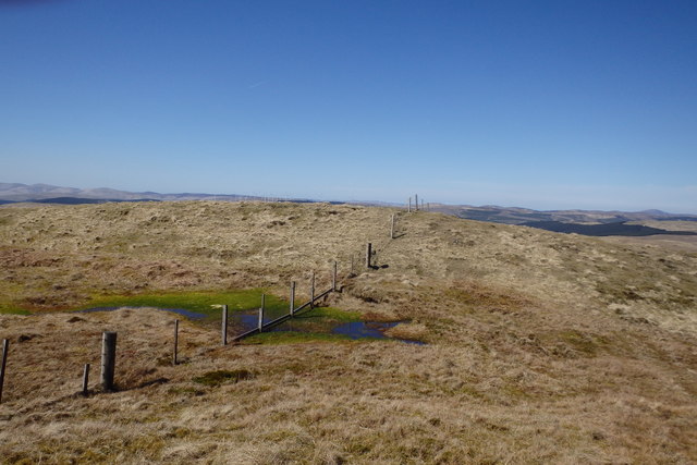
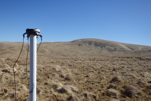
Little Black Cleuch is a picturesque valley located in Peeblesshire, in the southern region of Scotland. Nestled within the rolling hills and surrounded by a lush landscape, this valley offers a tranquil and scenic retreat for nature enthusiasts and hikers alike.

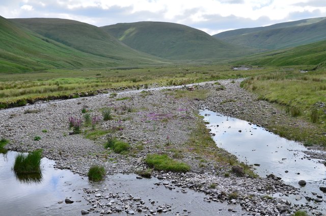
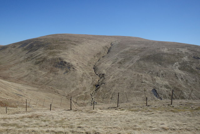
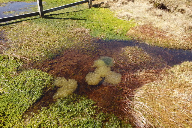
The valley gets its name from the Black Cleuch Burn, a small stream that runs through it, adding to its charm and beauty. The valley itself is characterized by its gentle slopes, covered with a mix of heather, grasses, and scattered trees. This diverse vegetation provides a vibrant display of colors throughout the year, from the vibrant purples of the heather in summer to the golden hues of the grasses in autumn.

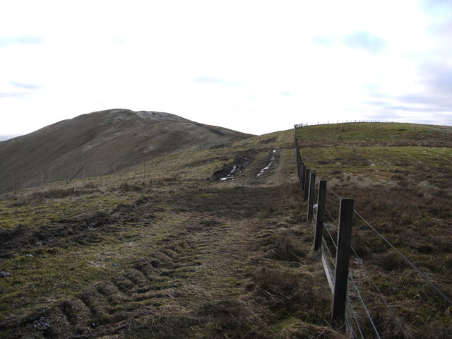
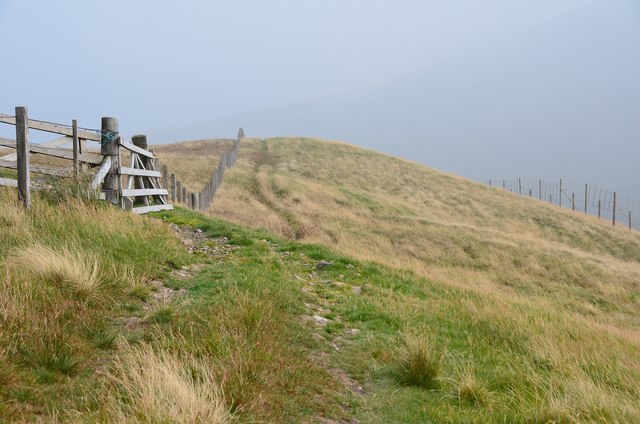
Little Black Cleuch is also home to a variety of wildlife, including red deer, rabbits, and various bird species. Nature lovers can spot these creatures while exploring the valley's numerous walking trails, which offer breathtaking views of the surrounding hills and the distant horizon.

The valley's peaceful ambiance and unspoiled natural beauty make it an ideal destination for those seeking solitude or a break from the hustle and bustle of everyday life. Visitors can relax and unwind, immersing themselves in the tranquility of the valley and taking in the fresh air and stunning vistas.

Overall, Little Black Cleuch is a hidden gem in Peeblesshire, offering an idyllic setting for nature lovers and a chance to reconnect with the serene beauty of the Scottish countryside.

If you have any feedback on the listing, please let us know in the comments section below.

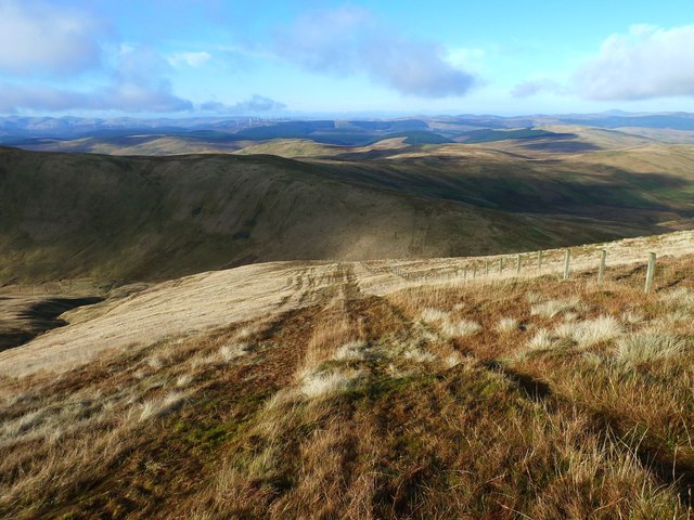
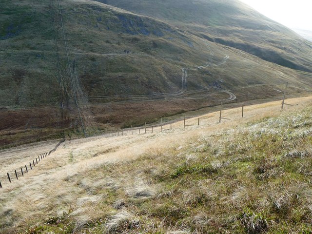
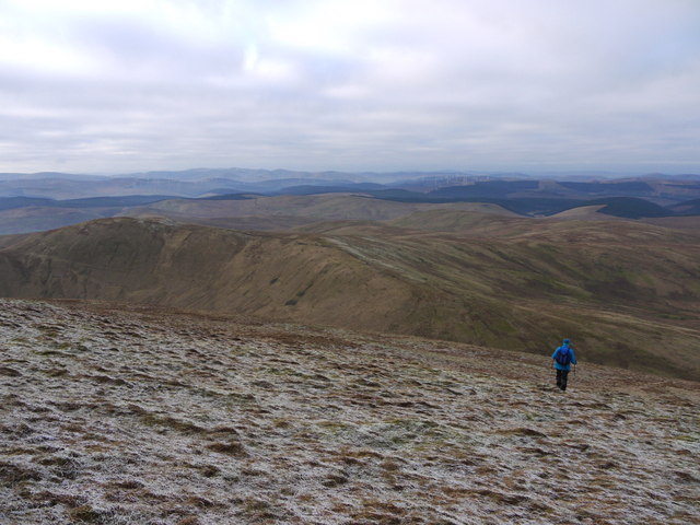
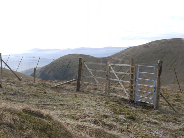
Little Black Cleuch Images

Images are sourced within 2km of 55.431025/-3.4183859 or Grid Reference NT1016. Thanks to Geograph Open Source API. All images are credited.

Wintry showers passing over Fruid Reservoir A cold day of snow and hail flurries and sunny intervals in a northerly airflow.
Wintry showers passing over Fruid Reservoir
A cold day of snow and hail flurries and sunny intervals in a northerly airflow.
The upper Fruid Water from Strawberry Hill Looking towards the Hart Fell group of hills, where a spell of cold northerly winds with snow showers has left decent snow cover above 600m. or so.
The upper Fruid Water from Strawberry Hill
Looking towards the Hart Fell group of hills, where a spell of cold northerly winds with snow showers has left decent snow cover above 600m. or so.
On Strawberry Hill - view to Fruid Reservoir
Bridge over the Fruid Water The bridge for the track from Fruid farm a short way upstream from the head of the reservoir. The slopes of Strawberry Hill, Garelet Dod and Ellers Cleuch Rig form a steep wall to the glen's eastern side.
Bridge over the Fruid Water
The bridge for the track from Fruid farm a short way upstream from the head of the reservoir. The slopes of Strawberry Hill, Garelet Dod and Ellers Cleuch Rig form a steep wall to the glen's eastern side.
Fruid Water and Fruid Reservoir Seen from the bridge on the track to Fruid farm. The plantations are on the side of Craig Law and extend north towards Talla Reservoir and Tweedsmuir.
Fruid Water and Fruid Reservoir
Seen from the bridge on the track to Fruid farm. The plantations are on the side of Craig Law and extend north towards Talla Reservoir and Tweedsmuir.
Fruid Water and glen A view upstream from the bridge on the track to Fruid farm.
Fruid Water and glen
A view upstream from the bridge on the track to Fruid farm.
Fence and track on The Gyle The tractor tracks have been caused by vehicle access for the extensive deer-fencing to protect an area of new, and not yet planted, forestry.
Fence and track on The Gyle
The tractor tracks have been caused by vehicle access for the extensive deer-fencing to protect an area of new, and not yet planted, forestry.
On Whitehope Knowe The fence to the left heads north while the Corehead boundary fence continues round to Hart Fell with the deer fence on the right keeping on the lower slopes of the hill, enclosing new plantation.
On Whitehope Knowe
The fence to the left heads north while the Corehead boundary fence continues round to Hart Fell with the deer fence on the right keeping on the lower slopes of the hill, enclosing new plantation.
On Whitehope Knowe Looking towards Hart Fell
On Whitehope Knowe
Looking towards Hart Fell
On Whitehope Knowe The summit area
On Whitehope Knowe
The summit area
Spring on Garlet Hill Under Whitehope Knowe
Spring on Garlet Hill
Under Whitehope Knowe
Frogspawn, Garlet Hill The spawn has a greenish tinge
Frogspawn, Garlet Hill
The spawn has a greenish tinge
Post Under Ballaman Hill Looking towards Hart Fell. Purpose of post unknown.
Post Under Ballaman Hill
Looking towards Hart Fell. Purpose of post unknown.
Descending NW from Hart Fell A steep descent from Hart Fell followed by a shorter, steep ascent to Whitehope Know.  The tracks have been made by tractors involved in erecting deer fencing.
Descending NW from Hart Fell
A steep descent from Hart Fell followed by a shorter, steep ascent to Whitehope Know. The tracks have been made by tractors involved in erecting deer fencing.
Deer Fencing on Barry Grain Rig The re-afforestation of Corehead involves erecting deer fencing.  Unfortunately, in the saturated conditions  the tractor has left extensive tracks in grass.
Deer Fencing on Barry Grain Rig
The re-afforestation of Corehead involves erecting deer fencing. Unfortunately, in the saturated conditions the tractor has left extensive tracks in grass.
Descending the NW slopes of Hart Fell
Deer fencing on Hartfell Shoulder This fence protects a huge area of new forestry planting. The fenced area seems to extend over a huge area to the SW of Hartfell and the access tracks have disrupted some of the paths in the area marked by the OS.
Deer fencing on Hartfell Shoulder
This fence protects a huge area of new forestry planting. The fenced area seems to extend over a huge area to the SW of Hartfell and the access tracks have disrupted some of the paths in the area marked by the OS.
Show me another place!

Little Black Cleuch is located at Grid Ref: NT1016 (Lat: 55.431025, Lng: -3.4183859)

Unitary Authority: The Scottish Borders

Police Authority: The Lothians and Scottish Borders

What 3 Words

///ratty.boom.clues. Near Moffat, Dumfries & Galloway

Related Wikis

Moffat Hills

The Moffat Hills are a range of hills in the Southern Uplands of Scotland. They form a roughly triangular shape with a west facing side, a north facing...

Hart Fell

Hart Fell is a hill in the Moffat Hills range, part of the Southern Uplands of Scotland. It lies north of the town of Moffat on the border with the Scottish...

Fruid Reservoir

Fruid is a small reservoir in the Scottish Borders area of Scotland, UK, near Menzion. It is formed by damming the Fruid Water, and supplements the contents...

Devil's Beef Tub

The Devil's Beef Tub (Marquis of Annandale's Beef-Tub, Beef-Stand, MacCleran's Loup) is a deep, dramatic hollow in the hills north of the Scottish town...

Have you been to Little Black Cleuch?

Leave your review of Little Black Cleuch below (or comments, questions and feedback).