Brown Hill

Hill, Mountain in Peeblesshire

Scotland

Brown Hill

Old shed, Cardon. By Cardon House, a slowly decaying wooden shed. Like a lot of Glenholm, this square is a mix of forestry and farmland.
Old shed, Cardon. Credit: Richard Webb

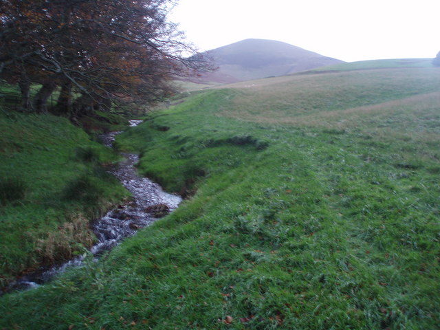
Brown Hill is a prominent hill located in the Peeblesshire region of Scotland. Situated in the southern part of the country, it forms part of the picturesque Scottish Borders. With an elevation of approximately 526 meters (1,726 feet), it is not classified as a mountain but rather a hill. However, its height and distinctive shape make it a notable landmark in the area.

Brown Hill boasts a gently sloping landscape covered in heather and grass, providing a beautiful contrast against the surrounding countryside. The hill is characterized by its rounded summit, which offers breathtaking panoramic views of the rolling hills and valleys that stretch out towards the horizon. On clear days, it is possible to see the nearby towns of Peebles and Innerleithen.

The terrain of Brown Hill is ideal for outdoor enthusiasts, as it provides excellent opportunities for hiking and walking. The hill is accessible via well-maintained paths that wind their way through the countryside, ensuring a pleasant and safe journey to the top. The ascent is of moderate difficulty, making it suitable for both experienced hikers and those seeking a more leisurely stroll.

Nature lovers will also appreciate the diverse wildlife that inhabits the area surrounding Brown Hill. Birdwatchers can spot a variety of species, including red grouse and golden plovers, while the hillside is home to roe deer and other small mammals.

Overall, Brown Hill in Peeblesshire offers a perfect blend of natural beauty, recreational activities, and stunning vistas, making it a popular destination for locals and visitors alike.

If you have any feedback on the listing, please let us know in the comments section below.

Brown Hill Images

Images are sourced within 2km of 55.586237/-3.4612967 or Grid Reference NT0733. Thanks to Geograph Open Source API. All images are credited.

Old shed, Cardon. By Cardon House, a slowly decaying wooden shed. Like a lot of Glenholm, this square is a mix of forestry and farmland.
Old shed, Cardon.
By Cardon House, a slowly decaying wooden shed. Like a lot of Glenholm, this square is a mix of forestry and farmland.
Pitch and Putt, Cardon Cardon Farm is now diversifying, with a winery and wildlife refuge. They have also got this road side pitch and putt course.
Pitch and Putt, Cardon
Cardon Farm is now diversifying, with a winery and wildlife refuge. They have also got this road side pitch and putt course.
Sunlit track to Mitchell Hill
Kilbucho Lodge House
Kilbucho Burn Looking NE towards Broughton hills
Kilbucho Burn
Looking NE towards Broughton hills
Road near Gosland Looking towards Knowehead Hill
Road near Gosland
Looking towards Knowehead Hill
The Summit of Goseland Hill View south towards a cloud capped Culter Fell from Goseland Hill (435m). This hill sits on the main watershed of Scotland with the Tweed a short distance to the east and the Clyde a short distance to the west.
The Summit of Goseland Hill
View south towards a cloud capped Culter Fell from Goseland Hill (435m). This hill sits on the main watershed of Scotland with the Tweed a short distance to the east and the Clyde a short distance to the west.
No Danger of Fire Managed forestry near Broughton in the Scottish Borders and not much chance of a fire on a dreich November day - even the sign looks damp!
No Danger of Fire
Managed forestry near Broughton in the Scottish Borders and not much chance of a fire on a dreich November day - even the sign looks damp!
Fort Remains Just about discernible are the remains of Knowe Kniffling prehistoric fort - also fairly new plantation on the other side of the fence.
Fort Remains
Just about discernible are the remains of Knowe Kniffling prehistoric fort - also fairly new plantation on the other side of the fence.
Common Law Fence Junction Near the summit of Common Law, fence junction and forestry - obviously been a boundary here for some time as there is an old wall beside the fence.
Common Law Fence Junction
Near the summit of Common Law, fence junction and forestry - obviously been a boundary here for some time as there is an old wall beside the fence.
Middle Rig Mosaic Nice mottled colours on the lower slopes of Cardon Hill south of Biggar in the Scottish Borders.
Middle Rig Mosaic
Nice mottled colours on the lower slopes of Cardon Hill south of Biggar in the Scottish Borders.
Manse Burn Head Fairly miserable day in the Scottish Borders looking across to Manse Burn Head from lower slopes of Cardon Hill
Manse Burn Head
Fairly miserable day in the Scottish Borders looking across to Manse Burn Head from lower slopes of Cardon Hill
Kilbucho Church I suspect the cemetery was used long after the church fell into ruin as there are several gravestones from the turn of the 19th century, unless the building has deteriorated rapidly - quite possible at 1000 feet up.
There are worse locations as a last resting place.
Hill in the distance is Cardons Hill.
Kilbucho Church
I suspect the cemetery was used long after the church fell into ruin as there are several gravestones from the turn of the 19th century, unless the building has deteriorated rapidly - quite possible at 1000 feet up. There are worse locations as a last resting place. Hill in the distance is Cardons Hill.
Cardon Hill View Cardon Hill seems to dominate the skyline round these parts, despite being basically a shoulder of Chapelgill.
Cardon Hill View
Cardon Hill seems to dominate the skyline round these parts, despite being basically a shoulder of Chapelgill.
Hill track near Kilbucho Taken from a junction of two roads - I hope and trust that the industrial sign refers to another road up to a new timber house on the right, not the road shown which runs into some fine hill country in the Coulter Fells.
Hill track near Kilbucho
Taken from a junction of two roads - I hope and trust that the industrial sign refers to another road up to a new timber house on the right, not the road shown which runs into some fine hill country in the Coulter Fells.
Goseland Hill above Kilbucho A heathery isolated hill above parkland.
Goseland Hill above Kilbucho
A heathery isolated hill above parkland.
Ruined church, Kilbucho The old parish church has a long history, certainly back to the 13th century. These ruins probably date from the 18th c; the church was abandoned around 1810. The house just visible in the trees is the manse, built in 1751 and in very good repair still.

More information can be found from the Royal Commission on the Ancient and Historical Monuments of Scotland (RCAHMS) website:  canmore.rcahms.gov.uk
Ruined church, Kilbucho
The old parish church has a long history, certainly back to the 13th century. These ruins probably date from the 18th c; the church was abandoned around 1810. The house just visible in the trees is the manse, built in 1751 and in very good repair still. More information can be found from the Royal Commission on the Ancient and Historical Monuments of Scotland (RCAHMS) website: canmore.rcahms.gov.uk
Old church and cultivation terraces, Kilbucho There are three very well-marked terraces on the N side of the Mitchelhill Burn. The 1:25,000 map shows them continuing a few hundred metres further east.
Old church and cultivation terraces, Kilbucho
There are three very well-marked terraces on the N side of the Mitchelhill Burn. The 1:25,000 map shows them continuing a few hundred metres further east.
Show me another place!

Brown Hill is located at Grid Ref: NT0733 (Lat: 55.586237, Lng: -3.4612967)

Unitary Authority: The Scottish Borders

Police Authority: The Lothians and Scottish Borders

What 3 Words

///pods.plankton.foremost. Near Biggar, South Lanarkshire

Nearby Locations

Brown Hill

Related Wikis

Kilbucho

Kilbucho (Scottish Gaelic: Cille Bheagha) is a small settlement in the parish of Broughton, Glenholm and Kilbucho in the Scottish Borders area of Scotland...
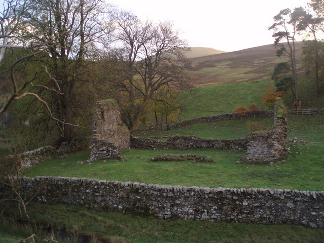
Wrae Tower

Wrae Tower is a ruined 16th-century stone tower house, located in the upper Tweed Valley in the Scottish Borders area of Scotland, and similarly south...

Broughton railway station (Scotland)

Broughton railway station served the village of Broughton, Scottish Borders, Scotland from 1860 to 1950 on the Symington, Biggar and Broughton Railway...

Broughton, Glenholm and Kilbucho

Broughton, Glenholm and Kilbucho is a parish in Peeblesshire in the Scottish Borders, 11 miles south-west of Peebles, lying in the upper part of the valley...

Nearby Amenities

Located within 500m of 55.586237,-3.4612967
Power: pole
Lat/Long: 55.5889111/-3.4551144
The data included in this document is from www.openstreetmap.org. The data is made available under ODbL.

Have you been to Brown Hill?

Leave your review of Brown Hill below (or comments, questions and feedback).