Newholm Hill

Hill, Mountain in Lanarkshire

Scotland

Newholm Hill

South-west of Black Mount summit The outcrops of Dunsyre Hill are visible beyond the green pastures in the distance.
South-west of Black Mount summit Credit: Alan O'Dowd

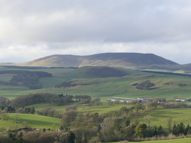
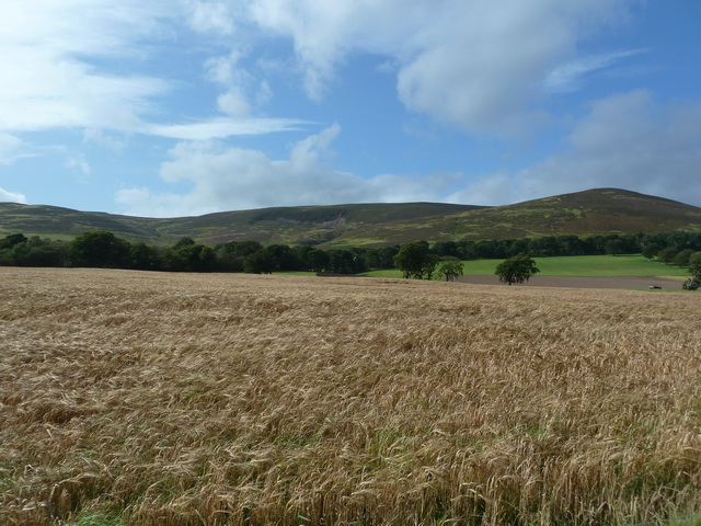
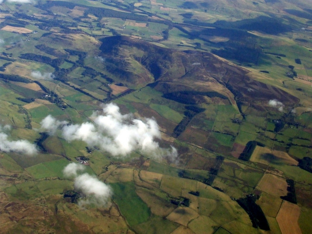
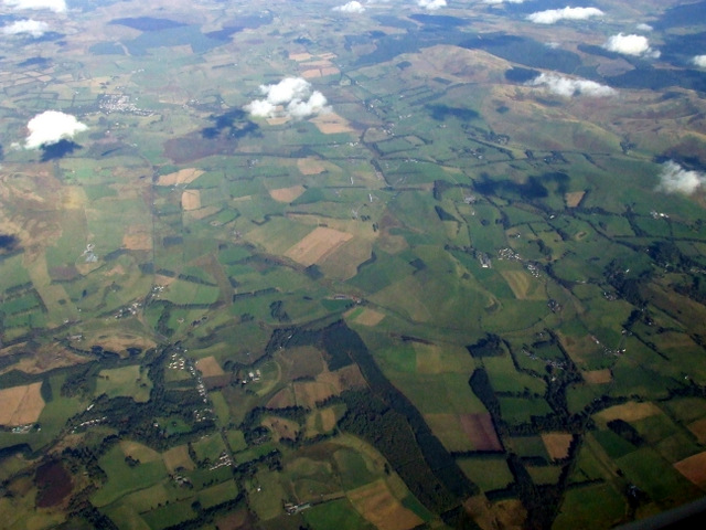
Newholm Hill is a prominent hill located in the county of Lanarkshire, in the central lowlands of Scotland. Situated near the village of Newholm, it is part of the scenic Southern Uplands range. With an elevation of approximately 500 meters (1,640 feet), it offers stunning panoramic views of the surrounding countryside.

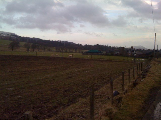
The hill is characterized by its gentle slopes covered in lush green vegetation, including heather, grasses, and scattered trees. Its summit is marked by a trig point, serving as a reference point for surveying and mapping purposes. From this vantage point, visitors can enjoy breathtaking vistas of the rolling hills, farmland, and distant peaks.

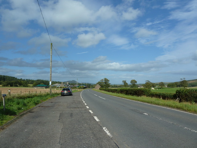
Newholm Hill is a popular destination for hikers and nature enthusiasts, offering various trails and footpaths to explore its natural beauty. The hill's location also provides a haven for wildlife, such as red grouse, rabbits, and various species of birds.

In addition to its natural allure, Newholm Hill holds historical significance. It is believed to have been a site for ancient settlements, with remnants of Iron Age forts and burial mounds found in its vicinity. These archaeological finds provide insight into the area's past inhabitants and their way of life.

Overall, Newholm Hill captivates visitors with its picturesque landscapes, diverse flora and fauna, as well as its rich historical heritage, making it a must-visit destination for those seeking a tranquil escape in Lanarkshire.

If you have any feedback on the listing, please let us know in the comments section below.

Newholm Hill Images

Images are sourced within 2km of 55.704783/-3.4659257 or Grid Reference NT0746. Thanks to Geograph Open Source API. All images are credited.

South-west of Black Mount summit The outcrops of Dunsyre Hill are visible beyond the green pastures in the distance.
South-west of Black Mount summit
The outcrops of Dunsyre Hill are visible beyond the green pastures in the distance.
Boggy pool south-west of Black Mount summit The very wet weather of the previous few days had given way to blue skies.
Boggy pool south-west of Black Mount summit
The very wet weather of the previous few days had given way to blue skies.
Long shadow and decaying trig point on Black Mount A photo in late afternoon the day before the clocks went back, with the main group of the Pentland Hills in the distance.
Long shadow and decaying trig point on Black Mount
A photo in late afternoon the day before the clocks went back, with the main group of the Pentland Hills in the distance.
Eroding trig point on Black Mount This trig seems to have been eroding from the base for many years.
Eroding trig point on Black Mount
This trig seems to have been eroding from the base for many years.
Setting sun on the Black Mount The low, late afternoon lit up the autumn colours on the hillside dramatically.
Setting sun on the Black Mount
The low, late afternoon lit up the autumn colours on the hillside dramatically.
Black Mount A Pentland outlier, viewed from Henderland Hill.
Black Mount
A Pentland outlier, viewed from Henderland Hill.
Black Mount View from Ewe Hill.
Black Mount
View from Ewe Hill.
Entering Dunsyre from the west Entering this small village on the minor road from Newbigging.
Entering Dunsyre from the west
Entering this small village on the minor road from Newbigging.
Tunnel through the old railway embankment, Dunsyre The Dunsyre Burn flows through this tunnel under the now dismantled railway line from Dolphinton to Carstairs.
Tunnel through the old railway embankment, Dunsyre
The Dunsyre Burn flows through this tunnel under the now dismantled railway line from Dolphinton to Carstairs.
Old railway bridge near Dunsyre A sturdy stone bridge remains after the Dolphinton - Carstairs railway has long been dismantled. Dunsyre Hill is in the background.
Old railway bridge near Dunsyre
A sturdy stone bridge remains after the Dolphinton - Carstairs railway has long been dismantled. Dunsyre Hill is in the background.
Black Mount Not so aptly named today, the snow is deep enough to cover the heather which is responsible for the hill's name.  A view from the north side of Tinto.
Black Mount
Not so aptly named today, the snow is deep enough to cover the heather which is responsible for the hill's name. A view from the north side of Tinto.
A702 southwest of The Bank Looking towards The Bank from the lay-by
A702 southwest of The Bank
Looking towards The Bank from the lay-by
Fields beneath Black Mount, southwest of The Bank
Black Mount from the air Viewed across Borland Moss from a Prague bound flight from Edinburgh.
Black Mount from the air
Viewed across Borland Moss from a Prague bound flight from Edinburgh.
Dolphinton from the Air White Hill can be seen in the foreground.
Dolphinton from the Air
White Hill can be seen in the foreground.
Dolphinton from the air Southhill Wood is prominent at the bottom of the photo, with Dolphinton in the lower left corner.
Dolphinton from the air
Southhill Wood is prominent at the bottom of the photo, with Dolphinton in the lower left corner.
Fields at The Bank Along the A702
Fields at The Bank
Along the A702
Black Mount As seen from the A702 near The Bank
Black Mount
As seen from the A702 near The Bank
Show me another place!

Newholm Hill is located at Grid Ref: NT0746 (Lat: 55.704783, Lng: -3.4659257)

Unitary Authority: South Lanarkshire

Police Authority: Lanarkshire

What 3 Words

///locator.kinks.grafted. Near West Linton, Scottish Borders

Nearby Locations

Newholm Hill

Related Wikis

Dunsyre railway station

Dunsyre railway station served the village of Dunsyre, South Lanarkshire, Scotland from 1867 to 1945 on the Dolphinton branch. == History == The station...

Dunsyre

Dunsyre (Scottish Gaelic: Dùn Saghair) is a village in South Lanarkshire, Scotland. It is 10 kilometres (6 mi) from Carnwath. Dunsyre is associated with...

Walston, South Lanarkshire

Walston is a hamlet in the middle of black mount area of South Lanarkshire. == History == Patrick Molleson in the Old Statistical Account records that...

Dolphinton

Dolphinton is a village and parish in Lanarkshire, Scotland. It is located 7 miles (11 km) northeast of Biggar, 11 miles (18 km) northeast of Carstairs...

Garvald, South Lanarkshire

Garvald is a small settlement on the boundary between the Scottish Borders and South Lanarkshire, Scotland. == References == The geographic coordinates...

Little Sparta

Little Sparta is a garden at Dunsyre in the Pentland Hills in South Lanarkshire, Scotland, created by artist and poet Ian Hamilton Finlay and his wife...

Dolphinton (CR) railway station

Dolphinton railway station served the village of Dolphinton, Lanarkshire, Scotland, from 1867 to 1945 on the Dolphinton branch. == History == The station...

Elsrickle

Elsrickle is a village in South Lanarkshire, Scotland. It lies on Blackmount Hill, which is at the end of the Pentland Hills. An elrick is an old place...

Related Videos

Merklands Wood Luxury Lodges

Merklands Wood Luxury Lodges are 100 % family owned, 100 % family run and 100 % family friendly. Alder and Aspen lodges ...

Nearby Amenities

Located within 500m of 55.704783,-3.4659257
Newholm Hill
Ele: 405
Natural: peak
Lat/Long: 55.7050162/-3.4654129
Power: pole
Lat/Long: 55.7079027/-3.4608935
Power: pole
Lat/Long: 55.7079453/-3.4624198
Power: pole
Lat/Long: 55.7079891/-3.4639272
Power: pole
Lat/Long: 55.7080294/-3.4654136
Power: pole
Lat/Long: 55.708078/-3.4669504
Power: pole
Lat/Long: 55.7079737/-3.4684726
Power: pole
Lat/Long: 55.7078671/-3.4699589
Power: pole
Lat/Long: 55.7076204/-3.4713591
Power: pole
Lat/Long: 55.7074525/-3.4723115
The data included in this document is from www.openstreetmap.org. The data is made available under ODbL.

Have you been to Newholm Hill?

Leave your review of Newholm Hill below (or comments, questions and feedback).