Horsford

Settlement in Norfolk Broadland

England

Horsford

Old Milestone by the B1149, Holt Road, Horsford Parish Concrete post by the B1149, in parish of HORSFORD (BROADLAND District), 100m South of junction with Drayton Lane, near front of wide verge with wooden bollards, on West side of road. NCC concrete, erected by the County Council in the 19th/20th century. 

Inscription reads:-
: TO / HOLT / 17 / MILES : : N C C / MAIN ROAD / HORSFORD : : TO / NORWICH / 4 / MILES : 

Milestone Society National ID: NO_NH04.
Old Milestone by the B1149, Holt Road, Horsford Parish Credit: Alan Lake

Horsford is a village located in the English county of Norfolk. Situated approximately 6 miles north of the city of Norwich, Horsford falls within the district of Broadland. The village has a population of around 2,500 people and covers an area of about 6 square miles.

Horsford boasts a rich history dating back to the Saxon era. The village is mentioned in the Domesday Book of 1086, where it is referred to as "Horsforda." Over the centuries, it has evolved from a predominantly agricultural community into a thriving residential area.

The village offers a range of amenities and services to its residents. These include a primary school, various shops, a medical practice, a post office, and several pubs. The local community is known for its strong sense of togetherness and active engagement in village life.

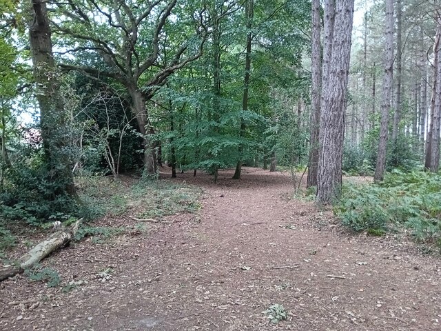
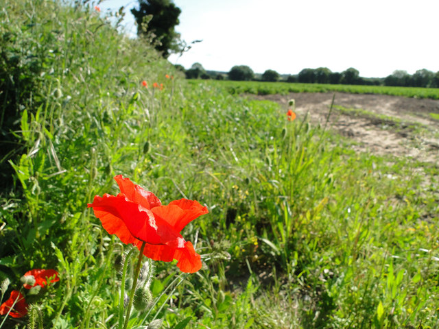
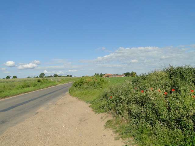
Horsford is surrounded by picturesque countryside, making it an ideal location for outdoor enthusiasts. The village is situated close to several nature reserves, such as Horsford Forest and the Norfolk Broads, providing opportunities for walking, cycling, and wildlife spotting.

Transport links in Horsford are convenient, with regular bus services connecting the village to Norwich city center and surrounding towns. The nearby Norwich International Airport offers easy access to domestic and international destinations.

Overall, Horsford is a charming village that combines a rich heritage with modern amenities, offering a peaceful and welcoming environment for its residents.

If you have any feedback on the listing, please let us know in the comments section below.
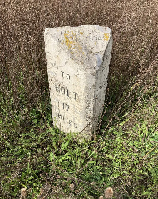
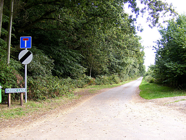
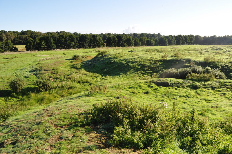
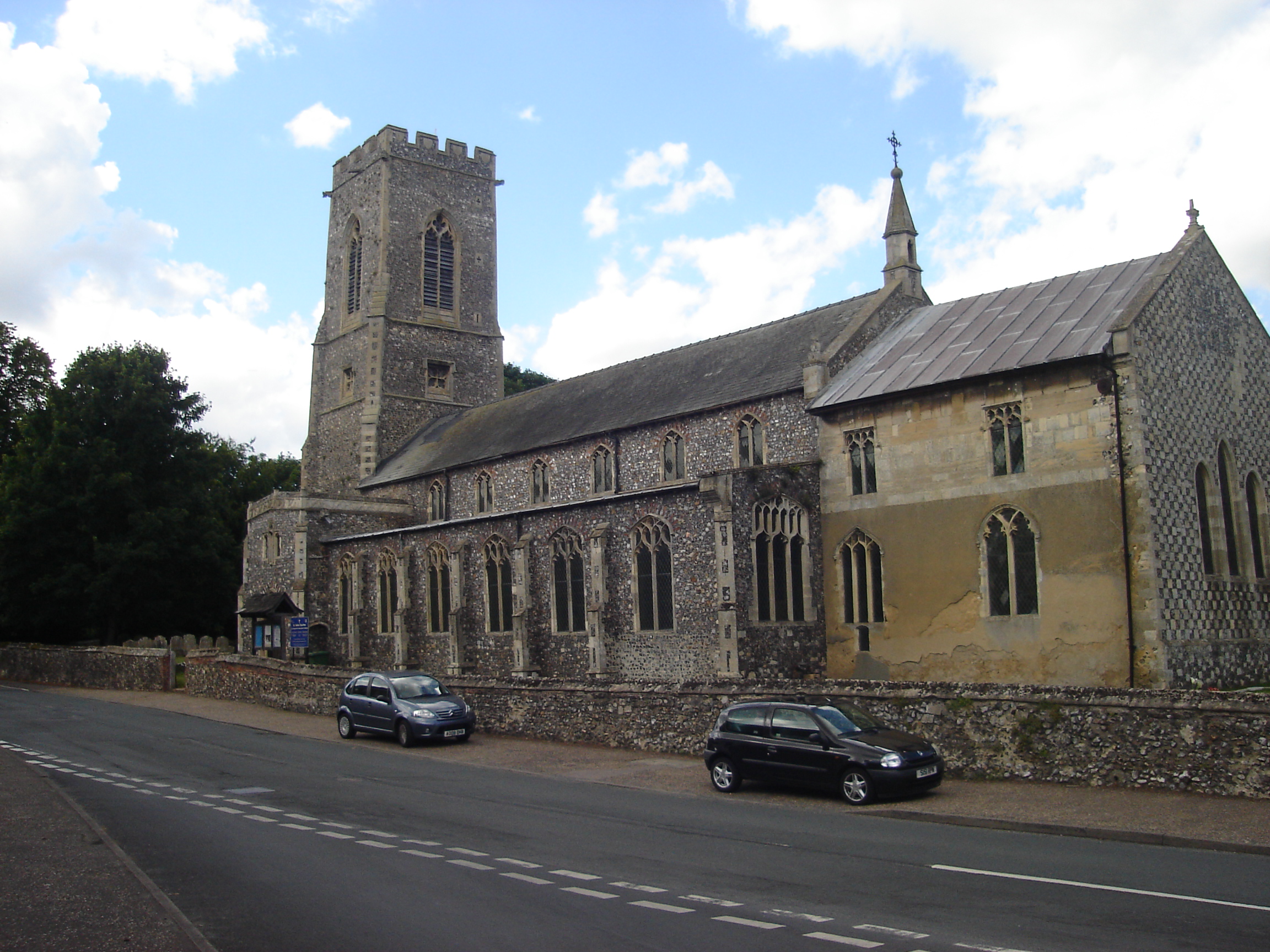
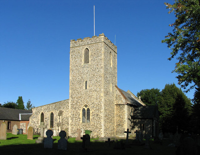
Horsford Images

Images are sourced within 2km of 52.698145/1.24431 or Grid Reference TG1916. Thanks to Geograph Open Source API. All images are credited.

Old Milestone by the B1149, Holt Road, Horsford Parish Concrete post by the B1149, in parish of HORSFORD (BROADLAND District), 100m South of junction with Drayton Lane, near front of wide verge with wooden bollards, on West side of road. NCC concrete, erected by the County Council in the 19th/20th century. 

Inscription reads:-
: TO / HOLT / 17 / MILES : : N C C / MAIN ROAD / HORSFORD : : TO / NORWICH / 4 / MILES : 

Milestone Society National ID: NO_NH04.
Old Milestone by the B1149, Holt Road, Horsford Parish
Concrete post by the B1149, in parish of HORSFORD (BROADLAND District), 100m South of junction with Drayton Lane, near front of wide verge with wooden bollards, on West side of road. NCC concrete, erected by the County Council in the 19th/20th century. Inscription reads:- : TO / HOLT / 17 / MILES : : N C C / MAIN ROAD / HORSFORD : : TO / NORWICH / 4 / MILES : Milestone Society National ID: NO_NH04.
Horsford Woods Popular woodland for walking.
Horsford Woods
Popular woodland for walking.
B1149 Holt Road, Horsford Looking towards Horsford near New Holme Farm
B1149 Holt Road, Horsford
Looking towards Horsford near New Holme Farm
B1149 Holt Road, Horsford Looking towards Horsford near New Holme Farm
B1149 Holt Road, Horsford
Looking towards Horsford near New Holme Farm
Poppy Near Hilltop Farm, Horsford
Poppy
Near Hilltop Farm, Horsford
Horsham to Horsford road A short cut between Horsford and the A140
Horsham to Horsford road
A short cut between Horsford and the A140
Roadsigns on the A140 Cromer Road At the junction with Church Street
Roadsigns on the A140 Cromer Road
At the junction with Church Street
Drewray Woods Public Footpath/Track The photo depicts the condition of the Footpath/Track which enters Drewray Wood from Dog Lane.
Drewray Woods Public Footpath/Track
The photo depicts the condition of the Footpath/Track which enters Drewray Wood from Dog Lane.
Entering Horsford on the B1149 Holt Road Approaching the junction with Haveringland Road & Green Lane
Entering Horsford on the B1149 Holt Road
Approaching the junction with Haveringland Road & Green Lane
Horsford Name sign On the B1149 Holt Road
Horsford Name sign
On the B1149 Holt Road
Haveringland Road, Horsford At the junction with the B1149 Holt Road
Haveringland Road, Horsford
At the junction with the B1149 Holt Road
Green Lane sign On Green Lane at the junction with the B1149 Holt Road
Green Lane sign
On Green Lane at the junction with the B1149 Holt Road
Green Lane, Horsford At the junction with the B1149 Holt Road
Green Lane, Horsford
At the junction with the B1149 Holt Road
Haveringland Road sign On Haveringland Road at the junction with the B1149 Holt Road
Road No.C278
Haveringland Road sign
On Haveringland Road at the junction with the B1149 Holt Road Road No.C278
Haveringland Road, Horsford Road no.C278
Haveringland Road, Horsford
Road no.C278
Haveringland Road, Horsford At Houghen Plantation
Road no.C278
Haveringland Road, Horsford
At Houghen Plantation Road no.C278
Entrance to the Car Park & Picnic area at Houghen Plantation Off Haveringland Road
Entrance to the Car Park & Picnic area at Houghen Plantation
Off Haveringland Road
Haveringland Road, Horsford At the junction with the B1149 Holt Road
Haveringland Road, Horsford
At the junction with the B1149 Holt Road
Show me another place!

Horsford is located at Grid Ref: TG1916 (Lat: 52.698145, Lng: 1.24431)

Administrative County: Norfolk

District: Broadland

Police Authority: Norfolk

What 3 Words

///afterglow.moderated.choppers. Near Horsford, Norfolk

Related Wikis

Horsford

Horsford is a village six miles north of Norwich, England which is surrounded by the Horsford Forest and is named after the dried up section of the River...

Horsford Castle

Horsford Castle is situated in the village of Horsford, 6 miles to the north of the city of Norwich. == Details == Before the Norman conquest of England...

Manor Park, Horsford

Manor Park is a cricket ground in Horsford, Norfolk. The ground is the main home ground of Norfolk County Cricket Club. The first recorded match on the...

Dussindale & Hellesdon Rovers F.C.

Dussindale & Hellesdon Rovers Football Club is a football club based in Norwich, England. They are currently members of the Eastern Counties League Division...

Horsham St Faith

Horsham St Faith is a village in Norfolk, England. The village lies close and to the east of the A140 road and is 5 miles (8.0 km) north of Norwich and...

Horsham St Faith and Newton St Faith

Horsham St Faith and Newton St Faith is a civil parish in the English county of Norfolk, consisting of the former parishes of Horsham St Faith and Newton...

Drayton, Norfolk

Drayton, Norfolk, is a suburban village in the English county of Norfolk. The village is located in the district of Broadland, 4.3 miles (6.9 km) north...

City of Norwich Aviation Museum

The City of Norwich Aviation Museum is a volunteer-run museum and charitable trust dedicated to the preservation of the aviation history of the county...

Nearby Amenities

Located within 500m of 52.698145,1.24431
Bus Stop
Bus Shelter, adj
Bus: yes
Naptan AtcoCode: 2900H461
Naptan Bearing: SE
Naptan CommonName: Bus Shelter
Naptan Indicator: adj
Naptan Landmark: Brooks Road
Naptan Locality: Horsford
Naptan NaptanCode: nfoawpwm
Naptan PlusbusZoneRef: NRCH
Naptan Street: Holt Road
Naptan Verified: no
Public Transport: platform
Source: naptan_import
Lat/Long: 52.7015941/1.2417455
Bus Stop
Dog, adj
Bench: no
Bin: no
Naptan AtcoCode: 2900H4610
Naptan Bearing: N
Naptan CommonName: Dog
Naptan Indicator: adj
Naptan Landmark: Dog Lane
Naptan Locality: Horsford
Naptan NaptanCode: nfoawpwp
Naptan PlusbusZoneRef: NRCH
Naptan Street: Holt Road
Naptan Verified: no
Shelter: no
Source: naptan_import
Tactile Paving: yes
Lat/Long: 52.6945914/1.2455634
Bus Stop
Dog, opp
Bench: no
Bin: no
Naptan AtcoCode: 2900H4611
Naptan Bearing: S
Naptan BusStopType: CUS
Naptan CommonName: Dog
Naptan Indicator: opp
Naptan Landmark: The Dog Public House
Naptan Locality: Horsford
Naptan NaptanCode: nfoawpwt
Naptan PlusbusZoneRef: NRCH
Naptan Street: Holt Road
Naptan Verified: no
Shelter: no
Source: naptan_import
Lat/Long: 52.694104/1.2459386
Bus Stop
Columbine Road, adj
Naptan AtcoCode: 2900H4617
Naptan Bearing: SE
Naptan CommonName: Columbine Road
Naptan Indicator: adj
Naptan Landmark: Residential Home
Naptan Locality: Horsford
Naptan NaptanCode: nfogmtpg
Naptan PlusbusZoneRef: NRCH
Naptan Street: Horsbeck Way
Naptan Verified: no
Source: naptan_import
Lat/Long: 52.6955274/1.2442266
Bus Stop
Corner Lane, adj
Bench: no
Bin: no
Naptan AtcoCode: 2900H4618
Naptan Bearing: NW
Naptan CommonName: Corner Lane
Naptan Indicator: adj
Naptan Landmark: Post Office
Naptan Locality: Horsford
Naptan NaptanCode: nfogmtpd
Naptan PlusbusZoneRef: NRCH
Naptan Street: Corner Lane
Naptan Verified: no
Shelter: no
Source: naptan_import
Lat/Long: 52.6979638/1.2442594
Bus Stop
Corner Lane, opp
Naptan AtcoCode: 2900H4619
Naptan Bearing: SE
Naptan CommonName: Corner Lane
Naptan Indicator: opp
Naptan Landmark: Corner Lane
Naptan Locality: Horsford
Naptan NaptanCode: nfogmtpj
Naptan PlusbusZoneRef: NRCH
Naptan Street: Holt Road
Naptan Verified: no
Source: naptan_import
Lat/Long: 52.6982204/1.2444117
Bus Stop
Bus Shelter, opp
Bus: yes
Naptan AtcoCode: 2900H4620
Naptan Bearing: NW
Naptan CommonName: Bus Shelter
Naptan Indicator: opp
Naptan Landmark: Bus shelter
Naptan Locality: Horsford
Naptan NaptanCode: nfogmtpm
Naptan PlusbusZoneRef: NRCH
Naptan Street: Holt Road
Naptan Verified: no
Public Transport: platform
Source: naptan_import
Lat/Long: 52.7007399/1.242067
Bus Stop
Meadow Way, adj
Bus: yes
Naptan AtcoCode: 2900H4622
Naptan Bearing: SW
Naptan CommonName: Meadow Way
Naptan Indicator: adj
Naptan Landmark: Meadow Way
Naptan Locality: Horsford
Naptan NaptanCode: nfogmtpw
Naptan PlusbusZoneRef: NRCH
Naptan Street: Gordon Godfrey Way
Naptan Verified: no
Public Transport: platform
Source: naptan_import
Lat/Long: 52.7014074/1.2406804
Bus Stop
Pimpernel Road, adj
Naptan AtcoCode: 2900H4624
Naptan Bearing: SE
Naptan CommonName: Pimpernel Road
Naptan Indicator: adj
Naptan Landmark: Pimpernel Road
Naptan Locality: Horsford
Naptan NaptanCode: nfogmtwd
Naptan PlusbusZoneRef: NRCH
Naptan Street: Horsbeck Way
Naptan Verified: no
Source: naptan_import
Lat/Long: 52.6962747/1.2405812
Bus Stop
Thistledown Road, adj
Naptan AtcoCode: 2900H466
Naptan Bearing: SE
Naptan CommonName: Thistledown Road
Naptan Indicator: adj
Naptan Landmark: Thisledown Road
Naptan Locality: Horsford
Naptan NaptanCode: nfoawtap
Naptan PlusbusZoneRef: NRCH
Naptan Street: Horsbeck Way
Naptan Verified: no
Source: naptan_import
Lat/Long: 52.6969136/1.2389261
Crossing
Crossing: unmarked
Lat/Long: 52.6962357/1.2402066
Turning Circle
Lat/Long: 52.6971084/1.244249
Turning Circle
Lat/Long: 52.7005004/1.2388092
Turning Circle
Lat/Long: 52.697327/1.2401278
Turning Circle
Lat/Long: 52.6966188/1.2408276
Turning Circle
Lat/Long: 52.6998738/1.2387974
Turning Circle
Lat/Long: 52.6961971/1.2451462
Barrier: cycle_barrier
Bicycle: yes
Foot: yes
Lat/Long: 52.6976331/1.2384887
Turning Circle
Lat/Long: 52.6998151/1.2397223
Turning Circle
Lat/Long: 52.6966738/1.2401337
Crossing
Crossing: uncontrolled
Crossing Island: no
Crossing Ref: zebra
Tactile Paving: yes
Lat/Long: 52.6989425/1.2436535
Turning Circle
Lat/Long: 52.7012657/1.2445264
Crossing
Crossing: unmarked
Lat/Long: 52.6961754/1.2413725
Turning Circle
Lat/Long: 52.6969907/1.2435639
Turning Circle
Lat/Long: 52.6982158/1.2388805
Turning Circle
Lat/Long: 52.6974103/1.2400394
Turning Circle
Lat/Long: 52.6966274/1.2399688
Turning Circle
Lat/Long: 52.6969812/1.2442608
Turning Circle
Lat/Long: 52.6991541/1.2379751
Turning Circle
Lat/Long: 52.7007703/1.2395417
Barrier: cycle_barrier
Bicycle: yes
Foot: yes
Lat/Long: 52.6980787/1.2382259
Turning Circle
Lat/Long: 52.6998151/1.2404074
Turning Circle
Lat/Long: 52.6964094/1.2451936
Barrier: cycle_barrier
Bicycle: designated
Lat/Long: 52.69632/1.240269
Post Box
Operator: Royal Mail
Post Box Type: lamp
Source: drive-by survey
Lat/Long: 52.69411/1.2457566
Barrier: cycle_barrier
Lat/Long: 52.6942033/1.2464499
Post Box
Operator: Royal Mail
Post Box Type: pillar
Ref: NR10 1005
Royal Cypher: EIIR
Royal Cypher Wikidata: Q33102113
Lat/Long: 52.6977087/1.2444944
Post Office
Horsford Post Office
Addr City: Norwich
Addr Country: GB
Addr Housenumber: 149
Addr Postcode: NR10 3AB
Addr Street: Holt Road
Addr Village: Horsford
Brand: Post Office
Brand Wikidata: Q1783168
Contact Website: https://www.postoffice.co.uk/branch-finder/1251368/horsford
Opening Hours: Mo-Sa 07:00-21:00; Su 07:00-19:00
Operator: Co-op Foodstore
Ref Pol Id: 2106
Lat/Long: 52.6976601/1.2443605
Waste Basket
Waste: dog_excrement
Lat/Long: 52.6993467/1.2434788
Give Way
Lat/Long: 52.7008533/1.2430705
Give Way
Lat/Long: 52.7008113/1.2431145
Horsford
Place: village
Wikidata: Q2417150
Wikipedia: en:Horsford
Lat/Long: 52.6995794/1.2430052
Ford: yes
Lat/Long: 52.6949327/1.2460657
Barrier: kissing_gate
Material: wood
Lat/Long: 52.6950163/1.2457755
Barrier: yes
Fixme: Could you please check access for drivers
Motor Vehicle: no
Lat/Long: 52.6946412/1.2411475
Give Way
Lat/Long: 52.7019591/1.2434609
Give Way
Lat/Long: 52.7025421/1.2434129
Give Way
Lat/Long: 52.7016931/1.2413949
Barrier: cycle_barrier
Bicycle: no
Lat/Long: 52.7022967/1.2421992
Barrier: cycle_barrier
Bicycle: no
Lat/Long: 52.7021524/1.2412241
Barrier: cycle_barrier
Bicycle: designated
Lat/Long: 52.6965708/1.2406504
Barrier: cycle_barrier
Bicycle: no
Lat/Long: 52.6969495/1.2434801
Barrier: cycle_barrier
Bicycle: no
Lat/Long: 52.6968682/1.2430014
Give Way
Lat/Long: 52.6963434/1.2397522
Give Way
Lat/Long: 52.6961226/1.2413588
Crossing
Crossing: unmarked
Lat/Long: 52.6962835/1.2402443
Barrier: cycle_barrier
Bicycle: yes
Lat/Long: 52.6965447/1.2454366
The data included in this document is from www.openstreetmap.org. The data is made available under ODbL.

Have you been to Horsford?

Leave your review of Horsford below (or comments, questions and feedback).