Diamond Jubilee Plantation
Wood, Forest in Norfolk Broadland
England
Diamond Jubilee Plantation
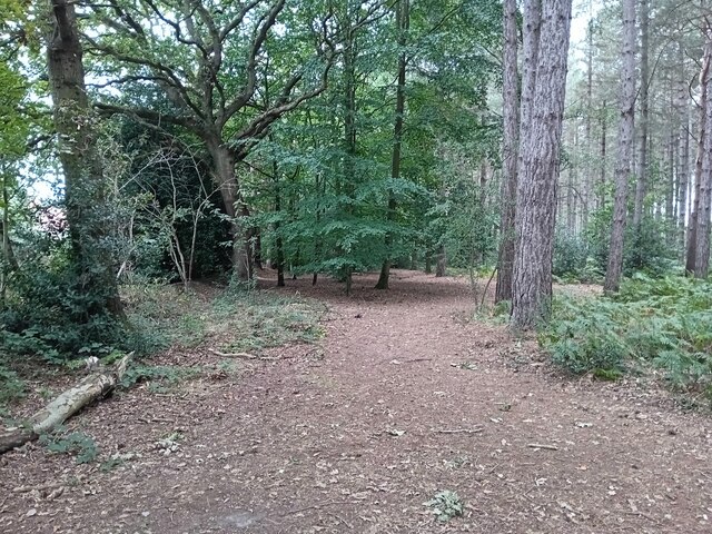
Diamond Jubilee Plantation is a beautiful woodland located in Norfolk, England. Spanning over a vast area, it is renowned for its picturesque landscapes and diverse range of flora and fauna. The plantation was established in 2012 to commemorate the Diamond Jubilee of Queen Elizabeth II, hence its name.
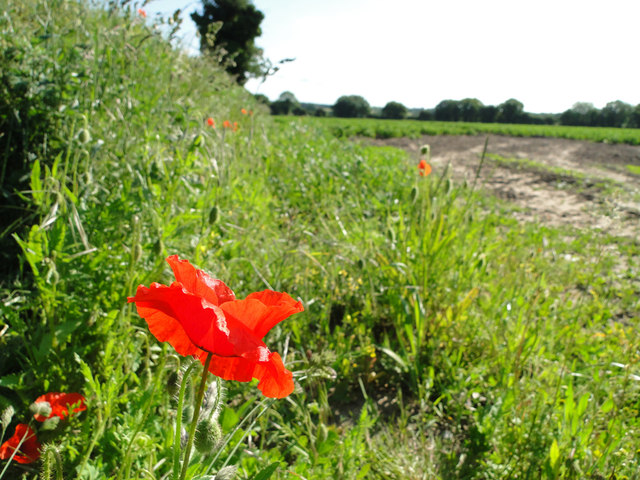
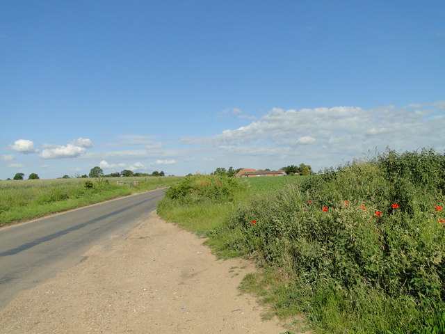
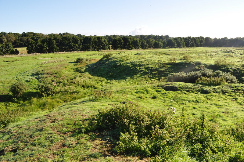
The woodland is characterized by its dense canopy of tall, mature trees, predominantly consisting of oak, beech, and birch. These majestic trees provide a serene and tranquil atmosphere, making it a popular destination for nature enthusiasts and hikers. The forest floor is covered with a rich carpet of wildflowers, adding vibrant colors to the surroundings.
The plantation also boasts a variety of wildlife, making it a haven for animal lovers. Visitors can spot numerous bird species, including woodpeckers, owls, and various songbirds. Squirrels, rabbits, and deer are often seen roaming freely within the woodland, adding to the enchanting experience of being in nature.
Diamond Jubilee Plantation is not only a place of natural beauty but also plays a crucial role in environmental conservation. It serves as a carbon sink, capturing and storing carbon dioxide, thus contributing to the fight against climate change. The woodland is carefully managed to ensure its sustainability and preservation for future generations.
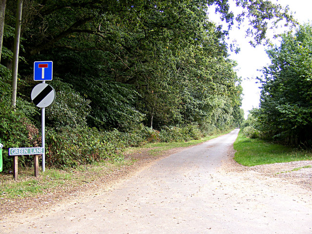
For those seeking recreational activities, the plantation offers well-maintained walking trails and picnic areas, allowing visitors to immerse themselves in the tranquility of the surroundings. Interpretive signage is placed strategically throughout the woodland, providing information about the various species of trees and wildlife present.
Overall, Diamond Jubilee Plantation is a remarkable destination that combines the beauty of nature with environmental conservation. It offers an escape from the hustle and bustle of everyday life, providing a serene retreat for individuals seeking solace in the embrace of nature.
If you have any feedback on the listing, please let us know in the comments section below.
Diamond Jubilee Plantation Images
Images are sourced within 2km of 52.701961/1.2509322 or Grid Reference TG1916. Thanks to Geograph Open Source API. All images are credited.


Diamond Jubilee Plantation is located at Grid Ref: TG1916 (Lat: 52.701961, Lng: 1.2509322)
Administrative County: Norfolk
District: Broadland
Police Authority: Norfolk
What 3 Words
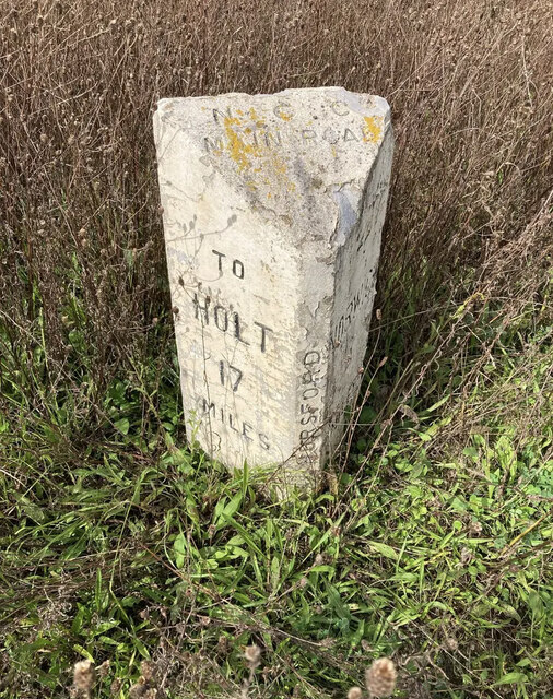
///humble.sculpture.slimy. Near Horsford, Norfolk
Nearby Locations
Related Wikis

Horsford
Horsford is a village six miles north of Norwich, England which is surrounded by the Horsford Forest and is named after the dried up section of the River...
Horsford Castle
Horsford Castle is situated in the village of Horsford, 6 miles to the north of the city of Norwich. == Details == Before the Norman conquest of England...
Horsham St Faith
Horsham St Faith is a village in Norfolk, England. The village lies close and to the east of the A140 road and is 5 miles (8.0 km) north of Norwich and...

Horsham St Faith and Newton St Faith
Horsham St Faith and Newton St Faith is a civil parish in the English county of Norfolk, consisting of the former parishes of Horsham St Faith and Newton...

Manor Park, Horsford
Manor Park is a cricket ground in Horsford, Norfolk. The ground is the main home ground of Norfolk County Cricket Club. The first recorded match on the...

Dussindale & Hellesdon Rovers F.C.
Dussindale & Hellesdon Rovers Football Club is a football club based in Norwich, England. They are currently members of the Eastern Counties League Division...
City of Norwich Aviation Museum
The City of Norwich Aviation Museum is a volunteer-run museum and charitable trust dedicated to the preservation of the aviation history of the county...

Felthorpe
Felthorpe is a village and civil parish in the English county of Norfolk. The village is located 11 miles (18 km) east of Dereham and 7.1 miles (11.4 km...
Nearby Amenities
Located within 500m of 52.701961,1.2509322Have you been to Diamond Jubilee Plantation?
Leave your review of Diamond Jubilee Plantation below (or comments, questions and feedback).